
Cube flat
|
Cube flat
|
||
|---|---|---|
| coat of arms | Austria map | |
 |
|
|
| Basic data | ||
| Country: | Austria | |
| State : | Lower Austria | |
| Political District : | Neunkirchen | |
| License plate : | NK | |
| Surface: | 12.26 km² | |
| Coordinates : | 47 ° 46 ' N , 16 ° 3' E | |
| Height : | 431 m above sea level A. | |
| Residents : | 1,586 (January 1, 2020) | |
| Population density : | 129 inhabitants per km² | |
| Postal code : | 2732 | |
| Area code : | 0 26 20 | |
| Community code : | 3 18 47 | |
| NUTS region | AT122 | |
| UN / LOCODE | AT WUR | |
| Address of the municipal administration: |
Willendorfer Strasse 150 2732 Würflach |
|
| Website: | ||
| politics | ||
| Mayor : | Franz Woltron ( ÖVP ) | |
|
Municipal Council : ( 2020 ) (19 members) |
||
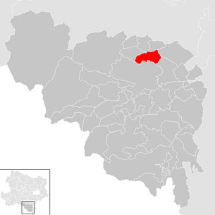
| Location of Würflach in the Neunkirchen district | ||
  |
||
.jpg) The municipal office of Würflach |
||
| Source: Municipal data from Statistics Austria | ||

Würflach is a municipality with 1586 inhabitants (as of January 1, 2020) in the Neunkirchen district in Lower Austria . Located between Hoher Wand and Neunkirchen , Würflach is a tourist community.
geography
Würflach is located in the industrial district in Lower Austria. The area of the municipality covers 12.32 square kilometers. 57.42 percent of the area is forested.
Community structure
The municipal area includes the following three cadastral communities and localities (population in brackets as of January 1, 2020):
- Hettmannsdorf (372)
- Wolfsohl (191)
- Cube (1023)
history
Bavarian monks from the Vornbach (Formbach) monastery founded Würflach. The name of the place comes from Wirbilach, the swirling Ache, the so-called Johannesbachklamm. The name is first mentioned in a deed of donation in 1094 . In the middle of the 12th century a farm yard with a choir square church was built; the walls of this church are preserved in the current one. The reason for the development of the settlement was its strategic location as the center of the scattered possessions of the Admont Abbey in the vicinity of Pitten .
Incorporations
On January 1, 1968, the community of Hettmannsdorf was incorporated into Würflach.
Population development

Religions and churches

According to the data of the 2001 census , 83.7% of the population were Roman Catholic and 2.4% Protestant . Church references characterize the development of Würflachs. The village passed from early Admont ownership to the Rein Abbey in the Middle Ages . Around 1617 the new monastery in Wiener Neustadt acquired the village. In pastoral matters, Würflach belonged to the mother parish of St. Lorenzen am Steinfeld . The medieval church building is the approx. 1450–1500 expansion of the square choir from the 12th century. The Sebastian chapel or Herz-Jesu chapel, which stands next to the parish church, was built around 1500, documented in 1503, and was under spiritual protection of the plague patron . The church was cleared for demolition in 1783 but was preserved. In 1885 it was rededicated as the Sacred Heart Chapel and served from 1968 to 1982 as a place of lay for the deceased before their burial. As of 2001, 0.1% of the local residents were Muslims and 0.3% belonged to Orthodox churches . 12.1% of the population had no religious denomination.
politics
The municipal council has 19 members. In 1995 it was divided according to the following distribution: 14 ÖVP, and 5 SPÖ. In the municipal council elections in Lower Austria 2020 , the distribution showed the following picture: 11 ÖVP, 5 together for Würflach and 3 SPÖ.
- mayor
- 1992–2012 Hans Schauer (ÖVP)
- since 2012 Franz Woltron (ÖVP)
Culture and sights

- Catholic parish church Würflach hl. Anna: The parish church was built at the beginning of the 13th century and has the character of a fortified church . From this time one can still admire a Christ Salvator head and a sun head. A number of elements from the late Gothic building are still preserved, although the church was destroyed in the Turkish War in 1683. It was rebuilt and redesigned in Baroque style and has a so-called roof turret as a tower . The Herz-Jesu-Kapelle or Sebastianskapelle next to the parish church is from the 15th century and was left to its own devices. It was only restored in 1885 and consecrated as the Herz-Jesu-Kapelle. Today it is one of the most beautiful Gothic sacred buildings in Lower Austria.
- The Johannesbachklamm offers great hiking fun for tourists and residents. In addition to the normal passage, there are six different hiking trails around the Johannesbachklamm.
- Regular events
- Advent market in the Johannesbachklamm
- Encounter of the 5 senses (Johannesbachklamm)
education
.jpg)
- There is an ecologically oriented elementary school called "ÖKOLOG" network school and two state kindergartens.
Web links
- 31847 - Cube flat. Community data, Statistics Austria .
- Topothek Würflach historical picture material, located, tagged and dated
Individual evidence
- ↑ Statistics Austria: Population on January 1st, 2020 by locality (area status on January 1st, 2020) , ( CSV )
- ^ Lower Austrian document book (St. Pölten 2013), vol. 2, p. 169.
- ^ Dehio Niederösterreich Süd (Horn / Vienna 2003), pp. 2747–2751
- ^ Result of the local council election 1995 in Würflach. Office of the Lower Austrian State Government, March 30, 2000, accessed on September 27, 2019 .
- ↑ Results of the municipal council election 2020 in Würflach. Office of the Lower Austrian State Government, January 26, 2020, accessed on January 26, 2020 .
- ↑ Municipal news Würflach, No. 479 of June 14, 2012: special announcement (PDF document, 5.97 MB; accessed on January 9, 2013)

Altendorf | Aspang Market | Aspangberg-St. Peter | Breitenau | Breitenstein | Buchbach | Bürg-Vöstenhof | Edlitz | Enzenreith | Feistritz am Wechsel | Gloggnitz | Grafenbach-St. Valentin | Grimmenstein | Grünbach am Schneeberg | Höflein on the Hohe Wand | Kirchberg am Wechsel | Mönichkirchen | Natschbach-Loipersbach | Neunkirchen | Otterthal | Payerbach | Pitten | Prigglitz | Puchberg am Schneeberg | Raach am Hochgebirge | Reichenau an der Rax | Scheiblingkirchen-Thernberg | Schottwien | Schrattenbach | Schwarzau am Steinfeld | Schwarzau in the mountains | Seebenstein | Semmering | St. Corona am Wechsel | St. Egyden am Steinfeld | Ternitz | Thomasberg | Trattenbach | Warth | Wartmannstetten | Willendorf | Wimpassing in the Black Valley | Cube | Rumble
Cadastral communities: Hettmannsdorf | Wolfsohl | Cube flat
Locations: Hettmannsdorf | Wolfsohl | Cube flat
Villages: Hettmannsdorf | Wolfsohl | Cube flat
Counting area: Cube flat | Hettmannsdorf