
Otterthal
|
Otterthal
|
||
|---|---|---|
| coat of arms | Austria map | |
 |
|
|
| Basic data | ||
| Country: | Austria | |
| State : | Lower Austria | |
| Political District : | Neunkirchen | |
| License plate : | NK | |
| Surface: | 6.2 km² | |
| Coordinates : | 47 ° 37 ′ N , 15 ° 57 ′ E | |
| Height : | 632 m above sea level A. | |
| Residents : | 586 (January 1, 2020) | |
| Population density : | 95 inhabitants per km² | |
| Postal code : | 2880 | |
| Area code : | 02641 | |
| Community code : | 3 18 20 | |
| NUTS region | AT122 | |
| Address of the municipal administration: |
Otterthal 31 2880 Otterthal |
|
| Website: | ||
| politics | ||
| Mayor : | Karl Mayerhofer ( ÖVP ) | |
|
Municipal Council : ( 2020 ) (15 members) |
||
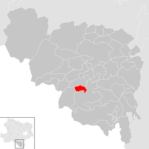
| Location of Otterthal in the Neunkirchen district | ||
  |
||
| Source: Municipal data from Statistics Austria | ||

Otterthal is a municipality with 586 inhabitants (as of January 1, 2020) in the Neunkirchen district in Lower Austria .
geography

Otterthal is located in the industrial district in Lower Austria. The area of the municipality covers 6.18 square kilometers. 61.72 percent of the area is forested.
Otterthal lies at the foot of the Otter and is traversed by the Otterbach , which flows into the Feistritz 3 km south-east near Kirchberg am Wechsel .
Community structure
There is only one cadastral community in Otterthal.
Neighboring communities
The neighboring communities are in the north Raach am Hochgebirge , in the east and south Kirchberg am Wechsel and in the west Trattenbach .
history
In ancient times, the area was part of the Noricum province .
With the Lower Austria. Municipal structural improvement were the communities as of 1 January 1971 Raach on high mountains and Trattenbach incorporated to Otterthal. On January 1st, 1985 these two communities became independent again. The reason was a finding by the Constitutional Court .
religion
According to the 2001 census data , 93.3% of the population are Roman Catholic and 1.1% Protestant . 1.8% are Muslims , 0.5% belong to Orthodox churches . 3.2% of the population have no religious denomination.
Population development

Culture and sights
There are no listed objects in Otterthal.
Economy and Infrastructure
In 2001 there were 14 non-agricultural workplaces, and according to the 1999 survey there were 25 in agriculture and forestry. The number of people in work at the place of residence was 266 according to the 2001 census. The employment rate in 2001 was 48.31 percent.
education
- Elementary school Otterthal
safety

- Volunteer Fire Brigade Otterthal
politics
The municipal council has 15 members.
- With the municipal council elections in Lower Austria in 1990, the municipal council had the following distribution: 8 SPÖ, 6 ÖVP and 1 other.
- With the municipal council elections in Lower Austria in 1995, the municipal council had the following distribution: 8 SPÖ and 7 ÖVP.
- With the municipal council elections in Lower Austria in 2000, the municipal council had the following distribution: 8 SPÖ, 4 ÖVP and 3 independent citizen lists for Otterthal.
- With the municipal council elections in Lower Austria in 2005 , the municipal council had the following distribution: 6 SPÖ, 6 ÖVP and 3 independent citizen lists for Otterthal.
- With the municipal elections in Lower Austria in 2010 , the municipal council had the following distribution: 10 ÖVP and 5 SPÖ.
- With the municipal council elections in Lower Austria in 2015 , the municipal council had the following distribution: 10 ÖVP and 5 SPÖ.
- With the municipal council elections in Lower Austria 2020 , the municipal council has the following distribution: 9 ÖVP and 6 SPÖ.
mayor
- until 2005 Karl Höfer (ÖVP)
- since 2005 Karl Mayerhofer (ÖVP)
Personalities
- Ludwig Wittgenstein (* 1889 Vienna; † 1951 Cambridge), 1925/26 elementary school teacher in Otterthal
Web links
- http://www.otterthal.at
- 31820 - Otterthal. Community data, Statistics Austria .
Individual evidence
- ↑ Change of community since 1945
- ↑ VfGH G29 / 83 October 13, 1983
- ^ Result of the local council election 1995 in Otterthal. Office of the Lower Austrian State Government, March 30, 2000, accessed on October 9, 2019 .
- ^ Election result of the municipal council election 2000 in Otterthal. Office of the Lower Austrian State Government, February 4, 2005, accessed on October 9, 2019 .
- ^ Election result of the local council election 2005 in Otterthal. Office of the Lower Austrian State Government, March 4, 2005, accessed on October 9, 2019 .
- ^ Election result of the local council election 2010 in Otterthal. Office of the Lower Austrian State Government, October 8, 2010, accessed on October 9, 2019 .
- ^ Election result of the 2015 municipal council election in Otterthal. Office of the Lower Austrian State Government, December 1, 2015, accessed on October 9, 2019 .
- ↑ Results of the local council election 2020 in Otterthal. Office of the Lower Austrian State Government, January 26, 2020, accessed on January 26, 2020 .

Altendorf | Aspang Market | Aspangberg-St. Peter | Breitenau | Breitenstein | Buchbach | Bürg-Vöstenhof | Edlitz | Enzenreith | Feistritz am Wechsel | Gloggnitz | Grafenbach-St. Valentin | Grimmenstein | Grünbach am Schneeberg | Höflein on the Hohe Wand | Kirchberg am Wechsel | Mönichkirchen | Natschbach-Loipersbach | Neunkirchen | Otterthal | Payerbach | Pitten | Prigglitz | Puchberg am Schneeberg | Raach am Hochgebirge | Reichenau an der Rax | Scheiblingkirchen-Thernberg | Schottwien | Schrattenbach | Schwarzau am Steinfeld | Schwarzau in the mountains | Seebenstein | Semmering | St. Corona am Wechsel | St. Egyden am Steinfeld | Ternitz | Thomasberg | Trattenbach | Warth | Wartmannstetten | Willendorf | Wimpassing in the Black Valley | Cube | Rumble
Cadastral communities: Otterthal
Locations: Otterthal
Village: Otterthal Settlement: Haidersiedlung Rotte: Brandstatt Scattered houses: Goldberg
Counting district: Otterthal