List of UNESCO Global Geoparks in Europe
On this page, sorted by country, the sites in the continent of Europe are listed that have been recognized by UNESCO as part of the International Geoscience and Geoparks Program (IGGP) as UNESCO Global Geopark and are therefore members of the Global Geopark Network.
The year denotes the year the site was recognized as a UNESCO Global Geopark. Years before 2015 mean that this year the Geopark was accepted as a member of the Global Geopark Network, which was integrated into the IGGP in 2015 and whose members were then awarded the title UNESCO Global Geopark .
Belgium
| image | designation | year | surface | Remarks |
|---|---|---|---|---|
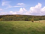 Famenne |
Famenne-Ardenne ( Location - Link ) |
2018 | 915 km² | Geopark in the Famenne , Calestienne and Ardennes regions |
Denmark
| image | designation | year | surface | Remarks |
|---|---|---|---|---|
|
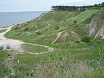
Odsherred ( Location - Link ) |
2014 | 355 km² | Geopark in the Odsherred area |
Germany
| image | designation | year | surface | Remarks |
|---|---|---|---|---|
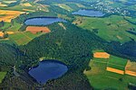 The Dauner Maare (further pictures) |
Vulkaneifel ( location - link ) |
2004 | 1,220 km² | Geopark in the Vulkaneifel . The landscape is shaped by volcanism and is characterized by a multitude of maars, cinder cones, lava flows, lava domes, calderas and bubbling springs. |
 Weser breakthrough Porta Westfalica (further pictures) |
TERRA.vita ( location - link ) |
2004 | 1,560 km² | includes the low mountain ranges Teutoburg Forest and Wiehengebirge , the western edge of the Weser Mountains and the Osnabrücker Land. The core of the area is a typical low mountain range with interesting geological fault lines. |
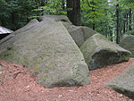 Felsenmeer in Lautertal (further pictures) |
Bergstrasse - Odenwald ( Location - Link ) |
2004 | 3,500 km² | Geopark in the area between the rivers Rhine , Main and Neckar |
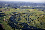 Randecker Maar (further pictures) |
Swabian Alb ( location - link ) |
2004 | 6,688 km² | encompasses the entire Swabian Alb , a karst landscape rich in caves, with unique fossil deposits and volcanic craters, from the Upper Rhine to the Nördlinger Ries |
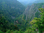 Roßtrappe (further pictures) |
Harz - Braunschweiger Land ( Location - Link ) |
2004 | 11,500 km² | includes the Harz , the Braunschweiger Land and Ostfalen in a transition area from the Geest lowlands along the Aller over the Eastern Brunswick hill country to the Harz low mountain range |
 Felixsee (further pictures) |
Muskauer fold arch ( location - link ) |
2011 | 578.8 km² | Geopark in the area of a compression moraine from the Elster Glaciation in the Lusatian border wall , cross-border with Poland |
Former Global Geopark:
- Mecklenburg Ice Age Landscape (2005-2011)
Finland
| image | designation | year | surface | Remarks |
|---|---|---|---|---|
 Long lake in Rokua National Park in Utajärvi |
Rokua | 2010 | 42.31 km² |
France
| image | designation | year | surface | Remarks |
|---|---|---|---|---|
| Haute Provence Geopark | 2004 | Haute Provence | ||
| Luberon Geopark | 2004 | 176500 | Luberon Regional Natural Park | |
| Bauges Geopark | 2011 | 85600 | Massif des Bauges regional nature park | |
| Chablais Geopark | 2012 | Chablais | ||
| Monts d'Ardeche Geopark | 2014 | 80000 | Monts d'Ardèche Regional Natural Park | |
| Causses du Quercy Geopark | 2017 | 185500 | Causses du Quercy Regional Natural Park | |
| Beaujolais Geopark | 2018 | Beaujolais |
Greece
| image | designation | year | surface | Remarks |
|---|---|---|---|---|
| Lesbos | 2004 | Lesbos | ||
| Psiloritis | 2004 | Psiloritis | ||
| Chelmos-Vouraikos | 2009 | |||
| Vikos - Aoos | 2010 | Vikos Gorge , Vikos Aoos National Park | ||
| Sitia | 2015 | Karst phenomena, caves and fossils in the Sitia Natural Park |
Ireland
| image | designation | year | surface | Remarks |
|---|---|---|---|---|
 Summit of Cuilcagh (more pictures) |
Marble Arch Caves ( Link ) |
2004 | 180 km² | includes the Marble Arch Caves and the Cuilcagh Mountains
cross border with the UK |
| Copper Coast | 2004 | Copper Coast : Coast of the towns of Fenor, Annestown-Dunhill, Boatstrand and Bunmahon in County Waterford | ||
| Burren and Cliffs of Moher | 2011 | Glacier Karstland |
Iceland
| image | designation | year | surface | Remarks |
|---|---|---|---|---|
 Mýrdalsjökull with Katla |
[[Katla |]] | 2011 | ||
| Reykjanes | 2015 | Mid-Atlantic ridge in the Reykjanesskagi region |
Italy
| image | designation | year | surface | Remarks |
|---|---|---|---|---|
| Madonie | 2004 | Madonie , Sicily | ||
| Beigua Park | 2005 | Beigua Natural Park , Genoa Province | ||
| Sardinia Geological and Mining Park | 2007 | Geological and Mining Park Sardinia ( Parco Geominerario Storico e Ambientale Della Sardegna ), consisting of eight sub-regions ( Monte Arci , Orani , Funtana Raminosa , Gallura , Argentiera - Nurra , Sos Enattos - Guzzwra , Sarrabus - Gerrei , Sulcis - Iglesiente - Guspinese ) | ||
| Adamello Brenta | 2008 | Adamello , Brenta | ||
| Cilento and the valley of the Diano | 2010 | Cilento and Vallo di Diano National Park | ||
| Tuscan mining park | 2010 | The San Silvestro Archaeological Mining Park is located in the hills of Campiglia Marittima
|
||
| Apuan Alps | 2011 | |||
| Rocca di Cerere | 2004 | |||
| Sesia - Val Grande | 2009 | Sesia , Val Grande (Val Grande National Park) | ||
| Pollino | 2015 | Geological features in the Pollino National Park , located in the border area between the Apennines and the Calabrian Peloritano Arch. |
Croatia
| image | designation | year | surface | Remarks |
|---|---|---|---|---|
 (more pictures) |
Papuk ( Link ) |
2007 | 524 km² | Geopark within the Papuk Nature Park |
Netherlands
| image | designation | year | surface | Remarks |
|---|---|---|---|---|
 In the Hunebedden Centrum Borger (further pictures) |
Geopark De Hondsrug | 2013 | Geopark in Drenthe and Groningen |
Norway
| image | designation | year | surface | Remarks |
|---|---|---|---|---|
| Gea-Norvegica | 2006 | Geopark from eight locations in Telemark and Vestfold , southern Norway: Skien , Porsgrunn , Kragerø , Larvik , Siljan , Bamble , Lardal , Nome | ||
| magma | 2010 | Anorthosite |
Austria
| image | designation | year | surface | Remarks |
|---|---|---|---|---|
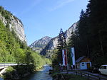 Salzatal (further pictures) |
Styrian Eisenwurzen ( Location - Link ) |
2004 | 586 km² | Geopark in the Styrian part of the Eisenwurzen with the Erzberg |
 Garnitzenklamm (further pictures) |
Carnic Alps ( Location - Link ) |
2012 | 830 km² | Geopark in the mountain range of the Carnic Alps in southern Austria on the border with Italy and includes the Carnic and Gailtal Alps |
 Obir stalactite caves |
Karawanken ( location - link ) |
2013 | 1,067 km² | Geopark in the Karawanken mountain range , cross-border with Slovenia |
 Mühlbach am Hochkönig |
Ore of the Alps ( location - link ) |
2014 | 211 km² | Geopark in Pongau in Salzburg |
Poland
| image | designation | year | surface | Remarks |
|---|---|---|---|---|
|
Muskauer fold arch ( location - link ) |
2011 | 578.8 km² | Geopark in the area of a compression moraine from the Elster Glaciation in the Lausitz border wall , cross-border with Germany |
Portugal
| image | designation | year | surface | Remarks |
|---|---|---|---|---|
| Naturtejo | 2006 | Tagus river | ||
| Arouca | 2009 | |||
| Lands of Knights | 2014 |
Romania
| image | designation | year | surface | Remarks |
|---|---|---|---|---|
| Hated | 2005 | Hațeg Dinosaur Park ( Hatzegopteryx ) |
Slovakia
| image | designation | year | surface | Remarks |
|---|---|---|---|---|
|
Novohrad-Nógrád ( Link ) |
2012 | 1,587 km² | Landscape in southern Slovakia and northern Hungary
cross-border with Hungary |
Slovenia
| image | designation | year | surface | Remarks |
|---|---|---|---|---|
| Idrija | 2013 | |||
|
Karawanken ( Link ) |
2013 | 1,067 km² | Geopark in the Karawanken mountain range , cross-border with Austria |
Spain
| image | designation | year | surface | Remarks |
|---|---|---|---|---|
| Maestrazgo | 2004 | Maestrazgo | ||
| Cabo de Gata | 2006 | Cabo de Gata | ||
| Sobrarbe | 2006 | Sobrarbe | ||
| Sierras Subbéticas | 2006 | Parts of the Betic Cordillera in Andalusia | ||
| Basque Country coast | 2010 | Basque Country coast | ||
| Central Catalonia | 2012 | |||
| Sierra Norte de Seville | 2011 | |||
| Villuercas-Ibores-Jara | 2011 | |||
| Molina and Alto Tajo | 2014 |
Czech Republic
| image | designation | year | surface | Remarks |
|---|---|---|---|---|
 Drachenfelsen (further pictures) |
Bohemian Paradise ( Location - Link ) |
2005 | 742 km² |
Hungary
| image | designation | year | surface | Remarks |
|---|---|---|---|---|
| Bakony-Balaton | 2012 | |||
|
Novohrad-Nógrád ( Link ) |
2012 | 1,587 km² | Landscape in southern Slovakia and northern Hungary
cross-border with Slovakia |
United Kingdom
| image | designation | year | surface | Remarks |
|---|---|---|---|---|
 Marble Arch Caves (further pictures) |
Marble Arch Caves ( Link ) |
2004 | 180 km² | includes the Marble Arch Caves and the Cuilcagh Mountains
cross border with Ireland |
| North Pennines | 2004 | Pennines | ||
| Forest Fawr | 2005 | Fforest Fawr in the Brecon Beacons National Park | ||
| North West Highlands | 2005 | Northwest Scottish Highlands | ||
| English Riviera | 2007 | English Riviera | ||
| Geo Mon | 2009 | |||
| Shetland | 2009 |
Former Global Geoparks:
- Abberley & Malvern Hills (2004-2008)
- Lochaber (2007-2011)
Web links
- List of current geoparks on the UNESCO website
- Members list on the website of the Global Geoparks Network (English)

