Geopark Harz - Braunschweiger Land - Ostfalen
The Harz - Braunschweiger Land - Ostfalen Geopark is a UNESCO Global Geopark in the three German states of Lower Saxony , Saxony-Anhalt and Thuringia .
Location and special features
In an area of around 100 × 120 kilometers, the Harz - Braunschweiger Land - Ostfalen Geopark encompasses nature parks and other nature conservation areas that identify the Harz , Braunschweiger Land and Ostfalen with Elm and Drömling as a destination for nature-based tourism . Within the Geopark Harz - Braunschweiger Land - Ostfalen a natural spatial change from the proceeds Geest valley of Aller -Flachlandes over the richly structured ostfälische hills up to the Harz Mountains.
history
The idea to establish a national geopark was born in 1997 in the open-air and adventure museum in Ostfalen by FEMO e. V. in Königslutter am Elm . The Harz - Braunschweiger Land - Ostfalen Geopark was founded in 2001. Together with the regional association Harz e. V., one of the largest geoparks in the world was founded. In 2003 the Geopark - initially with the Braunschweiger Land sub-area - became a member of the National Geopark Network. In 2004/2005 it was accepted into the European Geopark Network (EGN) and the Global Geopark Network (GGN) with the support of UNESCO. Since then, the Harz - Braunschweiger Land - Ostfalen Geopark has already been successfully revalidated three times, most recently in summer 2013. The infrastructure, management, program, budget and protection concept were all checked.
The Geopark is owned by the " Regionalverband Harz e. V. "based in Quedlinburg for the Harz region as well as the" Geopark-Trägererverein Braunschweiger Land - Ostfalen e. V. “based in Königslutter.
Geopark information centers have been set up in Königslutter, Goslar , Salzgitter , Torfhaus , Brockenhaus am Brockengipfel , Quedlinburg and the Einhornhöhle .
Landmarks and geopoints
Landmarks are particularly well-known locations or points in the area that are visible from afar. They are used for orientation in the Geopark. For each landmark and the surrounding area with geopoints - points of particular interest, at which the history of the earth but also the development of the cultural landscape can be recognized - there is a special leaflet with corresponding information.


![]() Map with all linked sites: OSM | WikiMap
Map with all linked sites: OSM | WikiMap
- Landmark 1: Hübichenstein with the geopoints of shell limestone outcrop near Eisdorf , glacier stone near Münchehof , deep Kuhle near Fürstenhagen and clay pit in Willershausen .
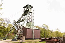
- Landmark 2: Ottiliae shaft
- Landmark 3: Rammelsberg
- Landmark 4: Brocken
- Landmark 5: Herzberg Castle
- Landmark 6: Poppenberg Tower
- Landmark 7: Kohnstein
- Landmark 8: Wernigerode Castle with the geopoints old and new town Wernigerode , mineral gorge in the Wernigerode public park, ruin Stapelburg , Mundglashütte Derenburg , Horstberg Wernigerode, Austberg- Rundweg, Ziegenberg near Heimburg, menhir from Benzingerode , stone cone near Blankenburg , show mine Büchenberg near Elbingen Volkmarskeller .
- Landmark 9: Bustard
- Landmark 10: Auerberg with the geopoints Museum Alte Münze in Stolberg, Glasebach mine in Straßberg, Stolberg Pentecost rock, Schneckenberg quarry , Alexisbad pioneer tunnel , Mühlenberg train under the Erichsburg, Bergrat-Müller-Teich , Erichsburg ruins , Brachmannsberg quarry, water solution tunnels in Selketal , Waldhof Silberhütte , Pfaffenberg mine and Güntersberge mountain lake .
- Landmark 11: Alte Burg Osterode am Harz with the geopoints Ritterhaus and the Harzkornmagazin , Aufschluss Fuchshalle, open-air museum in Lerbach , Sösetalsperre , Allertal near Riefensbeek-Kamschlacken , Pipinsburg , Teufelsbad , gypsum karst landscape Hainholz- Beierstein, Lichtenstein , Förste and karst hiking trail south Harz.
- Landmark 12: Point Cone Mine Dump Hohe Linde in Sangerhausen with Geopunkten Wipparer Zone "at the horses' heads" , Burggrill castle , Erlebniszentrum mining Wettelrode, castle head in Lengefeld, Karstwanderweg Dinsterbachschwinde , Bauerngraben , Alabaster balls and glacial potholes , Heimkehle at Uftrungen , Krebsbachwand in Rottleberode , New Moungsburg , Königspfalz Tilleda , Helmestausee as well as Europa-Rosarium and Spengler-Museum in Sangerhausen.
- Landmark 13: Baumannshöhle
- Landmark 14: Huysburg Monastery
- Landmark 15: Castle Ballenstedt with the geopoints Gegensteine , Bückeberg , Rambergmassiv , coal mine Oppenrode, Strulle in Meisdorf , Harzgerode , mining nature trail in Tilkerode , Carlswerk Mägdesprung , Erbstollen portal at Mägdesprung , Alexisbad , Museum of the City of Aschersleben and Quarry Rieder.
- Landmark 16: Sachsenstein with the geopoints Römerstein near Nüxei , Ravensberg near Bad Sachsa , Schwiebachtal near Bad Sachsa, Steina Glass Museum , Walkenried Monastery , Kranichstein near Neuhof, Glass and Huts Museum in Wieda , Bad Sachsa Natural History Museum and Sachsenstein Castle .
- Landmark 17: Mansfeld Castle
- Landmark 18: Liebenburg Castle
- Landmark 19: Bösenburg
- Landmark 20: Museum Schloss Salder
- Landmark 21: Lohra Castle
Web links
- Harz, Braunschweiger Land on the UNESCO website for Global Geoparks (English).
- Website about the Geopark Harz - Braunschweiger Land - Ostfalen
- State Office for Geology and Mining Saxony-Anhalt (LAGB)
Individual evidence
- ↑ Development of the Geopark at www.geopark-hblo.de; accessed on October 2, 2016
- ↑ Landmarks at www.harzregion.de
