Ries Geopark
The Ries Geopark has been certified as a National Geopark since May 2006 . In addition to the Nördlinger Ries impact crater, it includes the edge of the Ries and the areas with the ejecta that is still preserved today. With the Geopark project, the geological natural heritage is to be made more accessible to the public than before and made usable for regional tourism development.
Geography and Origin
Coordinates: 48 ° 53 ' N , 10 ° 32' E
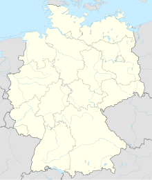
With an area of 1,800 km², it is almost six times the size of Munich . In the west the Swabian Alb borders the Geopark Ries, in the east it merges into the Franconian Alb . The Ries event , the impact of a meteorite ( asteroid ) 14.5 million years ago, left the Nördlinger Ries impact crater . It is the best preserved impact crater in Europe. The crater basin has a diameter of 25 km. The rim of the crater rises about 150 m. The Ries Geopark is a state and district-wide network. Most of the area is in Bavaria , a small part is in Baden-Württemberg . A total of five districts with 53 municipalities are involved. The design of the Geopark is therefore a complex development process.
tourism
The region is already well developed in terms of tourism. There is a dense network of cycling and hiking trails. The development focuses on gentle, natural tourism . As part of the nomination as a national geopark, information centers were set up in Nördlingen , Oettingen and Treuchtlingen, as well as an information point in Deiningen . The Rieskrater Museum in Nördlingen offers extensive information on the origins of the Ries crater . Outcrops and geotopes in the region are gradually being developed for tourism. In addition to the general tourist offers, there are thematically signposted hiking and cycling trails. The offer is supported by trained guides. Three information centers and five information points are contact points, knowledge centers and hubs for visitors and thus form the backbone of the Geopark. Other tourist regions in the area are the Altmühltal Nature Park , the Franconian Lake District or the Monheimer Alb .
Attractions
- The formerly free imperial city of Nördlingen , with its completely preserved city wall, forms the center of the Ries Geopark
- Other cities worth seeing in the Ries Geopark are Bopfingen , Wemding , Oettingen , Harburg and Donauwörth . In Wemding there is a Geopark-Ries information point not far from the market square.
- Palaces and fortresses can be found in Harbug, Hohenaltheim, Wallerstein , Oettingen and Baldern , for example
- Important monasteries and churches: Kirchheim Monastery, Neresheim Monastery, Mönchsdeggingen Monastery , pilgrimage basilica Maria Brünnlein Wemding , Maihingen Monastery, St. George's Church in Nördlingen
- Viewpoints: Ipf near Bopfingen, tower of St. George's Church in Nördlingen, Bockberg near Harburg, rocks in Wallerstein, Wemdinger Platte with the time pyramid
- Ofnet caves on the southwestern rim of the crater
literature
- Der Stein der Schwaben , 60 pages, Wilfried Rosendahl, Michael Schieber (ed.), ISBN 978-3-929981-78-0 , Staatsanzeiger-Verlag Stuttgart
- Sponsel, Wilfried (Ed.): DONAU-RIES district - nature and culture of a unique landscape , 2008, ISBN 978-3-935438-60-5
Web links
Individual evidence
- ↑ Information on the Ries Geopark . Website of the Geopark Ries. Retrieved November 8, 2010.
- ↑ Experience Geopark Ries . Website of the Geopark Ries. Retrieved May 3, 2016.
