Causses du Quercy Regional Natural Park
The Regional Nature Park Causses du Quercy ( French: Parc naturel régional des Causses du Quercy ) is located in the French department of Lot in the Occitanie region . The core area of this Nature Park includes the lime - highlands Causse de Gramat , Causse de Saint-Chels and Causse de Limogne . The north of the River Dordogne located Causse de Martel is not part of the territory of the nature park. The park stretches between Souillac in the north, Figeac in the east, Caussade in the south and Cahors in the west. On May 5, 2017, Causses du Quercy received the status of a UNESCO Global Geopark .
Park management
The nature park was founded on October 1, 1999 and today covers an area of around 185,500 hectares. The park administration is based in Labastide-Murat ( 44 ° 38 ′ 56 ″ N , 1 ° 34 ′ 2 ″ E, ), where the “Maison du Parc "is located. 102 municipalities with a catchment area of around 30,000 residents form the park.
Larger places in the park
landscape
The area is one of the most impressive landscapes in France due to its harsh beauty and low population density. The designation plateau is deceptive, however - the relief is almost always hilly at an altitude of 300 to 400 meters. The valleys of the Dordogne , Lot and Célé rivers structure the Causses de Quercy in an east-west direction.
The park includes the following natural landscapes and biotopes :
- the limestone plateaus (French Causses)
- Causse de Gramat (between Dordogne and Lot)
- Causse de Saint-Chels (between Célé and Lot)
- Causse de Limogne (south of the Lot)
- the river valleys
- the Limargue in the east
- the Quercy blanc in the south
Limestone plateaus
The limestone plateaus extend over an area of approximately 8,000 km². A thick layer of limestone deposited by the Jurassic Sea forms the geological basis. In the rock, which has become porous due to weathering , the precipitation seeps away immediately and forms a dry, stony plateau dominated by dry grass and downy oaks . The landscape here is shaped by karst features such as sinkholes , caves and natural shafts. A well-known example of such a shaft is the Gouffre de Padirac .
The dry grass landscape is particularly suitable for sheep farming . On this surface, formed by rocky plates, very resistant plant species thrive despite the drought: lichens and various types of sedum plant . Every year, small plants that are characterized by a short lifespan nestle in the tracks left by the sheep. Among them is a protected species of sand herb . The deeper soils offer the orchids perfect conditions for development and from spring to summer the daffodil unfolds its colored petals. A specific fauna has also adapted to this milieu. One encounters the pearl lizard , the largest European lizard, the mother-of-pearl shimmering six-spotted ram , a rare butterfly in the south of France or the screeching triel , a small wading bird whose plumage allows it to blend in with its surroundings.
River valleys
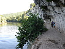
The waters flowing in the valleys create fertile land there that is used for agriculture. They impress with their green vegetation and their shining rock walls. But there are also numerous rivers that form arid and eroded valleys , such as As the Alzou or Ouysse that 3 / 4 of its travel spending below the surface. Here the river disappears at an infiltration point underground and mostly only comes back to daylight in the valley floor in the form of a karst spring . In midsummer, the contrast between the heat of the limestone plateaus and the freshness of the valleys is surprising. The great valleys have a strict gradation according to the height stratification. Each level has its own area of life:
- the river itself and its bank vegetation form a special biotope, which is also used by mills and inland shipping,
- the valley floor, where flooding can occur, is largely uninhabited and mostly only used for barns and tobacco drying sheds ,
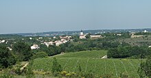
- the alluvial terraces , which are often separated from the valley floor by a forest backdrop, are used today for the course of traffic routes . This inhabited sector is largely protected against flooding and also houses agricultural crops , vines and fruit trees .
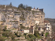
- on the valley flanks - alternating rock faces and wooded slopes - are the original villages , which are often flanked or towered over by castles . In the so-called abrises you can often find caves .
Thanks to the richness of their natural environment, several valleys belong to the European network of Natura 2000 protected areas. The valleys of Rauze and Vers in particular offer excellent living conditions for the rare species of great fire butterfly and for the peregrine falcons , which like to nest on the rock faces here. The valleys of the Ouysse and the Alzou also have the otters and bats as special fauna , which have chosen to live there.
Limargue
Further east, between the Causse de Gramat and the Ségala landscape , the chalky subsoil changes to clay or limestone marl and thus forms the lush green bocage landscape that is characteristic of the Limargue . It forms a narrow, fertile strip of land that connects the Lot and Dordogne rivers. From Figeac to Saint-Céré , this area offers a gentle hilly landscape with many small villages and lush vegetation with large stands of trees. It follows the valleys that open out of the limestone plateau of the Causse der Gramat and provide ample irrigation through a variety of karst springs.
Quercy blanc
In the south-west of the natural park, in the vicinity of Lalbenque and Cieurac, begins the area of the Quercy blanc (white Quercy), which extends to the valley of the Garonne . The name comes from the fact that shell limestone , chalk and marl are found underground . This leads to the peculiarity that the water of the heavy precipitation is stored in spring, even if its surface dries up strongly in summer. This temporary moisture enables the development of plant species that are otherwise only found in the humid, Mediterranean zones: rush lily or beach plantain . Fruit trees and intensive agriculture characterize the hilly landscape in the south, the north is dedicated to the truffle culture .
See also
Web links
- Website of the nature park (French)
Individual evidence
- ^ Eight Geological sites in Asia, Europe and Latin America become UNESCO Global Geoparks. In: en.unesco.org. UNESCO, May 5, 2017, accessed August 2, 2017 .


