Bamble
| coat of arms | map | |
|---|---|---|

|
|
|
| Basic data | ||
| Commune number : | 3813 | |
| Province (county) : | Vestfold and Telemark | |
| Administrative headquarters: | Langesund | |
| Coordinates : | 59 ° 1 ' N , 9 ° 34' E | |
| Surface: | 304.37 km² | |
| Residents: | 14,061 (Feb 27, 2020) | |
| Population density : | 46 inhabitants per km² | |
| Language form : | neutral | |
| Website: | ||
| politics | ||
| Mayor : | Hallgeir Kjeldal ( Ap ) (2015) | |
| Located in the province of Vestfold og Telemark | ||

|
||
Bamble is a Norwegian municipality in the south of Fylke Vestfold og Telemark with 14,061 inhabitants (as of February 27, 2020). The seat of the administration is in the locality Langesund .
geography
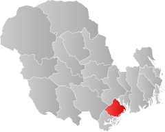
Bamble borders the municipalities of Kragerø , Drangedal , Skien and Porsgrunn and is located in the southwest of the Frierfjord . In 1964 the three municipalities of Bamble, Langesund and Stathelle were merged to form today's municipality of Bamble.
The area is heavily forested, characterized by basement hills and has a rugged coast. The highest mountain in the Bamble area is Hørsfjell with 288.2 moh. The rock is mostly limestone or slate. There are mineral deposits in the municipality, such as zinc, lead, nickel and uranium, but these are not mined.
population
The inhabitants of the place are called Bemling , Bamling or Bambling . As in many municipalities in Nordland , the official written language is Bokmål , which is the more widespread of the two Norwegian language forms. The greatest increase in population occurred in the 1970s after the establishment of petrochemical production. Currently, the population has been stable since around 2010.
Most of the inhabitants live in the towns of Stathelle and Langesund, which belong to the Tettsted of Porsgrunn and Skien .
economy
For a short time, nickel was mined in Bamble. Chemical production was set up in Rafnes in the 1970s. There are factories there that make ethene , chlorine , vinyl chloride and plastic .
Potatoes, wheat and barley, among other things, are grown on the agricultural land. The forest areas predominate, where mainly spruce and fir trees grow.
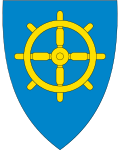
Langesund was a customs place from 1570 to 1962 and the port there was mainly used for shipping wood. He has a long shipbuilding tradition. The port of Stathelle was also used in a similar way. The coat of arms of the municipality is intended to depict this shipping tradition.
Personalities
- Atle Selberg (1917–2007), mathematician
- Ruth Ryste (* 1932), politician
- Bjørn Kjellemyr (* 1950), jazz bassist
- Jan-Halvor Halvorsen (* 1963), football player and coach
- Ivo de Figueiredo (* 1966), historian and biographer
- Jørn Lier Horst (* 1970), author
Web links
- Bamble in the store norske leksikon (Norwegian)
Individual evidence
- ↑ Statistisk sentralbyrå - Befolkning
- ↑ Høyeste fjelltopp i hver commune. Kartverket, September 1, 2015, accessed on August 29, 2020 (Norwegian Bokmål).
- ^ A b Jan Erik Nilsen, Sten Lundbo: Bamble . In: Store norske leksikon . February 5, 2020 (Norwegian, snl.no [accessed August 29, 2020]).
- ↑ Innbyggjarnamn. Språkrådet, accessed on August 29, 2020 (Norwegian Nynorsk).
- ↑ Forskrift om målvedtak i Kommunar og fylkeskommunar (målvedtaksforskrifta). In: Lovdata. January 6, 2020, accessed August 29, 2020 (Norwegian).
