Mortirolo Pass
| Mortirolo Pass | |||
|---|---|---|---|
|
|
|||
| Compass direction | North | south | |
| Pass height | 1896 m slm | ||
| province | Sondrio , Lombardy | Brescia , Lombardy | |
| Watershed | Oglino | ||
| Valley locations | Mazzo di Valtellina | Monno | |
| expansion | Pass road | ||
| map | |||
|
|
|||
| Coordinates | 46 ° 15 ′ 9 ″ N , 10 ° 18 ′ 16 ″ E | ||
Southwest of the Gavia Pass is the 1896 m slm , high Mortirolo Pass ( Italian Passo del Mortirolo ). In the surrounding area, the pass connects a whole network of hiking trails and easy roads. It represents an alternative route between Aprica and Stilfser Joch .
history
Modern times
The heyday of the Aprica and Mortirolo passes began in the late Middle Ages . The latter, at that time still known as "Mortaroul", was higher than the Apricapass, but it was able to shorten the route in north-south traffic considerably. Mortirolo was particularly popular in times of crisis, when you wanted to avoid the vulnerable aprica. From 1526 there is a travel report from a Venetian embassy that crossed the Mortirolo in December. They were accompanied by six local men who broke the ice and cleared away the deep snow so that the animals could get on safely.
You can still marvel at the cobbled streets from this time in Monno, the actual starting point of the pass trip. From Monno the path moved evenly to the top of the pass, this path is still lined almost up to the top with large forests and can be walked as a well-maintained ' mulattiera '. Since it is assumed that the top of the pass was still wooded in the 16th century, this enabled travelers at the time to be extremely safe when crossing, so that the Mortirolo could also be climbed in winter. In the 16th century, the short bloom of Mortirolos came to an end, it was Gavia who overtook him. There wasn't much that could change that the residents tried to mend the path.
Modern
If there is a good way here today, it is only because the Italian military built extensive fortifications in the mountains between Edola and the upper Valtellina, which required the appropriate connecting and connecting roads. The military roads around the Foppa were ultimately of little importance for the military. Only at the end of the Second World War, when partisan units were hiding in the area of the Foppa and Mortirolo, did these streets acquire a current importance for the military. The partisans repeatedly attacked the Germans in the valley from ambushes in the mountains, but especially their transports - the Germans did not accept this and organized regular hunts on the partisans. So there were battles at Mortirolo in February and again in April 1945, in which the attacked partisan units were able to hold their positions against a German superior force.
In the 1960s and 1970s, the project of a Fern- Reschen -Stilfser-Joch railway was discussed. The southern branch of this completely new Alpine transversal in particular had different route options. One of these variants envisaged a 9.5 km long tunnel under the Mortirolo pass, which was supposed to establish the connection Bormio-Edolo on a direct route. A 15.9 km long tunnel starting from Bormio was planned under the Stilfser Joch. This project was not realized.
present
Today, from Monno, hikers can largely hike on a mule track that was newly laid out at the beginning of this century, one to two meters wide, which leads to Alp San Giacomo. From there, the traces of the old path are somewhat blurred, only to be completely lost on the Veltliner side.
Giro d'Italia
With the ascent from Mazzo di Valtellina, the Mortirolo Pass has been part of the Giro d'Italia round tour of Italy about every two years since 1990 . With an average increase of 10.5% over 12.4 km, it is one of the first category mountain ratings. A total of 1,300 vertical meters have to be overcome with a maximum gradient of 18%.
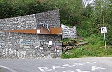
A memorial for the late racing cyclist Marco Pantani was erected in 2006, five kilometers below the top of the pass. In Giro stages, a special prize is awarded to the first driver, the Cima Pantani .
Individual evidence
- ↑ Istituto Geografico Militare : IGM 1:25 000, Portale Cartografico Nazionale ( Memento of the original of December 17, 2009 in the Internet Archive ) Info: The archive link was inserted automatically and has not yet been checked. Please check the original and archive link according to the instructions and then remove this notice. , accessed March 18, 2011
- ^ Steffan Bruns: Alpine passes. The passes between Lake Constance and Lake Como . tape 2 . L. Staackmann Verlag, Munich 2010, ISBN 978-3-88675-281-2 , p. 125 .
- ↑ Mortirolo
- ↑ Bianchi ( Memento of the original of September 29, 2007 in the Internet Archive ) Info: The archive link was automatically inserted and not yet checked. Please check the original and archive link according to the instructions and then remove this notice.


