
Aprica
| Aprica | ||
|---|---|---|

|
|
|
| Country | Italy | |
| region | Lombardy | |
| province | Sondrio (SO) | |
| Coordinates | 46 ° 9 ′ N , 10 ° 8 ′ E | |
| height | 1180 m slm | |
| surface | 20 km² | |
| Residents | 1,546 (Dec. 31, 2019) | |
| Population density | 77 inhabitants / km² | |
| Post Code | 23031 | |
| prefix | 0342 | |
| ISTAT number | 014004 | |
| Popular name | Aprichesi | |
| Patron saint | Assumption of Mary ( August 15 ) | |
| Website | Aprica | |
 Aprica to the west |
||

.svg)
Aprica is a municipality with 1546 inhabitants (as of December 31, 2019) in the province of Sondrio in Italy and is located on the Passo dell'Aprica .
geography
The municipality is located on the state road 39 (Strada Statale 39 del Passo di Aprica), which was once built under Austrian rule before Lombardy came to Italy . The neighboring communities are Corteno Golgi ( BS ), Teglio and Villa di Tirano .
In Austrian times, Aprica was still a sub-community of Teglio .
Community partnerships
-
 Legnano , Italy
 -
Borgo Val di Taro , Italy
photos

Aprica and Adamello
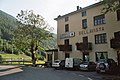
Old Ristorante - Albergo "Bellavista" on the pass road.
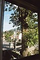
View of Aprica


literature
- Anna Ferrari-Bravo, Paola Colombini: Guida d'Italia. Lombardia (esclusa Milano). Milano 1987, p. 387.
- Lombardia - Touring club italiano, Touring Editore (1999), ISBN 88-365-1325-5 , Aprica Online
- Aprica on tuttitalia.it/lombardia
Web links
Individual evidence
- ↑ Statistiche demografiche ISTAT. Monthly population statistics of the Istituto Nazionale di Statistica , as of December 31 of 2019.

Albaredo per San Marco | Albosaggia | Andalo Valtellino | Aprica | Ardenno | Bema | Berbenno di Valtellina | Bianzone | Bormio | Buglio in Monte | Caiolo | Campodolcino | Caspoggio | Castello dell'Acqua | Castione Andevenno | Cedrasco | Cercino | Chiavenna | Chiesa in Valmalenco | Chiuro | Cino | Civo | Colorina | Cosio Valtellino | Dazio | Delebio | Dubino | Faedo Valtellino | Forcola | Fusine | Gerola Alta | Gordona | Grosio | Grosotto | Lanzada | Livigno | Lovero | Madesimo | Mantello | Mazzo di Valtellina | Mello | Mese | Montagna in Valtellina | Morbegno | Novate Mezzola | Pedesina | Piantedo | Piateda | Piuro | Poggiridenti | Ponte in Valtellina | Postalesio | Prata Camportaccio | Rasura | Rogolo | Samolaco | San Giacomo Filippo | Sernio | Sondalo | Sondrio | Spriana | Talamona | Tartano | Teglio | Tirano | Torre di Santa Maria | Tovo di Sant'Agata | Traona | Tresivio | Val Masino | Valdidentro | Valdisotto | Valfurva | Verceia | Vervio | Villa di Chiavenna | Villa di Tirano