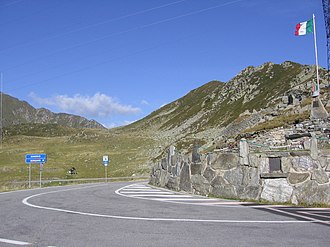
Passo San Marco
| Passo San Marco | |||
|---|---|---|---|
|
Pass height |
|||
| Compass direction | North | south | |
| Pass height | 1985 m slm | ||
| province | Sondrio ( Lombardy Region ) | Bergamo ( Lombardy Region ) | |
| Watershed | Adda → Po | Brembo → Adda → Po | |
| Valley locations | Morbegno ( Valtellina ) | Olmo al Brembo ( Val Brembana ) | |
| expansion | Strada Provinciale 8 (paved road) | Strada Provinciale 9 | |
| Winter closure | September to May | ||
| Mountains | Bergamasque Alps | ||
| map | |||
|
|
|||
| Coordinates | 46 ° 2 '20 " N , 9 ° 37' 46" E | ||
The Passo San Marco (German: “San Marco Pass”) is a mountain pass in the Bergamasque Alps with a peak height of 1985 m slm , which connects Morbegno in Valtellina with Mezzoldo and Olmo al Brembo in the Bergamo province . The pass road is the shortest connection from the Splügen Pass over the Valtellina into the Bergamasque region.
history
Already in the late Middle Ages there was considerable movement of people and goods over the San Marco Pass, which at that time was still called Montagna del Giogo or Monte Giogo . The name " Giogo " is to be equated with yoke , a name for a pass, which is very common in the Tyrolean region. In the 16th century, new pass names appeared, such as the names Monti di Averara , i.e. Averara Pass - after a village at the southern end of the actual pass route, a name that was mainly used by the Bergamans and Monte Albil , preferred by the Veltliners. It was not given today's name Passo San Marco until 1594. This commemorates San Marco , i.e. St. Mark, who is the patron saint of the Venetians.
From the late Middle Ages at the latest, the San Marco was part of the much-traveled trade route from Venice via Graubünden to southern Germany . It was probably during this time that the communities of Albaredo and Morbegno had built a path over the pass, but this still led through Averara and not yet through Mezzoldo . The north side had been sufficiently developed by the two Valtellina communities, but the Bergamasque south side was just an even older path and dangerously steep. In 1552, 40 municipalities in Val Brembana , on the southern route to the San Marco Pass, asked the Senate of Venice for help in expanding and improving the route over the San Marco. The petitioners also pointed out the strategic importance that the pass would be easy to defend against an enemy and to block. When visiting Venice in 1557, the ambassador from Graubünden, Friedrich Salis, also urged that the pass route be expanded. But Venice was not convinced of the need for expansion. That only changed when the differences between Venice and Habsburg - Spain got out of hand , and the project for San Marco Street was implemented before the end of the 16th century. After that, traffic from Venice, via Bergamo , San Marco and Splügen or Septimer , to Chur and on to Germany could make its way unhindered.

