Colle di Sampeyre
| Colle di Sampeyre | |||
|---|---|---|---|
|
Pass height |
|||
| Compass direction | Northeast | south | |
| Pass height | 2284 m slm | ||
| province | Cuneo | ||
| Watershed | Varaita , Po | Maira , Po | |
| Valley locations | Sampeyre | Stroppo | |
| expansion | Pass road | ||
| Mountains | Cottian Alps | ||
| profile | |||
| Denzel scale | SG 2-3 | ||
| map | |||
|
|
|||
| Coordinates | 44 ° 33 '4 " N , 7 ° 7' 8" E | ||
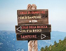
The Colle di Sampeyre (French: Col d'Sampeyre ) is a 2284 m slm high alpine pass in the province of Cuneo in the Italian Piedmont .
Location and surroundings
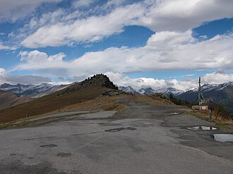
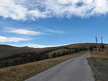
The continuously paved, almost two-lane pass road leads from Sampeyre in the Valle Varaita, mostly wooded, to the top of the pass with a beautiful view of the surrounding mountains. A three-kilometer high road leads to the south ramp, there alternatively down to Stroppo in the Valle Maira or via Elva and a side valley also to the Maira .
At the top of the pass, the so-called Varaita-Maira-Kammstraße crosses a gravel road. The road to Colle d'Esischie begins in Ponte Marmora, just a short distance from the southern end .
Web links
Commons : Colle di Sampeyre - Collection of images, videos and audio files
- Colle di Sampeyre at quaeldich.de
- Colle di Sampéyre at alpenrouten.de
Individual evidence
- ↑ a b Harald Denzel: Great Alpine Road Guide . 22nd edition; Denzel-Verlag Innsbruck 2005, ISBN 3-85047-764-9
- ↑ a b http://www.openstreetmap.org
- ↑ http://alpenrouten.de/Sampeyre-Colle-di_point433.html


