Wurzjoch
| Wurzjoch | |||
|---|---|---|---|
|
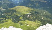
Würzjoch (a little to the left of the center of the picture) with Peitlerkofel |
|||
| Pass height | 1982 m slm | ||
| region | South Tyrol , Trentino-Alto Adige , Italy | ||
| Watershed | Untermoier Bach → Gader → Rienz → Eisack | Lasanke → Eisack | |
| expansion | National roads 29 and 30 | ||
| Winter closure | Yes | ||
| Mountains | between the Lüsner Mountains (north) and the Peitlerkofel group (south) in the Dolomites | ||
| Map (South Tyrol) | |||
|
|
|||
| Coordinates | 46 ° 40 '30 " N , 11 ° 48' 51" E | ||
The Würzjoch ( Ladin Ju de Börz ; Italian Passo delle Erbe ) is a 1982 m slm high mountain pass in the South Tyrolean Dolomites ( Italy ). The Würzjoch connects the Untermoital coming from the east with the Lüsner valley rising from the north or, more spaciously, the Gadertal with the Eisack valley . The Afer Valley also reaches the pass landscape from the west ; the transition from the Aferer to the Lüsner valley, the 1866 m high Kofeljoch or Halsl , lies around three kilometers west of the Würzjoch. To the south, the protected slopes of the Puez-Geisler Nature Park rise from the Würzjoch to the Peitlerkofel , in the north the gentle soils of the Lüsner Alm rise up . The Würzjoch is located in the municipality of St. Martin in Thurn . At the top of the pass there is a restaurant and a house of the Bolzano Cathedral Parish .
traffic
The Würzjoch is accessible for motor traffic by two state roads. The in some places narrow but well-developed state road 29 connects the Eisack Valley in the west with the Gadertal in the east; in its course it climbs uphill through the Afer valley, overcomes the Kofeljoch and the Würzjoch and finally climbs downhill through the Untermoital. The even narrower state road 30 leads up from the north-facing Lüsner valley and meets state road 29 just to the west under the Würzjoch. Another access option is available from the south-west via the Villnöss valley : the state road 163 coming from there changes at Russiskreuz over the watershed into the upper Aferer Valley and joins Landesstraße 29 below the Kofeljoch.
Compared to other, more important Alpine passes, the volume of traffic is low. The Würzjoch is closed in winter, but the top of the pass can still be reached from the west side. During this time there is also a cross-country ski run on the Würzjoch.
history
The Ladin linguist Lois Craffonara suspects that there has been a path over the Würzjoch since prehistoric times that connected the Eisack valley with the Gadertal valley . Near the yoke was the “Crep de la Scritüra”, the “rock with the writing”, which was destroyed when the road was rebuilt without a photograph of the old enigmatic inscription being made beforehand, so that one can now suspect is instructed. It could have been a Roman road inscription.


