
the Adrian Sea
|
Adria International: Adriatic Sea |
|
|---|---|
 (excerpt from NASA's Blue Marble map) |
|
| location | Southeast Europe |
| Important islands | Islands (selection) |
| Data | |
| surface | 132,000 km² |
| Maximum depth | 1260 m |
| Middle deep | 120 m |
|
particularities |
East coast more structured |
Coordinates: 42 ° 30 ′ 0 ″ N , 16 ° 0 ′ 0 ″ E

| |
Location of the Adriatic Sea within the Mediterranean |
The Adriatic Sea , or the Adriatic for short , ( Latin Mare Adriaticum ; Italian Mare Adriatico ; Serbo-Croatian Jadransko more or Jadran for short ; Slovenian Jadransko morje ; Albanian Deti Adriatik or Adriatiku for short ) is the elongated northern side basin of the Mediterranean Sea between the Apennine Peninsula and the Balkan Peninsula . The Adriatic Sea extends south to the Strait of Otranto . It is named after the city of Adria in Italy ( province of Rovigo ).
geography
location

The Adriatic Sea is 820 kilometers long from northwest to southeast and an average of 160 km wide. The greatest width is about 220 kilometers. It covers an area of 132,000 square kilometers and is between 40 and 200 meters deep in the north basin (north of the Monte Gargano foothills). The southern part is significantly deeper and reaches its greatest depth between Durrës and Bari at 1260 meters. The southern end of the sea is the Strait of Otranto , where the distance between Italy and Albania is 71 kilometers.
The neighboring countries are Italy , Slovenia , Croatia , Bosnia and Herzegovina , Montenegro and Albania .
Coastal
The north-western part, the upper Adriatic , is flat with some large lagoons . The largest is the Venice lagoon . After that, the Italian east coast south of Gabicce Mare suddenly becomes mountainous, with the entire coastline running relatively straight. Apart from the Tremiti Islands, there are no offshore islands. Only the in Puglia located Gargano -Gebirge protrudes some 50 kilometers to the east into the Adriatic Sea as a peninsula. The west coast of the Adriatic ends at the Italian boot heel near Otranto .

The east coast of the sea with the Istrian peninsula at its northern end is mountainous throughout. The Croatian landscape of Dalmatia occupies a large part of the east coast . The Bay of Kotor in Montenegro is about 30 kilometers long and is the largest bay in the Adriatic. The extreme southeast is again flat and swampy. There are well over a thousand islands along the entire east coast .
South of Shkodra in Albania extends along the coast of the Drin Gulf and also further south a wide lowland with partly untouched sandy beaches . Elongated lagoons have formed at many estuaries. The Adriatic coast ends at the bay of Vlora . The Albanian Riviera begins south of the city of Vlora on the Ionian Sea .
Port cities
Selected Adriatic ports are
- in Italy: Trieste , Venice including the port of Chioggia , Ravenna , Ancona , Pescara , Ortona , Bari , Brindisi
- in Slovenia: Koper
- in Croatia: Pula , Rijeka , Ploče , Zadar , Split , Dubrovnik
- in Bosnia and Herzegovina: Neum
- in Montenegro: Kotor , Bar
- in Albania: Durrës , Vlora
- Ports (selection)

Ancona

Rijeka
Twill


Islands


- Croatia: Brač , Cres , Čiovo , Dugi Otok , Hvar , Ilovik , Ist , Jabuka , Korčula , Krk , Lastovo , Lopud , Lošinj , Mljet , Pag , Premuda , Olib , Rab , Šipan , Susak , Vis , Unije and many others . In total, there are 1246 islands in the Croatian Adriatic . Only 47 of them are inhabited.
- Bosnia-Herzegovina: Mali Školj and Veliki Školj
- Montenegro: Sveti Stefan , Sveti Nikola and the group of small islands in the Bay of Kotor : Mamula , Sveti Marko , Ostrvo Cvijeća ("Island of Flowers"), as well as Gospa od Škrpjela and Sveti Đorđe off Perast ( list of islands in Montenegro )
- Albania: Sazan in front of the Karaburun peninsula near the Strait of Otranto
- Italy: Tremiti Islands , north of the Gargano Peninsula
climate
The climate is characterized by very warm, dry summers with little rain and mild, sometimes rainy and humid winters. In summer there are constant, weakly windy weather conditions. In winter, the Adriatic region is under the influence of low pressure areas from the Atlantic . This occasionally leads to warm south winds ( Scirocco ) and cold north winds ( Bora / Bura ).
Oceanography
Ocean currents
The ocean current runs north along the east coast and south along the west coast. Often three equally large, pronounced eddies can be observed counterclockwise (in the upper, middle and lower third of the basin), each filling the entire width of the Adriatic. The Adriatic is an elongated basin with a narrow opening at the southern end (approx. 70 km wide). Therefore there is relatively little water exchange with the rest of the Mediterranean.
Salinity
The salinity in the estuary of the large rivers (depending on the season and precipitation) is around 2.5 to 3% on the surface. Away from estuaries, the salinity in the north is around 3.4% and increases to 3.9% in the south. At a depth of 10 m, the water has almost the same salinity as the respective surface water away from the estuaries.
Water temperature
The water temperature on the surface reaches 23 to 28 ° C in summer (August), in bays and in the south it can also reach over 30 ° C, with the Italian coast generally having warmer water. In winter (February) the temperature in the north drops to around 7 ° C and in the south to around 15 ° C.
tourism
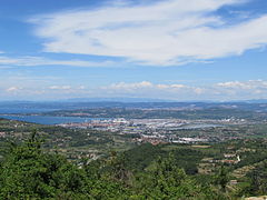
.jpg)
Tourism is economically important for the neighboring countries. Many seaside resorts by this sea are known throughout Europe, some worldwide. These include:
- Italy: Trieste , Bari , Venice , Ravenna , Rimini , Chioggia , Eraclea Mare , Jesolo , Caorle , Bibione , Grado , Ancona , San Benedetto del Tronto , Giulianova , Pescara , Vasto , Termoli , Vieste , Trani and Otranto
- Croatia: Dubrovnik , Rovinj , Poreč , Pula , Opatija , Zadar , Šibenik , Trogir , Split , the Makarska Riviera and the Croatian islands
- Slovenia: Izola , Koper , Piran , Portorož
- Montenegro: Budva , Herceg Novi , Ulcinj , Bar
- Bosnia and Herzegovina: Neum
- Albania: Durrës , Vlora , Golem , Velipoja and Shëngjin
On the Italian coast, several arteries run alongside the sea, some parallel to each other. The Italian state roads Strada Romea from Venice to Ravenna and then the Strada Adriatica from Ravenna to the south run along the coast . Furthermore, the Autostrada Adriatica motorway and the Bologna-Ancona railway lines from Rimini to Ancona and then the Ferrovia Adriatica all the way to the south.
The Adriatic Coastal Road (Jadranska Magistrala) runs along the east coast from Slovenia to Montenegro .
Environmental protection and climate change
In 2004, the water quality was largely good to very good in a test commissioned by the ADAC away from the Po estuary on the Italian and Croatian coasts. The Adriatic is polluted by various types of waste from the neighboring countries .
The Adriatic is increasingly becoming the focus of environmental protection and climate change . The most visible signs are the increase in tropical fish stocks as well as increasing algae and jellyfish plagues. In 2007, the then Italian Environment Minister Alfonso Pecoraro Scanio warned that global warming and environmental pollution "are making the Adriatic into a closed basin in which there is no longer any life at a depth of 150 meters". In September 2007, the Adriatic was a topic of the first Italian national conference on global warming in Rome.
literature
- Joseph Partsch : Adria . In: Paulys Realencyclopadie der classischen Antiquity Science (RE). Volume I, 1, Stuttgart 1893, Col. 417-419.
- Adriatic. In: ADAC motorwelt. Munich 2005.3. ISSN 0007-2842
- Uwe Rada: The Adriatic . Rediscovery of a place of longing. Pantheon Verlag, Munich 2014, ISBN 978-3-570-55222-3 .
Web links
Individual evidence
- ↑ Current graphic representations of wind, waves, salinity, temperature of the Adriatic, accessed on October 11, 2016
- ↑ ADAC on adria-istrien.de: - ( Memento of 29 September 2007 at the Internet Archive ) 2 ( Memento of 29 September 2007 at the Internet Archive )
- ↑ Croatia's coast is flooded with garbage diepresse.com
- ↑ Our sea no longer knows winter . In: Süddeutsche Zeitung