Jabuka (Adria)
| Jabuka (Adria) | ||
|---|---|---|
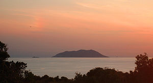
| Left to right: Brusnik, Svetac, Jabuka | ||
| Waters | the Adrian Sea | |
| Geographical location | 43 ° 5 '29.2 " N , 15 ° 27' 40.8" E | |
|
|
||
| surface | 2.2 ha | |
| Highest elevation | 97 m | |
| Residents | uninhabited | |
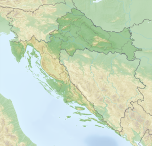
Jabuka ( Croatian for “apple”) is a cone-shaped , uninhabited island of volcanic origin with an area of 0.022 km² in the Adriatic Sea west of Vis .
It is a rock that juts 97 meters out of the sea and is a destination for many sailors. Since the rock contains a lot of magnetite , compasses do not work properly near the island, which is why common sea routes bypass the island.
The bank is steep and difficult to access, even in calm weather and from the south-west side. An endemic species of black lizards ( Podarcis melisellensis pomoensis ) and strictly protected species of endemic knapweed ( Centaurea jabukensis and Centaurea crithmifolia ) live on the island . Both belong to the daisy family ( Asteraceae ). All around the sea is rich in fish, especially dentex . In 1958 the island was declared a natural monument .
Web links
Individual evidence
- ↑ AmusingPlanet.com: Jabuka, The Magnetic Island. Retrieved August 1, 2017 .


