
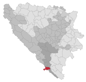
Neum
|
Neum Неум |
|||
|
|
|||
|
|||
| Basic data | |||
|---|---|---|---|
| State : | Bosnia and Herzegovina | ||
| Entity : | Federation of BiH | ||
| Canton : | Herzegovina-Neretva | ||
| Coordinates : | 42 ° 56 ' N , 17 ° 37' E | ||
| Height : | |||
| Area : | 225 km² | ||
| Residents : | 4,960 (2013) | ||
| Population density : | 22 inhabitants per km² | ||
| Structure and administration (as of 2016) | |||
| Mayor : | Živko Matuško ( HDZ BiH ) | ||
| Website : | |||
  |
|||


Neum ( Serbian - Cyrillic Неум [ ˈnɛum ]) is a place and the associated municipality with almost 5,000 inhabitants in the south of Bosnia and Herzegovina . The Neum Corridor is the country's only access to the sea.
Geography and climate
Neum is located on the Adriatic Sea in a small bay protected by the Pelješac peninsula . The place has the highest average annual temperature in all of Bosnia and Herzegovina. It lies in a headland five kilometers wide at its narrowest point, which separates the southernmost part of Croatia around Dubrovnik and up to the border with Montenegro from the rest of Croatia.
politics
Politically, the municipality belongs to the Herzegovina-Neretva canton of the Federation of Bosnia and Herzegovina . The vast majority of the population are Croatians. According to the 1991 census, there were 4,325 inhabitants in the municipality of Neum. 90% of them described themselves as Croats , 4.3% as Serbs and 3.7% as Bosniaks ; 2% of the population were listed under "Other". At the 2013 census, the population had risen to 4,960.
In addition to the main town of Neum , the municipality also includes the towns of Babin Do, Banja, Brestica, Broćanac, Brštanica, Cerovica, Crnoglav, Cerovo, Čukova Greda, Dašanica, Dobri Do, Dobrovo, Dračevica, Donji Drijen, Dubravice, Duži, Grabovice, Glumina, Gornje Hrasno, Gradac, Hotanj, Hutovo, Ilino Polje, Jazine, Kamenice, Kiševo, Kolojanj, Moševiči, Mramor, Nerađe-Podstjene, Opuće, Oskorušnica, Prapratnica, Praovice, Previževo, Vino, Selet Vranjula, Rabrani, , Zelenikovac and Žukovice.
history
In the area of the municipality of Neum there are a number of sites from prehistoric times, but archaeological research in this area is still inadequate. A large number of stećci (stone graves) can be found from the time of the medieval Bosnian kingdom, especially in the hinterland.
In the late Middle Ages, the area around Neum was a bone of contention between the Republic of Venice and the Republic of Ragusa . With the Peace of Karlowitz in 1699, it became part of the Ottoman Empire , among other things because the Republic of Ragusa wanted to prevent Venice from being further strengthened in the region and, for this purpose, the Ottomans as a buffer to the Venetian Dalmatia, two strips of land, including at Neum im North-west of the ragus area. This gave the Ottomans access to the Adriatic for the first time .
At the time of Napoleon Neum remained formally with the Ottoman Empire, but the French built a road through the area. Even in the age of the Austro-Hungarian monarchy , Neum remained attached to Bosnia-Herzegovina. In 1947, the then Yugoslav republic of Bosnia and Herzegovina exchanged a short stretch of coast near Sutorina in the Bay of Kotor with the neighboring republic of Montenegro for an area in the mountains. This made Neum the only Bosnian-Herzegovinian access to the sea. Neum has been part of the state of Bosnia and Herzegovina since 1992.
economy
Neum is the only place in Bosnia and Herzegovina that has access to the sea. That is why it has a certain importance for summer tourism . The first tourist accommodation was built in the 1950s, after the construction of the Adriatic Highway in 1965, a car camping site. In 1977 the “Hotel Neum” was built. Today there are six hotels and a large number of private guest houses in Neum. In addition to local guests, as in other smaller towns on the central Adriatic, tourists from the countries of the former Eastern Bloc , especially Poles , Czechs and Slovaks , predominate , with some German and Austrian tourists coming.
traffic
The port of Neum is the only point of access for Bosnia-Herzegovina's shipping to the Mediterranean .
The unusual demarcation between Bosnia-Herzegovina and Croatia results in some traffic-related challenges.
Neum corridor
The Neum Agreement provides for the EU accession of Croatia a major traffic bottleneck. At this point, not just a part of the continuous Croatian territory, but also the common will EU border km interrupted in a section of less than 10. In the context of Croatia's EU accession negotiations, this peculiarity was dealt with in a cross-political manner, which is why Croatia's EU accession treaty included exceptions to the Neum corridor, for example in terms of security policy or customs law ( Schengen Agreement ).
To solve the problem, construction work began in 2007 on the Pelješac Bridge , which was intended to connect the two Croatian parts of the country and bypass the Bosnian-Herzegovinian territory. After the construction work was stopped for the time being in 2012, it is to be continued in summer 2018. The completion date for the new bridge is planned for 2022.
Poor connection to the Bosnian-Herzegovinian road network
Another problem for Neum is that it has no paved road connection with the rest of the Bosnia and Herzegovina State territory, which limits above all the sales opportunities for products from Neum within the country, since heavy trucks the existing road towards Stolac can not pass , but the alternative route goes through EU territory and thus through the European customs union. The creation of an efficient connection between Neum and Stolac has been planned since the 1980s, but has not yet been implemented.
See also
- International conflicts in the successor states of Yugoslavia - details on the construction of a bridge over the Bay of Neum
- Neum harbor
Web links
Individual evidence
- ↑ About municipality Neum. In: Website of the city of Neum. Archived from the original on March 12, 2008 ; accessed on June 20, 2019 .
- ^ Franz Petter: Dalmatia represented in its various relationships . Justus Perthes, Gotha 1857. Vol. 2, p. 170.
- ↑ Lauren Simmonds: Pelješac Bridge Construction to Begin Soon, Without Workers? In: total-croatia-news.com. June 28, 2018, accessed July 4, 2018 .
- ^ Vedran Pavlic: Pelješac Bridge to Be Constructed Within 3.5 Years. In: total-croatia-news.com. April 3, 2017, accessed May 8, 2017 .

Banja Luka | Banovići | Berkovići | Bihać | Bijeljina | Bileća | Bos. Krupa | Bos. Brod | Bos. Petrovac | Šamac | Bos. Grahovo | Bratunac | Brčko | Breza | Bugojno | Busovača | Bužim | Cazin | Centar | Čajniče | Čapljina | Čelić | Čelinac | Čitluk | Derventa | Drvar | Doboj | Doboj Istok | Doboj Jug | Dobretići | Domaljevac-Šamac | Donji Vakuf | Donji Žabar | Foča | Foča-Ustikolina | Fojnica | Gacko | Glamoč | Goražde | Gornji Vakuf-Uskoplje | Gračanica | Gradačac | Gradiška | Grude | Hadžići | Han Pijesak | Ilidža | Ilijaš | Istočna Ilidža | Istočni Drvar | Istočni Mostar | Istočni Stari Grad | Istočno Novo Sarajevo | Jablanica | Jajce | Jezero | Kakanj | Kalesija | Kalinovik | Kiseljak | Kladanj | Ključ | Kneževo | Konjic | Kostajnica | Kotor Varoš | Kozarska Dubica | Kreševo | Krupa na Uni | Kupres | Kupres (RS) | Laktaši | Livno | Ljubinje | Ljubuški | Lopare | Lukavac | Maglaj | Milići | Modriča | Mostar | Mrkonjić degree | Neum | Nevesinje | Novi Grad | Novi Grad (Bos. Novi) | Novi Travnik | Novo Sarajevo | Odžak | Olovo | Orašje | Osmaci | Oštra Luka | Pale | Pale-Prača | Pelagićevo | Petrovac | Petrovo | Posušje | Prijedor | Prnjavor | Prozor-Rama | Ravno | Ribnik | Rogatica | Rudo | Sanski Most | Sapna | Sokolac | Srbac | Srebrenica | Srebrenik | Stari Grad | Stanari | Stolac | Šekovići | Šipovo | Široki Brijeg | Teočak | Teslić | Tešanj | Tomislavgrad | Travnik | Trebinje | Trnovo (RS) | Trnovo (FBiH) | Tuzla | Ugljevik | Usora | Ustiprača | Vareš | Velika Kladuša | Visoko | Višegrad | Vitez | Vlasenica | Vogošća | Vukosavlje | Zavidovići | Zenica | Zvornik | Žepče | Živinice