
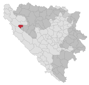
Petrovac (Republika Srpska)
|
Petrovac Петровац |
|||
|
|
|||
|
|||
| Basic data | |||
|---|---|---|---|
| State : | Bosnia and Herzegovina | ||
| Entity : | Republika Srpska | ||
| Municipality : | Petrovac | ||
| Coordinates : | 44 ° 30 ′ N , 16 ° 28 ′ E | ||
| Height : | 725 m. i. J. | ||
| Area : | 145 km² | ||
| Residents : | 516 (2018) | ||
| Population density : | 4 inhabitants per km² | ||
| Structure and administration (as of 2016) | |||
| Mayor : | Milan Grbić ( DNS ) | ||
| Website : | |||
  |
|||


Petrovac ( Serbian - Cyrillic Петровац ) is an association municipality (opština) in the northwest of Bosnia and Herzegovina . It belongs to the Republika Srpska and was created by the separation of the easternmost part of the community of Bosanski Petrovac as a result of the Dayton Agreement after the Bosnian War . The actual place Petrovac is in that larger part of the old unified municipality, which today belongs to the federation . The administrative seat is Drinić.
geography
The municipality is located in the Bosanska Krajina on the northern slope of the Klekovača mountain range about nine kilometers southeast of Bosanski Petrovac. About 90 percent of the community area is forested; only a small area in the northwest around the place Drinić is open land.
The populated area is between 730 and 760 meters above sea level, while the terrain in the south of the municipality rises to 1900 meters.
In the village of Drinić (near a restaurant), 27 km from the border, lies the geographical center of Croatia .
![]()
population
In the 1991 census, the district of Drinić of Bosanski Petrovac, which today mainly forms the municipality of Petrovac in the Republika Srpska, had 363 inhabitants, including 362 Serbs . There was also a Serb majority in the rest of the municipality of Bosanski Petrovac, but Bosanski Petrovac came to the federation regardless of the front location with the Dayton Treaty. At the 2013 census, Petrovac had 367 inhabitants.
Infrastructure
The community can be reached by an asphalt access road from Magistral Road 5 ( Bihać - Sarajevo ) six kilometers away . In addition to the municipal administration, Drinić has a medical ambulance, a primary school, a sports field, a police station , a fire brigade, a forestry office, a café , a petrol station, a car repair shop and a bank branch.
Individual evidence
- ↑ http://rzs.rs.ba/front/article/3630/ Updated population figures for 2018 from the Institute for Statistics of the Republika Srpska. Retrieved June 9, 2019.
- ↑ Popis stanovništva, domaćinstava i stanova u Bosni i Hercegovini 2013 - PRELIMINARNI REZULTATI. Sarajevo November 5, 2013, p. 10
- ↑ http://www.drinic.rs.ba/engleski/krozdrinic.htm

Banja Luka | Banovići | Berkovići | Bihać | Bijeljina | Bileća | Bos. Krupa | Bos. Brod | Bos. Petrovac | Šamac | Bos. Grahovo | Bratunac | Brčko | Breza | Bugojno | Busovača | Bužim | Cazin | Centar | Čajniče | Čapljina | Čelić | Čelinac | Čitluk | Derventa | Drvar | Doboj | Doboj Istok | Doboj Jug | Dobretići | Domaljevac-Šamac | Donji Vakuf | Donji Žabar | Foča | Foča-Ustikolina | Fojnica | Gacko | Glamoč | Goražde | Gornji Vakuf-Uskoplje | Gračanica | Gradačac | Gradiška | Grude | Hadžići | Han Pijesak | Ilidža | Ilijaš | Istočna Ilidža | Istočni Drvar | Istočni Mostar | Istočni Stari Grad | Istočno Novo Sarajevo | Jablanica | Jajce | Jezero | Kakanj | Kalesija | Kalinovik | Kiseljak | Kladanj | Ključ | Kneževo | Konjic | Kostajnica | Kotor Varoš | Kozarska Dubica | Kreševo | Krupa na Uni | Kupres | Kupres (RS) | Laktaši | Livno | Ljubinje | Ljubuški | Lopare | Lukavac | Maglaj | Milići | Modriča | Mostar | Mrkonjić degree | Neum | Nevesinje | Novi Grad | Novi Grad (Bos. Novi) | Novi Travnik | Novo Sarajevo | Odžak | Olovo | Orašje | Osmaci | Oštra Luka | Pale | Pale-Prača | Pelagićevo | Petrovac | Petrovo | Posušje | Prijedor | Prnjavor | Prozor-Rama | Ravno | Ribnik | Rogatica | Rudo | Sanski Most | Sapna | Sokolac | Srbac | Srebrenica | Srebrenik | Stari Grad | Stanari | Stolac | Šekovići | Šipovo | Široki Brijeg | Teočak | Teslić | Tešanj | Tomislavgrad | Travnik | Trebinje | Trnovo (RS) | Trnovo (FBiH) | Tuzla | Ugljevik | Usora | Ustiprača | Vareš | Velika Kladuša | Visoko | Višegrad | Vitez | Vlasenica | Vogošća | Vukosavlje | Zavidovići | Zenica | Zvornik | Žepče | Živinice