
Šekovići
|
Šekovići Шековићи |
|||
|
|
|||
|
|||
| Basic data | |||
|---|---|---|---|
| State : | Bosnia and Herzegovina | ||
| Entity : | Republika Srpska | ||
| Coordinates : | 44 ° 18 ' N , 18 ° 51' E | ||
| Height : | 550 m. i. J. | ||
| Area : | 202 km² | ||
| Residents : | 5,942 (2018) | ||
| Population density : | 29 inhabitants per km² | ||
| Telephone code : | +387 (0) (+387) 56 | ||
| Postal code : | 75450 | ||
| Structure and administration (as of 2016) | |||
| Mayor : | Momir Ristić ( SP ) | ||
| Website : | |||
| Others | |||
| City Festival : | August 28th | ||
  |
|||
.svg)

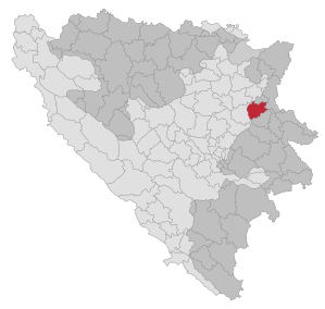
Šekovići ( Serbian - Cyrillic Шековићи ) is a municipality ( opština ) and the place of the same name in northeast Bosnia and Herzegovina . It borders the communities of Kalesija and Osmaci in the north, Zvornik in the east, Vlasenica in the south, Kladanj in the west and has belonged to the Republika Srpska since the Bosnian War .

The sparsely populated municipality is located in the wooded low mountain range of the Birač region in northeast Bosnia and is crossed by the Drinjača and Tišća rivers . There are two Serbian Orthodox monasteries in the municipality, Papraća and Lovnica in the valley of the river of the same name near the Šekovići municipality center.
In the last census before the Bosnian War in 1991 of 9,629 inhabitants, a total of 9,030 (93.8%) described themselves as Serbs and 326 (3.4%) as Bosniaks . Of 34 places in the municipality, the village of Papraća - the location of one of the two Serbian monasteries - was the only one with a Bosniak majority.
During the war the community was right on the front line; many places were badly damaged. At the 2013 census, the population was 6,761. Of these, 6,618 identified themselves as Serbs (97.9%) and 107 as Bosniaks.
Individual evidence
- ↑ http://rzs.rs.ba/front/article/3630/ Updated population figures for 2018 from the Institute for Statistics of the Republika Srpska. Retrieved June 9, 2019.
- ↑ Agencija za statistiku Bosne i Hercegovine: Popis stanovništva, domaćinstava i stanova u Bosni i Hercegovini, 2013. Rezultati popisa. (pdf, 19.7 MB) Sarajevo, June 2016; P. 65
Web links

Banja Luka | Banovići | Berkovići | Bihać | Bijeljina | Bileća | Bos. Krupa | Bos. Brod | Bos. Petrovac | Šamac | Bos. Grahovo | Bratunac | Brčko | Breza | Bugojno | Busovača | Bužim | Cazin | Centar | Čajniče | Čapljina | Čelić | Čelinac | Čitluk | Derventa | Drvar | Doboj | Doboj Istok | Doboj Jug | Dobretići | Domaljevac-Šamac | Donji Vakuf | Donji Žabar | Foča | Foča-Ustikolina | Fojnica | Gacko | Glamoč | Goražde | Gornji Vakuf-Uskoplje | Gračanica | Gradačac | Gradiška | Grude | Hadžići | Han Pijesak | Ilidža | Ilijaš | Istočna Ilidža | Istočni Drvar | Istočni Mostar | Istočni Stari Grad | Istočno Novo Sarajevo | Jablanica | Jajce | Jezero | Kakanj | Kalesija | Kalinovik | Kiseljak | Kladanj | Ključ | Kneževo | Konjic | Kostajnica | Kotor Varoš | Kozarska Dubica | Kreševo | Krupa na Uni | Kupres | Kupres (RS) | Laktaši | Livno | Ljubinje | Ljubuški | Lopare | Lukavac | Maglaj | Milići | Modriča | Mostar | Mrkonjić degree | Neum | Nevesinje | Novi Grad | Novi Grad (Bos. Novi) | Novi Travnik | Novo Sarajevo | Odžak | Olovo | Orašje | Osmaci | Oštra Luka | Pale | Pale-Prača | Pelagićevo | Petrovac | Petrovo | Posušje | Prijedor | Prnjavor | Prozor-Rama | Ravno | Ribnik | Rogatica | Rudo | Sanski Most | Sapna | Sokolac | Srbac | Srebrenica | Srebrenik | Stari Grad | Stanari | Stolac | Šekovići | Šipovo | Široki Brijeg | Teočak | Teslić | Tešanj | Tomislavgrad | Travnik | Trebinje | Trnovo (RS) | Trnovo (FBiH) | Tuzla | Ugljevik | Usora | Ustiprača | Vareš | Velika Kladuša | Visoko | Višegrad | Vitez | Vlasenica | Vogošća | Vukosavlje | Zavidovići | Zenica | Zvornik | Žepče | Živinice