
Kotor Varoš
|
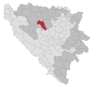
Kotor Varoš Котор Варош |
|||
|
|
|||
|
|||
| Basic data | |||
|---|---|---|---|
| State : | Bosnia and Herzegovina | ||
| Entity : | Republika Srpska | ||
| Coordinates : | 44 ° 37 ' N , 17 ° 22' E | ||
| Height : | 220 m. i. J. | ||
| Area : | 560 km² | ||
| Residents : | 18,007 (2018) | ||
| Population density : | 32 inhabitants per km² | ||
| Telephone code : | +387 (0) 51 | ||
| Postal code : | 78220 | ||
| Structure and administration (as of 2016) | |||
| Mayor : | Zdenko Sakan (Savez za promjene) | ||
| Website : | |||
  |
|||
.svg)

Kotor Varoš ( Serbian - Cyrillic Котор Варош ) is a small town in Bosnia and Herzegovina and the capital of the municipality of the same name with 22,000 inhabitants. Since 1995 (stipulated in the Dayton Agreement ) it has belonged to the Republika Srpska .
history
Today's town developed from the medieval town of Kotor and the settlement of Varoš (Hungarian for "town") founded in the 16th century.
geography
Kotor Varoš is located in the Vrbanja valley about 35 km southeast of Banja Luka . The 560 km² large municipal area extends at a height of 220 m (northwest) to 1,739 m (southeast, Vlašić Mountains). Around Kotor Varoš there are further, lower mountain ranges : in the north the Uzlomac , in the east the Borja , in the west the Čemernica .
Neighboring municipalities are Čelinac , Kneževo , Teslić and Travnik .
population
At the 1991 census, the municipality of Kotor Varoš had 36,853 inhabitants, including
- Serbs : 14,056 (38.14%)
- Bosniaks : 11,090 (30.09%)
- Croatians : 10,695 (29.02%)
- Yugoslavs : 745 (2.02%)
- Others: 267 (0.73%)
10,885 people lived in the main town, including
- Croatians : 5,205 (47.82%)
- Serbs : 2,735 (25.13%)
- Bosniaks : 2,256 (20.73%)
- Yugoslavs : 555 (5.10%)
- Others: 134 (1.23%)
No ethnic group made up an absolute majority of the population.
The municipality comprises a total of 43 places: Baština, Bilice, Boljanići, Borci Donji, Borci Gornji, Ćorkovići, Duratovci, Garići, Grabovica , Hadrovci, Hrvaćani, Hanifići, Jakotina, Kotor Varoš, Kruševo Brdo I, Kruševo Brdo II, Donje Liplje , Maslovare , Novo Selo, Obodnik , Orahova, Palivuk, Plitska, Podbrđe, Podosoje, Postoje, Prisočka, Radohova, Raštani, Ravne, Rujevica , Selačka, Sokoline, Stopan, Šibovi, Šiprage , Tovevladić, Vagani , Varjače, Vranić, Vrbanjci , Zabrđe and Zaselje.
traffic
In the Vrbanja valley runs the main road M4 (Banja Luka – Teslić – Doboj), from which side roads branch off to Skender Vakuf and (in Obodnik) to Šiprage .
Sports
The men's team of the handball club RK Kotor Varoš plays in the Premier League in 2008/2009. The teams of the football club FK Mladost and the basketball club KK Mladost each play in the (third-class) 2nd league of the Republika Srpska.
literature
- ↑ http://rzs.rs.ba/front/article/3630/ Updated population figures for 2018 from the Institute for Statistics of the Republika Srpska. Retrieved June 9, 2019.
- ↑ Vojnogeografski institute, Ed. (1955): Prnjavor (List map 1: 100.000, Izohipse near 20 m). Vojnogeografski institut, Beograd.
- ↑ Spahić M. et al. (2000): Bosna i Hercegovina (1: 250,000). Izdavačko preduzeće "Sejtarija", Sarajevo.
- ↑ Mučibabić B., Ed. (1998): Geografski atlas Bosne i Hercegovine. Geodetski zavod BiH, Sarajevo.
Sons and daughters
- Mateo Kovačić (* 1994), football player
- Senijad Ibričić (* 1985), football player

Banja Luka | Banovići | Berkovići | Bihać | Bijeljina | Bileća | Bos. Krupa | Bos. Brod | Bos. Petrovac | Šamac | Bos. Grahovo | Bratunac | Brčko | Breza | Bugojno | Busovača | Bužim | Cazin | Centar | Čajniče | Čapljina | Čelić | Čelinac | Čitluk | Derventa | Drvar | Doboj | Doboj Istok | Doboj Jug | Dobretići | Domaljevac-Šamac | Donji Vakuf | Donji Žabar | Foča | Foča-Ustikolina | Fojnica | Gacko | Glamoč | Goražde | Gornji Vakuf-Uskoplje | Gračanica | Gradačac | Gradiška | Grude | Hadžići | Han Pijesak | Ilidža | Ilijaš | Istočna Ilidža | Istočni Drvar | Istočni Mostar | Istočni Stari Grad | Istočno Novo Sarajevo | Jablanica | Jajce | Jezero | Kakanj | Kalesija | Kalinovik | Kiseljak | Kladanj | Ključ | Kneževo | Konjic | Kostajnica | Kotor Varoš | Kozarska Dubica | Kreševo | Krupa na Uni | Kupres | Kupres (RS) | Laktaši | Livno | Ljubinje | Ljubuški | Lopare | Lukavac | Maglaj | Milići | Modriča | Mostar | Mrkonjić degree | Neum | Nevesinje | Novi Grad | Novi Grad (Bos. Novi) | Novi Travnik | Novo Sarajevo | Odžak | Olovo | Orašje | Osmaci | Oštra Luka | Pale | Pale-Prača | Pelagićevo | Petrovac | Petrovo | Posušje | Prijedor | Prnjavor | Prozor-Rama | Ravno | Ribnik | Rogatica | Rudo | Sanski Most | Sapna | Sokolac | Srbac | Srebrenica | Srebrenik | Stari Grad | Stanari | Stolac | Šekovići | Šipovo | Široki Brijeg | Teočak | Teslić | Tešanj | Tomislavgrad | Travnik | Trebinje | Trnovo (RS) | Trnovo (FBiH) | Tuzla | Ugljevik | Usora | Ustiprača | Vareš | Velika Kladuša | Visoko | Višegrad | Vitez | Vlasenica | Vogošća | Vukosavlje | Zavidovići | Zenica | Zvornik | Žepče | Živinice