
Prijedor
|
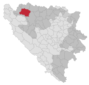
Prijedor Приједор |
|||
|
|
|||
|
|||
| Basic data | |||
|---|---|---|---|
| State : | Bosnia and Herzegovina | ||
| Entity : | Republika Srpska | ||
| Coordinates : | 44 ° 59 ' N , 16 ° 43' E | ||
| Height : | 136 m. i. J. | ||
| Area : | 834 km² | ||
| Residents : | 78,826 (2018) | ||
| Population density : | 95 inhabitants per km² | ||
| Telephone code : | +387 (0) 52 | ||
| Postal code : | 79000 | ||
| Structure and administration (as of 2016) | |||
| Mayor : | Milenko Đaković ( DNS ) | ||
| Website : | |||
  |
|||


Prijedor ( Serbian - Cyrillic Приједор ) is the administrative seat of the Opština of the same name (large municipality) in the north-western part of Bosnia and Herzegovina . It belongs to the Republika Srpska entity .
geography
The northern part of the municipality largely includes the Kozara Mountains with the national park of the same name, while south of the city there is an agricultural plain, the so-called Prijedorfeld ( Prijedorsko polje ).
The city of Prijedor is located on the northern edge of the Prijedorfeld. It is located at around 136 m. i. J. on the Sana River , around 48 kilometers northwest of Banja Luka and around 110 kilometers southeast of Zagreb .
The municipality has an area of 834 km².
climate
There is a moderate continental climate with the four seasons usual for Europe. The maximum temperatures range from −30 to +40 ° C. The amount of precipitation is around 1000 L / m². On average, snow falls on 26 days, which remains there for around 40 days. Due to the nearby Ribnjak Saničani fish pond and the Sana River, up to 80 foggy days form per year.
Community structure
In the municipality of Prijedor there are a total of 71 settlements, which are grouped into 48 so-called Mjesne zajednice (local communities). The settlements are:
Ališići, Babići, Bistrica, Bišćani, Božići, Brđani, Brezičani, Briševo, Busnovi, Cikote, Crna Dolina, Čarakovo, Čejreci, Čirkin Polje, Ćela, Dera, Donja Dragotinja, Donja Ravska, Donji Garevci, Donani Orjić , Gomjenica, Gornja Dragotinja, Gornja Jutrogošta, Gornja Puharska, Gornja Ravska, Gornji Garevci, Gornji Jelovac, Gornji Orlovci, Gornji Volar, Gradina, Hambarine, Hrnići, Jaruge, Jelićka, Jugovci, Kalajevo, Kamičani , Kevljani, Kozarac , Kozaruša , Krivaja , Lamovita, Ljeskare, Ljubija, Malo Palančište, Marićka, Marini, Miljakovci , Miska Glava, Niševići, Ništavci, Omarska , Orlovača, Pejići, Petrov Gaj, Prijedor, Rakelići, Rakovčani, Tis, Sankovičići, Rakovčani, Raljauri, Rasavci, Rizovčani, Raljauri, Rasavci, Rizovčani, Raljauri Tomašica, Trnopolje, Veliko Palančište, Zecovi and Žune.
history

Evidence from early history suggests that there were settlements in the area of the city as early as the times of the Roman Empire . There are finds from Roman times in Ljubija as evidence of iron production in the region at that time . An Illyrian burial place was also found in Zecovi . Prijedor was first mentioned as a foundation fortress in letters from Count Adam Bacani from the time of the so-called Vienna War in the years 1683 to 1699.
During the Bosnian War , from May 1992 onwards, Serbian troops carried out so-called ethnic cleansing of the Muslim and Croatian civilian populations and carried out massacres. The camps Omarska , Keraterm and Trnopolje were located nearby . Around 3,300 Croats and Bosniaks were murdered in the vicinity of Prijedor .
In 2013, a mass grave with the remains of 430 people, mainly Bosniaks but also Croats, was discovered in a disused mine near the village of Tomašica. From July 2015, body parts up to 5 m deep were found in the village of Jakarina Kosa, a secondary mass grave of those who were probably murdered around 1992.
Population development
97,588 people live in the municipality and 65,000 people in the actual city of Prijedor. About 17,000 people who had fled during the Bosnian War lived on the territory of the municipality .
Before the outbreak of war, Prijedor was mainly inhabited by Yugoslavs , Bosniaks , Croats and Serbs . Most of the Bosniak and Croatian population fled or were expelled during the Bosnian War . About 24,000 Bosniaks and Croats returned after the war. The Bosnian Serbs make up the majority of the population today, minorities are Bosniaks, Croats and Roma as well as Czechs, Ukrainians, Romanians and Slovenes.
| Serbs | Bosniaks | Croatians | Yugoslavs | other | |
|---|---|---|---|---|---|
| 1971 | 46,487 (47.47%) | 39,190 (40.02%) | 8,845 (9.03%) | 1,458 (1.48%) | 1,941 (2.00%) |
| 1981 | 45,279 (41.59%) | 42,129 (38.69%) | 7,297 (6.70%) | 10,556 (9.69%) | 3,607 (3.33%) |
| 1991 | 47,745 (42.45%) | 49,454 (43.97%) | 6,300 (5.60%) | 6,371 (5.66%) | 2,600 (2.32%) |
economy


Industrialization in the territory of the Prijedor municipality began with a sawmill that was established in 1883 near Kozarac . In addition, there was the only agricultural association and poultry farm in the Austro-Hungarian Bosnia .
The first industrial plants built at the beginning of the 20th century included the Prva krajiška tvornica cigle i crijepa (First Carniolan brick and roof tile factory) and a food and poultry export company founded by the trader Zarija Gašić, which was the first of its kind in Europe . The first biscuit bakery in Bosnia was also established in Prijedor with the Ćetić company . After the Second World War it was named "Mira Cikota". This company is still one of the largest candy factories in the country today.
traffic

Prijedor is located on Bosnian Magistral Road 4 , which runs from Novi Grad to Banja Luka and runs along the Sana River.
The city was connected to the railway network as early as 1873 with the Banja Luka – Dobrljin railway, the first railway line in Bosnia and Herzegovina. Until 1975 it was also the starting point of the narrow-gauge Steinbeisbahn to Lička Kaldrma and Jajce . As a result of the war, rail traffic was interrupted in 1992. Since 2001 there is again a rail connection from Zagreb via Prijedor-Omarska to Banja Luka and via Doboj to Sarajevo . There are also trains to Bihać .
There is also a well-developed bus network, which also includes some international connections, for example to Germany.
Culture
The most important cultural institutions in the city and the community are the Kozara Mountain Museum, the city library " Cyril and Method ", the city theater and the cultural and artistic Mladen-Stojanović Association, which was founded a century ago as the Serbian vocal ensemble "Vila".
Attractions

The city has a large number of old churches. At the beginning of the 1990s, several Catholic churches and most of the mosques were destroyed in the Bosnian War. After the war, many of them were rebuilt or renovated.
In the surrounding area, the Kozara Mountains with a national park as an excursion area are particularly worth mentioning. On its peaks Mrakovica (804 m) and Patrija , there are monuments to the victims of the Second World War. The Moštanica monasteries from the 12th century and Klisina are also important.
Sports
The first records of sporting activities in Prijedor come from the 19th century. The Society of Physical Education was founded in 1907 under the name Sokol .
Prijedor's oldest sports clubs are the tennis club, founded in 1914, and the football club “Prijedor”, founded in 1919.
The local football club FK Rudar Prijedor played in the Premijer Liga , the top division in Bosnia and Herzegovina , from 2009 to 2015 . The club is currently active in the Prva Liga RS .
Personalities
- Zlatan Arnautović (* 1956), handball player
- Nasko Budimlić (* 1960), musician, drummer in the band Divlje Jagode
- Fritz Czermak (1894–1966), German politician
- Nebojša Grahovac (* 1984), handball player
- Idriz Hošić (* 1944), football player
- Josip Iličić (* 1988), football player
- Halid Muslimović (* 1961), folk & pop singer
- Duško Tadić (* 1955), politician and war criminal
See also
Web links
- Official website of the city of Prijedor
- Association for Economic Development Prijedor (German, English, Italian, Serbian)
- map
Individual evidence
- ↑ http://rzs.rs.ba/front/article/3630/ Updated population figures for 2018 from the Institute for Statistics of the Republika Srpska. Retrieved June 9, 2019.
- ↑ http://www.hrw.org/reports/1997/bosnia/Bosnia-03.htm
- ↑ 430 bodies recovered. Taz.de, November 8, 2013, accessed on August 7, 2019.
- ↑ http://orf.at/#/stories/2300101/ Hundreds of body parts in Bosnian mass grave, orf.at, September 21, 2015, accessed September 21, 2015.
- ↑ http://www.bhas.ba/obavjestenja/Preliminarni_rezultati_bos.pdf
- ↑ a b Archived copy ( memento of the original dated December 3, 2013 in the Internet Archive ) Info: The archive link has been inserted automatically and has not yet been checked. Please check the original and archive link according to the instructions and then remove this notice.

Banja Luka | Banovići | Berkovići | Bihać | Bijeljina | Bileća | Bos. Krupa | Bos. Brod | Bos. Petrovac | Šamac | Bos. Grahovo | Bratunac | Brčko | Breza | Bugojno | Busovača | Bužim | Cazin | Centar | Čajniče | Čapljina | Čelić | Čelinac | Čitluk | Derventa | Drvar | Doboj | Doboj Istok | Doboj Jug | Dobretići | Domaljevac-Šamac | Donji Vakuf | Donji Žabar | Foča | Foča-Ustikolina | Fojnica | Gacko | Glamoč | Goražde | Gornji Vakuf-Uskoplje | Gračanica | Gradačac | Gradiška | Grude | Hadžići | Han Pijesak | Ilidža | Ilijaš | Istočna Ilidža | Istočni Drvar | Istočni Mostar | Istočni Stari Grad | Istočno Novo Sarajevo | Jablanica | Jajce | Jezero | Kakanj | Kalesija | Kalinovik | Kiseljak | Kladanj | Ključ | Kneževo | Konjic | Kostajnica | Kotor Varoš | Kozarska Dubica | Kreševo | Krupa na Uni | Kupres | Kupres (RS) | Laktaši | Livno | Ljubinje | Ljubuški | Lopare | Lukavac | Maglaj | Milići | Modriča | Mostar | Mrkonjić degree | Neum | Nevesinje | Novi Grad | Novi Grad (Bos. Novi) | Novi Travnik | Novo Sarajevo | Odžak | Olovo | Orašje | Osmaci | Oštra Luka | Pale | Pale-Prača | Pelagićevo | Petrovac | Petrovo | Posušje | Prijedor | Prnjavor | Prozor-Rama | Ravno | Ribnik | Rogatica | Rudo | Sanski Most | Sapna | Sokolac | Srbac | Srebrenica | Srebrenik | Stari Grad | Stanari | Stolac | Šekovići | Šipovo | Široki Brijeg | Teočak | Teslić | Tešanj | Tomislavgrad | Travnik | Trebinje | Trnovo (RS) | Trnovo (FBiH) | Tuzla | Ugljevik | Usora | Ustiprača | Vareš | Velika Kladuša | Visoko | Višegrad | Vitez | Vlasenica | Vogošća | Vukosavlje | Zavidovići | Zenica | Zvornik | Žepče | Živinice