Kozaruša
|
Kozaruša Козаруша |
||
|
|
||
| Basic data | ||
|---|---|---|
| State : | Bosnia and Herzegovina | |
| Entity : | Republika Srpska | |
| Municipality : | Prijedor | |
| Coordinates : | 44 ° 59 ' N , 16 ° 49' E | |
| Height : | 175 m. i. J. | |
| Area : | 6.81 km² | |
| Residents : | 3,361 (2013) | |
| Population density : | 494 inhabitants per km² | |
| Telephone code : | +387 (0) 52 | |
| Postal code : | 79 202 | |
Kozaruša ( Serbian - Cyrillic Козаруша ) is a village in the northwestern part of Bosnia and Herzegovina , in the Republika Srpska . The village belongs to the municipality of Prijedor .
In the Bosnian war Kozaruša was heavily damaged. The place borders in the northeast to Kozarac , from where it was also administered earlier. Kozaruša is eight kilometers from Prijedor and 42 kilometers from Banja Luka . The Kozaruša mosque was rebuilt after the Bosnian War.
geography
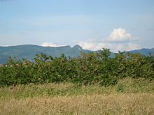
Kozaruša is located on the southern slope of the Kozara Mountains.
climate
The winter in Kozaruša is usually severe, the summers are usually very hot, as everywhere in Bosnia.
history
Before 1992 Kozaruša was part of Yugoslavia . Many Kozaruša residents were expelled during the Bosnian War, and many men were deported to the Omarska camp and killed there. Since the war the place belongs to the Republika Srpska.
population
Most of the inhabitants of Kozaruša are Bosniaks, but there are also Roma, Serbs and Croats living in the village.
Individual evidence
- ↑ cf. ICTY judgment against Duško Tadić , z. B. International Law Reports 1999, p. 127

