Strait of Sicily
| Strait of Sicily | |
|---|---|
| Connects waters | Western Mediterranean |
| with water | Eastern Mediterranean |
| Separates land mass | Sicily |
| of land mass | North africa |
| Data | |
| Geographical location | 37 ° 12 ' N , 11 ° 12' E |
| Smallest width | 145 km |
| Coastal towns | Marsala |
| Islands | Pantelleria |
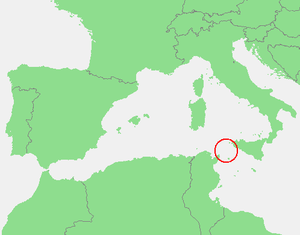
| Map of the Strait of Sicily | |
The Strait of Sicily ( Italian Canale di Sicilia , French canal de Sicile or canal du cap Bon , sometimes also called Strait of Tunis ) is a strait or sea region (Sicilian Sea) of the Mediterranean , between Sicily and Tunisia . It connects the eastern and western Mediterranean. Here the Libyan Sea merges into the western basin of the Mediterranean ( Sardinian Sea ) and the Tyrrhenian Sea . In the narrower sense, only the strait between Cap Bon and Mazara del Vallo / Marsala itself, the road in the sense of the less common expression "Sicilian Sea" is seen in the east as far as Malta and the Pelagic Islands . At its narrowest point, the Strait of Sicily is about 145 km wide. The strait has a maximum depth of 316 m.
Ocean currents
As in the Strait of Gibraltar , the ocean current in the Strait of Sicily has a direction from west to east at the surface and from east to west at depth.
Islands
The island of Pantelleria , which belongs to Italy, is located near the narrowest point in the middle of the Strait of Sicily , with the Pelagic Islands and the Malta Archipelago to the southeast.
Submarine plate tectonics
In the Strait of Sicily, the African Plate meets the Eurasian Plate , which due to plate tectonics leads to submarine volcanism . Examples of this are the temporarily active underwater volcanoes Ferdinandea and Empedocles .


