
Tyrrhenian Sea

The Tyrrhenian Sea ( Italian Mar Tirreno , French Mer Tyrrhénienne ) is part of the Mediterranean . It is located west of the Apennine Peninsula between the islands of Sardinia , Corsica and Sicily . The Ligurian Sea joins to the north, the open Mediterranean Sea to the south and the Ionian Sea to the east via the Strait of Messina . In the west, the Strait of Bonifacio represents the transition into the open Mediterranean Sea. The name originated from the Greek name Τυρρηνοί (Tyrrhenoí) for the Etruscans who settled on the adjacent mainland.
The sea lies over a complex plate tectonic system and is geologically young. Volcanism shaped coastlines and islands. The oceanic crust forms parts of the deep sea floor, which is characterized by trenches and deep sea mountains . The sea is about 3600 meters deep. Located in the middle of the densely populated western Mediterranean , the Tyrrhenian Sea has been a theater of trade and war since ancient times . The seafarers on the sea included Etruscans, Greeks, Romans, Vandals , Normans , Genoese , Spaniards and French. Rome is connected to the wider Mediterranean by the Tyrrhenian Sea, just like the sea route from Marseille and Genoa to the east and to the Suez Canal through the Tyrrhenian Sea. The most important sea port is Gioia Tauro in Calabria .
Compared to the rest of the Mediterranean, the Tyrrhenian Sea has a rather low bio-productivity. The mostly rocky coastal areas, in which, among other things, precious corals and lobsters settle, are biologically important. Coasts like the Gulf of Naples , the Amalfi Coast , the Sicilian coasts and smaller islands like Capri or Ischia have been among the most popular tourist regions in the world since the dawn of modern tourism.
Surname
The name of the sea is derived from the Greek name for the Etruscans , who were called Tyrrhenoi in ancient Greek . According to Greek tradition , the Etruscans, who lived in the area where Tuscany is located today , were brought to their later settlement area by Prince Tyrrhenus from Lydia . In the Latin of the Roman Empire, the sea was the Mare Tyrrhenicum . The name and its modifications are also used by the residents themselves, the French name of the sea is Mer Tyrrhénienne , the Italian Mar Tirreno . In Ligurian it is Mâ Tirren , in Sicilian and Corsican it is called Mari Tirrenu , in Sardinian it is Mare Tirrenicu .
geography
location
The Tyrrhenian Sea lies between mainland Italy in the east, the islands of Sardinia and Corsica in the west, Sicily in the southeast, in the north it borders on the Ligurian Sea and in the south on the open Mediterranean. On the Italian mainland, it borders the regions of Tuscany, Lazio , Campania , Basilicata and Calabria . The sea covers an area of 231,000 km².
The exact limits are as defined by the IHO :
![]() Map with all coordinates: OSM | WikiMap
Map with all coordinates: OSM | WikiMap
- In the road from Messina from the northernmost point of Cape Paci ( 38 ° 15 '27 " N , 15 ° 42' 52" O ) to the easternmost point Sicily at Cape Pelore ( 38 ° 16 '3 " N , 15 ° 39' 11 ″ O ).
- In the southwest (the Strait of Sicily ) from the westernmost point of Sicily ( Cape Lilibeo ) ( 37 ° 48 ′ 7 ″ N , 12 ° 25 ′ 27 ″ E ) to the southernmost point of Sardinia ( Cape Teulada ) ( 38 ° 51 ′ 51 ″ N , 8 ° 38 ′ 44 ″ E ).
- In the road from Bonifacio from the westernmost point of Capotesta in Sardinia ( 41 ° 14 '15 " N , 9 ° 8' 17" O ) to the south-westernmost point of Cape Feno ( 41 ° 23 '31 " N , 9 ° 5' 46 ″ O ) in Corsica.
- To the north: a line from Cap Corse ( 43 ° 0 ′ 37 ″ N , 9 ° 23 ′ 0 ″ E ) to Tinetto ( 44 ° 1 ′ 25 ″ N , 9 ° 51 ′ 3 ″ E ), through the islands of Tino and Palmaria to Saint Pietro Point ( 44 ° 2 ′ 53 ″ N , 9 ° 49 ′ 57 ″ E ) on the Italian mainland coast.
Emergence

The Tyrrhenian Sea is geologically much younger than the rest of the Mediterranean. It opened as a backarc basin , probably 7 million years ago in the Miocene . The movement ended about 3 million years ago in the Pliocene . At the time of the beginning of the opening, the Corsican-Sardinian continental block lay next to the Adriatic plate . The Eurasian and African plates pushed the Corsican-Sardinian block together in a north-south direction, as a result of which the Adriatic plate turned counterclockwise and the Tyrrhenian Sea opened in an east-west direction.
The crust under the Tyrrhenian Sea has structures of real oceanic crust, but it has a limited volume. The deepest layers in the vast majority of the sea consist of extensive continental crust. The thin crust of the Tyrrhenian Sea borders the Calabrian Subduction Zone in the east and is sandwiched in the north and south by the Adriatic and African plates. Under the Tyrrhenian Sea lies the subducted part of the Ionic plate .
In the past 13,000 years, the water level in the Tyrrhenian Sea has risen by 67 meters. There have been regular measurements of the increase since 1884. The average increase between 1897 and 1942 was 1.2 millimeters per year, between 1931 and 1971 an average of 1.54 millimeters per year and by the end of the 1980s it was 1.6 millimeters per year.
Shape and hydrology
shape

The sea is roughly triangular in shape. The maximum depth is unclear, data are mostly around 3600 meters, but range from around 3,400 to 3,840 meters. The continental shelf is narrow and reaches widths of 10 to 40 kilometers. Of the total area of 231,000 km², 14,800 km² are on the continental shelf and a further 48,600 km² are on the continental slope . The rest of the area is taken up by deep sea basins. Based on tectonic and magnetic criteria, the shape of the ground can be divided to about 41 degrees north latitude. To the south of this line the crust is significantly thinner and the volcanic irregularities are much more pronounced.
In the north of the sea, the Canale di Corsica forms the main connection between the Tyrrhenian deep-sea basin and the Ligurian- Provençal basin to the north . The deep sea channel is about 100 kilometers long and at its narrowest point between the Tuscan shelf with the islands of Capraia and Corsica only about 30 kilometers wide. It reaches depths of 460 meters. The northern Tyrrhenian Sea does not get deeper than 2000 meters. The western half, the so-called Corsica Basin, is comparatively flat. The islands of Elba , Montecristo , Capraia and Pianosa lie on the central ridge . On the coast lies the again comparatively flat Tuscan shelf. The seamounts Etruschi and Cialdi are at the transition to the deeper southern Tyrrhenian Sea. The earth's crust is around 25 kilometers thick in the northern Tyrrhenian Sea.
The southern part of the Tyrrhenian Sea probably consists partly of basaltic ocean crust. The earth's crust is around 30 kilometers thick near Sardinia in the west and thins to values between five and ten kilometers to the west. The crust is particularly thin here in the central area under the deep-sea mountains Vavilov and Marsili , which also lies above a comparatively soft earth mantle . Similar characteristics can be found under Ischia . The Tyrrhenian Sea has the thinnest earth crust in the Mediterranean. The soil there is complex, consisting of numerous slopes and comparatively small, deep plains. These are surrounded by deep sea mountains, which can also be located in the middle of the plains. There is also a variable and complex coastline. From the northern coast of Sicily , the seabed drops steeply into a basin that is one of the deepest parts of the sea. On the Sicilian coast towards the Italian peninsula, the slope is less pronounced.
The southern Tyrrhenian Sea shows numerous igneous soil structures that can pile up to almost three thousand meters. This includes several deep sea mountains of volcanic origin such as Vavilov and Marsili. Marsili rises 2600 meters above the sea floor and seems to consist of the oldest rocks. The Aeolian Islands to the north of Sicily are younger than the Tyrrhenian Sea and only around a million years old. They formed due to magma movements that occurred when the Ionian Plate pushed under the Tyrrhenian Sea. The island of Ustica lies on the continental crust in the transition area between the Tyrrhenian ocean crust and the surrounding plates and is of volcanic origin.
Hydrology
Since the entire Mediterranean is only connected to the Atlantic via the narrow Strait of Gibraltar , the tides are hardly pronounced. The current conditions in the sea are almost exclusively determined by long-lasting seasonal currents, which are, however, comparatively weak. Stronger currents occur mainly in the connections to other seas. The Strait of Bonifacio has strong currents, as does the Strait of Messina. In the latter, these are particularly pronounced, as the tides in the Tyrrhenian Sea in the north and in the Ionian Sea in the south are opposite, so that high tide in one sea meets low tide in the other, and the direction of flow changes with the tides.
The water in the Tyrrhenian Sea basically flows from the south to the north at all depths. Even in comparison to other basins in the Mediterranean, the Tyrrhenian Sea is characterized by distinctly barotropic conditions in which individual layers of water circulate similarly. In winter there is a clear anti-clockwise circulation in all water layers. This weakens in spring and summer, and in summer there is a surface current in the opposite direction. All year round, the water flows from the Tyrrhenian Sea northwards into the Ligurian Sea at all depths .
Surface water comes with the Algerian Current from the western open Mediterranean. It rotates counterclockwise in the Tyrrhenian Sea before flowing into the Ligurian Sea. It consists of modified Atlantic water with a temperature of about 16.5 degrees and a salinity of 36.5.
The middle water region around 200 to 600 meters deep consists of Mediterranean Intermediate Water (MIW), which has a temperature of 14.5 degrees and a salinity of 38.75. It has its origin in the eastern Mediterranean on the Levant and flows from the open Mediterranean on the Sardinian coast northwards into the Tyrrhenian Sea, where it forms a vortex. On the seabed, West Mediterranean Deep Water (WMDW) flows from the Golfe du Lion at a depth of around 1500 to 3000 meters into the Tyrrhenian Sea in spring .
Large rivers that flow into the sea are the Arno and Tiber , whereby the Tiber has on average the larger water volume, but the Arno has significantly more pronounced differences between high and low levels and at times can far exceed the Tiber in water volume. An average of 1225 m³ / s fresh water flows directly into the sea.
climate
This sub-sea of the Mediterranean has a subtropical Mediterranean climate with a hot, dry summer and a mild, rainy winter. In general, precipitation decreases from north to south and the average temperature rises both in the water and in the air. Water temperatures of the uppermost water layer in the Tyrrhenian Sea are around 13 degrees Celsius in winter and rise to around 23 to 24 degrees Celsius in summer.
The deep and wide Tyrrhenian Sea - compared to the Adriatic, for example - has a moderating influence on the mainland climate, so that the summers are a little cooler here and the winters are a little warmer than in other areas of the Mediterranean . The Italian mainland coasts are comparatively rainy, as the humid air masses from the Tyrrhenian Sea are held up by the Apennines here. Sardinia and Sicily, on the other hand, are among the driest regions in Italy. Sicily is also the hottest region, with average winter temperatures in Sicily and Calabria not falling below 10 degrees Celsius.

Climate diagram Pisa

Climate diagram Bastia

Climate diagram Naples

Climate diagram Palermo

-Frankreich.png)
-Italien.png)
-Italien.png)
In contrast to the other areas of the western Mediterranean, the Tyrrhenian Sea does not have a clearly dominant wind direction. In the summer months, northwest winds are most common, westerly winds are almost as common, and southwest, south, and southeast winds are also regularly seen. In general, the winds are rather weak in summer and the sea is prone to frequent calm. In Südtyrrhenischen sea of from the plays Sahara coming Scirocco a role. In winter and spring, the mistral coming from the northwest changes , which both increases wind speeds and establishes a predominant wind direction and is also known as Libeccio after it has passed Corsica . Compared to the North Sea, for example, the winds on the Tyrrhenian Sea are weak, the storms are shorter and less strong. Only in the case of singular events such as the storm of January 11, 1987, storms cause destruction on the coasts.
Coasts and islands
Coasts and islands reflect the turbulent geological development of the Tyrrhenian Sea and are accordingly complex and varied. Numerous islands are of volcanic origin. The volcanic belt of Italy is believed to be closely related to the opening of the Tyrrhenian Sea. Volcanism spread along what is now Italy from north to south, with the volcanoes in the north now all extinct, while the south still has numerous active volcanic areas on the coasts, on the islands and as seamounts.
Coastal


The entire west coast of Italy is criss-crossed by estuaries and erosion channels and offers numerous natural harbors. Most of these rivers are comparatively short and have small drainage areas. The few plains, apart from the Po Plain, which Italy has, mostly border the coasts, on the central Tyrrhenian Sea these are the Maremma , the Pontine Plain and the Campanian Plains . The numerous beaches on the Tyrrhenian coast are mostly surrounded by rocks on the land side and are narrow compared to other beaches in Italy.
The coasts of Tuscany and Lazio consist mainly of long, winding sandy beaches , which are occasionally interrupted by rock formations. The beaches are continuations of the coastal plains formed by the numerous rivers from the Apennines on their way west. The coast is deep and flat, until modern times the area directly behind the sandbanks was filled with wetlands and lagoons that were only drained in the last few centuries. In the Middle Ages in particular, the coast became marshy, but it also grew into the sea, while it has been exposed to dramatic erosion processes in some cases since the 20th century.
Calabria, Sardinia and Sicily have a high proportion of comparatively steep pebble beaches. They usually consist of short stretches of beach that are located between rocks jutting out into the sea. With its east coast, Sardinia in particular has an almost exclusively rocky coast, while otherwise rock and beach sections occur in constant alternation, the proportion of rock slightly increasing towards the south. On the coast of the Gulf of Cagliari there is also the largest existing marshland of the Tyrrhenian coast in Sardinia.
In the 1990s, coasts of the Tyrrhenian Sea were on the decline in all regions of mainland Italy. While 48 percent of the coasts were subject to erosion , only 6 percent of the coasts grew. Especially on the comparatively short coast of Basilicata, the entire coast is in retreat, the erosion is taking on threatening forms for the residents. In Calabria, 196 kilometers of coastline are directly threatened by erosion, in Sicily 140 kilometers, in Tuscany 122 kilometers and in Lazio it is 117 kilometers. Campania has relatively stable coasts, around 80 percent of its coasts show no decline. Estuaries are particularly affected here. Due to water management and dam structures, many sediments no longer reach the coast, which in recent decades has shifted the natural process in favor of erosion. The numerous forest fires also favor erosion: Once the forests have disappeared, landslides become more frequent, which carry away the soil and erode into the sea.
Islands
In the northern sea off the coast of Tuscany is the Tuscan Archipelago . He lies on two different backs. On the one hand there is the Pianosa sediment ridge , on the other hand the Capraia - Montecristo ridge. It contains islands of granite intrusion such as Elba or Montecristo, while Capraia consists of volcanic extrusion rock . Giglio, in turn, is an extension of the Tuscan shelf on an eyrie . The Tuscan archipelago also includes Gorgona and Giannutri .
Off the coast of Lazio are the Pontine Islands , namely Ponza , Gavi , Palmarola , Zannone , Ventotene and Santo Stefano . They are around one to two million years old and also of volcanic origin. Further south, off the coast of Campania, are the Phlegraean Islands of Ischia , Vivara , Procida , Nisida and Capri . Except for the last, explosive eruptions are responsible for their development.

Stromboli
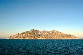
Montecristo

Levanzo

capri


The Aeolian Islands are of volcanic origin and probably the result of a subduction zone . The African plate slipped under the Eurasian plate . However, whether it is the main plates that move here or the microplates connected to them has not yet been conclusively researched. So far, science considers all four variants to be possible. The Aeolian Islands are north of Sicily. You are younger than a million years. Below the surface of the sea, they are extended by a series of seamounts. The islands vary widely in terms of age, shape and activity. Several volcanoes appear to be extinct, Lipari is probably still active, Vulcano erupts irregularly and Stromboli , the so-called lighthouse of the Mediterranean , has been active almost continuously for at least 200 years, estimates assume that this period could be up to 2,500 years. The extinct volcanic islands there are Alicudi , Filicudi , Panarea , Salina and Ustica . Erosion has already blurred the clear volcanic shape, and the islands are generally only sparsely populated. Islets like Basiluzzo , Lisca Bianca , Strombolicchio are extinct and eroded to such an extent that they can no longer be recognized from the outside as volcanoes.
To the west of Sicily and thus forming the southern border of the Tyrrhenian Sea are the Egadi Islands , namely Favignana , Levanzo and Marettimo . The Corsican coast forms the extension of the Corsican Basin under the sea to the east. The Aleria Plateau is on the east coast of the island before it merges into the Corsican Alps.
fauna


Biogeographically , the northern Tyrrhenian Sea forms a province together with the Ligurian Sea and the Golfe du Lion. The South Tyrrhenian Sea is either counted as a separate province or combined with the Ionian Sea. The Strait of Messina is sometimes viewed as a province in its own right because of its particular composition of the ecosystem. In general, the species are evenly distributed throughout the Mediterranean with only minor regional differences. The greatest differences are less between individual sea basins than between the northern and southern Mediterranean. Various waves of immigration from the Atlantic and Black Seas brought temperate or subtropical and tropical species to the Mediterranean, which are now distributed based on the prevailing climate. The northern regions have a significantly lower number of subtropical species than the southern.
In general, the sea itself has a low bio-productivity compared to the Mediterranean. Only the Strait of Messina is an exception here. In the sea itself, above the continental shelf, sea bream produce the highest biomass of fish with 520 kg / km², followed by sardines (340 kg / km²), red mullets (180), hake (170), mackerel (120) and anchovies (40). Compared to the rest of the Mediterranean, sardines and anchovies are rather sparse, while Centracanthidae (perch-like) are more common in the Tyrrhenian Sea than in other Mediterranean basins. Above the continental slope, pale red deep-sea shrimp Aristeus antennatus (20 kg / km²) and lobster (10) are comparatively common. For a long time, researchers suspected no life at all in the abysses of the deep sea, as life there was completely extinct during the Messinian salinity crisis and any migrating species from the Atlantic could not cross the 900-meter-flat threshold on the Strait of Gibraltar . The existence of a deep-sea fauna is now considered to be certain, but it is significantly poorer than in the Atlantic. From the deep sea there are indications of blunt-nosed six-gill sharks and pointed-head seven-gill sharks , which, as bottom scavengers , feed on the remains of whales. Fin whales are present in the region.
The mostly rocky soil regions on the coast with precious corals - biocenoses , lobsters and sea breams are particularly rich in species . These communities, which occur at depths of around 20 to 1200 meters, are of particular importance for the entire Mediterranean. The coasts of Sardinia, Sicily and Calabria are of particular biological importance here. The Strait of Bonifacio and especially the Strait of Messina, with their varied terrain and complex hydrological conditions, form a habitat for a large number of species and are also important passage areas in various basins of the Mediterranean. Various deep sea corals live in the Tyrrhenian Sea. For the species Madrepora oculata from the Oculinidae family , Carl von Linné made the first description based on specimens from Sicily and the Tyrrhenian Sea. Often at a depth between 200 and 1200 meters are specimens of Desmophyllum dianthus from the family of the Caryophylliidae . Corals of the genus Lophelia are rarer and in decline, but they are also present on the coast of Sicily, for example.
Man on and in the sea
fishing
The Food and Agriculture Organization of the UN counts the Tyrrhenian Sea to the statistical region of Sardinia, which also includes the Ligurian Sea, the open Mediterranean south of Sicily and Sardinia, and a strip of water west of Sardinia and Corsica. It is mainly Italian boats that fish in this area. Tunisian fishermen are only found in the southern parts of the area, especially outside the Tyrrhenian Sea.
Two thirds of the Italian fishing fleet is concentrated in the Tyrrhenian or Ligurian Sea and there mainly in the northern half. Until the mid-1990s it consisted mainly of small boats with less than 10 GRT whose engines had less than 100 hp. The fleet fishing from Sardinia consisted only of such boats. The most important objects caught were mussels harvested in 1991 , while sardines , anchovies , hake and octopus were caught in the open . The occurrence of the most important edible fish, sardines and anchovies, is well below that in the rest of the Mediterranean.
Merchant shipping

Most of the approximately 200 ports in Italy are on the Tyrrhenian Sea. Compared to the Adriatic, the Italian west coast has both more favorable natural conditions for ports and better connections to the trade routes towards the Atlantic. Here as there is a more established maritime and shipbuilding tradition. The weather conditions on the Tyrrhenian Sea are more constant and on average less dangerous than on the Adriatic.
Of the six groups of important ports, four are at least partly on the Tyrrhenian Sea: The so-called group of northern Tyrrhenian ports is partly on the Ligurian Sea (Genoa, Savona ), partly on the border to ( La Spezia ) or the Tyrrhenian Sea ( Livorno ). However, all ports play a crucial role in the shipping traffic that runs through the Tyrrhenian Sea. In the time of the Italian city-states, they were important factors in power politics. A little further to the north-west, the French Marseille plays a decisive role, as the route from Marseille leads east through the Tyrrhenian Sea. The southern Tyrrhenian group ( Naples and Salerno ) lies entirely on the Tyrrhenian Sea. The Sicilian ( Palermo ) and Sardinian ports form two further groups, but cannot compete with the major mainland ports in terms of their economic importance. The most important port in Corsica is Bastia . Most ship and passenger movements take place in Naples, but since there is comparatively little cargo handling here, the economically largest port in Italy is that of Genoa.
Nevertheless, the ports of the Mediterranean are largely cut off from the great flows of world trade and, in economic terms, are far behind those of the North Range . A slight improvement was achieved with the opening of a large container terminal in Gioia Tauro in the mid-1990s. This, only a few nautical miles from the main route through the Mediterranean, serves primarily as a transshipment port for global shipping routes for around another 50 ports in the Mediterranean region, around 95 percent of container transshipment in Gioia Tauro leaves the port again by ship. While the port still handled a total of 50 ships with 16,000 standard containers in 1995 , this figure rose to more than 3,000 ships with 2.6 million standard containers by the year 2000. The port now handles more containers than the port of Genoa.
military
.png)
There are important NATO and United States Navy facilities on the Tyrrhenian Sea, the most important of which are concentrated in Naples. There, NATO maintains the Allied Joint Force Command Naples , one of three main operational commands in Europe, and with the Component Command Maritime Naples (CC-MAR Naples) also the supreme command of the NATO naval forces in southern Europe. The US has set up the headquarters of the Navy in Europe, the United States Naval Forces Europe , in Naples . The headquarters of the 6th US fleet has also been moving there from Gaeta near Rome since 2004 . Although only the command ship Mount Whitney and a few smaller support ships permanently belong to the 6th Fleet , it is at times the most powerful naval group in the world. In principle, every ship belongs to the 6th fleet that is in its area of responsibility. Their size can therefore at times include several aircraft carrier groups. There are around 16,000 Americans permanently in Naples who belong directly or indirectly to the local naval base . Smaller US / NATO naval bases are located in La Maddalena off Sardinia and Livorno. Camp Darby near Livorno is used by the US military as a replenishment base for operations in the Mediterranean region.
The US Navy has been present in this area of the Mediterranean since 1815. The bases are the oldest US bases in Italy and have been there since the end of World War II. In the years since 1990, they have grown significantly as US military operations have shifted more towards the eastern Mediterranean and the Middle East, and the ports on the Tyrrhenian Sea serve as starting points. The command of the United States Naval Forces moved from London to Naples after the end of the Cold War. New bases were added in Eastern Sicily, the Sigonella base primarily serves as a logistics center for the 6th fleet and has tripled in size between the late 1970s and 1990. From 1990 to 2009 the strength of the team in Sigonella grew from 500 to 3000 men.
One of the two main bases of the Italian Marina Militare is in La Spezia , where the Italian flagship, the aircraft carrier Cavour (550) , frigates, mine layers and special forces are stationed. In Augusta , Sicily, just across the Tyrrhenian Sea, there are coast guards and patrol boats for the Mediterranean, while smaller Italian naval bases are also in La Maddalena and Cagliari.
Tourism and passenger shipping


The Tyrrhenian Sea is part of the Mediterranean, which accounts for 30 percent of all global tourism, three quarters of which takes place in the four EU member states of Spain, France, Italy and Greece. In the last few decades, both the population and the number of tourists on the Italian coasts have increased. In the meantime, many kilometers of sections of the coast have been completely built up. More than half of the 20 stretches of beach in Italy that are free for more than 20 kilometers are on the Sardinian coast.
The entire coast of the Tyrrhenian Sea is a popular holiday area from all over Europe. One of the roots of tourism is the Grand Tours . During the 18th century, the Gulf of Naples was the traditional final stop on these Grand Tours. While the Tyrrhenian coast further north , which was then still swampy and characterized by undrained marshland, was considered repulsive, travelers appreciated the view of the Gulf of Naples. The more southern Campania, Calabria and Sicily were still considered the foothills of Africa that did not belong to civilization. It was only in the last decades of the 18th century that travelers began to venture further south and integrated the extreme south of Italy into their tours.
The sea is crossed by ferry lines. Significant connections run partly on a small scale, such as in the Gulf of Naples and along the Amalfi Coast , as well as across the sea through connections from the Italian mainland to Corsica and Sardinia. Like the rest of the Mediterranean, the Tyrrhenian Sea is a popular area for sailing. Especially in Tuscany in the transition area to the Ligurian Sea there is one of the highest yacht densities in the world. Both the long tradition of tourism in the area and the predominantly friendly and easy-to-sail weather, such as the ports that are easy to reach by sea, contribute to this.
Pollution and environmental protection
Until the 1990s, the Tyrrhenian Sea was in better shape than the Adriatic. Algal blooms and fish deaths were limited to individual episodes of comparatively short duration in limited areas. The estuary of the Tiber , the coast of Pisa , the bays of Naples and Palermo and the north-west coast of Sicily are particularly prone to eutrophication .
The sea also suffered from the fact that until a few years ago many Italian cities discharged their wastewater untreated. Here again the mouth of the Tiber was particularly affected. Cinnabarite mines in Tuscany, on the other hand, helped raise mercury levels in the northern Tyrrhenian Sea. A particularly high concentration of microplastics , of up to 1.9 million pieces per square meter, was measured in the sediments . Only particles with a maximum length of one millimeter were taken into account. The tourism industry puts significant pressure on the existing environment. According to WWF, the Sardinian-Corsican coast and the southern mainland coast of Italy are particularly at risk .
Marine protected areas are for example between Sardinia and Corsica or around Ustica near Sicily. The Parco nazionale dell'Arcipelago Toscano comprises a 67,500 hectare marine reserve, a nature reserve on Montecristo and the land areas of Capraia, Gorgona and Giannutri and their coastal waters up to 100 meters deep. The islands apart from Montecristo are divided into three protection zones.
history
Antiquity and early Middle Ages

The Tyrrhenian Sea is surrounded on all coasts by populous regions that have a long history of settlement. Apart from the Roman Empire , no power succeeded in gaining control of the sea on its own until modern times. Central disputed areas were always the large water area in the middle as well as the two straits that represented the exit into the Ligurian Sea and the open Mediterranean.
At the beginning of written records, the Etruscans in Tuscany dominated the central part of the Tyrrhenian Sea, Greek colonies of Magna Graecia in Sicily ( Syracuse ) and in the south of the Apennine Peninsula controlled the south, while Carthaginians , those in Tunisia , Sardinia, Corsica and the west - Sicily settled the western exits controlled. In the north-west, the Greek colony of Massalia (now Marseille ) was an important factor. Greek seafarers probably used in the 8th and 7th centuries BC BC the sea as a direct route between the Aegean Sea and Marseille and established a trade center in the Etruscan city of Gravisca , for example , they were obviously welcome in many Etruscan cities. From the centuries thereafter, descriptions have been passed down that describe the sea as particularly rich in pirates , so that it was considered dangerous for merchant shipping. The archaeological evidence both for the piracy thesis and for a thesis as a flourishing trade route is comparatively thin and the science of history relies primarily on conjecture for this period.
For the Roman Empire, the Tyrrhenian Sea was the access route to Rome itself and thus of central economic importance. The Roman era was the only time until modern times when a power could clearly exercise control over the Tyrrhenian Sea. With the connections Alexandria - Rome and Carthage - Rome, the main trade routes of the Roman Empire developed, which supplied the city of Rome with Egyptian and Tunisian grain. One of the main fleets of the Roman navy that exercised this control was stationed in Misenum on the Gulf of Naples .
In late antiquity and in the early Middle Ages the importance of the Tyrrhenian Sea as a trade route increased. Since land connections in the Mediterranean area became increasingly unsafe and many sea routes were no longer used, around 700 there was only one reliable route between western and eastern Christianity: from Rome through the Tyrrhenian Sea and then further east to Constantinople . The ports of southern Italy, especially Amalfi and Gaeta , but also Sicily, were important points of contact, as was an extension of this main Christian route through the Tyrrhenian Sea to Marseille. The Tyrrhenian ports of Amalfi and Gaeta were at times the main carriers of trade towards Byzantium.
With the Muslim expansion, Muslim seafarers appeared on the Mediterranean in the second half of the 7th century. Their power and economic structures in North Africa and on the Iberian Peninsula were so well developed in the 8th century that a second main trade route in the Mediterranean was able to establish itself along the southern Mediterranean coast. This tied the trade to areas protruding far beyond the Mediterranean. Travel across North Africa, with a stop in Sicily, and then further north through the Tyrrhenian Sea became more common. This traffic was not interrupted by pirate trains in the Tyrrhenian Sea (775 to Sardinia, 813 to Rome) and the conquest of Sicily from 827. The southern Tyrrhenian Sea in particular developed into the most complex and diverse shipping region in the Mediterranean in the 8th and 9th centuries. The northern Tyrrhenian Sea and the communication routes to Corsica and Sardinia, however, were fiercely contested, with Muslim pirates dominating the picture, often due to the location of the sources.
Middle Ages and Renaissance

Even in the centuries after the fall of the Western Roman Empire , the sea remained economically important. Although the Lombards conquered most of the Italian mainland, the Eastern Roman or Byzantine Empire continued to control the coasts and islands of southern Italy and thus the economically more valuable part of the country.
In the 5th century the Vandals were added, in the 8th the Saracens , in the 11th century the Normans and in the 13th the French of the House of Anjou . In the later Middle Ages, the sea was the scene of intense rivalry between the two Italian city-states and neighboring Pisa and Genoa . The Tyrrhenian Sea, however, formed an important internal trading area that was able to meet a large part of the needs of the neighboring cities. Grain came from Sicily and until around 1550 from Provence , salt came from Trapani , cheese from Sardinia, wine from Naples, cured meat from Corsica, silk from Sicily or Calabria, fruits and nuts from Provence, iron from Elba, money and capital from Genoa or Florence . Leather, wool, spices and dyes, however, came from outside.
In the High Middle Ages entering coastal changes silting had individual ports like that of Luna result. Above all, however, since the 10th and 11th centuries, Saracen pirates made the sea unsafe and hindered the flow of trade. The most important port on the Tyrrhenian mainland coast was Pisa. It was in competition with other Italian city-states on the islands or on the Ligurian Sea and was able to expand its influence to Corsica and Sardinia at the beginning of the 11th century. The two naval powers Genoa and Pisa, as well as smaller players, did not shy away from acting as pirates if they could find each other's merchant ships. The clashes between the two maritime republics culminated in the naval battle of Meloria in 1284, which ended with a decisive victory for Genoa over its rival. It was only after Genoa gained control of the Tyrrhenian Sea in the late 13th century that it was able to assert itself as a trading power in competition with the Republic of Venice . Genoa also controlled the Tyrrhenian Sea from its colony in Corsica.
The Tuscan coast served Genoa's rising competitor Florence as the most important connection to the sea in its competition with Venice on the Adriatic . At times Florence had its own fleet, which was mainly stationed in smaller ports that belonged neither to Pisa nor to Genoa, but Florence was never one of the major naval powers.
Further south, the House of Anjou was finally able to establish itself against the Norman-Staufer rule in 1268 in the Kingdom of Naples and on its coast, while the Kingdom of Aragon wrested Sicily from it in 1282 and was able to assert itself in Sardinia between around 1322 and 1365. There they mined silver at Iglesias, but exports broke down when there was an uprising in 1365-1423. Both islands played a diminishing role in the economic development of the Tyrrhenian Sea. In 1442 the Kingdom of Naples fell to Aragon, making the Tyrrhenian Sea practically a Catalan. It continued to lose importance as it mainly served the interests of Aragon. With the unification of the Iberian kingdoms of Aragon and Castile, the islands came to Spain in 1492. Up until the 18th century, the bases on the islands, together with Naples, served as the starting point for his marine endeavors, but the region continued to sideline economically.
Modern times and modernity

France controlled Genoa and with it its fleet from around 1500, lost the hegemony in the region relatively quickly to the Habsburgs and Charles V. This had inherited the Kingdom of Naples and in 1528 he succeeded in pulling the Genoese on his side, so that he controlled the largest fleets directly on the Tyrrhenian Sea. The Habsburgs were now able to set up large fleets, but mostly disbanded them relatively quickly for reasons of cost. Despite their theoretical superiority, they did not exercise permanent control of the Tyrrhenian Sea, so that pirates or warships from other realms kept coming into the sea.
In addition to the pirates of the barbarian states , who struck especially in summer, pirates from England began to find a profitable business area in the western Mediterranean. They specialized in the winter season. Numerous smaller European states took part in the clashes with the barbarian states, and even orders of knights specialized in piracy, such as the Order of St. Stephen in Livorno, emerged.
As Spanish power faded, France and Great Britain in particular gained influence in the Mediterranean. The Tyrrhenian Sea played only a minor role in the disputes of the 17th and 18th centuries. While France exerted significant influence in the northern part of the sea, the United Kingdom dominated the south. There it felt safe enough to banish Napoleon Bonaparte to Elba, apparently within the safe sphere of influence of the British fleet. For most of the 19th century, the United Kingdom was the main power in the Tyrrhenian Sea. The country was also able to exercise control over the Tyrrhenian Sea from its military bases in Malta and in the Ionian Sea. The Royal Navy often drove through the Tyrrhenian Sea to its consulates in Palermo, Naples, Civitavecchia near Rome, Livorno and Genoa for demonstrations of force .
In the late 19th and 20th centuries, the Tyrrhenian Sea was a challenge , especially for the Italian Regia Marina . The long coast offered attackers numerous opportunities, while the inland transport routes were too poor to react in time. The many good landing possibilities on the coast threatened Rome and Naples in particular, which would have been largely defenseless at the mercy of any superior fleet. The relocation of the southern Italian naval base from Naples to Taranto made the problem worse, as Taranto was no longer on the Tyrrhenian Sea and the whole south of the sea could no longer be reached quickly by the navy. Italy responded by building some large battleships , which in terms of quantity and equipment were by no means equal to the French and even British fleets and were primarily intended to prevent troops from landing in some strategically important places. It also built the fortifications on the Strait of Messina and in La Maddalena on the Strait of Bonifacio . The main focus of Italian efforts in the period before the First World War was in the Adriatic, where the Austro-Hungarian fleet was located. Although officially allied, the two military leaderships viewed each other with great suspicion and, above all, armed each other. In the First World War itself, the Tyrrhenian Sea played only a subordinate role, Italy's main fighting took place in the Adriatic Sea, and supplies from the western allies were mainly along the Ligurian Sea and the port of Genoa.
Between the world wars, Italy managed to fortify Sicily, Sardinia and Elba militarily to such an extent that the Tyrrhenian Sea was safe Italian territory as long as the fascist state retained control of Sicily. The French base on Corsica, which still existed at the beginning of the war, posed a particular danger to the Ligurian coast. In the period since the Second World War, the sea played a role as a safe haven. Italy itself was only a secondary target for NATO and the Soviet Union. However, the sea, which is protected on all three sides, served as a refuge for NATO. Their naval commandos for southern Europe were located in Naples and Gaeta, where both the US and Italian navies had important bases and used them to advance into the hotly disputed areas south and east of Italy.
Web links
Individual evidence
- ↑ Etruscans in: Nigel Guy Wilson (Ed.): Encyclopedia of ancient Greece Routledge, 2006 ISBN 0-415-97334-1 p. 275
- ↑ a b c d A. Mauffret and I. Contrucci: Crustal Structure of the North Tyrrhenean Sea: first result of a multichannel seismic LISA cruise in: Bernard Durand, Geological Society of London (eds.): The Mediterranean Basins: tertiary extension within the Alpine Orogen Geological Society, 1999 ISBN 1-86239-033-9 pp. 169-172
- ↑ a b Harriet D. Allen: Mediterranean ecogeography Pearson Education, 2001 ISBN 0-582-40452-5 p. 66
- ↑ IHO: Limits of Oceans and Seas , Monte Carlo, 3rd edition 1953 p. 17 iho.int (PDF; 994 kB)
- ↑ a b Alexander I. Shemenda: Subduction: insights from physical modeling Springer, 1994 ISBN 0-7923-3042-0 pp. 129-132
- ^ William Cavazza et al .: The Mediterrean Area and the Surrounding Regions: Active Processes, Remnants of Former Thetys Oceans and Related Thrust Belts in: William Cavazza (Ed.): The TRANSMED atlas: the Mediterranean region from crust to mantle: geological and geophysical framework of the Mediterranean and the surrounding areas Springer, 2004 ISBN 3-540-22181-6 pp. 14-15
- ↑ Grant Heiken et al .: he seven hills of Rome: a geological tour of the eternal city Princeton University Press, 2005 ISBN 0-691-06995-6 p. 82
- ^ A b c d e Leopoldo Franco: History of Coastal Engineering in Italy in: Nicholas C. Kraus, Coastal Engineering Research Council (Hrsg.): History and heritage of coastal engineering ASCE Publications, 1996 ISBN 0-7844-0196-9 p 275-335 pp. 277-280
- ↑ The information mostly relates to approximate values, but "precise" information about the lowest point can also vary. The minimum values are a little over 3400 meters, Cognetti et al. however, 3840 meters indicate
- ^ A b c d Carles Bas: The Mediterranean: a synoptic overview in: Contributions to Science, 5 (1): 25–39 (2009) pp. 32–37 as pdf
- ↑ a b c d e f Renzo Sartori: Corsica-Sardinia block and the Tyrrhenean Sea in: Gian Battista Vai, Peter Martini (ed.): Anatomy of an orogen: the Apennines and adjacent Mediterranean basins Springer, 2001 ISBN 0-412- 75040-6 pp. 370-373
- ^ A b Stefano Aliani and Roberto Meloni: Dispersal Strategies of benthic species and water current variability in the Corsica Channel in: Scientia Marina 63 (2) 1999: 137-146 p. 139
- ^ A b c d John Guest: Volcanoes of Southern Italy Geological Society, 2003 ISBN 1-86239-138-6 pp. 2-6
- ↑ GF Panza et al .: Geophysical and petrological modeling of the structure and composition of the crust and upper mantle in complex geodynamic settings: The Tyrrhenian Sea and surroundings Earth-Science Reviews 80 (2007) 1-46, p. 1 as pdf
- ↑ S. Pierini and A. Simioli: A wind-driven circulation model of the Tyrrhenian Sea area Journal of Marine Systems 18 1998.161-178 S. 162 pdf ( Memento of the original dated 7 January 2012 at the Internet Archive ) Info: The archive link was used automatically and not yet checked. Please check the original and archive link according to the instructions and then remove this notice.
- ↑ a b Eelco Rohling: The Marine Environment: Present and Past in: Jamie Woodward: The Physical Geography of the Mediterranean Oxford University Press, 2009 ISBN 0-19-926803-7 pp. 35-39
- ↑ Alain Saliot: The Mediterranean Sea Birkhauser, 2005 ISBN 3-540-25018-2
- ^ Eelco Rohling: The Marine Environment: Present and Past in: Jamie Woodward: The Physical Geography of the Mediterranean Oxford University Press, 2009 ISBN 0-19-926803-7 pp. 42-43
- ↑ a b c B. Gumiero et al .: The Italian Rivers in: Klement Tockner et al. (Ed.): Rivers of Europe Academic Press, 2009 ISBN 0-12-369449-3 pp. 467-497
- ↑ a b c d G. Cognetti et al .: Abstract von diess: The Adriatic Sea and the Tyrrhenian Sea , in: CRC Sheppard (Ed.): Seas at the millennium: an environmental evaluation: 1. Regional chapters: Europe, The Americas and West Africa pp. 267-284, 2000
- ^ Margherita Mussi : Earliest Italy: an overview of the Italian Paleolithic and Mesolithic Springer, 2001 ISBN 0-306-46463-2 p. 5
- ↑ Barbara M. Kreutz: The Ecology of Maritime Success: The Puzzling Case of Amalfi in: Irad Malkin, Robert L. Hohlfelder: Mediterranean cities: historical perspectives p. 106 Routledge, 1988 ISBN 0-7146-3353-4
- ↑ S. Pierini and A. Simioli: A wind-driven circulation model of the Tyrrhenian Sea area Journal of Marine Systems 18 1998.161-178 S. 166 pdf ( Memento of the original dated 7 January 2012 at the Internet Archive ) Info: The archive link was used automatically and not yet checked. Please check the original and archive link according to the instructions and then remove this notice.
- ^ Leopoldo Franco: History of Coastal Engineering in Italy in: Nicholas C. Kraus, Coastal Engineering Research Council (ed.): History and heritage of coastal engineering ASCE Publications, 1996 ISBN 0-7844-0196-9 pp. 275-335 pp 282-285
- ^ A b c d e Alwyn Scarth, Jean-Claude Tanguy: Volcanoes of Europe Oxford University Press US, 2001 ISBN 0-19-521754-3 pp. 7-10
- ^ A b Robert J. Allison: Applied geomorphology: theory and practice John Wiley and Sons, 2002 ISBN 0-471-89555-5 p. 408
- ↑ a b c Silvia Orvietani Busch: Medieval mediterranean ports: the Catalan and Tuscan coasts, 1100 to 1235 Brill, 2001 ISBN 90-04-12069-6 pp. 159-165
- ^ Burghard W. Flemming: Geographic Distribution of Muddy Coasts in: Terry R. Healy et al. (Ed.): Muddy coasts of the world: processes, deposits, and function Gulf Professional Publishing, 2002 ISBN 0-444-51019-2 p. 134
- ↑ a b c Foppe B. DeWalle et al .: Environmental condition of the Mediterranean Sea: European Community countries Springer, 1993 ISBN 0-7923-2468-4 p. 339
- ^ A b Enrico Costa et al .: The Enhancement of the Tyrrhenian Coast of Calabria by Endogenetic / Endogenous Development of Local Resources , University of Reggio Calabria pp. 296-300 as pdf
- ↑ Alwyn Scarth, Jean-Claude Tanguy: Volcanoes of Europe Oxford University Press US, 2001 ISBN 0-19-521754-3 pp. 32-35
- ^ A b Carlo Nike Bianchi: Biodiversity Issues for the forthcoming tropical Mediterranean Sea in: Giulio Relini et al. (Ed.): Biodiversity in Enclosed Seas and Artificial Marine Habitats: Proceedings of the 39th European Marine Biology Symposium Springer, 2007 ISBN 1-4020-6155-2 p. 10
- ^ Paul A. Tyler: The Peripheral Deep Seas in: ders. (Ed.): Ecosystems of the deep oceans Elsevier, 2003 ISBN 0-444-82619-X p. 282
- ↑ a b c d J.F. Caddy: Some Futire Perspectives for Assessment and Management of Mediterranean Fisheries for Demersal and Shellfish Resources and Small Pelagic Fish in: General Fisheries Council for the Mediterranean (Ed.): Studies and Reviews 66: Resource and Environmental Issues Relevant to Mediterranean Fisheries Management 1996 p 32-35
- ↑ a b c Guidelines for sustainable tourism investments in vulnerable ecological areas of the Mediterranean coasts . (PDF) WWF Mediterranean Program Office and Ambienteitalia, 2004, p. 7 , archived from the original on December 18, 2011 ; accessed on March 6, 2018 .
- ↑ a b Peter Heslenfeld, Council of Europe: Corridors and ecosystems: coastal and marine areas Council of Europe, 2003 ISBN 92-871-5258-6 S. 16-17
- ↑ Marco Taviani et al .: Deep coral growth in the Mediterranean: an overview in: André Freiwald, J. Murray Roberts: Cold-water corals and ecosystems Springer, 2005 ISBN 3-540-24136-1 p. 139
- ↑ Phillips Payson O'Brien: Technology and naval combat in the twentieth century and beyond Routledge, 2001 ISBN 0-7146-5125-7 p. 7
- ^ A b c Matthew Bunson: A dictionary of the Roman Empire Oxford University Press US, 1995 ISBN 0-19-510233-9 p. 431
- ↑ Russell King: The industrial geography of Italy Taylor & Francis, 1985 ISBN 0-7099-1501-2 p. 116
- ^ A b European Conference of Ministers of Transport: Transport infrastructure in ECMT countries: profiles and prospects OECD Publishing, 1998 ISBN 92-821-1231-4 p. 210
- ^ Harry Caldwell et al .: Freight transportation: the European market DIANE Publishing, 2002 ISBN 1-4289-5192-X p. 10
- ^ A b Carla Monteleone: Impact and Perspectives of American Bases in Italy pp. 127–145 in: Luís Rodrigues, Sergiy Glebov: Military Bases: Historical Perspectives, Contemporary Challenges IOS Press, 2009 ISBN 1-58603-967-9
- ↑ Eric Wertheim: Naval Institute Guide to Combat Fleets of the World Naval Institute Press, 2007 ISBN 1-59114-955-X p. 336
- ^ Alain Corbin: The lure of the sea: the discovery of the seaside in the western world, 1750-1840 University of California Press, 1994 ISBN 0-520-06638-3 p. 41
- ^ Giovanni Ridolfi: High Speed at Sea in: David Pinder and Brian Slack (eds.): Shipping and ports in the twenty-first century: globalization, technological change and the environment Routledge, 2004 ISBN 0-415-28344-2
- ^ Italy Sailing: Nautical Tourism
- ^ Organization for Economic Co-operation and Development (Ed.): Environmental performance reviews: Italy, Volume 7 OECD Publishing, 2002 ISBN 92-64-19915-2
- ^ Ian A. Kane, Michael A. Clare, Elda Miramontes, Roy Wogelius, James J. Rothwell, Pierre Garreau, Florian Pohl: Seafloor microplastic hotspots controlled by deep-sea circulation. In: Science. April 30, 2020, p. Eaba5899, doi : 10.1126 / science.aba5899 .
- ↑ Patrice Francour et al: A review of marine protected areas in the northwestern Mediterranean region: Siting, usage, zonation and management. In: Aquatic Conservation Marine and Freshwater Ecosystems 11 (3). May 2001, p. 157 , accessed March 6, 2018 .
- ↑ a b c d e Fernand Braudel : Mediterranean and the Mediterranean World in the Age of Philipp II. Vol. 1 University of California Press, 1996 ISBN 0-520-20308-9 pp. 120-122
- ↑ Archeology was able to make numerous contributions to the early history of trade, which cannot be grasped by written sources, as Michel Gras: Trafics thyréniens archaïques , Rome 1985, was able to show. The same applies to the Etruscans (L. Vigliotti, M. Roverib, L. Capotondi: Etruscan archaeometallurgy record in sediments from the Northern Tyrrhenian Sea , Bologna 2002).
- ↑ Samuel Eugene Mark: Homeric seafaring , Texas A & M University Press, 2005, ISBN 1-58544-391-3 , pages 40-44
- ↑ Michael McCormick: Origins of the European economy: communications and commerce, AD 300-900 , Cambridge University Press, Cambridge 2001, ISBN 0-521-66102-1 , pp. 502-510
- ^ A b Michael McCormick: Origins of the European economy: communications and commerce, AD 300-900 Cambridge University Press, 2001 ISBN 0-521-66102-1 pp. 512-516
- ↑ Chris Wickham : Framing the Early Middle Ages: Europe and the Mediterranean, 400-800 , Oxford University Press, Oxford 2005, ISBN 0-19-921296-1 , p. 739
- ↑ Gino Luzzatto , Philip Jones: An Economic History of Italy: From the Fall of the Roman Empire to the Beginning of the 16th Century , Taylor & Francis, 2006, ISBN 0-415-37923-7 , p. 20
- ^ Antonio Placanica: Maritimes Republics in: André Vauchez et al. (Ed.): Encyclopedia of the Middle Ages, Volume 1 Routledge, 2000 ISBN 1-57958-282-6 p. 908
- ↑ Jakub J. Grygiel: Great powers and geopolitical change , Johns Hopkins University Press, 2006, ISBN 0-8018-8480-2 , p. 61
- ^ Richard A. Goldthwaite: The Economy of Renaissance Florence , Johns Hopkins University Press, 2009, ISBN 0-8018-8982-0 , p. 116
- ^ Richard A. Goldthwaite: The Economy of Renaissance Florence JHU Press, 2009 ISBN 0-8018-8982-0 p. 144
- ↑ John Day: The Decline of a Money Economy: Sardinia under Catalan Rule , in: Ders .: The Medieval Market Economy , Oxford / New York 1987, pp. 73-89
- ^ John B. Hattendorf: Naval policy and strategy in the Mediterranean: past, present, and future Taylor & Francis, 2000 ISBN 0-7146-8054-0 pp. 14-15
- ^ John B. Hattendorf: Naval policy and strategy in the Mediterranean: past, present, and future Taylor & Francis, 2000 ISBN 0-7146-8054-0 pp. 14-15
- ^ CT McIntire: England against the papacy, 1858–1861 Cambridge University Press, 1983 ISBN 0-521-24237-1 p. 59
- ^ Theodore Ropp, Stephen S. Roberts: The development of a modern navy: French naval policy, 1871-1904 Naval Institute Press, 1987 ISBN 0-87021-141-2 pp. 77-82
- ↑ Jack Greene: Italy, Navy in: Spencer Tucker, Priscilla Mary Roberts (Ed.): Encyclopedia of World War I ABC-CLIO, 2005 ISBN 1-85109-420-2 p. 599
- ↑ Milan N. Vego: Naval Strategy and Operations in Narrow Seas Routledge, 2003 ISBN 0-7146-5389-6 p. 45
Coordinates: 39 ° 31 ' N , 13 ° 21' E