Alicudi
| Alicudi | ||
|---|---|---|
| Silhouette of the island | ||
| Waters | Tyrrhenian Sea | |
| Archipelago | Aeolian Islands | |
| Geographical location | 38 ° 32 '38 " N , 14 ° 21' 12" E | |
|
|
||
| length | 2.9 km | |
| width | 2.3 km | |
| surface | 5.2 km² | |
| Highest elevation | Filo dell'Arpa 675 m slm |
|
| Residents | 105 (2001) 20 inhabitants / km² |
|
| main place | Alicudi postage | |
| The Aeolian Islands | ||
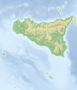
Alicudi and its neighboring islands Lipari , Stromboli , Vulcano , Salina , Panarea and Filicudi belong to the archipelago of the Aeolian Islands , which are located in the Tyrrhenian Sea off the north coast of Sicily . The island belongs to the municipality of Lipari in the metropolitan city of Messina .
General information
In ancient times the island was called Ericusa because of the lush heather of the same name .
It is the westernmost and with 5.2 km² the second smallest of the Aeolian Islands. The nearly circular island consists of the 675-meter-high stratovolcano Filo dell'Arpa. Two thirds of the island are not cultivated. The only place on the island, Alicudi Porto, is connected to the settlements of Sgurbio , Tonna, Pianicello, Bazzina and Montangola by stone steps.
The almost 100 inhabitants, who live from agriculture (cultivation of figs, capers, almonds and grapevines), from fishing and from tourism, are concentrated on the south-eastern part of the island.
There is no road network, the houses are connected by centuries-old stairways. Muli serve as a means of transport . Electricity and connection to the telephone network have only been available since 1990. There is now a stable GPRS signal on the island .
The artist Paola Pivi lived on Alicudi for two years and worked on the Alicudi project in 2007 .
literature
- Peter Amann: Aeolian Islands . Hiking and enjoying between Etna and Vesuvius. A travel companion. Rotpunktverlag , Zurich 2017, ISBN 978-3-85869-730-1
- Eva Gründel, Heinz Tomek: Lipari Islands. DuMont Reiseverlag, Cologne 2003, ISBN 3-7701-6028-2
- Ralf Gryl: Alicudi. Time out on a volcanic island. Shaker Media, Aachen 2009, ISBN 978-3-86858-357-1


