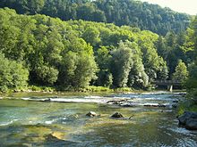
List of tributaries of the Inn
The Inn ( Rhaeto-Roman. En ) is 517 kilometers long from its source. Its catchment area is 25,700 square kilometers.
Various tributaries with mouths are named.
Tributaries of the Inn in Switzerland

The Beverin at the entrance to Val Bever
| Left | right |
|---|---|
|
|
Tributaries of the Inn in Austria

The flag in the Kaunertal

The Gurglbach near Tarrenz

The Melach in the Sellraintal

The mouth of the Sill in Innsbruck

The Brandenberger Ache near Kramsach
| Left | right |
|---|---|
|
|
Tributaries of the Inn in Germany

The Alz near Emmerting

The Mangfall at Mangfallknie

The Rott near Ruhstorf
| Left | right |
|---|---|
|
|
| from the mouth of the Salzach | |
|
( → Austria ) |
| in Passau | |
|
|
Tributaries of the Inn in Austria from the mouth of the Salzach

The Salzach in Salzburg
| Left | right |
|---|---|
|
( → Germany ) |
|
Individual evidence
- ↑ Stadtplandienst.ch
- ↑ a b Stadtplandienst.at
- ↑ a b c Openstreetmap.org
- ↑ Stadtplandienst.de
- ↑ a b Bayernviewer of the Bavarian Surveying Administration ( Memento of the original from April 8, 2015 in the Internet Archive ) Info: The archive link was inserted automatically and has not yet been checked. Please check the original and archive link according to the instructions and then remove this notice.
