Brancla
|
Brancla Aua Chöglias |
||
|
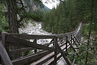
The Brancla in Val Sinestra |
||
| Data | ||
| Water code | CH : 5236 | |
| location | Switzerland | |
| River system | Rhine | |
| Drain over | Inn → Danube → Black Sea | |
| Headwaters | at Piz Val Gronda 46 ° 55 ′ 17 ″ N , 10 ° 17 ′ 35 ″ E |
|
| Source height | approx. 2745 m above sea level M. | |
| muzzle | at Ramosch in the Inn Coordinates: 46 ° 49 '32 " N , 10 ° 23' 3" E ; CH1903: 824 705 / 190 264 46 ° 49 '32 " N , 10 ° 23' 3" O |
|
| Mouth height | 1094 m above sea level M. | |
| Height difference | approx. 1651 m | |
| Bottom slope | approx. 10% | |
| length | 16 km | |
| Catchment area | 66.44 km² | |
| Discharge at the mouth of the A Eo : 66.44 km² |
MQ Mq |
2.23 m³ / s 33.6 l / (s km²) |
| Left tributaries | Aval Piz Chamis, Aval Tiatscha | |
| Right tributaries | Aua da Laver, Aval Ruinas | |
| Communities | Scuol , Valsot | |
The Brancla is a 16 km long left tributary of the Inn in the Swiss canton of Graubünden . The river flows through the Val Chöglias as well as the Val Sinestra and its side valleys, draining an area of 66.4 square kilometers. The Brancla, which is also called Aua Chöglias in its upper course , forms the border between the political communities Scuol (until the end of 2014 municipality Sent ) and Valsot (until the end of 2012 municipality Ramosch ) almost along its entire course .
course
The Brancla rises on the southern slope of the Swiss-Austrian border summit Piz Val Gronda ( 2812 m above sea level ) directly below the Fuorcla Val Gronda and flows mainly in a south-easterly direction. In its upper course it crosses the Val Chöglias , which joins the Val Laver to form the Val Sinestra at Zuort . Only a little later, from about the confluence of the Aval Ruin , the Brancla forms a narrow gorge before it enters the Lower Engadine between Piz Spadla ( 2912 m above sea level ) and Piz Arina ( 2828 m above sea level ) and into the at Ramosch Inn flows.
Web links
Individual evidence
- ↑ a b c Geoserver of the Swiss Federal Administration ( information )
- ↑ a b Topographical catchment areas of Swiss waters: sub-catchment areas 2 km². Retrieved August 3, 2018 .
