Weerbach
| Weerbach | ||
|
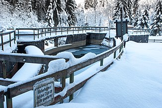
Wehr am Weerbach just above the mouth of the Nurpensbach |
||
| Data | ||
| location | Tyrol , Austria | |
| River system | Danube | |
| Drain over | Inn → Danube → Black Sea | |
| Headwaters |
Grafennsalm at Grafennsspitze in the Tux Alps 47 ° 12 ′ 21 ″ N , 11 ° 40 ′ 55 ″ E |
|
| Source height | approx. 2380 m above sea level A. | |
| muzzle | between Kolsass and Weer in the Inn Coordinates: 47 ° 18 '39 " N , 11 ° 37' 58" E 47 ° 18 '39 " N , 11 ° 37' 58" E |
|
| Mouth height | approx. 543 m above sea level A. | |
| Height difference | approx. 1837 m | |
| Bottom slope | approx. 11% | |
| length | 16.6 km | |
| Catchment area | 73 km² | |
| Discharge at the gauge Weer A Eo : 72.8 km² Location: 580 m above the mouth |
NNQ (12/29/1978) MNQ 1971–2009 MQ 1971–2009 Mq 1971–2009 MHQ 1971–2009 HHQ (08/06/1985) |
60 l / s 520 l / s 2.25 m³ / s 30.9 l / (s km²) 14.1 m³ / s 35.2 m³ / s |
| Left tributaries | Sagbach | |
| Right tributaries | Nafingbach, Nurpensbach | |
| Communities | Kolsassberg , Weerberg | |
The Weerbach is a right side stream of the Inn in Tyrol .
geography
The Weerbach rises in the Tux Alps in the area of the Grafennsalm below the Grafennsspitze in the municipality of Kolsassberg . It then flows relatively straight to the north in a deeply cut valley and flows into the Inn between Kolsass and Weer . For long stretches it forms the border between the communities Kolsassberg and Kolsass on the western side and Weerberg and Weer on the eastern side and thus also between the districts of Innsbruck-Land and Schwaz .
The Weertal or Weerbachtal can be accessed by roads on both sides. Only near the confluence with the Inn valley is it more densely populated (Innerweerberg, Kolsassberg). It used to be an important connection to the Tuxertal , into which it is the shortest connection from the Inn Valley.
use
Gold was panned from the Weerbach for centuries . The gold panning was first mentioned in the 13th century and lasted until the early 19th century. The gold found in other streams in the Tux Alps probably comes from the quartz phyllites and their deposits, where it was released as free gold through weathering. The gold washing on the Weerbach has also found its way into the municipal coat of arms of Weer, which shows the stylized brook, a gold washing bowl and a sun as a symbol for gold.
Today the water of the Weerbach is used by small power plants to generate electricity.
Web links
- Water level, water temperature and flow of the Weerbach at the Weer gauge (Hydrographischer Dienst Tirol)
Individual evidence
- ↑ a b c d Land Tirol: tirisMaps
- ↑ Federal Ministry for Agriculture, Forestry, Environment and Water Management (ed.): Hydrographisches Jahrbuch von Österreich 2009. 117th volume. Vienna 2011, p. OG 103, PDF (12.1 MB) on bmlrt.gv.at (yearbook 2009)
- ^ Austrian map (ÖK 50)
- ^ Franz Niederwolfsgruber: Gold in the Tyrolean mountains . In: Tiroler Heimatblätter, Volume 32, Issue 4–6, 1957, pp. 40 ff. ( Online )
- ^ Kraftwerk Haim KG: Kraftwerke

