
Tuxertal
| Tuxertal | ||
|---|---|---|
 View over Lanersbach to the end of the valley near Hintertux |
||
| location | Tyrol , Austria | |
| Waters | Tuxbach | |
| Geographical location | 47 ° 10 ′ N , 11 ° 45 ′ E | |
|
||
| length | 13 km | |

The Tuxertal is located in Tyrol ( Austria ) and is a side valley of the Zillertal , from which it branches off at Mayrhofen . In total, it is about 13 kilometers long and accessed through Tuxer Straße . From Mayrhofen ( 630 m above sea level ) to Tux or Hintertux (1,500 m), which gives the valley its name, there is a difference in altitude of around 850 m. The valley ends in Hintertux on the Hintertux Glacier .
The Tuxbach , which rises at the Tuxerjoch, flows below Finkenberg into the Zemmbach , which flows into the Ziller near Mayrhofen .
The valley floor represents the boundary between the Tuxer ( orographic left, foreground) and the Zillertal Alps (orographic right, left side and background in the photo).
places
In the Tuxertal are the five Tux districts Hintertux (1,500 m), Madseit (1,385 m), Juns (1,360 m), Lanersbach (1,300 m), Vorderlanersbach (1,300 m) and the municipality of Finkenberg (840 m) .
The Tuxertal offers the only way to get to the Hintertux Glacier by road and cable car.
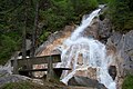
Tuxbach, which is fed by melt water


Web links
- The Tuxertal - the westernmost of the side valleys mayrhofen.at