Fedacla
| Fedacla | ||
|
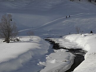
The Fedacla in the Fex valley in winter |
||
| Data | ||
| Water code | CH : 5456 | |
| location | Canton of Graubünden ; Switzerland | |
| River system | Danube | |
| Drain over | Inn → Danube → Black Sea | |
| confluence | from three source streams below the Fex Glacier 46 ° 21 ′ 26 ″ N , 9 ° 47 ′ 42 ″ E |
|
| Source height | up to approx. 2320 m above sea level M. | |
| muzzle | near Seglias in the Silvaplana Coordinates: 46 ° 26 '31 " N , 9 ° 46' 41" E ; CH1903: 779 742 / 146 069 46 ° 26 '31 " N , 9 ° 46' 41" O |
|
| Mouth height | 1790.5 m above sea level M. | |
| Height difference | 529.46 m | |
| Bottom slope | 50 ‰ | |
| length | 10.5 km | |
| Catchment area | 33.69 km² | |
| Discharge at the estuary A Eo gauge: 33.69 km² |
MQ Mq |
1.26 m³ / s 37.4 l / (s km²) |
| Right tributaries | Ova dal Munt | |
| Communities | Sils in the Engadin / Segl | |
The Fedacla is a 10.5 kilometer long tributary of Lake Silvaplana in the Swiss canton of Graubünden . The Fedacla, also called Fexbach, flows through the Fex valley, a side valley of the Upper Engadine , and drains an area of around 34 square kilometers.
course
The Fedacla is created by several spring streams that arise at the Vadret da Fex , Vadret dal Güx and Vadret dal Tremoggia glaciers . The river flows through the valley in a north-westerly direction to the settlement of Platta , where it curves north-east. It now forms a short and narrow, wooded valley that is only separated from Lake Sils by a mountain range . A dam and an overflow tunnel into Lake Sils have been providing flood protection in this valley since 1972. At Maria , the river enters the Upper Engadin and flows parallel to the Inn into the Silvaplana Lake, where it forms a natural delta that is constantly changing due to new debris.
Individual evidence
- ↑ a b Geoserver of the Swiss Federal Administration ( information )
- ↑ Hydrological Atlas of Switzerland of the Federal Office for the Environment FOEN, Table_13
- ↑ a b Modeled mean annual discharge. In: Topographical catchment areas of Swiss waters: sub-catchment areas 2 km². Retrieved August 26, 2017 .
- ↑ Fadecla on ortsnames.ch
- ↑ NZZ: From hamlet to hamlet in the quiet Fextal , year 1972 in: Ökologisches Aufwertungspotenzial Sils flood plain , on the other hand year 1970 after minute 39 in the documentary: Our wild Switzerland 1/4: The Upper Engadine
- ↑ Office for Forests and Natural Hazards of the Canton of Graubünden ( page no longer available , search in web archives ) Info: The link was automatically marked as defective. Please check the link according to the instructions and then remove this notice.
