
Auerbach (Inn)
| Auerbach | ||
 Course of the Auerbach |
||
| Data | ||
| location | Germany , Bavaria , Rosenheim district | |
| River system | Danube | |
| Drain over | Inn → Danube → Black Sea | |
| source | Wildalpjoch south slope 47 ° 41 ′ 43 ″ N , 12 ° 2 ′ 2 ″ E |
|
| Source height | approx. 1400 m above sea level NN | |
| muzzle | At Oberaudorf - Reisach from the left and west in the Inn Coordinates: 47 ° 39 ′ 40 ″ N , 12 ° 11 ′ 2 ″ E 47 ° 39 ′ 40 ″ N , 12 ° 11 ′ 2 ″ E |
|
| Mouth height | 469 m above sea level NN | |
| Height difference | approx. 931 m | |
| Bottom slope | approx. 58 ‰ | |
| length | approx. 16 km | |
| Catchment area | 37.9 km² | |
| Drain |
NNQ MQ MHQ |
195 l / s 1.29 m³ / s 37.7 m³ / s |
| Left tributaries | Arzbach , Fischbach | |
| Right tributaries | Gassenbach , Baumoosbach , Kaser Bach , Hinterlängaubach , Vorderlängaubach , Längautalbach | |
| Communities | Oberaudorf | |

The Auerbach is an approximately 16 km long left tributary of the Inn in the Alps in Germany .
Name interpretation
The name Auerbach goes back to the Old High German "Urpah", is mentioned for the first time in a deed of donation from 980 and is the origin of the name for the towns of Ober- and Niederaudorf on the Auerbach.
course

The Auerbach rises from two main and several secondary sources in a forest on the southern slope of the Wildalpjoch at an altitude of around 1400 m above sea level. NN , then flows in the upper reaches as a small stream over alpine meadows southwards to Sudelfeld , past the Arzmoos and from there south-eastwards, later eastwards through the wide valley between Wildbarren in the north and Brünnstein in the south. In the middle course from Sudelfeld to Bad Trissl, the mountain stream is characterized by numerous small waterfalls and pools . At an altitude of about 800 m above sea level. NN it falls down the well-known Tatzelwurm waterfall in a narrow point . Via several districts of Oberaudorf (Rechenau, Seebach, Wall, Hummelei, Agg) the brook reaches its lower reaches in the district of Bad Trissl, which is straightened and secured against flooding with many sleepers and lateral barriers. A biotope was created behind the crossing under State Road 2089 . After a total of 16 km it flows into the Inn, which flows northwards here .
Landscape protection areas
The Auerbachtal up to and including Bad Trissl is designated as a protected landscape area for the Auerbachtal including Regau (am Förchenbach) and Bichlersee, the municipalities of Niederaudorf, Oberaudorf, Flintsbach and Kiefersfelden (LSG-00047.01). In addition, the Auerbach flows through the Inntal Süd landscape protection area between the railway line and the mouth of the Inn (LSG-00595.01).
Pictures from the course of the Auerbach

Source 1
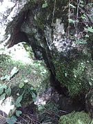
Source 2

Whitewater hut

Gorge with pool

Tatzelwurm waterfall

Underflow in front of the mouth


literature
- Fritz Bauer: Our Audorf Chronicle, Part 1 , Oberaudorf Municipality, 1980, p. 9 and 49.