Arzmoos
| Arzmoos | ||
|---|---|---|
|
View from the upper to the lower Arzmoos (north to south), in the background the Sudelfeld ski area with its facilities. |
||
| location | Bavaria , Germany | |
| Geographical location | 47 ° 41 '32 " N , 12 ° 3' 32" E | |
|
|
||
The Arzmoos is a grazed trough valley and high moor in the Bavarian Alps in the Mangfall Mountains in southeastern Upper Bavaria , which belongs to the municipality of Flintsbach am Inn in the Rosenheim district. It is located opposite Sudelfeld to the south and is divided into two levels by a valley step, Unterarzmoos , which borders the Sudelfeldpass , and Oberarzmoos, north-west and slightly higher. The Arzmoos takes its name from the Arzbach, which flows through the valley and flows into the Auerbach at the foot of the Sudelfeld .
geography
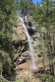
The Unterarzmoos borders in the south on the Sudelfeld and the Auerbach , which runs there from west to east , and in the north-west on the higher lying Oberarzmoos. Between the two valley levels at the foot of the Jackelberg there is the approx. 30 meter high Arzbach waterfall (Arzmoos waterfall) . The lower Arzmoos is bounded in the west by the Jackelberg (1412 m above sea level ) and in the east by Dümpfel (1354 m above sea level ) and Schreckenkopf (1316 m above sea level ). The upper Arzmoos is bordered to the southwest by the Jackelberg and northeast by the Schortenkopf (1322 m above sea level ). There is an old abandoned tunnel near the waterfall . The Arzmoos with its neighboring mountains lies in the catchment areas of the Auerbach valley and the extended Soinkar area and is therefore part of two landscape protection areas .
Transport links

The Arzmoos can be reached from Bayrischzell on Sudelfeldstrasse ( Bundesstrasse 307 ) over the Sudelfeldpass , from Brannenburg also over the Sudelfeldstrasse , which is subject to a toll here, and over the Tatzelwurmstrasse from Oberaudorf . The German Alpine Road along the Sudelfeld is one of the most popular motorcycle touring routes in Bavaria . The Arzmoos, Flintsbach am Inn stop is in the immediate vicinity on the Arzbach bridge, and the Arzmoos hiking car park is a few meters further east.
Development
The Arzmoos is accessible by a gravel road. From there, several meadow paths lead into the neighboring mountains, to the alpine huts and to the Arzbach waterfall (Arzmoos waterfall) . To the northeast the Steinerne Stiege leads towards Brannenburg. The area is used for alpine farming in the summer months until autumn . In the upper Arzmoos there is the DAV Wasserburg section hut, the Kernalm and further north the Kronberger Alm. The lower Arzmoos is built on by a group of rustic huts near the waterfall. At the southern end of the Unterarzmoos there is the Jackelberg Alm of the same name on a hill on the Jackelberg and the Kelheimer Hut of the DAV in the immediate vicinity .
Web links
- Wasserburger hut of the DAV
- Kelheimer Hut of the DAV
- YouTube video of a flight over the lower Arzmoos
Individual evidence
- ↑ Niederaudorf - responsibility for fauna and flora. Retrieved February 14, 2020 .
- ↑ a b Hofmann, Peter R .: Paths in the Inntal An anthropospelaeological excursion guide to the caves of the lower Inntal between Rosenheim and Kufstein . Ed .: BoD - Books on Demand, 2013. Books on Demand, Norderstedt 2013, ISBN 978-3-8482-6956-3 , pp. 109 - 117 ( google.de [accessed on February 13, 2020]).
- ↑ a b c OpenStreetMap Hike & Bike Map. Retrieved February 13, 2020 .
- ↑ Mineral Atlas - Fossil Atlas. Retrieved February 13, 2020 .
- ↑ Protection of parts of the landscape in the extended Soinkar area in the communities of Brannenburg, Flintsbach Am Inn and Oberaudorf. Retrieved February 14, 2020 .
- ↑ Protection of the Auerbach valley incl. Regau (Am Förchenbach) and Bichlersee, municipalities Niederaudorf, Oberaudorf, Flintsbach and Kiefersfelden. Retrieved February 14, 2020 .
- ^ Agricultural heritage project - Kronberger Alm. Accessed on February 13, 2020 .


