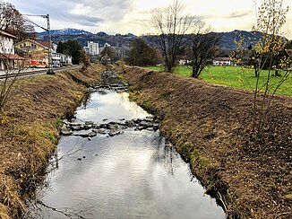
Rohrdorfer Achen
| Rohrdorfer Achen | ||
|
Rohrdorfer Achen in Rohrdorf |
||
| Data | ||
| Water code | DE : 181998 | |
| location | Bavaria | |
| River system | Danube | |
| Drain over | Inn → Danube → Black Sea | |
| source | at Schwarzenberg 47 ° 46 ′ 17 ″ N , 12 ° 16 ′ 33 ″ E |
|
| Source height | approx. 1075 m above sea level NHN | |
| muzzle | near Rosenheim from the right into the Inn Coordinates: 47 ° 51 '10 " N , 12 ° 8' 51" E 47 ° 51 '10 " N , 12 ° 8' 51" E |
|
| Mouth height | 442 m above sea level NHN | |
| Height difference | approx. 633 m | |
| Bottom slope | approx. 34 ‰ | |
| length | 18.6 km | |
| Catchment area | 170.82 km² | |
| Left tributaries | Haberbach, Sailerbach | |
| Right tributaries | Aubach, Bauniglbach, Sims | |
The Rohrdorfer Achen , in the upper reaches just Achen or Weißenbach , is a flowing water in the Bavarian district of Rosenheim . It arises in the Chiemgau Alps , flows as Weißenbach northwards to the union with the Aubach. From then on called Achen, it flows further west to Achenmühle , from then on as Rohrdorfer Achen further northwards, before - after largely parallel to the Inn - it flows into the Inn from the right in Stephanskirchen .
Web links
Commons : Rohrdorfer Achen - Collection of images, videos and audio files
