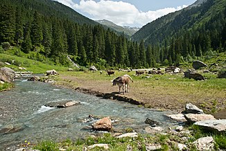
Voldertalbach
| Voldertalbach | ||
| Data | ||
| Water code | AT : 2-8-165 | |
| location | Tyrol , Austria | |
| River system | Danube | |
| Drain over | Inn → Danube → Black Sea | |
| source | below the Naviser Jöchl in the Tux Alps 47 ° 10 ′ 23 ″ N , 11 ° 33 ′ 43 ″ E |
|
| Source height | 2315 m above sea level A. | |
| muzzle | in Volders in the Inn Coordinates: 47 ° 17 ′ 22 " N , 11 ° 33 ′ 36" E 47 ° 17 ′ 22 " N , 11 ° 33 ′ 36" E |
|
| Mouth height | 549 m above sea level A. | |
| Height difference | 1766 m | |
| Bottom slope | 12% | |
| length | 14.6 km | |
| Catchment area | 40.2 km² | |
| Communities | Volders , Tulfes | |
The Voldertalbach is an almost 15 km long right tributary of the Inn in the Innsbruck-Land district in Tyrol .
It rises at 2315 m above sea level. A. below the Naviser Jöchl in the Tux Alps . It then runs relatively straight to the north through the Voldertal , flows through the village of Volders and flows north of it into the Inn. At the end of the valley into the Inn valley, he dug himself into a ravine. Over long stretches the brook forms the municipal boundary between Tulfes and Volders. In the Voldertal, numerous smaller streams flow into it, the most important of which are the Kressbach, the Gamsbach and the Klausbach, all of which flow from the right.
The catchment area of the Voldertalbach measures around 40 km² and extends from 549 m above sea level. A. (Inntal) up to 2796 m above sea level. A. ( Rosenjoch ).
In February 1820, the Voldertalbach was blocked by a landslide below Schwarzbrunn and dammed into a 100 m long and up to 2 m deep lake. This was silted up again at the end of the 19th century, but is still recognizable today as a conspicuously flat surface.
The water power of the Voldertalbach has been used to generate electricity since 1912. The Voldertal power plant, operated today by the town of Hall in Tirol , generates around 31 GWh of electricity per year.
Web links
Individual evidence
- ↑ a b c d e TIRIS - Tyrolean regional planning and information system
- ↑ Christoph Spötl: In search of the Speckbacher Gufel in the Voldertal. In: Höhlenkundliche Mitteilungen, Volume 48, Episode 62 (2009), p. 16 ( PDF; 3.6 MB ( page no longer available , search in web archives ) Info: The link was automatically marked as defective. Please check the link according to the instructions and then remove this notice. )
- ↑ Hans Spötl: 100 Years of the Voldertal Power Plant I. In: Haller Blatt of September 6, 2012, pp. 34-35 ( PDF; 11.3 MB )
- ↑ Volderer Gemeindeblatt, No. 2-2008, p. 15 ( PDF; 8.3 MB )
