
Tulfes
|
Tulfes
|
||
|---|---|---|
| coat of arms | Austria map | |
 |
|
|
| Basic data | ||
| Country: | Austria | |
| State : | Tyrol | |
| Political District : | Innsbruck country | |
| License plate : | IL | |
| Surface: | 27.7 km² | |
| Coordinates : | 47 ° 15 ' N , 11 ° 32' E | |
| Height : | 923 m above sea level A. | |
| Residents : | 1,642 (January 1, 2020) | |
| Population density : | 59 inhabitants per km² | |
| Postal code : | 6075 | |
| Area code : | 05223 | |
| Community code : | 7 03 60 | |
| NUTS region | AT332 | |
| Address of the municipal administration: |
Schmalzgasse 27 6075 Tulfes |
|
| Website: | ||
| politics | ||
| Mayor : | Martin Wegscheider (Together for Tulfes) | |
|
Municipal Council : (2016) (13 members) |
||
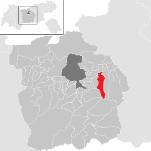
| Location of Tulfes in the Innsbruck-Land district | ||
  |
||
 Tulfes from the southeast |
||
| Source: Municipal data from Statistics Austria | ||


Tulfes is a municipality in the Innsbruck-Land district in the state of Tyrol ( Austria ) with 1642 inhabitants (as of January 1, 2020). The municipality is located in the judicial district of Hall in Tirol .
geography
Tulfes is located on a low mountain range 6 km from Hall and 12 km from Innsbruck , at the foot of the 2677 m high Glungezer . The municipality extends from the Inntalboden over the low mountain range to the rear Voldertal , but only includes the left side of the valley, the right side belongs to Volders .
Community structure
The municipality consists of the cadastral municipality of Tulfes and includes the following two localities (population in brackets as of January 1st, 2020):
- Tulfes (1138)
- Volderwald (504)
|
structure
|
||||||
|
Legend for the breakdown table
|
Neighboring communities
history
Finds from the first millennium BC BC show a first settlement by the Illyrians . The name comes from the Latin tellevo , which means something like usable earth. In 1240 a dispute about a property in the Volderwald was recorded in a document.
Population development

politics
The last mayoral elections took place at the same time as the municipal council elections on February 28, 2016.
In the mayoral elections, Martin Wegscheider (Together for Tulfes) prevailed with a clear majority against Karl Angerer (FPÖ and Independent List Tulfes).
| Voter group | percent | be right | Mandates | Coupling |
|---|---|---|---|---|
| Together for Tulfes | 44.36% | 425 | 6th | |
| LIST OF TULFES | 21.71% | 208 | 3 | A. |
| TEAM TULFES | 24.84% | 238 | 3 | A. |
| FPÖ and Independent List Tulfes | 9.08% | 87 | 1 |
Economy and Infrastructure
Today, in addition to agriculture, tourism plays a role, with the excursion and ski mountain Glungezer. The valley station of the Glungezerbahn is located in the southeast of the outskirts . In addition, Tulfes is a popular residential area near the urban agglomeration of Innsbruck-Hall.
Culture and sights
Web links
- Municipality of Tulfes: Official website of the municipality in the Hall-Wattens region
- 70360 - Tulfes. Community data, Statistics Austria .
Individual evidence
- ↑ Statistics Austria: Population on January 1st, 2020 by locality (area status on January 1st, 2020) , ( CSV )
- ^ State of Tyrol - elections. March 24, 2016, archived from the original on March 24, 2016 ; accessed on March 24, 2016 .
City: Hall in Tirol . Market communities: Fulpmes • Matrei am Brenner • Steinach am Brenner • Völs • Wattens • Zirl . Municipalities: Absam • Aldrans • Ampass • Axams • Baumkirchen • Birgitz • Ellbögen • Flaurling • Fritzens • Gnadenwald • Götzens • Gries am Brenner • Gries im Sellrain • Grinzens • Gschnitz • Hatting • Inzing • Kematen in Tirol • Kolsass • Kolsassberg • Lans • Leutasch • Mieders • Mils • Mühlbachl • Mutters • Natters • Navis • Neustift im Stubaital • Oberhofen im Inntal • Obernberg am Brenner • Oberperfuss • Patsch • Pettnau • Pfaffenhofen • Pfons • Polling in Tirol • Ranggen • Reith bei Seefeld • Rinn • Rum • St. Sigmund im Sellrain • Scharnitz • Schmirn • Schönberg im Stubaital • Seefeld in Tirol • Sellrain • Sistrans • Telfes im Stubai • Telfs • Thaur • Trins • Tulfes • Unterperfuss • Vals • Volders • Wattenberg • Wildermieming .
Localities: Tulfes | Volderwald
Villages:
Tulfes |
Hamlet:
Moser |
Rotten:
Bramor •
Dörfl •
Gasteig •
Halsmarter •
Heißangerer •
Oberlavieren |
Scattered houses:
Tulfein •
Tulferberg •
Voldertal •
Volderwald
Other locations:
Glungezerhütte •
Lambichlerhütte •
Naturfreundehütte-Voldertalhütte •
Tulferhütte •
Windegg
Almen:
Stiftsalm |
Presidents:
nail branches
Counting district:
Tulfes