
Ranggen
|
Ranggen
|
||
|---|---|---|
| coat of arms | Austria map | |
 |
|
|
| Basic data | ||
| Country: | Austria | |
| State : | Tyrol | |
| Political District : | Innsbruck country | |
| License plate : | IL | |
| Surface: | 6.98 km² | |
| Coordinates : | 47 ° 15 ' N , 11 ° 13' E | |
| Height : | 826 m above sea level A. | |
| Residents : | 1.101 (January 1, 2020) | |
| Population density : | 158 inhabitants per km² | |
| Postal code : | 6179 | |
| Area code : | 05232 | |
| Community code : | 7 03 43 | |
| NUTS region | AT332 | |
| Address of the municipal administration: |
Oberdorf 14 6179 Ranggen |
|
| Website: | ||
| politics | ||
| Mayor : | Manfred Spiegl (Citizen List Ranggen) | |
|
Municipal Council : (2016) (11 members) |
||
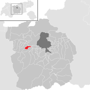
| Location of Ranggen in the Innsbruck-Land district | ||
  |
||
 Ranggen seen from the south |
||
| Source: Municipal data from Statistics Austria | ||

Ranggen is a municipality with 1101 inhabitants (as of January 1, 2020) in the Innsbruck-Land district in Tyrol ( Austria ). The community is located in the judicial district of Telfs .
geography
Ranggen is located in a hollow of the Inntalterrasse , west of Innsbruck or in the eastern continuation of the Inzinger Berg.
The actual Rangger local area is divided into an outer, upper and lower village. There are also alley-like densities and hamlets that shape the image of the cultural landscape. The Ferklehen residence (located in the valley floor near Unterperfuss), whose name is derived from “Fergen”, which originally meant the right to look after the Inn ferry at Zirl, is a special feature of the settlement area . After the construction of the Inn Bridge (1482), Fergenrecht then related to bridge maintenance.
The Rettenbach flows through Ranggen. A very popular bicycle route leads from the Inn Valley to Ranggen over approx. 5 km and 200 m elevation gain. This also represents the main traffic connection. The highest mountain is the Rangger Köpfl , with 1939 m a very popular excursion mountain for summer and winter sports enthusiasts of all kinds. One of the longest natural toboggan runs with a length of almost 8 km and a height difference of approx 950 m.
Districts:
|
|
|
Neighboring municipalities:
history
In the Middle Ages and early modern times, the Premonstratensian Monastery Wilten (Innsbruck) had important possessions in Ranggen. It ran its own archive drawer under the name "Lutzlranggen" (from Middle High German lützel , lützelig = small, little), which is now linguistically represented in the Ortried Itzlranggen.
Population development

politics
The last mayoral elections took place at the same time as the municipal council elections on February 28, 2016.
Manfred Spiegl was re-elected as mayor with 84.94% (547 votes). The opposing candidate (FPÖ Ranggen) received 15.06% (97 votes).
| Political party | percent | be right | Seats on the local council | Coupling |
|---|---|---|---|---|
| Together for Ranggen | 48.06% | 334 | 6th | |
| Mayor team with Manfred Spiegl | 37.70% | 262 | 4th | |
| FPÖ Ranggen | 14.24% | 99 | 1 |
coat of arms
A green step in the coat of arms of the municipality of Ranggen indicates its location on the Inntalterrasse. At the same time, the slightly inclined landing illustrates the "Abhang" important place name.

The dragon points on the one hand as a sign of Saint Magnus to his parish patronage, on the other hand to the dangerously steeply sloping "raging Ranggen", after which the community is named.
Attractions
- Ranggen parish church: baroque, built 1775–1778
Individual evidence
- ↑ Martin Bitschnau , Hannes Obermair : Tiroler Urkundenbuch, II. Department: The documents on the history of the Inn, Eisack and Pustertal valleys. Volume 1: By the year 1140 . Universitätsverlag Wagner, Innsbruck 2009, ISBN 978-3-7030-0469-8 , p. XXXVIII, ark 62 .
- ↑ Local council and mayoral elections 2016 | Ranggen community . Tyrol Our country
Web links
- 70343 - Ranggen. Community data, Statistics Austria .
City: Hall in Tirol . Market communities: Fulpmes • Matrei am Brenner • Steinach am Brenner • Völs • Wattens • Zirl . Municipalities: Absam • Aldrans • Ampass • Axams • Baumkirchen • Birgitz • Ellbögen • Flaurling • Fritzens • Gnadenwald • Götzens • Gries am Brenner • Gries im Sellrain • Grinzens • Gschnitz • Hatting • Inzing • Kematen in Tirol • Kolsass • Kolsassberg • Lans • Leutasch • Mieders • Mils • Mühlbachl • Mutters • Natters • Navis • Neustift im Stubaital • Oberhofen im Inntal • Obernberg am Brenner • Oberperfuss • Patsch • Pettnau • Pfaffenhofen • Pfons • Polling in Tirol • Ranggen • Reith bei Seefeld • Rinn • Rum • St. Sigmund im Sellrain • Scharnitz • Schmirn • Schönberg im Stubaital • Seefeld in Tirol • Sellrain • Sistrans • Telfes im Stubai • Telfs • Thaur • Trins • Tulfes • Unterperfuss • Vals • Volders • Wattenberg • Wildermieming .