Scharnitz
|
Scharnitz
|
||
|---|---|---|
| coat of arms | Austria map | |
|
|
||
| Basic data | ||
| Country: | Austria | |
| State : | Tyrol | |
| Political District : | Innsbruck country | |
| License plate : | IL | |
| Surface: | 159.29 km² | |
| Coordinates : | 47 ° 23 ' N , 11 ° 16' E | |
| Height : | 964 m above sea level A. | |
| Residents : | 1,361 (January 1, 2020) | |
| Population density : | 8.5 inhabitants per km² | |
| Postal code : | 6108 | |
| Area code : | 05213 | |
| Community code : | 7 03 48 | |
| NUTS region | AT332 | |
| Address of the municipal administration: |
Adolf-Klinge-Platz 72 6108 Scharnitz |
|
| Website: | ||
| politics | ||
| Mayoress : | Isabella Blaha (Citizen For Scharnitz) | |
|
Municipal Council : (2016) (13 members) |
||
| Location of Scharnitz in the Innsbruck-Land district | ||
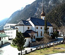
 Scharnitz, view from the west |
||
| Source: Municipal data from Statistics Austria | ||
Scharnitz is a municipality with 1,361 inhabitants (as of January 1, 2020) in the Innsbruck-Land district of the state of Tyrol ( Austria ). The municipality is located in the judicial district of Innsbruck .
geography
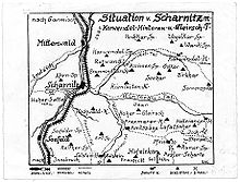
Scharnitz is located on the Scharnitz Pass on the border with Bavaria , on the connection from Seefeld in Tirol to Garmisch-Partenkirchen . The place is on the Isar a few kilometers west of its source, at the end of a valley widening where the Karwendeltal , Hinterautal and Gleirschtal meet with the Isar valley . It is an important starting point for many mountain bike and mountain tours in the Karwendel .
Community structure
The municipality consists of only one cadastral municipality , but is divided into ten districts:
|
|
Neighboring communities
In Austria
as well as in Germany
history
The Roman fort " Scarbia " was located in Scharnitz between the Karwendel and Wetterstein mountains . In early medieval documents an inhospitable forest between is with "Scharnitz" Walchensee and Seefeld in Tirol referred, for the first time than in the year 763 in the " locum Scaraza built," the Diocese of Freising occurs imputed monastery church of St. Peter in appearance, which, however, with the monastery Scharnitz in Klais north of Mittenwald is equated. In the Middle Ages, Scharnitz was an important gateway to Tyrol on the Venice - Augsburg trade route .
Originally belonging to the County of Werdenfels (the border with the County of Tyrol was at Schlossberg Castle north of Seefeld), the long-term goal of Tyrol was to move the state border to the strategically important Scharnitz Pass. The Tyroleans achieved partial success when, on October 20, 1500, Emperor Maximilian I and Prince-Bishop Philipp von Freising ratified a treaty that had been concluded the year before, which moved the Tyrolean border to a kilometer south of the town.
In 1633, Tyrol was given the right to build the Porta Claudia dam on the Scharnitz Pass in the Werdenfels area to protect it from the advancing Swedes in the Thirty Years' War ; it was named after the former Tyrolean princess Claudia von Medici . Remnants of it can still be viewed today.
By contract of October 29, 1656, Scharnitz and the area around the Porta Claudia were exchanged for an area strip around the Kienleithenkopf with the Karolingerhof and right of way into the Hinterautal. With the contract of May 28, 1766, the affiliation of Scharnitz and Porta Claudia to Tyrol was confirmed, as well as for an area strip "on a musket shot at all fortification works at that time against Mittenwald".
Parts of the Scharnitz municipal area, which drains from the Karwendel to the Isar, today belong to the city of Innsbruck , the form of appropriation of these areas by Innsbruck after 1912 has not yet been clarified.
In 1845 the “First Tyrolean Asphalt Factory” was located in Scharnitz. Even the inner city of Innsbruck was once asphalted with this asphalt.
From October 2015 to 2018, a bypass for Seefelder Straße with the Porta Claudia tunnel was built. The Scharnitz bypass was officially opened on November 10, 2018.
Population development

Culture and sights
Economy and Infrastructure
Today Scharnitz is a tourist municipality and belongs to the tourist region Olympiaregion Seefeld . Summer tourism plays a major role as the gateway to the Karwendel hiking and climbing area. Through the three large west-east valleys of the Karwendel (Karwendeltal, Hinterautal, Gleirschtal) you can quickly get to the center of the mountains by bike and climb the Karwendel peaks from there.
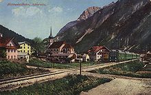
Scharnitz is located on the Mittenwaldbahn ( Innsbruck - Munich ) and is the terminus of the S-Bahn line ![]() from Innsbruck.
from Innsbruck.
Scharnitz can be reached by car from Innsbruck via Seefelder Straße (B 177), which continues as Bundesstraße 2 on the German side .
The Isar Cycle Path , an international long-distance cycle route , runs through Scharnitz .
politics
The local council of Scharnitz has 13 members: mayor, vice mayor, three community boards including mayor and vice mayor as well as ten community councils. The municipality board is the equivalent of a city council. In Scharnitz, political parties hardly appear in local council elections, most recently the SPÖ until 1992, groups close to the party run on lists of names.
Since 1989, the "Scharnitz Citizens List" (SBL) of former mayor Hubert Heiss has dominated Scharnitz. The second largest parliamentary group after the current elections in March 2010 was the list “Citizens for Scharnitz” (formerly Citizens' Forum Scharnitz ) (BFS). The parliamentary group “Bürgerforum Scharnitz” (BFS), a non-party group that was originally founded in 1992 by the residents of the Gießenbach district (top candidate was Johann Hofmann), was expanded and restructured in 1998 through the commitment of its list member Isabella Blaha and thus won list candidates the entire village. Since 1992, the FSO has increased its share of the vote in every election and ultimately won two seats.
As of 2004, the FSO and its top candidate Isabella Blaha appointed the vice-mayor. Also in 2004 the Dr. Reinhold Wöll founded "Dorfliste" (DL) under the Seefeld school director and VP local party chairman Thomas Grössl, MAS for the first time the strongest parliamentary group, but won the same number of mandates as the citizens' list. Also in the spectrum of municipal council lists is the list of women and families, which ran for the first time in 1998 and entered the municipal council as an all-women faction with two female mandataries. In 2004 the list was halved, in 2010 she withdrew from the political landscape and no longer ran.
Lists that have not existed since 1998 are the “Mitte Scharnitz” (represented with two mandates from 1992 to 1998) and the SPÖ Scharnitz. On April 4, 2006, Mayor Hubert Heiss resigned after 18 years in office for health reasons. A mid-term election then had to be held. There were two mayoral candidates. From the parliamentary group of Mayor Hubert Heiss of the SBL the lateral entrant Walter Lechthaler and the list leader of the FSO and Vice Mayor Isabella Blaha, whereby Isabella Blaha lost with only 2 votes and Walter Lechthaler became the new mayor.
The general Tyrolean municipal council and mayoral elections in March 2010 changed the parliamentary landscape in Scharnitz seriously.
The BFS list with Isabella Blaha achieved the same number of seats as the former SBL list of mayors (4 seats each). Isabella Blaha is elected mayor. The "Dorfliste" (DL) only receives three mandates and, with its list leader Bernhard Vonmetz, is the vice mayor. As the fourth parliamentary group, Ernst Reinpold's newly founded young list “AUF Scharnitz - The young list” (AUF) moves into the municipal council with two mandates.
coat of arms
The Scharnitz coat of arms represents the Porta Claudia as a fortification during the Thirty Years War and the entrance to Tyrol .
The colors of the church are black and yellow.
flag
The municipality's flag is striped black and yellow (1: 1) and has the municipality's coat of arms in the center.
Community partnerships
There has been a partnership with Plattling in Lower Bavaria since 2009 . The Isar flows into the Danube in Plattling, while it rises in Scharnitz. The green Isar is the connecting link in this partnership.
Personalities
- Natalie Klotz (* 1997), figure skater
Individual evidence
- ↑ Martin Bitschnau , Hannes Obermair : Tiroler Urkundenbuch, II. Department: The documents on the history of the Inn, Eisack and Pustertal valleys. Volume 1: By the year 1140 . Ed .: Tiroler Landesmuseen-Betriebsgesellschaft mb H. Universitätsverlag Wagner, Innsbruck 2009, ISBN 978-3-7030-0469-8 , p. 25-27, No. 45 . (authoritative edition with further references).
- ↑ Walter Sage: The early medieval monastery in the Scharnitz. The excavations on the "Kirchfeld" in Klais, municipality of Krün, district of Garmisch-Partenkirchen, in the years 1968 - 1972 , in: Volume 31 - Contributions to old Bavarian church history. Franz X. Seitz & Val. Höfling 1977, ISBN 9783877440261
- ↑ County Werdenfels - extent and boundaries of the county: The Tyrolean border , p. 15, in: Altbayern. Series I, Issue 9: Grafschaft Werdenfels, Commission for Bavarian State History, Munich 1955.
- ^ Daniel-Erasmus Khan: The German State Borders - Legal-Historical Basics and Open Legal Issues. Mohr Siebeck 2004, p. 211 f. ISBN 978-3-16-148403-2 Preview on Google Books
- ↑ County Werdenfels - extent and boundaries of the county: The Tyrolean border , p. 16, in: Altbayern. Series I, Issue 9: Grafschaft Werdenfels, Commission for Bavarian State History, Munich 1955.
- ↑ Scharnitz bypass officially opened on ORF-Tirol on November 10, 2018, accessed on November 10, 2018.


