Werdenfels county
| Werdenfels county | |
|---|---|
| Originated: | 1294 from the possessions of the Count of Eschenlohe . |
| Raised: | 1803 in the Kingdom of Bavaria . |
| Main court: | Garmisch |
| Today's region: | The southern district of Garmisch-Partenkirchen . |
| Situation map | |
 The territorial area of the County of Werdenfels (marked in red) in 1789. |
|
The county of Werdenfels in today's Werdenfelser Land was an imperial county owned by the Hochstift Freising . The territory of the county is roughly congruent with the southern part of today's Garmisch-Partenkirchen district in Upper Bavaria . The municipalities of the area continue to form the Werdenfels deanery of the Archdiocese of Munich and Freising .
geography
The county of Werdenfels, which encompasses parts of the Upper Loisach and Isar valleys , was the largest sub-territory of the Hochstift Freising in terms of area . The southern natural border formed the main ridge of the Wetterstein Mountains and in the east the Karwendel with its northern promontory . In the west, parts of the Ammergau Alps and in the center a large part of the Estergebirge belonged to the county. The northern neighbors were the Bavarian monastery courts Ettal and Benediktbeuern . In the west, south and east, Freundsberg, Hörtenberg, Petersberg and Ehrenberg, all courts of the County of Tyrol , joined.
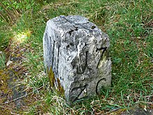
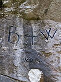
A first boundary description comes from the years 1073-1078: In a record of the Hochstift Freising the border course in Werdenfelser Land and Ammergau is described in detail. A somewhat more recent border description from 1305 and names 15 border points: The border course went from Eschenlohe to Walchensee and on to Sylvenstein . From there the border ran to the Hallerangersattel, on to Seefeld and across the Leutasch valley to the Wetterwandeck in the Zugspitze massif . From the Wetterwandeck, Werdenfels extended to the Plansee , then the border continued in a straight line through the Ammergau Alps back to Eschenlohe. After the Schlossberg castle north of Seefeld was transferred from the Counts of Eschenlohe to the Counts of Tyrol in 1284 , it actually formed the border fortifications to the County of Werdenfels. The church division also followed this boundary: Scharnitz belonged to the diocese of Freising , Seefeld and Oberleutasch to the diocese of Brixen . Against this background, the boundary descriptions from 1305, 1315 and 1436 are to be understood as the registration of territorial claims rather than descriptions of the actual territory. For example, Laliders had been owned by the Absam parish since 1426 . The goal of Tyrol, on the other hand, was to move the border to the strategically important Scharnitz Pass .
As a result, the prince-bishopric suffered some loss of territory to its powerful neighbors. Large parts of the Karwendel and the Leutasch Valley went to Tyrol in 1500. In 1539 Bavaria moved the border from Sylvenstein to shortly before Wallgau. In 1554 the Steinerne Brückl near Farchant and the bridge near Obernach formed the border with Bavaria. In 1633, Tyrol was given the right to build the border fortification Porta Claudia on the Scharnitz Pass in the Werdenfels area to protect against the advancing Swedes in the Thirty Years' War . By contract of October 29, 1656, Scharnitz and the area around the Porta Claudia were exchanged for an area strip around the Kienleithenkopf with the Karolingerhof and right of way into the Hinterautal. With the contract of May 28, 1766, the Karwendeltal was finally exchanged for the Ebenwald, Frauenalpl and Reintal , whereby the hunting rights remained with the County of Werdenfels and the wood and grazing rights with the citizens of Mittenwald .
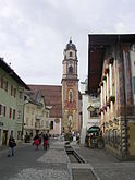
When the county was founded, it was divided into three nursing courts: Garmisch , Partenkirchen and Mittenwald . The other core locations were today's communities Farchant , Grainau , Krün and Wallgau .
history
Werdenfels Castle was its center . In 1294 Count Perchthold von Eschenloh sold his county to the Bishop Enichen (Emicho) von Freising . The chief judge was based in Garmisch, where he held his court days. The meetings initially took place in the castle, and it was not until 1632 that the nursing home was moved to a new office building in Schwaigwang.
The country had considerable deposits of ore and silver. Of even greater economic importance for the county at the beginning of modern times was the control of the trade routes to Italy. What came from the south (spices, fruit, incense, wine) had to be deposited in Mittenwald, what came from the north (copper, brass, cloth, jewelry, metal goods) in Partenkirchen for a fee. Only a Werdenfels wagoner association had the right to transport the goods within the county. It was of particular importance that Siegmund der Münzreich relocated the important Bozen market to Mittenwald on the occasion of his war with the Republic of Venice in 1487 , where it was held until 1679. This is how the area came to a certain degree of prosperity and was known as the "golden country".
The neighbors Tyrol and Bavaria, the latter represented by the neighboring monastery Ettal and monastery Benediktbeuern , repeatedly claimed parts of the area. In 1530, Duke Wilhelm IV of Bavaria offered the Bishop of Freising large parts of the country between Isar and Amper in exchange for the entire county, but negotiations in Munich failed.
After the Thirty Years War, the area gradually lost its importance as a trading center. Brought a certain revival, founded by Matthias Klotz , the violin-making in Mittenwald. 1803 ended with the secularization in Bavaria, the rule of the Hochstift Freising, the County of Werdenfels came to the Kingdom of Bavaria .
Witch trials
At the end of the 16th century, sensational witch trials took place in the county , in which 51 people were convicted and executed as witches between 1590 and 1591 . Among these people was a man, Simon Kembscher . A total of 127 people were accused of witchcraft during this period.
In 1583 the easily influenced Caspar Poissl von Atzenzell became the new caretaker in the county of Werdenfels. The inhabitants of the country had been very restless the years before. Plague epidemics , disease, hailstorms that devastated the fields and dead animals frightened the general public. While the predecessor of the new caretaker was still moderating allegations of witchcraft, Poissl met open ears. When Ursula Klöck, who came from Tyrol, was accused of witchcraft by the Eibsee fisherman , the keeper had her taken to the Garmisch administrative building on September 28, 1589. Ten days later, two other women were arrested and put in dungeons. The experienced Schongau executioner and witch finder Jörg Abriel examined all three women and the keeper Poissl wrote to his superiors about his judgment: "... all three women were found to be fiends because he really discovered the sign of the devil on them." With the embarrassing questioning the nurse squeezed confessions out of the women. Another woman was suspected through questioning and arrested in December. The nurse then shipped the four accused to the dungeon of Werdenfels Castle. Without the permission of the Freising government, Poissl continued to torture and suspected more and more women. Then on December 21st, one of the women committed suicide. Following this, in January the male nurse held the first Malefice Rights Day and the women were sentenced to death. Six more days of maleficence law followed; in most cases, the convicts were burned alive by the Schongau executioner.
See also
literature
- Johannes Haslauer: Werdenfels, county . In: Historisches Lexikon Bayerns ( online , accessed June 4, 2016).
- Dieter Albrecht : The county of Werdenfels . In: Unknown Bavaria - Discoveries and Hikes . Süddeutscher Verlag, Munich 1955, ISBN 3-7991-5839-1 .
- Josef Ostler / Michael Henker / Susanne Bäumler: County of Werdenfels 1294–1802 . Catalog book for the exhibition Mohr × Lion × Raute in the Kurhaus Garmisch. In: Association for history, art and cultural history in the district eV (Ed.): Contributions to the history of the district of Garmisch-Partenkirchen . tape 2 . Garmisch-Partenkirchen 1994.
- Johannes Haslauer: Erected to annoy all neighbors . The role of the Bavarian Academy of Sciences in the political dispute over the county of Werdenfels (1765–1768). In: Journal for Bavarian State History . No. 72 . Munich 2009, p. 399-459 .
- Johann Baptist Prechtl : Chronicle of the former episcopal Freising County Werdenfels in Upper Bavaria with its three lower courts and parishes Garmisch, Partenkirchen and Mittenwald . Compiled in Augsburg 1850. Ed .: Gebrüder Ostler. Garmisch 1931.
- Wolfgang Wüst : Change in the Golden Landl 200 years ago . The Partenkirchen market and the county of Werdenfels in secularization trauma. In: Association for history, art and cultural history in the district eV (Ed.): Contributions to the history of the district of Garmisch-Partenkirchen . tape 11 . Garmisch-Partenkirchen 2006, p. 141-162 .
Individual evidence
- ↑ a b Josef Brandner: Around the Landl . Alt Werdenfelser boundary stones and rock fairytales. Adam-Verlag, Garmisch-Partenkirchen 1993, Werdenfels - Freising's "Best Piece", p. 6th f .
- ↑ On the history of the county. In: Historical Atlas of Bavaria - County Werdenfels. Bayerische Staatsbibliothek München, p. 1 , accessed on May 12, 2011 .
- ↑ Martin Bitschnau , Hannes Obermair (arr.): Tiroler Urkundenbuch . The documents on the history of the Inn, Eisack and Pustertal II / 1 . Innsbruck: Wagner 2009. ISBN 978-3-7030-0469-8 , pp. 217f. No. 245 ( “Terminus huius episcopii… inde a summas Alpes…” ). The description is dated to approx. 1060 in the older literature ( [1] ).
- ↑ Grafschaft Werdenfels - Scope and boundaries of the county: The Tyrolean border p. 15, in: Altbayern Series I, Issue 9: Grafschaft Werdenfels, Komm. Für Bayerische Landesgeschichte, Munich 1955.
- ↑ Grafschaft Werdenfels - Scope and boundaries of the county: The Tyrolean border p. 14, in: Altbayern series I issue 9: Grafschaft Werdenfels, Komm. Für Bayerische Landesgeschichte, Munich 1955.
- ^ Daniel-Erasmus Khan: The German State Borders - Legal-Historical Basics and Open Legal Issues. Mohr Siebeck 2004, p. 211 f. ISBN 9783161484032 Preview on Google Books
- ↑ Josef Brandner: Around the Landl . Alt Werdenfelser boundary stones and rock fairytales. Adam-Verlag, Garmisch-Partenkirchen 1993, 64 Werdenfelser Grenzgeschichten at a glance, p. 189 .
- ↑ Grafschaft Werdenfels - Scope and boundaries of the county: The Tyrolean border p. 16, in: Altbayern series I issue 9: Grafschaft Werdenfels, Komm. Für Bayerische Landesgeschichte, Munich 1955.
- ↑ Josef Brandner: Around the Landl . Alt Werdenfelser boundary stones and rock fairytales. Adam-Verlag, Garmisch-Partenkirchen 1993, 64 Werdenfelser Become Tyrolean, p. 40 .
- ↑ Fritz Kuisl: The Witches of Werdenfels . Hexenwahn in Werdenfelser Land, reconstructed on the basis of the trial documents from 1589 to 1596. Adam-Verlag, Garmisch-Partenkirchen 1979, p. 6th f .
Coordinates: 47 ° 31 '10.3 " N , 11 ° 5' 51.2" E


