
Thaur
|
Thaur
|
||
|---|---|---|
| coat of arms | Austria map | |
 |
|
|
| Basic data | ||
| Country: | Austria | |
| State : | Tyrol | |
| Political District : | Innsbruck country | |
| License plate : | IL | |
| Surface: | 21.04 km² | |
| Coordinates : | 47 ° 18 ' N , 11 ° 28' E | |
| Height : | 633 m above sea level A. | |
| Residents : | 4,058 (January 1, 2020) | |
| Population density : | 193 inhabitants per km² | |
| Postal code : | 6065 | |
| Area code : | 05223 | |
| Community code : | 7 03 58 | |
| NUTS region | AT332 | |
| UN / LOCODE | AT THR | |
| Address of the municipal administration: |
Dorfplatz 4 6065 Thaur |
|
| Website: | ||
| politics | ||
| Mayor : | Christoph Walser (Thaurer Unit List) | |
|
Municipal Council : ( 2010 ) (15 members) |
||
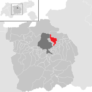
| Location of Thaur in the Innsbruck-Land district | ||
  |
||
 Thaur from the northwest |
||
| Source: Municipal data from Statistics Austria | ||

Thaur is a municipality with 4058 inhabitants (as of January 1, 2020) in the Innsbruck-Land district in Tyrol ( Austria ). The municipality is located in the judicial district of Hall in Tirol .
Due to its proximity to the provincial capital Innsbruck, the municipality is subject to a great deal of pressure to settle, but the rural and village center has been well preserved. Among other things, Thaur is now a popular residential community .
geography
Thaur is located at the eastern foot of the Nordkette , on the old village road from Innsbruck to Hall and is one of the MARTHA villages . The community forms a clustered village on a slight slope, which is mainly located north of this road. The highest point of the municipality is the Hintere Bachofenspitze ( 2668 m above sea level ) in the Gleirsch-Halltal chain .
Neighboring communities
history
An urn grave field from the Bronze Age indicates that the area was already around 1000 BC. Was settled.
The name Thaur may come from the Illyrian language and means 'rock'. Another origin of the name could be the Rhaeto-Romanic taur or tgaura " goat " and thus indicate the use of pasture. 827 Thaur is mentioned for the first time in the so-called Quartinus document as "Taurane" - ownership there is transferred to the San Candido monastery .
Salt extraction was important in the Middle Ages .
The castle of Thaur was expanded in the 13th century and was court seat. After a fire and an earthquake with serious consequences, only ruins remain today.
The community has five churches. The baroque pilgrimage church Romedikirchl above the village is important. It is built near the presumed home of St. Romedius , Thaur Castle . Only ruins remain of the once proud castle. Thaur Castle was once one of the largest castles in the Inn Valley .
Since 1959 the municipality had a share in the Tyrolean duty-free zone (cadastral municipality Thaur II , an exclave in the Haller municipality). In 1971 another strip on the Inn was dedicated as a commercial and industrial zone ( commercial and industrial zone Au ) .
After the basic consolidations ( land consolidations ) in the Thaurer Au by 2006, the Thaurer fields , which have always been rather fragmented, are now being cleaned up. The extent to which there can still be read Roman road system , which as an important archaeological monument of early settlement history of the Middle Inn Valley is a listed building , actually comes from Roman times, is still unclear.
Population development

politics
mayor
Christoph Walser was elected Mayor of Thaur in 2016 . He won with 50.49% against his competitors, the incumbent mayor Konrad Giner (28.83%), Thomas Rainer (8.78%) and Josef Bertsch (11.9%).
Municipal council
The municipal council consists of 15 members and has been composed of mandates from the following parties since the 2016 municipal council election:
- 4 List of mayors Konrad Giner
- 6 Thaurer unit list
- 1 SPÖ and non-party list Thaur
- 1 citizen in Thaur
- 1 DU-zählst.at
- 2 The Greens Thaur
coat of arms
The three silver towers appearing in the coat of arms indicate the Thaur Castle, which was located here at the time, of which only a ruin has now remained.
Economy and Infrastructure
To the south of the new federal road to Hall lies an important industrial and commercial area that is directly adjacent to that of the municipality of Hall. Vegetable cultivation in the surrounding fields is of great importance. Thaur is the seat of the Physiotherm company .
Not far south of Thaur is the Inntal Autobahn (A12), and thus also the European route E45 and E60 . Before that is the Tiroler Straße (B171). Thaur is from the main road passing through L372. The nearest train station is in Rum, where there is a connection to the S-Bahn Tirol . There is a flight connection with Innsbruck Airport not too far away.
Culture and sights


- Parish Church of the Assumption of Mary:
- One of the five churches in the parish and seat of the original parish of Thaur. Late Gothic building. Mentioned in a document in 1244. Consecrated in 1487. Redesigned in 1766 in baroque style. Removed Baroque style in the 19th century and frescoed by Franz Pernlochner . Classicist high altar with a late Gothic Mother of God. 4 rococo altars in the nave.
- Vigil Church:
- First mentioned in a document in the 14th century. Rebuilt in 1643 by salt works officials. Furniture from the 19th century.
- Ulrichskirche and Afrahof:
- Originally Romanesque complex. Rebuilt in the 16th century. Wooden west gallery and coffered ceiling from the 16th century. Late Gothic paintings by the master of the Magdalen Chapel in Hall in Tirol. Winged altars from the 16th century.
- Castle Church:
- The castle church to the Hll. Apostles Peter and Paul is the former pilgrimage church of St. Romedius , a hermit from what is now South Tyrol. Consecrated in 1432. Rebuilt in 1648. Rococo stucco and altars.
- On Haller Straße, station of a former pilgrimage. Built and donated by Archduke Ferdinand II of Tyrol. Renaissance columnar altar from the former women's monastery in Hall .
- Ruins of Thaur Castle:
- Formerly the largest castle complex in the Inn Valley and seat of the court. In the 13th century owned by the Counts of Andechs , later in the Tyrolean. From the 16th century onwards increasing decline. Theater performances for several years.
- The Imperial Column at an altitude of 1,700 meters commemorates the visit of Emperor Franz I on October 22, 1815.
regional customs
The nativity scene is very important in Thaur. There is a nativity scene in almost every house . Many artists from the village have been involved in building - mostly oriental - mountains, carving figures or painting the backgrounds. The most famous family of artists are the giners . The tradition is cultivated with crib exhibitions and Mullerlauf (a carnival custom ).
Thaur is the only remaining municipality in Tyrol in which a palm donkey procession is still held. A life-size figure of Christ on a donkey - both carved - is pulled from the parish church to the castle church with bells ringing, where protection and help are prayed in the All Saints' Litany , and then continued to the neighboring village of Rum. The way back to Thaur used to take the still car-free village road, but today it is a dirt road.
Also, as the only congregation, an entombment procession takes place on Good Friday . As at a funeral, a life-size body of Christ is carried through the village to the sounds of the band playing funeral marches and the praying of the painful rosary. When you get back to the church, the “grave lieger” is placed in the large holy grave that covers the entire sanctuary . At the celebration of Easter vigil on the following day, the resurrection is represented with the lifting of the Holy Sepulcher canvas and the appearance of the risen Christ . Furthermore, on the Ascension of Christ, the Ascension is visibly carried out: Christ, accompanied by four angels, floats in the central nave of the parish church after the intercessions during the solemn high mass through a hole in the ceiling “up to heaven”.
The Thaurer Partisanerbund , an association founded in 1660 that accompanies the Holy of Holies in processions, was recognized by UNESCO in 2013 as an intangible cultural heritage in Austria under the name Sacramentsgarden in Tyrol .
Personalities
Sons and daughters of the place
- Johann Giner the Elder (1756–1833), sculptor and nativity scene carver
- Franz Xaver Pernlochner (1847–1895), painter
- Ferdinand Stabinger (1866–1948), sculptor and teacher
- Ambros Giner (1887–1965), abbot of the Neustift monastery
- Konrad Lechner (1901–1994), abbot of the Neustift monastery
- Maria Giner (1922-2018), politician (ÖVP)
- Chrysostomus Giner (* 1930), abbot of the Neustift monastery
Connected with Thaur
- Artist family Giner , painters and nativity scene carvers in the 18th and 19th centuries
- Hartmann Grisar (1845–1932), Jesuit and church historian, lived in Thaur
- Claudia Giner (* 1985), pop singer, grew up in Thaur
- Toni Innauer (* 1958), ski jumper, trainer and manager, lives in Thaur
literature
- Municipality of Thaur: local spatial planning concept. Update of the environmental report on the strategic environmental assessment (SUP). November 2014 ( pdf , 8.3 MB; thaur.tirol.gv.at, accessed March 29, 2015) - extensive inventory of nature-relevant aspects in the municipality.
Web links
- Official website of the municipality
- Thaur at www.tirolatlas.uibk.ac.at
- Thaur , in the history database ofthe association "fontes historiae - sources of history"
- Chronos: Association for village history
Individual evidence
- ↑ Martin Bitschnau , Hannes Obermair : Tiroler Urkundenbuch, II. Department: The documents on the history of the Inn, Eisack and Pustertal valleys. Vol. 1: Up to the year 1140 . Universitätsverlag Wagner, Innsbruck 2009, ISBN 978-3-7030-0469-8 , p. 61-64, No. 86 .
- ^ Die Thaurer Dorfgeschichte: 1971. Association for Village History Thaur: chronos-thaur.at, accessed March 13, 2015.
- ↑ Fundamental consolidation Thaurer Au West , tirol.gv.at (pdf)
- ↑ Consolidation: Thaurer Au under one roof! In: The Schlossbichler. Journal for Thaur, No. 08 / 3rd volume, April 2006, p. 6 ( pdf , thaur.tirol.gv.at).
- ↑ Notification (...) for the amalgamation of the “Thaurer fields”. (PDF; 280 KB) In: portal.tirol.gv.at. Office of the Tyrolean Provincial Government, Agricultural Authority, May 27, 2009, accessed on February 13, 2019 (direct download).
- ↑ Johannes Pöll: Annual Report on Archaeological Monument Preservation 2009. Bundesdenkmalamt , 2009, p. 31 , archived from the original on July 1, 2016 ; accessed on October 28, 2017 .
- ↑ There used to be many settlements on the Thaurer fields . In: mein district.at . July 14, 2010, accessed October 24, 2019.
- ↑ a b Municipal council and mayoral elections 2016: Municipality of Thaur. In: Wahlen.tirol.gv.at. State of Tyrol, 2016, accessed on August 2, 2017 .
- ↑ a b c d e f g Dehio Tirol, Verlag Anton Schroll & Co. Vienna 1980, pp. 804–808
City: Hall in Tirol . Market communities: Fulpmes • Matrei am Brenner • Steinach am Brenner • Völs • Wattens • Zirl . Municipalities: Absam • Aldrans • Ampass • Axams • Baumkirchen • Birgitz • Ellbögen • Flaurling • Fritzens • Gnadenwald • Götzens • Gries am Brenner • Gries im Sellrain • Grinzens • Gschnitz • Hatting • Inzing • Kematen in Tirol • Kolsass • Kolsassberg • Lans • Leutasch • Mieders • Mils • Mühlbachl • Mutters • Natters • Navis • Neustift im Stubaital • Oberhofen im Inntal • Obernberg am Brenner • Oberperfuss • Patsch • Pettnau • Pfaffenhofen • Pfons • Polling in Tirol • Ranggen • Reith bei Seefeld • Rinn • Rum • St. Sigmund im Sellrain • Scharnitz • Schmirn • Schönberg im Stubaital • Seefeld in Tirol • Sellrain • Sistrans • Telfes im Stubai • Telfs • Thaur • Trins • Tulfes • Unterperfuss • Vals • Volders • Wattenberg • Wildermieming .
Cadastral parishes: Thaur I | Thaur II
Location: Thaur
Village: Thaur | Rotten: Madleinhof • Schloßhof | Settlements: Kapon Settlement | Other locations: Commercial and industrial zone Au • St. Loretto • Romediuskirchl • Thaurer Alm
Counting district: Thaur | Thaur area