Zirl
|
market community Zirl
|
||
|---|---|---|
| coat of arms | Austria map | |
|
|
||
| Basic data | ||
| Country: | Austria | |
| State : | Tyrol | |
| Political District : | Innsbruck country | |
| License plate : | IL | |
| Surface: | 57.14 km² | |
| Coordinates : | 47 ° 16 ' N , 11 ° 14' E | |
| Height : | 622 m above sea level A. | |
| Residents : | 8,110 (January 1, 2020) | |
| Postal code : | 6170 | |
| Area code : | 05238 | |
| Community code : | 7 03 69 | |
| NUTS region | AT332 | |
| UN / LOCODE | AT ZIR | |
| Address of the municipal administration: |
Bühelstrasse 1 6170 Zirl |
|
| Website: | ||
| politics | ||
| Mayor : | Thomas Öfner (Zirl list) | |
|
Municipal Council : (2016) (19 members) |
||
| Location of Zirl in the Innsbruck-Land district | ||
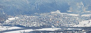 Zirl from the southwest |
||
| Source: Municipal data from Statistics Austria | ||
Zirl is a market town with 8110 inhabitants (as of January 1, 2020) in the Innsbruck-Land district in Tyrol ( Austria ). The community is located in the judicial district of Telfs .
geography
location
Zirl is located at the south-western end of the Karwendel Mountains about 10 km west of Innsbruck in the Inn Valley at the south-eastern foot of the Zirler Berg (1057 m). It lies on the north bank of the Inn on the alluvial cone of Ehnbach and Schloßbach .
Community structure
In addition to the main town of Zirl, the municipality also includes the Hochzirl , which is about 300 m higher , the Martinswand , the Ehnbachklamm and part of the northern chain with the 2,637 m high Kleiner Solstein . The Zirl Bahnhof district is the only one south of the Inn. Eigenhofen and Dirschenbach are two hamlets west of the town center on the old main road.
Neighboring communities
history
Settlement on the Martinsbühel has been proven since the La Tène period . In the 4th / 5th In the 16th century, the Roman military station Teriolis existed here , which was expanded into a hunting lodge around 1500 under the Roman-German King and later Emperor Maximilian I. The Kaiser Max Grotto / Martinswand Grotto is a reminder that Maximilian I is said to have climbed up here at the end of the 15th century while hunting chamois .
Zirl was an important traffic junction on the Roman road Via Raetia to Augsburg . This is where the steep ascent to the Seefelder Sattel began , the course of which can no longer be clearly explained today. The place was first mentioned on October 28, 799 as "Cyreolu" or "Cyreola" on the occasion of a transfer of ownership to the Schlehdorf Monastery .
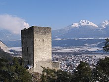
The current ruin of the castle inquiries stone was founded before 1209 and blown up in 1703 during the War of the Spanish Succession ( Bavarian Rummel ), whereupon it has fallen into disrepair since then. The area around the ruin is now a nature reserve .
Since the 17th century, the community, along with Thaur, was one of the centers for the construction of Christmas cribs. Zirl was repeatedly hit by floods and fires, most recently on June 21, 1908 in a major fire that destroyed most of the houses.
In 1826, the important Tyrolean church painter Franz Plattner was born in Zirl . He died in Innsbruck in 1887.
From 1910 to 1912 the Mittenwaldbahn was built with complex structures, of which the Martinswandtunnel , the Schloßbachviadukt, the Ehnbachklammviadukt and the Hochzirl station are located in Zirl .
A large population growth in the last decades made Zirl a residential community.
Since June 1, 1984, Zirl has had the title of market town .
Population development

politics
The last mayoral elections took place at the same time as the municipal council elections on February 28, 2016.
Josef Kreiser ("Zirl Aktiv") was voted out of office as mayor. A runoff election took place on March 13, 2016 between the candidates Iris Zangerl-Walser (ÖVP) & Thomas Öfner (SPÖ).
| Political party | percent | be right | Seats on the local council |
Coupling |
|---|---|---|---|---|
| For Zirl - SPÖ and non-party members | 26.50% | 1112 | 6th | |
| Zirl Aktiv - List Josef Kreiser | 25.07% | 1052 | 5 | |
| Future Zirl - People's Party | 25.40% | 1066 | 5 | |
| Fresh wind and green | 12.10% | 508 | 2 | |
| Freedom Party Austria - Local group Zirl, Margit Gastl - FPÖ Zirl | 8.03% | 337 | 1 |
In the runoff election, Mag. Thomas Öfner (SPÖ) received 64.69% of the vote and was thus elected mayor.
Culture and sights
- The Zirl parish church is decorated with frescoes by the church painter Franz Plattner .
- Martinsbühel Castle
- The Zachäussingen in Zirl in front of the church has been part of the intangible cultural heritage in Austria since 2015 .
Economy and Infrastructure
education
schools
- Hauptschule / New Middle School
- Elementary school
- Polytechnic school
- Two general special schools
Other educational institutions
- State Music School Zirl
- Fire department competence center
- Two kindergartens
- Swimming school
traffic
Zirl has a connection to the A 12 Inntal motorway with the Zirl-West and Zirl-Ost exits.
The Arlbergbahn train station is located southwest of the town center, on the other side of the river, where several industrial and commercial enterprises have settled. Due to the numerous operations, the Zirl station is one of the largest freight stations in Tyrol.
The district of Hochzirl located above with the state hospital Hochzirl (a special hospital for internal medicine and neurological acute aftercare) has a stop for the Mittenwaldbahn . Zirl also has connections to Innsbruck and Telfs via regional buses.
The favorable local climate enables viticulture here, which, like agriculture, is of little importance (the vineyards are currently not cultivated). Important companies can be found in the construction industry, chemical industry, crushed stone works and recycling.
leisure
The Martinswand east of Zirl offers a demanding via ferrata that requires surefootedness and many climbing routes.
Zirl is the starting point for hikes in the Karwendel area, for example to the Neue Magdeburger Hütte (Martinsbergalm) or the Solsteinhaus .
The event and meeting center B4, completed in 2015, offers space for over 500 people. The rifle club, theater club and alpine club are rented in B4, and the area offers an underground car park for up to 80 vehicles.
Personalities
Sons and daughters of the church
- Peter Erasmus Gspan (1790–1864), lawyer and politician
- Franz Plattner (1826–1887), church painter
- Regina Hilber (* 1970), writer
- Heinrich Klier (* 1926), writer, alpinist, entrepreneur and political activist
- Elias Schneitter (* 1953), writer and publisher
Connected to the community
- Josef Pfefferle (1862–1939), founder of the Zirler Mosaikanstalt
Web links
- Official information from the state of Tyrol about the market town of Zirl
- Official information from the market town of Zirl
- General information about Zirl
- Zirl , in the history database ofthe association "fontes historiae - sources of history"
- Entry on Martinswand in the Austria Forum (in the AEIOU Austria Lexicon )
Individual evidence
- ↑ a b c d e f g Benjamin Flöß: Zirl in words and pictures. Steiger Verlag, Innsbruck 1983, ISBN 3-85423-021-4
- ↑ Martin Bitschnau , Hannes Obermair : Tiroler Urkundenbuch, II. Department: The documents on the history of the Inn, Eisack and Pustertal valleys. Volume 1: By the year 1140 . Universitätsverlag Wagner, Innsbruck 2009, ISBN 978-3-7030-0469-8 , p. 46-47, no. 68 .
- ^ History of Tyrol - Questionsstein Castle
- ^ Helmuth Öhler: Franz Plattner (1826-1887). A Tyrolean church painter in the second half of the 19th century (diploma thesis), Innsbruck 1992.
- ↑ [1] market town of Zirl (mg.zirl.at)
- ↑ [2] wahlen.zirl.at
- ↑ Zachäussingen in Zirl
