Lech
The Lech is a right tributary of the Danube . The 256 km long river has its source in Vorarlberg and flows through Tyrol and southern Bavaria , where it flows into the Danube. Shortly before the Austrian-German border it takes up the Vils , forms the artificial Lechfall before Füssen and crosses Swabia and Upper Bavaria on its way . The largest cities on the Lech are Landsberg and Augsburg , where it receives its largest tributary, the Wertach . The river flows into the Danube at Marxheim .
etymology
Inscriptions from 8/7 BC BC prove that the river name is first mentioned in the Celtic tribal name Licates ' Likatier '. The river itself is called Likios or Likias in the 2nd century . The name Licca is found around the year 570 . In the 8th century, terms such as Lecha and Lech appear. The term Licus is still used in 1059.
The name is analogous to the Cymric word llech 'stone slab' and the Breton lec'h 'tombstone'. In this context, the word meaning of Lech is explained as 'the stony'.
Geography and hydrology
River course
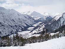
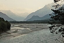
The Lech rises in the Lechquellengebirge ( Vorarlberg ) from its two source streams Formarinbach (source near the Formarinsee ) and Spullerbach , which flows out of the Spullersee . They unite near the Lower Älpele between the Formarinsee and Zug . The Lech initially flows in a north-easterly direction between the Allgäu Alps and the Lechtal Alps through Tyrol . On its way through the Lech Valley , it runs through the communities of Lech , Warth , Steeg , Holzgau , Bach , Elbigenalp , Häselgehr , Elmen , Stanzach , Forchach , Weißenbach , Ehenbichl , Höfen and Lechaschau . Reutte is the largest place on the Lech in Austria. In the lower Lech Valley, the Lech then passes Pflach , Musau and Pinswang .
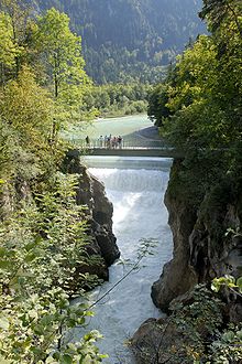
Shortly before the border with southern Bavaria , the Lech takes on the Vils ; Immediately behind it, the river forms the Lechfall at a 12 m high stepped weir . Shortly afterwards it flows through Füssen and the Forggensee , the largest of the 24 reservoirs through which the Lech flows , below the royal castles of Hohenschwangau and Neuschwanstein . The towns of Roßhaupten , Halch , Rieden and Schwangau are also located here . In the further course to the north, the Lech Prem , Lechbruck and the municipality of Steingaden pass . Behind it it runs through the Litzau loop , where it is still natural. Then the Lech is crossed by the Lechtalbrücke Schongau , the longest bridge on its course. In Hohenfurch the edge ran the former powerful Lech glacier . Other localities in the now dense series of reservoirs are Kinsau , Apfeldorf , Epfach , Reichling , Seestall , Mundraching , Unterdießen and Pitzling , a district of the medieval town of Landsberg am Lech , which the Lech then crosses. This is followed by Kaufering , Schwabstadl , Scheuring , Prittriching and Unterbergen on the Lech, which is still often dammed. At the Mandicho Lake near Merching , the Lech is also used for leisure. Then it flows through the drinking water and nature reserve Augsburg city forest . Finally, he encounters the populated area of the more than 2,000 year old city of Augsburg . There, at the Hochablass , part of the Lech water is diverted into the Augsburg canal system.

At the northern end of Augsburg, the Lech takes on the water of the Wertach . From this point on, the course of the river has been severely straightened and diked . This is followed by the bridge of the Federal Motorway 8 and the Gersthofen weir , where part of the water is diverted into the Lech Canal , which feeds the Gersthofen, Langweid and Meitingen hydropower plants . The canal runs parallel to the Lech at a short distance on the left and flows back into the river after Meitingen. Other localities on the lower Lech are Thierhaupten , Ellgau , Münster , Oberndorf am Lech , Rain and Niederschönenfeld .
Opposite Marxheim , about 12 km downstream from Donauwörth , the Lech flows into the Danube . The village of Lechsend, which belongs to Marxheim, is no longer exactly opposite the mouth due to changes in the estuary area.
Length and catchment area
There is different information about the length of the Lech between 248 and 285 km. The Bavarian water management and river engineering authorities name a value of 256 km. However, most of the values given for the Lech are lower, so that one can assume that the Lech, after the Inn and Isar , for which values of 283 km and 295 km are given, is the third longest tributary of the Danube on German territory.
In 1896 the entire catchment area of the Lech River was given as 4,126 km², in 1927 even as 4,400 km². The Bavarian State Office for Water Management gives today 3,919 km². About a third of the catchment area is on Austrian territory.
Tributaries
The largest tributaries of the Lech are the Vils (7.68 m³ / s) and the 159 km long Wertach , the discharge of which can be calculated from the surrounding water levels at around 27 m³ / s.
Small rivers like the Zürser- , Bocks- , Streim- , horn and Schwarzwasserbach are tributaries of the first order, as is the Rotlech which Archbach and Halblech . Other smaller tributaries are the Doldensee and Reiserbächlein , the Peitnach , the Rossgraben , the Schönach , the Rottbach and the Illach . The last tributary is the Münsterer Alte , before the Lech joins the Danube.
The Krumbach flows into the Lech near Warth . The Krumbach rises from the Hochtannbergpass. The Höhenbach is the next significant side stream. It flows into the Lech near Holzgau and drains the important valley cut south of the striking Allgäu main ridge. It begins with the confluence of the Schochenalpbach and Rossgumpenbach. The Simms waterfall is located in the lower reaches of the Höhenbach.
The Bernhardsbach flows into the Lech near Elbigenalp. It drains the valley cut between the central Hornbach chain and the Bernhardseck upstream to the south.
Only at the end of the long Hornbach chain does the next larger side stream flow, the Hornbach . It drains the Hornbachtal, a longer valley between the Hornbach range in the south and the Allgäu main ridge with the Hochvogel in the north. At the beginning of the 1960s, the Hornbach was dammed two kilometers before the confluence with the Lech by a 15 meter high bed load barrier (dam wall). In the years that followed, the bed load barrier held back hundreds of thousands of cubic meters of rubble. As part of the new nature reserve Tiroler Lechtal (see section Protected Areas), the bed load barrier was partially removed in two stages in 2003 and 2005. As a result, over 100,000 cubic meters of rubble shifted towards Lech. There they contributed to the elevation of the Lech sole by several meters.
The Jochbachtal is an important side valley of the Hornbachtal. The Jochbach rises below the Hornbachjoch and flows into the Hornbach at Hinterhornbach. In the lower part of the Jochbach forms an interesting gorge. It is not accessible, but you can look down into the gorge from the Gufelbrücke in Hinterhornbach and from the hiking trails in the Jochbachtal. This is the wildest and most pristine valley in the Allgäu Alps. Not even a road leads to the Jochbachhütten (alpine huts), which are located approximately in the middle of the valley. Like the entire valley, they can only be reached on a path that is sometimes difficult to walk.
The Schwarzwasserbach flows between Stanzach and Forchach. In order to avoid confusion with the stream of the same name in the Kleiner Walsertal, it is also called the Tiroler Schwarzwasserbach . The Tyrolean Schwarzwassertal is located between the Rosszahn group in the south and the Vilsalpsee mountains in the north.
The Weißenbach flows into the Lech at the same place. It comes from the middle of the Vilsalpsee mountains from the Birkental between the Leilachspitze in the south and the Litnisschrofen in the north.
The Lech between Warth and Füssen, with its side streams, is one of the most important wild rivers still preserved in the Alps. It is also called " Tagliamento of the North". (The Tagliamento in the Southern Limestone Alps is the most important wild river in the Alps that has been preserved). Efforts to place the Lech under protection ended at the end of 2004 with the designation of large parts of the Lech Valley and its side valleys as a nature reserve and nature park. The initially planned designation of the area as a national park could not be enforced. Despite the protection, there will probably also be conflicts between the different interests in the future. Because a wild river with all its dynamism and populated valley areas are difficult to reconcile.
The Archbach , the outflow of the Plansee, flows north of Reutte .

Shortly before it emerges into the foothills of the Alps, the Vils from the Allgäu Alps, the tributary with the most water up to that point, flows into the Lech. It drains large parts of the Tannheimer valley and the valley cut near Pfronten .
Shortly before feet of Lech crashes in Lechfall cascading down one from 1784 built, tiered defense. The stowage above has meanwhile been completely diluted. After that, the river squeezes through a gorge-like narrow point, which is also known as a mang step itself after a horseshoe-shaped rock depression above the wall . At Füssen, the Lech reaches the foothills of the Alps and flows into the Forggensee , the largest reservoir in Germany, into which the small tributaries Füssener Achen and Mühlberger Ach flow.
Below the dam opens Halblech one. Its gravelly river bed can dry out completely when the water is completely low, while a high water discharge of 200 m³ / s completely floods it.
In Steingaden which opens Illach one. Their runoff behavior also fluctuates strongly (between a runoff of 1 m³ / s low water, up to 60 m³ / s high water).

In the vicinity of Hohenfurch the Schönach flows towards the Lech. Their discharge also fluctuates greatly and can reach 50 m³ / s.
After a straight line to the north, the Wertach joins from the left . At 159 km it is both the longest and, with an average discharge of 27 m³ / s, the most water-rich Lech tributary. Its water flow here is about a third of the Lech.
The last tributary is the Münsterer Alte , a small river that runs almost parallel to the Lech.
Drainage behavior
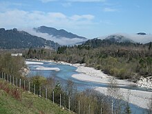
The Lech drains the Lechtal Alps and parts of the Bavarian Alps northwards to the Danube and ultimately to the Black Sea . The catchment area covers a total of around 3920 square kilometers . Since precipitation in winter in the Alps mostly falls as snow, the Lech carries a particularly large amount of water during the snowmelt in spring and summer. With an average discharge of around 114 cubic meters per second, it is comparable to rivers like the Neckar , which drains a catchment area three times as large with a discharge of 145 m³ / s. The discharge of the Lech fluctuates between an extremely low water of 33 m³ / s and an HQ-200 value of 2,300 m³ / s.
The mean discharge (series 1960–2012) at the Augsburg gauge below the Wertach estuary , the last gauge before the estuary, is 113 m³ / s. This level is almost 39 km above the estuary, but the catchment area below is relatively small, so that the mean discharge at the confluence with the Danube is around 114 m³ / s. The Lech ranks sixth among the Bavarian rivers behind the Danube (1,490 m³ / s), Inn (741 m³ / s), Salzach (250 m³ / s), Main (211 m³ / s) and Isar (175 m³ / s) .
Geological development
The Lech, which today strives north to the Danube, still flowed in the older Pleistocene (current period shaped by ice ages), as remains of earlier deposits and valley shapes can be recognized or suggested, in northeastern directions to the Danube at that time, as well as further east the Isar and Inn . It reached the Danube at a more acute angle than it does today. The same applies to the neighboring Iller to the west, which once crossed today's Lech river below Augsburg to the northeast.
After the Lech found the more direct route north to the Danube in the Middle Pleistocene near Schongau , the Danube flowed from the Lech estuary, unlike today, further north through the Wellheimer dry valley and further in the valley of today's lower Altmühl . It was not until the end of the Rift Cold Age (penultimate Ice Age) that the current, more southerly course of the Danube emerged with the “breakthrough at Stepperg ”.
Islands
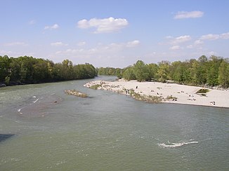
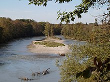
Most of the small islands and gravel banks of the Lech are repeatedly changed in size and shape by the annual floods . The construction of dams and dams has significantly restricted the dynamism of the Lech. Today, during floods, the Lech is unable to carry new amounts of gravel from the Alpine region. The gravel banks were among species-rich habitats at the beginning of the 19th century. Floods and seeds from the Alpine region were able to settle on the biotopes. Due to the lack of floods, which were held up by the reservoirs, and the associated silting up of the gravel banks, weakly competitive plant species have to bow to the advancing scrub. Today the gravel bank areas are often used as bathing or sunbathing areas when the water is low. These interventions also lead to negative consequences for nature. Especially ground-breeding bird species are disturbed in their natural behavior by humans. Some islands in the immediate vicinity of (larger) cities were built in the 19th century or the river was canalized. These river straightening also damage the natural area.
Water quality
One understands immediately that a river normally has the color beige ("dirty brown") during floods . The reason is due to the loess- containing clay and humus soil that colors the water . Or if the soil looks brown due to algae infestation , which can be seen much more clearly in the Wertach , the matter is self-explanatory. But more interesting is the question of why the Lech glows so green-blue.
As early as the 19th century , the scientist John Tyndall proved that the color of a river is not due to the water (pure H 2 O), but to the minerals that the river brings with it. If the proportion of fine sediments is low, such as in snow or glacier ice , the sunlight is filtered and refracted in such a way that the river appears bluish. With higher proportions of dissolved and suspended minerals , which come from limestone like Lech , the color turns more green.
The clarity of the Lech water is due, on the one hand, to the low annual mean temperature and, on the other hand, to the high proportion of lime (especially the magnesium carbonate from the main dolomite), which is rather hostile to life and means that there is little plankton-like life. Below the Wertach estuary, its green-brown water initially dominates.
Typical of the Lech water is the high proportion of bed load , which has a particular effect on reservoirs such as the Forggensee , whose storage capacity has been reduced by 30,000 m³.
The water quality is divided into classes (I unpolluted; I – II low; II light; II – III moderate; III critical; III – IV high; III – IV very high; IV extreme pollution). In its Austrian section, the Lech has quality classes I-II, from Reutte class II. At Füssen it is in class I – II. The Forggensee through which it flows below was still heavily polluted a few decades ago. As far as Augsburg - apart from short sections of class II-III between Landsberg am Lech and Schongau - quality class II was consistently verified. Up until the 1970s, the Lech from Augsburg was still very heavily polluted because the wastewater used to be fed into the sewer system without being cleaned. In the meantime, a sewage treatment plant below Augsburg removes 99% of the pollution of the supplied water, which means that the river now again achieves quality class II.
In addition, the Lech has an extremely low water temperature (summer: 14 ° C, winter: 1 ° C), so that only a few algae can grow.
History on the Lech

During the migration period and in the early Middle Ages, the Lech formed the border between the Alemannic tribal area in the west and the Baier region in the east, and it still roughly marks the boundary between the Bavarian and Swabian dialects today . The Lech also reflected the border between Old Bavaria and Swabia , this can also be seen in the local endings -ing ( Bavarian ) and -ingen ( Swabian ), even if the Swabian dialect reaches south from Landsberg over the Lech to the Ammersee . Among other things, gold was panned from the river deposits along the course of the Lech . However, the quantities of precious metal obtained in this way were not of great economic importance.
Events
In the early Middle Ages, at the end of the Roman province of Raetia , Lechrain was mainly settled by Alemanni , but it should soon have come under Bavarian influence. As early as 576, the Lombard author Venantius Fortunatus placed the Lech in Bavarian territory in an epistle to Gregory of Tours ( PL 88,62A). The affiliation of Lechrain to the Duchy of Baiern can accordingly be assumed from the 6th century; The Lech border between Baiern and Swabia has been historically secured since the 8th century. Unaffected by this, the Lechrain remains part of the Swabian diocese of Augsburg to this day .
In 955 the Hungarians were defeated by the German army under the leadership of King Otto I and Bishop Ulrich von Augsburg at the Battle of the Lechfeld . The battle on August 10, 955 was the end point of the Hungarian invasions and Otto the Great's greatest military victory against the Hungarian horsemen, who had previously traversed large parts of Central Europe with their raids. The battle is named after the Lechfeld near Augsburg .
After Welfen , Staufer and the Counts of Dießen-Andechs ruled Lechrain, the area fell to the Wittelsbachers in the 13th century , who set up the Landsberg , Friedberg, Mering and Schongau regional courts here. As border towns towards Swabia, Landsberg and Friedberg enjoyed numerous ducal privileges, which at times led to considerable prosperity. On the other hand, Friedberg in particular was repeatedly a victim of the constant clashes between the Duchy of Baiern and the wealthy imperial city of Augsburg. For centuries, there were repeated disputes about the right to divert water from the Lech for use in Augsburg. The dispute over the Augsburger Lechanstich at Hochablass escalated between 1457 and 1596 into a real "water war".
In 1632 the troops under King Gustav II Adolf of Sweden captured Nuremberg and then Donauwörth . Now they were about to move against Ingolstadt . Field Marshal Graf von Tilly wanted to prevent this by stopping them at Rain on the Lech crossing with the quantitatively inferior Bavarian army . The battle of Rain on Lech followed . After two days of continuous fire on both sides of the river, the Swedes managed to cross a little further south, to which Tilly was unable to react too late. As the fighting continued, Tilly was hit in the right thigh by a falconet bullet , which completely shattered it. Maximilian I ordered the retreat to Ingolstadt, where Count von Tilly succumbed to his injury on April 30, 1632. Gustav II Adolf did not succeed in conquering Ingolstadt.
With the incorporation of Augsburg and East Swabia into the later Kingdom of Bavaria in 1803/1806, Lechrain lost its border function in political terms - mentally it has remained alive to this day. In the course of the administrative reforms of the early 19th century, the Landsberg , Schongau and Friedberg regional courts (with Mering, which was incorporated in 1799), were assigned to Upper Bavaria . In 1944, the Friedberg district came to the Swabian district , where it was merged with the neighboring Aichach district to the north in 1972 to form the new Aichach-Friedberg district . In the same year, Schongau was merged with its eastern neighbor Weilheim to form the new Weilheim-Schongau district, but like the existing Landsberg am Lech district , it remained in the Upper Bavaria district. Despite this political and administrative fragmentation, the Lechrain is still perceived as a culturally, linguistically and historically particularly shaped landscape and is separated from the neighboring regions ( Allgäu , Oberland , Munich metropolitan area ). Numerous clubs, but also cultural institutions and companies today use the Lechrain in their name.
A catastrophic flood of the Lech in 1910 caused severe damage along the entire Lech. Augsburg was hardest hit, where the high drainage weir broke and finally had to be blown up in order to avert worse.
New construction of the Lech Bridge in Gersthofen
When the new Lech bridge on the A 8 was built , there was a setback during the flood in August 2005 . The temporary eastern foundation was washed away, the new bridge sagged on one side and threatened to fall into the Lech. As a result of this incident, the A 8 in the section between Augsburg- East and Augsburg-West had to be completely closed for over a day. The foundation could be stabilized, but it took until December 2005 for the damage to be repaired and the bridge to be raised again. Due to the incident, the completion of the entire bridge was delayed until the end of 2007.
The Lechrain dialect
The Lechrain dialect (linguistically: Vorostschwäbisch) combines East Swabian and Central or South Baier dialect forms with Middle High German relics. While Swabian and Bavarian are otherwise quite clearly differentiated from each other, a peculiar hybrid form has developed in Lechrain, which can probably be traced back to an originally Alemannic population that has adopted numerous Baier dialect features over centuries of Baier rule.
Noticeable features of Lechrainian are the hard, throaty -kch- that you usually hear in the Allgäu and Tyrol , the retention of a -ch- instead of the mute -h- (pull → ziacha , lend → leicha ) and a sound shift from High German - i- zum -u- (church → Kurcha , host → Wurt ).
The expression of the Lechrain dialect runs parallel to the course of the Lech: The strongest forms are found in the municipalities on the river, while to the east - often within a few kilometers - Lechrainian features decrease and more and more Baier forms appear.
Lechtal habitat
Nature and environmental protection
Since the middle of the 19th century, the natural course of the Lech has been severely restricted by various flood protection measures and the construction of reservoirs - with far-reaching consequences for the native flora and fauna on the Lech. The continuity of the running water is often disturbed by weirs , for example . This makes it difficult or even impossible for fish to migrate and spread fish upstream or downstream. The function of the Lech as a biotope bridge was also severely restricted. Animal and plant species that used the gravel road of the Lech to exchange their biotopes can only survive today on protected remaining refuges. The dike in some areas also meant an interference with the originally existing ecological balance. The alluvial forests were shielded from the natural inflow of water by the dykes , so that the alluvial forest is only present in remnants.
In order to preserve the original river landscape at least in some areas, several nature and landscape protection areas were designated.
In Austria , the Lech still largely has the character of a wild river with extensive gravel banks. The Tiroler Lech Nature Park is set up here. Several power plant projects could be prevented because citizens' initiatives campaigned for the preservation of the wild river landscape.
In the further course there are the protection zones Litzau Loop near Steingaden and the Lechtalheiden between Landsberg and Augsburg. The Lechtalheiden contain individual areas of different heaths and dry grasslands . It is one of the most species-rich habitats in Central Europe .
The remaining stocks of the large Lech floodplain forests include the Augsburg city forest , the Lechaue west of Todtenweis , a nature reserve within the Lechauwald nature reserve near Todtenweis and Rehling , and the Lechau meadows near Thierhaupten , which are also protected .
Nature conservation initiative "Lechtal habitat"
The large-scale nature conservation project Lebensraum Lechtal was launched by the Association for Landscape Management in 1998. It was primarily intended to improve the network of biotopes along the Lech, but also to convey its ecological importance to the population of the Lech Valley and to promote nature conservation among them. The visitors should be better directed, the nature-friendly herding should be promoted through better marketing ("Lechtal lamb") and many species and biotopes better protected.
The districts were involved:
- Donau-Ries district
- District of Augsburg
- Aichach-Friedberg district
- Landsberg am Lech district
- Weilheim-Schongau district
- District of Ostallgäu
- City of Augsburg
From the project to the association “Lebensraum Lechtal e. V. "
Even before the end of the project's funding phase, those involved in the project expressed the wish in 2004 to secure the structures that had been created through an association. This was done on October 13, 2005, shortly after the end of the project funding phase, with the founding of the association “Lebensraum Lechtal e. V. ”implemented. Founding members were: the districts of Donauries , Aichach-Friedberg , Augsburg , Landsberg , Weilheim-Schongau , Ostallgäu , the city of Augsburg , Markt Thierhaupten and the communities of Kissing , Kaufering , Oberndorf and Rehling .
A particular concern of both the project and the association is cooperative nature conservation in amicable cooperation with land users, landowners and the local population. Great importance is therefore attached to extensive public relations work (e.g. by means of information boards in the area or the "Lechfloß" series of events) and close cooperation with authorities, volunteers, land users and politics.
Since 2011, the association "Lebensraum Lechtal eV" has been responsible for the Lechtal area management , through which, with financial support from the Bavarian Nature Conservation Fund and the Upper Bavaria District, provides a full-time employee for nature conservation management, environmental education, public relations and the monitoring of rare species on the Lech.
Since 2014 the association has been a project partner of the WWF and further cooperation partners in the hotspot project of the Federal Agency for Nature Conservation “Alpine River Landscapes - Living Diversity from Ammersee to Zugspitze” and implements measures within the project focus “Litzauer Loop” on the Lech. In addition, a project office was established in Schongau and the environmental education area strengthened.
Lech economic area
In the past, timber and other goods were rafted on the Lech in considerable quantities from Füssen via Landsberg and Augsburg to the Danube . When the first weirs, such as the Hochablass near Augsburg, were built, separate lanes were built for the rafting to keep this possible.
Inland navigation never took place on the Lech, as the river is not navigable over its entire course. Today the Lech is no longer important for transport. The river gained economic importance through its hydropower , which in the past drove mills (for example on the Lech canals in Augsburg) and was used for crafts and factories, and which is now widely used to generate electricity. The Lech covers a few percent of today's electricity needs in Bavaria .
energy
The Lech is used intensively in Germany to generate energy. Several suppliers operate a total of 30 power plants and 24 reservoirs ( run-of-river and storage power plants ) with a net electrical output of 335 MW (1998). The largest reservoir of all is the Forggensee , which can store a maximum of 168 million cubic meters of water. The chain of barrages may be expanded. In this regard, level 17 at Sandau comes into question, but this is only possible when the Lech has deepened its river bed a little. Levels 5, 24 and 25 will probably not be built as they would run through nature reserves .
Hydropower plants need a consistently high water level so that energy generation does not come to a standstill in months with little rainfall. This was ensured by the construction of several canals that accompany the course of the Lech, but do not carry a large proportion of the river water with them. The water for the Lochbach , on which there are three other, smaller weirs, is diverted from the Lech at Lech barrage 22 . On the northern edge of Augsburg, the wide, parallel Lech Canal branches off towards Meitingen and only flows back into the river bed after more than 20 kilometers. There are three power plants built between 1898 and 1922 (channel power plants Gersthofen, Langweid and Meitingen) on this Lech Canal. The power plants along the Lech generate an average of 3–4 billion kilowatt hours of electrical energy per year.
tourism
In addition to the Bavarian-Swabian district capital and a number of other cities worth seeing along the Lech, numerous Lech landscapes and nature reserves are of touristic importance, for example the Lechtalheiden south of Augsburg. Long stretches of the river are lined with cycle paths that allow cycling from the Alps to the Danube.
Driving on the Lech with canoes , rafts or similar small and manoeuvrable boats is possible without any problems over sections of the (near) alpine region. In the upper reaches of the Lech, rafting is carried out between Steeg and Weißenbach.
The certified long-distance hiking trail Lechweg is described below under traffic.
rafting

From Roman times until the first Lech barrage was built around 1914, the Lech served as a transport route for wood (the wood drift) from the Alps . Logs were drifted from the alpine forests over the broad, gravelly Lech to Augsburg , where they were pulled out of the water and then sold as firewood. Mainly but was floated , the rafts were used as a means of transporting goods. The most important ports were in Reutte , Füssen , Lechbruck , Epfach , Landsberg , and at Hochablass in Augsburg, where the port can still be seen on the west side. Rafting had its peak in the middle of the 19th century with several thousand rafts per year.
fishing
The importance of fishing , from which the whole population lived in some places in the Middle Ages , declined sharply in the course of the 19th and 20th centuries. The reason is nature conservation and the abundant fish stocks of various species. Even complete fishing bans have been imposed on the Peitinger Ache and on sections of the Lech.
Lech canals
Water is taken from the Lech at Lech barrage 22 and at the Hochablass in Augsburg and channeled into canal-like city streams .
- Lochbach - discharge from barrage 22 (4.5 m³ / s). It flows as the Vorderer Lech (2.0 m³ / s) into the Stadtbach , which arises from the confluence of the Middle (4 m³ / s) and the Hinteren Lech (2 m³ / s).
- Capital stream - diversion at the Hochablass (45 m³ / s), of which 10 m³ / s already flow 660 m further after flowing through the Augsburg ice canal, flowing back into the Lech. On the ice track competitions were in the canoe slalom the Olympic Games held 1,972th
In addition to the Augsburg canal system, which is fed by Lechwasser, there are other canals in Augsburg, which are fed exclusively by Wertach and Singoldwasser . There is no mixing of the two canal systems.
The Lech canals are divided into numerous smaller canals in the Augsburg city area. Various small spring streams from the drinking water protection area Stadtwald Augsburg flow into this canal system. Summarized as a discharge channel, they flow only a few meters above the Wertach mouth in the conservation area Wolfzahnau back to Lech.
There are other Lech canals in Kinsau at barrage 8a , in Landsberg , and the Lech canal from Gersthofen to Ellgau .
Use of hydropower on the Lech
The water power of the Lech has been used mechanically in the Lech canals near Augsburg since the Middle Ages, for example in water-wheel-operated mills and craft businesses. In the 19th century it was one of the prerequisites for the flourishing of the textile industry in Augsburg . The first hydropower plants were also built on the Lech canals: the hydropower plant near Gersthofen went into operation in 1901, the hydropower plant on Wolfzahnau in 1902, and the Langweid run-of-river power plant in 1906. At that time, the technology was not yet ready to use the main river of the Lech itself. The Lech Museum Bavaria , opened in 2008, shows the history of the Lech as a natural area, economic factor and historical scene as well as a representation of the development of hydropower on the Lech, electrical energy and the Lech works.
The first plans for the use of hydropower at Roßhaupten were made at the end of the 19th century. In 1898 the company Siemens & Halske bought the first land in the area of the Lech breakthrough near Roßhaupten and received a concession to build a hydropower plant, which expired in 1907.
In 1910 the Royal Supreme Building Authority published a memorandum on the use of the water power on the Lech, according to which a dam wall with a height of 34 m, a crown length of 140 m and a storage tank with a total volume of 65 million m³ was to be built at Roßhaupten . The First World War and economically difficult post-war years prevented the project from being realized.
The increasing demand for electricity in the interwar years aroused renewed interest in building a Lech storage facility. A draft from 1936/37 called for a damming target of 784.00 meters above sea level, i.e. three meters higher than later, and a concrete wall with a built-in power station. Due to the start of the war, work on the Roßhaupten storage facility was postponed for the time being.
In 1939, the Bavarian Ministry of the Interior decided to use hydropower on the upper Lech, and by 1942 20 run-of-river power plants were to be built using the Arno Fischer power plant design . Bayerische Wasserkraftwerke AG (Bawag) , founded in 1940 for this purpose, began building 5 barrages in summer and autumn 1940. Levels 11, 12, 13 and 15 went online in 1943, level 14 together with level 9 only in 1944. By the end of 1943, the investment volume had risen to around 75 million Reichsmarks, three times the amount originally calculated by Arno Fischer.
After the end of the war, three more barrages based on the Arno Fischer design were put into operation: level 8 (1947), level 10 (1948), level 7 (1950).
Forggensee
→ Main article: Forggensee
As a result of the growing energy demand after the end of the Second World War , the Lechspeicher project was resumed. After tough negotiations, the target was set at 781.00 m above sea level. NN - the originally planned water level of 784.00 m above sea level. NN would have meant larger resettlements of 1,500 to 2,000 people and, especially in the area around Schwangau, considerable loss of land for agriculture. The Whitsun flood in 1999 gave an impression of this extent , when the lake level on May 22, 1999 was 782.91 m above sea level. NN was a good meter lower than the originally planned congestion destination.
Bawag, now only responsible for expanding the Lech barrages, started building the Lech reservoir in 1950. Strong protests took place by the residents who founded a protection community and reached a largely satisfactory agreement with Bawag with the 1952 Schwangau Treaty. For those affected, new farms could either be found nearby or new houses were built. Above all, many of the farmers and their descendants who lived in what is now the Forggensee area can be found in the surrounding communities to this day.
Construction of the dam began in early 1951 after the development measures - including the construction of the new access roads and a residential camp for the up to 1,000 workers involved - had been completed. In order to ensure the tightness of the dam structure, the entire dam and the associated structures were founded directly on rock; For geological reasons, this did not happen directly at the breakthrough of the Lech through the Illas Gorge, as originally planned , but about a kilometer downstream. On the lake side, a five meter thick concrete barrier was built into the rock up to 20 meters deep. In the spring of 1952, the Lech was dammed on this and diverted through a tunnel that had been built in the meantime. In the remaining two years until completion at the end of 1954, the remaining structures were built and the dam was raised. Most of the building materials were obtained from the reservoir itself.
List of power plants / reservoirs on the Lech
|
* VHF = Uniper power plants
Traffic routes on the Lech
As in most rivers, trade routes arose early on the Lech, the most famous of which is the former Roman trade route Via Claudia Augusta , which ran from the then Augusta Vindelicum (Augsburg) in the direction of Rome . Today the Lech Valley serves as a route for modern traffic routes, i.e. for railways and modern roads .
Lechweg
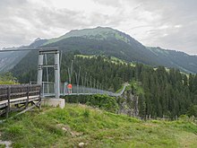
The upper reaches of the river in the Lech Valley can be hiked on the newly established Lechweg since July 2012 . From the source at Formarinsee to the end of the hiking trail at Lechfall , the slightly more than 120 km and 16 stages can be hiked in individually tailored sections in around six to eight days. The starting point can be reached from Lech with the hiking bus in summer . The path can usually be walked from May to October, the two stages between Formarinsee and Warth only from the start of the season in Lech am Arlberg, which is usually around June 20. The highlight of the tour is the Holzgau suspension bridge . The trail was already classified as a Leading Quality Trail by the European Hiking Association when it opened .
Road traffic
The Lechlauf is accompanied by federal roads for almost its entire length .
The alpine Lech is accompanied by the federal road 198 , which is also called "Lechtalstraße", from the municipality of the same name in Lech in Vorarlberg via Weißenbach am Lech to Reutte in Tyrol . From Reutte, the Lech meets the " Fernpass Straße " B 179, which accompanies it to the Austria / Germany border crossing .
Federal road 17 and federal road 16, which branches off to the west of the B17, run along Lake Forggensee to the east .
Near the Litzau loop , the B 17 makes a curve in the direction of Peiting , where, together with the federal road 472, it turns west towards Schongau and crosses the Lech in the transition from the Litzau loop to the Dornauer dam . Although the B 17 runs completely parallel to the Lech, the almost 600-meter-long Lechtal bridge Schongau is the only way to cross the river, but it is also one of the longest bridges in Bavaria.
From Schongau to Landsberg am Lech , the Lech flows in a meandering manner along the B 17 at a distance of one kilometer , which is here turned into a straight road. It runs permanently west of the Lech from Landsberg because of the steep east bank. To the north of Landsberg, the Lech passes under the Bundesautobahn 96 .
Further in the direction of Augsburg , the B 17 has been expanded into a “ yellow motorway ”. In order not to endanger the ecological system of the Lechtalheiden and the alluvial forest , the B 17 turns away from the Lech up to a maximum distance of six kilometers.
In the urban area of Augsburg, the Lech crosses the federal highway 300 and the federal highway 2 , which runs about four kilometers on the banks of the Lech. At the city limits between Augsburg and Gersthofen, the river crosses under the Lechbrücke of the federal motorway 8 , which was built as a new building from 2004 to 2007 due to the 6-lane expansion.
To the north of Augsburg, the Lech flows parallel to the B 2, which continues in the direction of Nuremberg. Shortly before its confluence near Donauwörth , the Lech crosses the B 16 again. Both the first and the last street in Germany that the Lech crosses is the B 16.
Railways on the Lech
The railway uses the Lech Valley to create north-south connections, mainly connections from the Allgäu to Augsburg and from Augsburg to northern Bavaria . Four railway lines run completely or partially parallel to the Lech, namely:
- the Augsburg – Nördlingen railway, which is also used by long-distance traffic , to Donauwörth
- the Augsburg – Landsberg am Lech line ("Lechfeldbahn", Augsburg - Bobingen - Kaufering - Landsberg am Lech , KBS 986)
- the Landsberg am Lech – Schongau line ("Fuchstalbahn", closed for passenger traffic)
- the Ausserfernbahn in the section between Reutte and Vils
In Rain Bavarian crosses Donautalbahn the Lech in Augsburg-Hochzoll the Munich-Augsburg Railway in Kaufering the Allgäu Railway .
The Kinsau cog railway , Bavaria's first cog railway , existed in Kinsau from 1907 to 1929 . It was used to transport cellulose from a paper mill located at what is now barrage 8a to Kinsau station on the Fuchstalbahn .
literature
- Marita Krauss , Stefan Lindl , Jens Soentgen : The tamed Lech. A river of extremes. Volk Verlag, Munich 2014, ISBN 978-3-86222-140-0 .
- Eberhard Pfeuffer: The Lech. Wissner-Verlag, Augsburg 2010, ISBN 3-89639-768-0 .
- Franz X. Bogner: The Lech from the air. Bayerland Verlag, Dachau 2010, ISBN 978-3-89251-413-8 .
- Martin Kluger : The Lech. Landscape. Nature. History. Economy. Wasserkraft context publishing house, Augsburg 2011, ISBN 978-3-939645-36-8 .
- Peter Nowotny: Experience Lech - Sights between Arlberg and Danube. Verlag - J. Eberl KG, Immenstadt 2003, ISBN 3-920269-23-3 .
- Werner Gamerith: Lechtal. Tyrolia Verlag, Innsbruck / Vienna 2002.
- Rupert Zettl: Lechauf-lechab. Worth knowing, lovable. Wißner-Verlag, Augsburg 2001, ISBN 3-89639-316-2 .
- Adalbert Riehl, Harald Reinelt, Günther Reichherzer: View of the Lech-Danube area. Rain 2001 (aerial photos of the places from Herbertshofen to the Lech estuary).
- Bayerisches Hauptstaatsarchiv (Ed.): Old Bavarian river landscapes on the Danube, Lech, Isar and Inn. = Exhibition catalog, Anton H. Konrad, Weißenhorn Verlag, 1998.
- Norbert Müller: Augsburg ecological writings , volume 2: The Lech . City of Augsburg 1991, ISSN 0941-2123 .
- Bernhard Raster: Use and anthropogenic changes in the Lech in historical times. Diss., Würzburg 1979.
- Peter Nasemann: Habitat Füssener Lech. Holdenrieds Druck- und Verlags GmbH, undated
- Peter Nasemann: The Lech in the mountains. Lechkiesel tell a geological history. Edition Koch, Höfen 2007, ISBN 978-3-85445-500-4 .
- Sigfrid Hofmann: About the Lech and its raftsmen from yesteryear . In: Lech-Isar-Land , 1978 yearbook, pp. 211–214
- Anton Lichtenstern: Electricity for war - BAWAG's power plants between Schongau and Landsberg am Lech . In: Landsberger Geschichtsblätter 2015 , pp. 103-134
Web links
- Entry on Lech, River in the Austria Forum (in the AEIOU Austria Lexicon )
- Flood news service Bavaria - a lot of data about the Bavarian rivers: current water levels, long-term runoff data, catchment area, etc.
- Life nature conservation project Tiroler Lech
- Lechtal habitat
- Spektrum .de: A tamed river goes wild again January 24, 2019
Individual evidence
- ↑ Federal Ministry of Agriculture, Forestry, Environment and Water Management (ed.): Hydrographisches Jahrbuch von Österreich 2010. 118th volume. Vienna 2012, p. OG 84, PDF (12.6 MB) on bmlrt.gv.at (yearbook 2010)
- ^ German Hydrological Yearbook Danube Region 2006 Bavarian State Office for the Environment, p. 124, accessed on October 4, 2017, at: bestellen.bayern.de (PDF, German, 24.2 MB).
- ↑ Level value Augsburg below the Wertach estuary increased by the area runoff (5.8 l / s.km²) of the remaining catchment area (127.85 km²), determined for the enclosing intermediate catchment area of the gauges Donauwörth (Danube), Augsburg and Wertach estuary (Lech), Winkl ( Lost Bach) and Ingolstadt Luitpoldstrasse (Danube)
- ↑ Ptolemy 2:12, 1 and 2, 12, 4
- ^ Venantius Fortunatus , De virtutibus Martini Turonensis 4,642
- ↑ Wolf-Armin Frhr. v. Reitzenstein : Lexicon of Bavarian place names. Origin and meaning . CH Beck, Munich 2006, ISBN 3-406-55206-4 , p. 152 .
- ↑ Gauge value Türkheim (Wertach) increased by the area runoff (13.5 l / s.km²) of the remaining catchment area (774.84 km²), determined for the enclosing intermediate catchment area of the gauges Haunstetten (Lech), Unterbergen (Lochbach), Langerringen (Singold) , Buchloe (Gennach), Türkheim (Wertach) and Augsburg ud Wertach estuary (Lech)
- Jump up ↑ Lorenz Scheuenpflug: The early Pleistocene Augsburger Altwasserscheide on the eastern edge of the Iller-Lech-Platte (southern German Alpine foothills, Bavaria) , Ice Age a. Present volume 41, pp. 47 - 55, Hannover 1991
- ↑ Federal Ministry of Agriculture, Forestry, Environment and Water Management (ed.): Saprobiological water quality of the flowing waters of Austria. Status 2005 ( PDF; 1 MB ( Memento of the original from December 22, 2015 in the Internet Archive ) Info: The archive link has been inserted automatically and has not yet been checked. Please check the original and archive link according to the instructions and then remove this note. )
- ↑ Information on the project history on the website of the Lebensraum Lechtal eV association . Retrieved October 18, 2011
- ↑ Alpine river landscapes - diversity lives from Lake Ammersee to Zugspitze. WWF Germany, accessed January 20, 2016 .
- ↑ Rafting and logging. In: Georg Paula, Stefanie Berg-Hobohm: District of Weilheim-Schongau: Monuments in Bavaria. Karl M Lipp Verlag, Munich 2003, Volume 1, Page XXIII
- ↑ RMD power plants on the lower Lech ( memento of the original from October 30, 2013 in the Internet Archive ) Info: The archive link has been inserted automatically and has not yet been checked. Please check the original and archive link according to the instructions and then remove this notice.
- ↑ Rhein-Main-Donau AG power plants ( memento of the original from October 12, 2013 in the Internet Archive ) Info: The archive link was automatically inserted and not yet checked. Please check the original and archive link according to the instructions and then remove this notice.
- ↑ The Lechweg at Lechtal-Info
- ↑ Official website of the Lechweg

