
Schongau district
| coat of arms | Germany map | |
|---|---|---|

|
Coordinates: 47 ° 49 ' N , 10 ° 54' E |
|
| Basic data (as of 1972) | ||
| State : | Bavaria | |
| Administrative region : | Upper Bavaria | |
| Administrative headquarters : | Schongau | |
| Area : | 507.78 km 2 | |
| Residents: | 41,756 (May 27, 1970) | |
| Population density : | 82 inhabitants per km 2 | |
| License plate : | SO-CALLED | |
| Circle key : | 09 1 50 | |
| Circle structure: | 24 municipalities | |
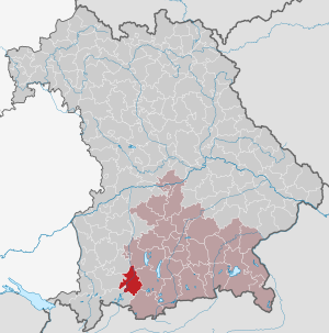
| Location of the district of Schongau in Bavaria | ||
  |
||

The district of Schongau belonged to the Bavarian administrative district of Upper Bavaria . When it was dissolved in the regional reform in 1972, the district comprised 24 municipalities.
geography
location
The district of Schongau was bordered by two prominent foothills of the Bavarian Alps: the Auerberg in the west and the Hohen Peißenberg in the east. The origins of the district of Schongau lie in the former Wittelsbach high court of Schongau, which at times extended from Fuchstal in the north to Schwangau in the south. As part of the Upper Bavarian Pfaffenwinkel , the district of Schongau housed the monastery towns of Steingaden and Rottenbuch , the pilgrimage site Hohenpeißenberg and the famous pilgrimage church in the Wies (Wieskirche) . It was the only district in Upper Bavaria that extended a large part of its territory, including the district town, to Swabian territory west of the Lech.
Important places
The municipalities with the highest population were the district towns of Schongau , Peiting , Hohenpeißenberg , Altenstadt and Steingaden .
Neighboring areas
In 1972 the district bordered clockwise in the north, starting with the districts of Landsberg am Lech , Weilheim in Upper Bavaria , Garmisch-Partenkirchen , Füssen , Marktoberdorf and Kaufbeuren .
history
District Office
The district office of Schongau in the Kingdom of Bavaria in 1862 succeeded the regional court of the older order of Schongau .
On August 4, 1865, the community of Schwangau moved from the district office of Schongau to the district office of Füssen .
On November 1, 1874, the district office of Landsberg am Lech was enlarged by the municipalities of the district office of Schongau.
On the occasion of the reform of the layout of the Bavarian district offices, the district office of Schongau ceded communities to the district office of Füssen on January 1, 1880.
On January 1, 1913, the Schongau district office ceded the communities of Kohlgrub and Saulgrub to the Garmisch district office .
district
On January 1, 1939, the term district was uniformly introduced in the German Reich . So the district office became the district of Schongau.
On July 1, 1972, the district was dissolved as part of the regional reform in Bavaria :
- The municipality of Bayersoien came to the district of Garmisch-Partenkirchen.
- The communities of Apfeldorf , Epfach , Kinsau and Reichling came to the Landsberg am Lech district.
- All other municipalities were the Weilheim i.OB slammed shut. The district council of the newly created district decided to change the name to the Weilheim-Schongau district with effect from May 1, 1973 .
politics
District administrators
| Term of office | District Administrator | Political party |
|---|---|---|
| 1945 to 1946 | Xaver Bauer | |
| September 1, 1946 to December 31, 1948 | Franz Josef Strauss | CSU |
| January 1, 1949 to 1970 | Gustav Hilger | CSU |
| 1970 to 1972 | Manfred Blaschke | CSU |
In the district election on April 28, 1946, Franz Josef Strauss was defeated by his opponent Josef Hamberger , but he was also elected district administrator for the Augsburg district and did not take up office in Schongau. Strauss won the repeat election on August 31, 1946.
Population development
| year | Residents | source |
|---|---|---|
| 1864 | 19,924 | |
| 1885 | 18,020 | |
| 1900 | 20,014 | |
| 1910 | 22,612 | |
| 1925 | 22,941 | |
| 1939 | 24,670 | |
| 1950 | 38,911 | |
| 1960 | 37,900 | |
| 1971 | 42,500 |
Communities
The 24 communities in the district of Schongau before the community reform. The churches that still exist today are in bold .
| former parish | today's parish | today's district |
|---|---|---|
| Altenstadt | Altenstadt | Weilheim-Schongau district |
| Apple village | Apple village | Landsberg am Lech district |
| Bayersoien | Bad Bayersoien | Garmisch-Partenkirchen district |
| Bernbeuren | Bernbeuren | Weilheim-Schongau district |
| Birkland | Peiting | Weilheim-Schongau district |
| Boing | Boing | Weilheim-Schongau district |
| Burggen | Burggen | Weilheim-Schongau district |
| Epfach | Thinkers | Landsberg am Lech district |
| Hohenfurch | Hohenfurch | Weilheim-Schongau district |
| Hohenpeissenberg | Hohenpeissenberg | Weilheim-Schongau district |
| Kinsau | Kinsau | Landsberg am Lech district |
| Peiting , market | Peiting | Weilheim-Schongau district |
| Prem | Prem | Weilheim-Schongau district |
| Reichling | Reichling | Landsberg am Lech district |
| Rottenbuch | Rottenbuch | Weilheim-Schongau district |
| Sachsenried | Schwabsoien | Weilheim-Schongau district |
| Schoenberg | Rottenbuch | Weilheim-Schongau district |
| Schongau , city | Schongau | Weilheim-Schongau district |
| Schwabbruck | Schwabbruck | Weilheim-Schongau district |
| Schwabniederhofen | Altenstadt | Weilheim-Schongau district |
| Schwabsoien | Schwabsoien | Weilheim-Schongau district |
| Steingaden | Steingaden | Weilheim-Schongau district |
| Tannenberg | Burggen | Weilheim-Schongau district |
| Wildsteig | Wildsteig | Weilheim-Schongau district |
The communities Fronreit , Lauterbach and Urspring were merged on April 1, 1939 to form the Steingaden community.
License Plate
On July 1, 1956, the district was assigned the distinguishing sign SOG when the vehicle registration number that is still valid today was introduced . Since September 16, 2013 it has been available again in the Weilheim-Schongau district due to the license plate liberalization .
Individual evidence
- ^ Official register of places for Bavaria 1964
- ^ Wilhelm Volkert (ed.): Handbook of Bavarian offices, communities and courts 1799–1980 . CH Beck, Munich 1983, ISBN 3-406-09669-7 , p. 566 .
- ^ Wilhelm Volkert (ed.): Handbook of Bavarian offices, communities and courts 1799–1980 . CH Beck, Munich 1983, ISBN 3-406-09669-7 , p. 97 .
- ^ Federal Statistical Office (ed.): Historical municipality directory for the Federal Republic of Germany. Name, border and key number changes in municipalities, counties and administrative districts from May 27, 1970 to December 31, 1982 . W. Kohlhammer, Stuttgart / Mainz 1983, ISBN 3-17-003263-1 , p. 590 and 595 .
- ^ Helmut Schmidbauer: Brief history of the state administration in the old district of Schongau. (PDF; 2.50 MB) In: The Altlandkreise Weilheim and Schongau. 2012, pp. 28–29 , accessed on March 26, 2019 .
- ↑ Little scruples on the way to the ministry. In: Merkur.de. April 26, 2009. Retrieved March 26, 2019 .
- ^ Eugen Hartmann: Statistics of the Kingdom of Bavaria . Ed .: Royal Bavarian Statistical Bureau. Munich 1866, population figures of the district offices 1864 ( digitized version ).
- ↑ Royal Bavarian Statistical Bureau (ed.): Localities directory of the Kingdom of Bavaria . Munich 1888, population figures of the district offices 1885 ( digitized ).
- ↑ a b www.gemeindeververzeichnis.de
- ^ Localities directory for the Free State of Bavaria, based on the census of June 16, 1925
- ↑ Statistical Yearbook for the German Reich 1940
- ↑ Statistical Yearbook for the Federal Republic of Germany 1952
- ↑ Statistical Yearbook for the Federal Republic of Germany 1961
- ↑ Statistical Yearbook for the Federal Republic of Germany 1973
- ^ Michael Rademacher: German administrative history from the unification of the empire in 1871 to the reunification in 1990. Schongau district. (Online material for the dissertation, Osnabrück 2006).
- ↑ BayernViewer of the Bavarian Surveying Administration (accessed on July 27, 2010)
literature
- Sigfrid Hofmann: The district of Schongau. A home book. Verlag Bayerische Heimatbücher, Munich 1959.
Aichach | Alzenau i.UFr. | Amberg | Bad Aibling | Bad Neustadt adSaale | Bad Toelz | Beilngries | Berchtesgaden | Bow | Brückenau | Burglengenfeld | Dingolfing | Dinkelsbühl | Donauwörth | Ebermannstadt | Boars | Eggenfelden | Erlangen | Eschenbach idOPf. | Feuchtwangen | Friedberg | Feet | Gemünden a.Main | Gerolzhofen | Grafenau | Griesbach i.Rottal | Gunzenhausen | Hammelburg | Hassfurt | Hersbruck | Hilpoltstein | Höchstadt adAisch | Hofheim i.UFr. | Illertissen | Ingolstadt | Karlstadt | Kaufbeuren | Kemnath | Kempten (Allgäu) | Königshofen i.Grabfeld | Kötzting | Krumbach (Swabia) | Landau adIsar | Lauf adPegnitz | Running | Lohr a.Main | Mainburg | Mallersdorf | Marktheidenfeld | Marktoberdorf | Mellrichstadt | Memmingen | Mindelheim | Münchberg | Nabburg | Naila | Neuburg adDonau | Neunburg vorm Wald | Neustadt adAisch | Nordlingen | Nuremberg | Obernburg am Main | Oberviechtach | Ochsenfurt | Parsberg | Pegnitz | Parish churches | Rehau | Riedenburg | Roding | Rothenburg ob der Tauber | Rottenburg adLaaber | Scheinfeld | Schongau | Schrobenhausen | Schwabach | Schwabmünchen | Sonthofen | Stadtsteinach | Staffelstein | Straubing | Sulzbach-Rosenberg | Uffenheim | Viechtach | Vilsbiburg | Vilshofen | Vohenstrauss | Waldmünchen | Wasserburg a.Inn | Wegscheid | Weilheim i.OB | Weißenburg i.Bay. | Wertingen | Wolfratshausen | Wolfstein
1939–1945 affiliated districts: Bergreichenstein | Eisenstein market | Prachatitz