
Grafenau district
| coat of arms | Germany map | |
|---|---|---|

|
Coordinates: 48 ° 51 ' N , 13 ° 24' E |
|
| Basic data (as of 1972) | ||
| Existing period: | 1862-1972 | |
| State : | Bavaria | |
| Administrative region : | Lower Bavaria | |
| Administrative headquarters : | Grafenau | |
| Area : | 379.72 km 2 | |
| Residents: | 29,600 (Dec. 31, 1971) | |
| Population density : | 78 inhabitants per km 2 | |
| License plate : | GRA | |
| Circle key : | 09 2 35 | |
| Circle structure: | 25 municipalities | |
| Address of the district administration: |
8352 Grafenau (Lower Bavaria) | |
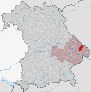
| Location of the Grafenau district in Bavaria | ||
  |
||

The district of Grafenau was part of the Bavarian administrative district of Lower Bavaria . Its former area is now in the Freyung-Grafenau district .
geography
Important places
The largest towns were Grafenau (administrative headquarters), Sankt Oswald, Riedlhütte, Schönberg and Schönanger (now Neuschönau ).
Neighboring areas
In 1972 the district bordered counterclockwise in the northwest, beginning with the districts of Regen , Deggendorf , Vilshofen , Passau and Wolfstein . In the northeast it bordered on Czechoslovakia .
history
district Court
In the 15th century, the Wittelsbachers made Bärnstein the seat of a nursing court for the Grafenauer Land, whose keeper, as captain in front of the forest, was also head of the regional military organization and had an armory . In 1799 the seat of the Bärnstein Regional Court was relocated to Grafenau. In 1811, as a result of the administrative restructuring of the state in the new Kingdom of Bavaria , the Grafenau district court was established and assigned to the Lower Danube District. The district capital at that time was Passau . In 1838 the Lower Danube District was renamed the District of Lower Bavaria , from which the administrative district of the same name emerged . The district capital was moved to Landshut .
District Office
The Grafenau district office followed the Grafenau regional court of the same area in 1862.
The district office gave the municipality of Oberaign on April 1, 1928 to the district office of Deggendorf.
district
On January 1, 1939, the designation district was introduced as everywhere else in the German Reich . This is how the district office became the Grafenau district.
In 1946, the Grafenau district was enlarged to include the Allhartsmais community in the Deggendorf district. Allhartsmais was incorporated into Schöfweg .
On July 1, 1972, the Grafenau district was merged with the Wolfstein district to form the new Freyung district as part of the regional reform in Bavaria . On May 1, 1973, the district was given its current designation as Landkreis Freyung-Grafenau .
In addition, several communities were merged, so that today only the eleven communities Eppenschlag , Grafenau , Innernzell , Neuschönau , Saldenburg , Sankt Oswald-Riedlhütte , Schöfweg , Schönberg , Spiegelau , Thurmansbang and Zenting exist in the Altlandkreis area . With 31,686 inhabitants, 39% of the district population of Freyung-Grafenau live in this area today
Population development
| year | Residents | source |
|---|---|---|
| 1840 | 14,366 | |
| 1861 | 15,946 | |
| 1885 | 18,180 | |
| 1900 | 18,574 | |
| 1910 | 20,058 | |
| 1925 | 21,740 | |
| 1939 | 22,999 | |
| 1950 | 30,071 | |
| 1960 | 28,100 | |
| 1971 | 29,600 |
Communities
Before the beginning of the Bavarian regional reform, the Grafenau district comprised 25 communities in the 1960s:
|
|
- Incorporation and renaming until 1959
- Bärnstein , hit on January 1, 1946
- Furth , renamed Haus im Wald on August 1, 1951
- Gmünd , on January 1, 1946 in Innernzell
- Großmisselberg , on December 28, 1946 in Eppenschlag
- Hilgenreith , on January 1, 1946 in Innernzell
- Klingenbrunn , renamed Spiegelau on August 14, 1959
- Kreuzberg , renamed Oberkreuzberg in 1931
- Liebersberg , 1946 to Schlag and Neudorf
- Midnight on December 28, 1946 at Schönberg
politics
The last district administrator was Karl Bayer ( SPD , from 1972 CSU ). One of the predecessors was Anton Bogenstätter , in office from 1948 to 1964. After the district reform, the Freyung-Grafenau tax office moved into the former district office in Grafenau in Friedhofstrasse.
To this day, this old district lives on in various subdivisions, such as the group of voters of the Free Voters . In the Grafenauer Land, the “Free Voters Community - Grafenauer Land” got involved, in the former Wolfstein district the “Christian Voters Community”. This different commitment in the individual district parts then also has an impact on the significantly different election results. The local edition F of the PNP is also published with two different titles, Grafenauer Anzeiger and Passauer Neue Presse . The boundary of the Roman Catholic dean's office in Grafenau also coincides with the district boundaries before 1972. This division can also be found to some extent in the banking world. The Volksbanken-Raiffeisenbanken of the Freyung-Grafenaus district split on the former district border. However, these have merged with their respective neighbors, VR-Bank in Regen for Grafenau and VR-Bank Passau for Freyung.
coat of arms
The coat of arms of the Grafenau district was approved on January 24, 1957. Under the Bavarian diamonds, it shows the red griffin with the hare of the Counts of Formbach , who ruled the area between 950 and 1158 and also gave the city of Grafenau its name. Until 1972, the community of Neuburg am Inn had the same coat of arms, but without the Bavarian diamonds.
License Plate
On July 1, 1956, the district was assigned the distinctive sign GRA when the vehicle registration number that is still valid today was introduced . It was issued until August 3, 1974. It has been available in the Freyung-Grafenau district since July 10, 2013.
literature
- District council of the district Grafenau (Hrsg.): The picture of an old Bavarian district. Grafenau. Rachel, Lusen, Sonnenwald. Bavarian forest. Morsak, Grafenau 1972.
Individual evidence
- ↑ Franziska Jungmann-Stadler: Historical Atlas of Bavaria, part of Old Bavaria. Row I / Grafenau: District Court Bärnstein, Nursing Courts Diessenstein and Hals. Edited by the Commission for Bavarian State History at the Bavarian Academy of Sciences, Munich, 1992.
- ^ Wilhelm Volkert (ed.): Handbook of Bavarian offices, communities and courts 1799–1980 . CH Beck, Munich 1983, ISBN 3-406-09669-7 , p. 473 .
- ^ Wilhelm Volkert (ed.): Handbook of Bavarian offices, communities and courts 1799–1980 . CH Beck, Munich 1983, ISBN 3-406-09669-7 , p. 97 .
- ^ Federal Statistical Office (ed.): Historical municipality directory for the Federal Republic of Germany. Name, border and key number changes in municipalities, counties and administrative districts from May 27, 1970 to December 31, 1982 . W. Kohlhammer, Stuttgart / Mainz 1983, ISBN 3-17-003263-1 , p. 608 .
- ^ Federal Statistical Office (ed.): Historical municipality directory for the Federal Republic of Germany. Name, border and key number changes in municipalities, counties and administrative districts from May 27, 1970 to December 31, 1982 . W. Kohlhammer, Stuttgart / Mainz 1983, ISBN 3-17-003263-1 , p. 627 .
- ↑ a b c d e f g h Bavarian State Statistical Office (Hrsg.): Historical municipality register: The population of the municipalities of Bavaria from 1840 to 1952 (= contributions to Statistics Bavaria . Issue 192). Munich 1954, DNB 451478568 , p. 50–51 , urn : nbn: de: bvb: 12-bsb00066439-3 ( digitized version ).
- ↑ Statistical Yearbook for the Federal Republic of Germany 1961
- ↑ Statistical Yearbook for the Federal Republic of Germany 1973
- ^ Official register of places for Bavaria 1964
- ↑ Bavarian State Statistical Office (Hrsg.): Historical municipality register: The population of the municipalities of Bavaria in the period from 1840 to 1952 (= contributions to Statistics Bavaria . Issue 192). Munich 1954, DNB 451478568 , p. 56–57 , urn : nbn: de: bvb: 12-bsb00066439-3 ( digitized version - Grafenau district; footnote 8).
Web links
Aichach | Alzenau i.UFr. | Amberg | Bad Aibling | Bad Neustadt adSaale | Bad Toelz | Beilngries | Berchtesgaden | Bow | Brückenau | Burglengenfeld | Dingolfing | Dinkelsbühl | Donauwörth | Ebermannstadt | Boars | Eggenfelden | Erlangen | Eschenbach idOPf. | Feuchtwangen | Friedberg | Feet | Gemünden a.Main | Gerolzhofen | Grafenau | Griesbach i.Rottal | Gunzenhausen | Hammelburg | Hassfurt | Hersbruck | Hilpoltstein | Höchstadt adAisch | Hofheim i.UFr. | Illertissen | Ingolstadt | Karlstadt | Kaufbeuren | Kemnath | Kempten (Allgäu) | Königshofen i.Grabfeld | Kötzting | Krumbach (Swabia) | Landau adIsar | Lauf adPegnitz | Running | Lohr a.Main | Mainburg | Mallersdorf | Marktheidenfeld | Marktoberdorf | Mellrichstadt | Memmingen | Mindelheim | Münchberg | Nabburg | Naila | Neuburg adDonau | Neunburg vorm Wald | Neustadt adAisch | Nordlingen | Nuremberg | Obernburg am Main | Oberviechtach | Ochsenfurt | Parsberg | Pegnitz | Parish churches | Rehau | Riedenburg | Roding | Rothenburg ob der Tauber | Rottenburg adLaaber | Scheinfeld | Schongau | Schrobenhausen | Schwabach | Schwabmünchen | Sonthofen | Stadtsteinach | Staffelstein | Straubing | Sulzbach-Rosenberg | Uffenheim | Viechtach | Vilsbiburg | Vilshofen | Vohenstrauss | Waldmünchen | Wasserburg a.Inn | Wegscheid | Weilheim i.OB | Weißenburg i.Bay. | Wertingen | Wolfratshausen | Wolfstein
1939–1945 affiliated districts: Bergreichenstein | Eisenstein market | Prachatitz