
District of Sulzbach-Rosenberg
| coat of arms | Germany map | |
|---|---|---|

|
Coordinates: 49 ° 30 ' N , 11 ° 45' E |
|
| Basic data (as of 1972) | ||
| Existing period: | 1862-1972 | |
| State : | Bavaria | |
| Administrative region : | Upper Palatinate | |
| Administrative headquarters : | Sulzbach-Rosenberg | |
| Area : | 341.66 km 2 | |
| Residents: | 32,700 (Dec. 31, 1971) | |
| Population density : | 96 inhabitants per km 2 | |
| License plate : | SUL | |
| Circle key : | 09 3 46 | |
| Circle structure: | 31 municipalities | |
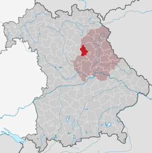
| Location of the district of Sulzbach-Rosenberg in Bavaria | ||
  |
||

The district of Sulzbach-Rosenberg was a district in the Bavarian administrative district of Upper Palatinate . Today his area belongs to the district of Amberg-Sulzbach .
geography
Important places
The largest towns were Sulzbach-Rosenberg , Neukirchen bei Sulzbach-Rosenberg , Illschwang and Königstein .
Neighboring areas
In 1972 the district bordered clockwise in the north, beginning with the districts of Eschenbach in the Upper Palatinate and Amberg , the independent city of Amberg and the districts of Neumarkt in the Upper Palatinate and Hersbruck .
history
district Court
In 1803, as part of the administrative restructuring of Bavaria, the Sulzbach Regional Court was established. After the founding of the Kingdom of Bavaria, this was added to the Regenkreis , whose capital was initially Straubing and became Regensburg from 1810.
In 1838 the rain district was renamed the Oberpfalz district , from which the administrative district of the same name emerged .
District Office
The district office in 1862 Sulzbach followed the same area district court order of older Sulzbach.
On January 1, 1911, the municipality of Alfeld of the Sulzbach district office was reclassified to the Hersbruck district office.
On July 1, 1934, the town of Sulzbach was merged with the neighboring community of Rosenberg to form the town of Sulzbach-Rosenberg , into which the community of Großalbershof was also incorporated on April 1, 1935 . As a result, the district office was renamed accordingly and was henceforth called the Sulzbach-Rosenberg district office.
district
On January 1, 1939, the designation district was introduced as everywhere else in the German Reich . The district office of Sulzbach-Rosenberg became the district office.
On July 1, 1972, the district of Sulzbach-Rosenberg was dissolved as part of the regional reform in Bavaria and merged with the district of Amberg . On May 1, 1973, the new district was given the current name Amberg-Sulzbach district .
Population development
| year | Residents | source |
|---|---|---|
| 1864 | 15,487 | |
| 1885 | 19,288 | |
| 1900 | 20.102 | |
| 1910 | 20,541 | |
| 1925 | 20,911 | |
| 1939 | 22,333 | |
| 1950 | 32,736 | |
| 1960 | 32,400 | |
| 1971 | 32,700 |
District administrators
- 1945: Franz Bauer
- 1945: Wilhelm Krafft
- 1945–1946: Eberhard Urbatis
- 1946–1947: Rudolf Deku
- 1947–1948: August Kalb
- 1948–1963: Alwin Müller
- 1963–1972: Karl Winkler
Communities
Before the Bavarian regional reform began in the early 1970s, the district comprised 31 municipalities:
Other communities
- eighth
- Angfeld
- Augsberg
- Bachetsfeld
- Dietersberg
- Eckeltshof
- Edelsfeld
- Eschenfelden
- Frechetsfeld
- Fürnried
- Gaissach
- Götzendorf
- Hirschbach
- Holnstein
- Illschwang
- Kirchenreinbach
- Mittelreinbach
- Namsreuth
- Neidstein
- Neukirchen near Sulzbach-Rosenberg
- Poppberg
- Poppenricht
- Dressing
- Schmidtstadt
- Schwend
- Steinling
- Sunzendorf
- Trondorf
- Weigendorf
License Plate
On July 1, 1956, the district was assigned the distinguishing sign SUL when the vehicle registration number that is still valid today was introduced . It was issued until August 3, 1974. Since July 12, 2013 it has been available again in the Amberg-Sulzbach district due to the license plate liberalization .
literature
- Günther U. Müller (Ed.): Our district Sulzbach-Rosenberg. Publishing house Bild + Druck, Munich 1970.
Individual evidence
- ^ Wilhelm Volkert (ed.): Handbook of Bavarian offices, communities and courts 1799–1980 . CH Beck, Munich 1983, ISBN 3-406-09669-7 , p. 578 .
- ^ Wilhelm Volkert (ed.): Handbook of Bavarian offices, communities and courts 1799–1980 . CH Beck, Munich 1983, ISBN 3-406-09669-7 , p. 97 .
- ^ Federal Statistical Office (ed.): Historical municipality directory for the Federal Republic of Germany. Name, border and key number changes in municipalities, counties and administrative districts from May 27, 1970 to December 31, 1982 . W. Kohlhammer, Stuttgart / Mainz 1983, ISBN 3-17-003263-1 , p. 662 .
- ^ Federal Statistical Office (ed.): Historical municipality directory for the Federal Republic of Germany. Name, border and key number changes in municipalities, counties and administrative districts from May 27, 1970 to December 31, 1982 . W. Kohlhammer, Stuttgart / Mainz 1983, ISBN 3-17-003263-1 , p. 639 .
- ^ Eugen Hartmann: Statistics of the Kingdom of Bavaria . Ed .: Royal Bavarian Statistical Bureau. Munich 1866, population figures of the district offices 1864 ( digitized version ).
- ↑ K. Bayer. Statistical Bureau (Ed.): Localities directory of the Kingdom of Bavaria. According to government districts, administrative districts, ... then with an alphabetical register of locations, including the property and the responsible administrative district for each location. LIV. Issue of the contributions to the statistics of the Kingdom of Bavaria. Munich 1888, Section II, p. VI ( digitized version ).
- ↑ a b www.gemeindeververzeichnis.de
- ↑ Bavarian State Statistical Office (ed.): Localities directory for the Free State of Bavaria according to the census of June 16, 1925 and the territorial status of January 1, 1928 . Issue 109 of the articles on Bavaria's statistics. Munich 1928, p. 10 * ( digitized version ).
- ↑ Statistical Yearbook for the German Reich 1940
- ↑ Statistical Yearbook for the Federal Republic of Germany 1952
- ↑ Statistical Yearbook for the Federal Republic of Germany 1961
- ↑ Statistical Yearbook for the Federal Republic of Germany 1973
- ↑ Bavarian State Statistical Office (ed.): Official city directory for Bavaria, territorial status on October 1, 1964 with statistical information from the 1961 census . Issue 260 of the articles on Bavaria's statistics. Munich 1964, DNB 453660959 , Section II, Sp. 611 ( digitized version ).
Aichach | Alzenau i.UFr. | Amberg | Bad Aibling | Bad Neustadt adSaale | Bad Toelz | Beilngries | Berchtesgaden | Bow | Brückenau | Burglengenfeld | Dingolfing | Dinkelsbühl | Donauwörth | Ebermannstadt | Boars | Eggenfelden | Erlangen | Eschenbach idOPf. | Feuchtwangen | Friedberg | Feet | Gemünden a.Main | Gerolzhofen | Grafenau | Griesbach i.Rottal | Gunzenhausen | Hammelburg | Hassfurt | Hersbruck | Hilpoltstein | Höchstadt adAisch | Hofheim i.UFr. | Illertissen | Ingolstadt | Karlstadt | Kaufbeuren | Kemnath | Kempten (Allgäu) | Königshofen i.Grabfeld | Kötzting | Krumbach (Swabia) | Landau adIsar | Lauf adPegnitz | Running | Lohr a.Main | Mainburg | Mallersdorf | Marktheidenfeld | Marktoberdorf | Mellrichstadt | Memmingen | Mindelheim | Münchberg | Nabburg | Naila | Neuburg adDonau | Neunburg vorm Wald | Neustadt adAisch | Nordlingen | Nuremberg | Obernburg am Main | Oberviechtach | Ochsenfurt | Parsberg | Pegnitz | Parish churches | Rehau | Riedenburg | Roding | Rothenburg ob der Tauber | Rottenburg adLaaber | Scheinfeld | Schongau | Schrobenhausen | Schwabach | Schwabmünchen | Sonthofen | Stadtsteinach | Staffelstein | Straubing | Sulzbach-Rosenberg | Uffenheim | Viechtach | Vilsbiburg | Vilshofen | Vohenstrauss | Waldmünchen | Wasserburg a.Inn | Wegscheid | Weilheim i.OB | Weißenburg i.Bay. | Wertingen | Wolfratshausen | Wolfstein
1939–1945 affiliated districts: Bergreichenstein | Eisenstein market | Prachatitz