
Nabburg district
| coat of arms | Germany map | |
|---|---|---|

|
Coordinates: 49 ° 27 ' N , 12 ° 11' E |
|
| Basic data (as of 1972) | ||
| State : | Bavaria | |
| Administrative region : | Upper Palatinate | |
| Administrative headquarters : | Nabburg | |
| Area : | 412.28 km 2 | |
| Residents: | 32,641 (May 27, 1970) | |
| Population density : | 79 inhabitants per km 2 | |
| License plate : | NAB | |
| Circle key : | 09 3 37 | |
| Circle structure: | 41 municipalities | |
| District Administrator : | Hans Werner ( CSU ) | |
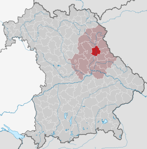
| Location of the district of Nabburg in Bavaria | ||
  |
||

The district of Nabburg belonged to the Bavarian administrative district of Upper Palatinate . Most of its area today belongs to the Schwandorf district .
geography
location
The district was in the Upper Palatinate Forest natural area in the so-called Naab Mountains . From north to south the Naab and from east to west the Schwarzach , which flows into the Naab at Schwarzenfeld , flowed through the district. The highest elevations in the district reached heights of 700 m.
Important places
The communities with the largest population were Nabburg , Wernberg, Oberköblitz, Pfreimd , Schwarzach , Stulln , Schwarzenfeld , Schmidgaden and Trausnitz .
Neighboring areas
In 1972 the district bordered clockwise in the north, beginning with the districts of Neustadt an der Waldnaab , Vohenstrauß , Oberviechtach , Neunburg vorm Wald , Burglengenfeld and Amberg .
history
district Court
In 1803 the regional court of Nabburg was established in the course of the administrative restructuring of Bavaria . After the founding of the Kingdom of Bavaria, this was added to the Regenkreis , whose capital was initially Straubing and became Regensburg from 1810.
In 1838 the rain district was renamed the Oberpfalz district from which the administrative district of the same name emerged .
District Office
The district office of Nabburg followed in 1862 the area court of the older order of Nabburg.
On January 1, 1926, the district office of Nabburg was enlarged to include the municipalities of Deindorf, Glaubendorf and Woppenhof of the district office of Vohenstrauß.
district
On January 1, 1939, the uniform imperial designation Landkreis was introduced. This is how the district office became the Nabburg district.
On July 1, 1972, the district of Nabburg was dissolved as part of the regional reform in Bavaria . The municipality of Kemnath am Buchberg became part of the new district of Amberg-Sulzbach . All other communities were combined with parts of the districts of Amberg , Burglengenfeld , Neunburg vorm Wald , Oberviechtach , Regensburg and Roding as well as the previously independent town of Schwandorf to form the new district of Schwandorf .
Population development
| year | Residents | source |
|---|---|---|
| 1864 | 17,985 | |
| 1885 | 19,699 | |
| 1900 | 18,201 | |
| 1910 | 17,760 | |
| 1925 | 18,383 | |
| 1939 | 20,586 | |
| 1950 | 29,216 | |
| 1960 | 28,100 | |
| 1971 | 33,100 |
Communities
Before the beginning of the Bavarian regional reform, the district comprised 41 municipalities in the 1960s:
The community of Neusath was incorporated into Diendorf on January 1, 1946.
License Plate
On July 1, 1956, the district was assigned the distinctive sign NAB when the vehicle registration number that is still valid today was introduced . It was issued until August 3, 1974. Due to the license plate liberalization , it has been available again in the Schwandorf district since July 10, 2013 and also in the Amberg-Sulzbach district since July 12, 2013 .
literature
- Günther U. Müller (Ed.): Our district of Nabburg. Publishing house Bild + Druck, Munich 1971.
- Elisabeth Müller-Luckner: Nabburg (= Historical Atlas of Bavaria , part of Old Bavaria, Series 1: Districts / Regional Courts, Issue 50), published by the Commission for Bavarian State History at the Bavarian Academy of Sciences. Commission for Bavarian State History, Munich 1981, ISBN 3-7696-9915-7 .
Individual evidence
- ^ Wilhelm Volkert (ed.): Handbook of Bavarian offices, communities and courts 1799–1980 . CH Beck, Munich 1983, ISBN 3-406-09669-7 , p. 529 .
- ^ Wilhelm Volkert (ed.): Handbook of Bavarian offices, communities and courts 1799–1980 . CH Beck, Munich 1983, ISBN 3-406-09669-7 , p. 97 .
- ^ Ordinance on the reorganization of Bavaria into rural districts and independent cities of December 27, 1971
- ^ Federal Statistical Office (ed.): Historical municipality directory for the Federal Republic of Germany. Name, border and key number changes in municipalities, counties and administrative districts from May 27, 1970 to December 31, 1982 . W. Kohlhammer, Stuttgart / Mainz 1983, ISBN 3-17-003263-1 , p. 647 .
- ^ Eugen Hartmann: Statistics of the Kingdom of Bavaria . Ed .: Royal Bavarian Statistical Bureau. Munich 1866, population figures of the district offices 1864 ( digitized version ).
- ↑ Royal Bavarian Statistical Bureau (ed.): Localities directory of the Kingdom of Bavaria . Munich 1888, population figures of the district offices 1885 ( digitized ).
- ↑ a b www.gemeindeververzeichnis.de
- ^ Localities directory for the Free State of Bavaria, based on the census of June 16, 1925
- ↑ Statistical Yearbook for the German Reich 1940
- ↑ Statistical Yearbook for the Federal Republic of Germany 1952
- ↑ Statistical Yearbook for the Federal Republic of Germany 1961
- ↑ Statistical Yearbook for the Federal Republic of Germany 1973
- ^ Official register of places for Bavaria 1964
Aichach | Alzenau i.UFr. | Amberg | Bad Aibling | Bad Neustadt adSaale | Bad Toelz | Beilngries | Berchtesgaden | Bow | Brückenau | Burglengenfeld | Dingolfing | Dinkelsbühl | Donauwörth | Ebermannstadt | Boars | Eggenfelden | Erlangen | Eschenbach idOPf. | Feuchtwangen | Friedberg | Feet | Gemünden a.Main | Gerolzhofen | Grafenau | Griesbach i.Rottal | Gunzenhausen | Hammelburg | Hassfurt | Hersbruck | Hilpoltstein | Höchstadt adAisch | Hofheim i.UFr. | Illertissen | Ingolstadt | Karlstadt | Kaufbeuren | Kemnath | Kempten (Allgäu) | Königshofen i.Grabfeld | Kötzting | Krumbach (Swabia) | Landau adIsar | Lauf adPegnitz | Running | Lohr a.Main | Mainburg | Mallersdorf | Marktheidenfeld | Marktoberdorf | Mellrichstadt | Memmingen | Mindelheim | Münchberg | Nabburg | Naila | Neuburg adDonau | Neunburg vorm Wald | Neustadt adAisch | Nordlingen | Nuremberg | Obernburg am Main | Oberviechtach | Ochsenfurt | Parsberg | Pegnitz | Parish churches | Rehau | Riedenburg | Roding | Rothenburg ob der Tauber | Rottenburg adLaaber | Scheinfeld | Schongau | Schrobenhausen | Schwabach | Schwabmünchen | Sonthofen | Stadtsteinach | Staffelstein | Straubing | Sulzbach-Rosenberg | Uffenheim | Viechtach | Vilsbiburg | Vilshofen | Vohenstrauss | Waldmünchen | Wasserburg a.Inn | Wegscheid | Weilheim i.OB | Weißenburg i.Bay. | Wertingen | Wolfratshausen | Wolfstein
1939–1945 affiliated districts: Bergreichenstein | Eisenstein market | Prachatitz