
Regensburg district
| coat of arms | Germany map |
|---|---|

|

Coordinates: 49 ° 1 ' N , 12 ° 7' E |
| Basic data | |
| State : | Bavaria |
| Administrative region : | Upper Palatinate |
| Administrative headquarters : | regensburg |
| Area : | 1,391.9 km 2 |
| Residents: | 194,070 (Dec. 31, 2019) |
| Population density : | 139 inhabitants per km 2 |
| License plate : | R. |
| Circle key : | 09 3 75 |
| NUTS : | DE238 |
| Circle structure: | 41 municipalities |
| Address of the district administration: |
Altmühlstrasse 3 93059 Regensburg |
| Website : | |
| District Administrator : | Tanja Schweiger ( Free Voters ) |
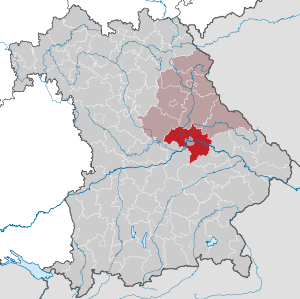
| Location of the district of Regensburg in Bavaria | |
 .svg) |
|
The district of Regensburg is the southernmost district of the administrative district of Upper Palatinate in Eastern Bavaria and completely surrounds the independent city of Regensburg . In the south it borders on three districts of Lower Bavaria .
geography
location
The landscape of the district is diverse. It includes the Danube valley and the Laber , Regen and Naab valleys , all of which are tributaries of the Danube. In the east the district belongs to the Falkensteiner Vorwald , the westernmost part of the Bavarian Forest , and in the west to the foothills of the Franconian Alb .
The area of the district covers 1391.87 km². The largest extension of the district in east-west direction is approx. 61 km, in north-south direction approx. 52 km. The highest point at 676 m above sea level. NN lies west of Frauenzell , the lowest point is the Gmünder Au at 320 m above sea level. NN .
Neighboring areas
The district borders clockwise in the north, beginning with the districts of Schwandorf , Cham , Straubing-Bogen , Landshut , Kelheim and Neumarkt in the Upper Palatinate .
history
Before 1803, the areas of today's Regensburg district belonged primarily to the Prince Diocese of Regensburg , to Spa Bavaria and to the Duchy of Palatinate-Neuburg . In 1628 the Upper Palatinate fell to Bavaria, including parts of the current district.
Regional courts
The Stadtamhof district court was established as early as 1803 . In 1810 the city of Regensburg became an immediate district . In 1811 the Regenstauf Regional Court was established. Furthermore, there was the princely since 1811 Thurn and Taxis ' sche domination Court Woerth, from 1850, the district court of the same name was built. The city of Regensburg and all regional courts belonged to the Regenkreis , which was renamed Upper Palatinate in 1838 .
In 1857, the new Regensburg Regional Court was established from 43 municipalities from the Stadtamhof Regional Court and one municipality from the Kelheim Regional Court. The reduced Stadtamhof district court remained in existence.
District Offices
From an administrative point of view, the Regensburg District Office was formed in 1862 through the merger of the regional courts of the older order of Regensburg and Wörth. The regional courts Regenstauf and Stadtamhof were also merged to form the Stadtamhof district office in administrative terms. However, the city of Regensburg did not belong to these districts.
On the occasion of the reform of the layout of the Bavarian district offices, the Regensburg district office received municipalities from the Roding district office on January 1, 1880 when the municipality of Pittrich was ceded to the Straubing district office . At the same time, the Stadtamhof district was expanded to include the districts of Hemau (was dissolved), Kelheim and Roding.
The judicial districts within the Regensburg District Office were changed in 1879 and 1905. The Stadtamhof district was also expanded in 1879 with the addition of communities from the neighboring Hemau, Kelheim and Roding districts. The area of the city of Regensburg expanded significantly in 1924 through incorporations at the expense of the Stadtamhof district. On October 1, 1929, the Stadtamhof district office was finally dissolved and its area assigned to the Regensburg district office.
On April 1, 1938, the city received the municipalities of Dech Betten , Großprüfening and Ziegetsdorf from the Regensburg District Office.
district
On January 1, 1939, the designation district was introduced as everywhere else in the German Reich . So the Regensburg district became the district of Regensburg.
In 1946 the district of Straubing was enlarged to include the communities of Kirchroth and Zeitldorn of the district of Regensburg. At the same time, the Pfaffenfang community came from the Roding district. It was incorporated into Altenthann .
As part of the regional reform in Bavaria , the district of Regensburg was significantly enlarged on July 1, 1972. New arrivals to the county
- the communities Dinau , Duggendorf , Hochdorf , Holzheim am Forst , Kallmünz , Krachenhausen , Rohrbach and Traidendorf from the dissolved district of Burglengenfeld
- the municipality of Bergmatting in the Kelheim district
- the communities of Buchhausen , Eggmühl , Inkofen , Mannsdorf , Oberdeggenbach , Pinkofen , Schierling , Unterlaichling and Zaitzkofen from the dissolved district of Mallersdorf
- the city of Hemau and the communities of Aichkirchen , Beratzhausen , Berletzhof , Brunn , Deuerling , Haag , Hohenschambach , Klingen , Kollersried , Laaber , Langenkreith , Laufenthal , Mausheim , Neukirchen , Oberpfraundorf , Pellndorf , Rechberg , Schwarzenthonhausen and Thonlohe from the dissolved district of Parsberg as well
- the communities of Allersdorf and Wahlsdorf from the dissolved district of Rottenburg an der Laaber .
The district of Regensburg, for its part, gave the municipality of Rettenbach in the east to the district of Cham, the municipality of Wulkersdorf to the district of Schwandorf and the communities of Höhenberg , Niederachdorf , Obermiethnach , Pillnach and Pondorf to the district of Straubing-Bogen.
On January 1, 1974, Wulkersdorf returned from the Schwandorf district to the Regensburg district and was incorporated into Bernhardswald . On January 1st, 1977 the communities Burgweinting , Harting and Oberisling were incorporated into the independent city of Regensburg. On May 1, 1978, the Ponholz community moved from the Regensburg district to the Schwandorf district and was incorporated into Maxhütte-Haidhof there .
Population development
From 1988 to 2008 the district of Regensburg grew by almost 36,000 inhabitants or around 24%. The strong growth of the last few decades has weakened in recent years. In contrast to most of the districts in Eastern Bavaria, the district of Regensburg is still seeing a growth in population. On June 30, 2016, the district had 160,016 inhabitants.
Between 1988 and 2018 the district grew from 147,021 to 193,572 by 46,551 inhabitants or by 31.7%.
The following figures refer to the territorial status on May 25, 1987.
| Population development | ||||||||||||||
|---|---|---|---|---|---|---|---|---|---|---|---|---|---|---|
| year | 1840 | 1900 | 1939 | 1950 | 1961 | 1970 | 1987 | 1991 | 1995 | 2000 | 2005 | 2010 | 2015 | |
| Residents | 58,773 | 69,408 | 80.029 | 104,272 | 103,698 | 120,290 | 144.278 | 157.011 | 166.215 | 176.067 | 182.193 | 183,796 | 189,390 | |
politics
District administrators
- July 13, 1946 to May 31, 1948: Georg von Mallinckrodt
- June 1, 1948 to April 30, 1978: Leonhard Deininger ( CSU )
- May 1, 1978 to April 30, 2002: Rupert Schmid (CSU)
- May 1, 2002 to April 30, 2014: Herbert Mirbeth (CSU)
- since May 1, 2014: Tanja Schweiger ( Free Voters )
In the district election of 2020 , Tanja Schweiger prevailed from the free voters in the first ballot with 68.15%.
District council
The result of the district election on March 15, 2020:
- CSU 24 seats
- FW 20 seats
- GREEN 9 seats
- SPD 7 seats
- AfD 4 seats
- ödp / party-free environmentalists 3 seats
- FDP 2 seats
- LEFT 1 seat
Of the 154,939 residents of the district of Regensburg who are entitled to vote, 103,028 exercised their right to vote, bringing the turnout to 66.5 percent.
coat of arms
|
|
Blazon : “Under the shield head with the Bavarian diamonds split by red and silver; in front a silver sloping bar, behind a continuous straight arm red paw cross . " |
License Plate
The official license plate number has been "R" since July 1, 1956, both in the city of Regensburg and in the district. Combinations of two letters and three digits as well as one letter (only B, F, G, I, O and Q) and one to three digits are reserved for approvals in the city of Regensburg. The remaining combinations are reserved for approvals in the district; Two letters and four digits are used for both areas.
Economy and Infrastructure
In the Future Atlas 2016 , the district of Regensburg was ranked 39th out of 402 districts, municipal associations and independent cities in Germany, making it one of the regions with "very high future prospects". In the 2019 edition, it was ranked 103rd out of 401.
traffic
Rail network
The capital of the Upper Palatinate district is the hub of important railways that were initially created by the AG der Bayerische Ostbahnen :
In 1859 the first railway line reached Regensburg from Munich via Sünching and continued to Schwandorf - Amberg - Nuremberg .
The direct route via Neumarkt to Nuremberg did not follow until 1873 . In the same year you could also take the shorter route to Landshut - Munich via Eggmühl, while from Sünching you only drove in the direction of Straubing - Passau.
In 1874 the Danube Valley Railway to Saal and Ingolstadt was put into operation by the Bavarian State Railways . From here the short branch line to Alling branched off in Sinzing in 1875.
Further state local railways followed only after the turn of the century: 1903: Eggmühl - Schierling - Langquaid and 1913: Regensburg-Wutzlhofen - Wenzenbach - Falkenstein .
A special feature presented narrow- Walhalla train the Lokalbahn AG is Munich, which of Stadtamhof 1889 to Donaustauf and 1903 continue to Wörth drove along the left bank of the Danube. Passenger traffic was shut down here as early as 1960; on the other local railway lines in 1967/68 and 1984, a total of 50 kilometers:
- 1960: R-Reinhausen - Donaustauf - Wörth = M = 23 km
- 1984: R-Wutzlhofen - Irlbach - Falkenstein 18 km
- 1967: Sinzing - Alling 4 km
- 1968: Eggmühl - Schierling - Langquaid 5 km
The main lines remained with a length of 112 km.
Road traffic
The district of Regensburg is accessed by the A 3 (Passau – Nuremberg) and A 93 (Munich – Hof) motorways.
Communities
The district of Regensburg comprises 41 municipalities, including 3 cities and 8 markets.
(Area in km², population as of December 31, 2019)
Other communities
|
Unregulated areas (32.35 km²)
  |
Municipalities of the district before the territorial reform 1971/78
Before the beginning of the Bavarian regional reform, the district of Regensburg comprised 124 municipalities in the 1960s. The churches that still exist today are written in bold :
| former parish | today's parish | today's district |
|---|---|---|
| Adlmannstein | Bernhardswald | Regensburg district |
| Alteglofsheim | Alteglofsheim | Regensburg district |
| Altenthann | Altenthann | Regensburg district |
| Aufhausen | Aufhausen | Regensburg district |
| Bach on the Danube | Bach on the Danube | Regensburg district |
| Barbing | Barbing | Regensburg district |
| Bernhardswald | Bernhardswald | Regensburg district |
| Brennberg | Brennberg | Regensburg district |
| Bruckbach | Brennberg | Regensburg district |
| Bubach am Forst | Holzheim am Forst | Regensburg district |
| Buchenlohe | Regenstauf | Regensburg district |
| Burgweinting | regensburg | City of Regensburg |
| Demling | Bach on the Danube | Regensburg district |
| Dengling | Mötzing | Regensburg district |
| This brook | Regenstauf | Regensburg district |
| Dietersweg | Wiesent | Regensburg district |
| Donaustauf , market | Donaustauf | Regensburg district |
| Ehring | Riekofen | Regensburg district |
| Eichhofen | Nittendorf | Regensburg district |
| Eilsbrunn | Sinzing | Regensburg district |
| Eitlbrunn | Regenstauf | Regensburg district |
| Eltheim | Barbing | Regensburg district |
| Etterzhausen | Nittendorf | Regensburg district |
| Frankenberg | Brennberg | Regensburg district |
| Frauenzell | Brennberg | Regensburg district |
| Friesheim | Barbing | Regensburg district |
| Gailsbach | Hail city | Regensburg district |
| Gebelkofen | Obertraubling | Regensburg district |
| Geisling | Patter | Regensburg district |
| Gmuend | Patter | Regensburg district |
| Count Winn | Regenstauf | Regensburg district |
| Grass | regensburg | City of Regensburg |
| Graßlfing | Pentling | Regensburg district |
| Griesau | Patter | Regensburg district |
| Grossberg | Pentling | Regensburg district |
| Grünthal | Wenzenbach | Regensburg district |
| Hague | Rettenbach | Cham district |
| Hackenberg | Bernhardswald | Regensburg district |
| Hail city | Hail city | Regensburg district |
| Haidenkofen | Sünching | Regensburg district |
| Shark book | Mötzing | Regensburg district |
| Hainsacker | Lappersdorf | Regensburg district |
| Harting | regensburg | City of Regensburg |
| Haugenried | Nittendorf | Regensburg district |
| Hauzendorf | Bernhardswald | Regensburg district |
| Hauzenstein | Wenzenbach | Regensburg district |
| Heilinghausen | Regenstauf | Regensburg district |
| Heitzenhofen | Duggendorf | Regensburg district |
| Deerling | Regenstauf | Regensburg district |
| Hofdorf | Wörth on the Danube | Regensburg district |
| Höhenberg | Wiesenfelden | District of Straubing-Bogen |
| Hohengebraching | Pentling | Regensburg district |
| Illkofen | Barbing | Regensburg district |
| Irnkofen | Aufhausen | Regensburg district |
| Kareth | Lappersdorf | Regensburg district |
| Karlstein | Regenstauf | Regensburg district |
| Pine wood | Wörth on the Danube | Regensburg district |
| Kneiting | Pettendorf | Regensburg district |
| Köfering | Köfering | Regensburg district |
| Kruckenberg | Wiesent | Regensburg district |
| Freestyle | Bernhardswald | Regensburg district |
| Langenerling | Hail city | Regensburg district |
| Lappersdorf | Lappersdorf | Regensburg district |
| Lichtenwald | Altenthann | Regensburg district |
| Luckenpaint | Thalmassing | Regensburg district |
| Mangolding | Mintraching | Regensburg district |
| Matting | Pentling | Regensburg district |
| Mintraching | Mintraching | Regensburg district |
| Moosham | Mintraching | Regensburg district |
| Mötzing | Mötzing | Regensburg district |
| Neudorf | Pettendorf | Regensburg district |
| Neutraubling | Neutraubling | Regensburg district |
| Niederachdorf | Kirchroth | District of Straubing-Bogen |
| Niedertraubling | Obertraubling | Regensburg district |
| Nittendorf | Nittendorf | Regensburg district |
| Oberachdorf | Wörth on the Danube | Regensburg district |
| Oberhinkofen | Obertraubling | Regensburg district |
| Oberisling | regensburg | City of Regensburg |
| Obermiethnach | Kirchroth | District of Straubing-Bogen |
| Obertraubling | Obertraubling | Regensburg district |
| Pentling | Pentling | Regensburg district |
| Pettendorf | Pettendorf | Regensburg district |
| Pettenreuth | Bernhardswald | Regensburg district |
| Petzkofen | Aufhausen | Regensburg district |
| Pfakofen | Pfakofen | Regensburg district |
| Patter | Patter | Regensburg district |
| Pielenhofen | Pielenhofen | Regensburg district |
| Pillnach | Kirchroth | District of Straubing-Bogen |
| Poign | Pentling | Regensburg district |
| Pondorf | Kirchroth | District of Straubing-Bogen |
| Ponholz | Maxhütte-Haidhof | Schwandorf district |
| Ramspau | Regenstauf | Regensburg district |
| Regendorf | Time warning | Regensburg district |
| Regenstauf , market | Regenstauf | Regensburg district |
| Rettenbach | Rettenbach | Cham district |
| Riekofen | Riekofen | Regensburg district |
| Rogging | Pfakofen | Regensburg district |
| Rosenhof | Mintraching | Regensburg district |
| Sanding | Thalmassing | Regensburg district |
| Sarching | Barbing | Regensburg district |
| Schönach | Mötzing | Regensburg district |
| Schönhofen | Nittendorf | Regensburg district |
| Schönleiten | Regenstauf | Regensburg district |
| Sengkofen | Mintraching | Regensburg district |
| Sinzing | Sinzing | Regensburg district |
| Steinsberg | Regenstauf | Regensburg district |
| Sünching | Sünching | Regensburg district |
| Sulzbach on the Danube | Donaustauf | Regensburg district |
| Taimering | Riekofen | Regensburg district |
| Tegernheim | Tegernheim | Regensburg district |
| Thalmassing | Thalmassing | Regensburg district |
| Tiefenthal | Wörth on the Danube | Regensburg district |
| Triftlfing | Aufhausen | Regensburg district |
| Viehhausen | Sinzing | Regensburg district |
| Pond | Wörth on the Danube | Regensburg district |
| Weillohe | Thalmassing | Regensburg district |
| Wenzenbach | Wenzenbach | Regensburg district |
| Wiesent | Wiesent | Regensburg district |
| Wolfsegg | Wolfsegg | Regensburg district |
| Cloud ring | Thalmassing | Regensburg district |
| Wörth an der Donau , city | Wörth on the Danube | Regensburg district |
| Wulkersdorf | Bernhardswald | Regensburg district |
| Time warning | Time warning | Regensburg district |
| Zinzendorf | Wörth on the Danube | Regensburg district |
- Incorporation and outsourcing before 1950
- Auburg , on April 1, 1949 in Illkofen
- Dech Betten , on April 1, 1938 in Regensburg
- Ebersroith , on January 1, 1946 in Rettenbach
- Frengkofen , on January 1st, 1946 in Bach on the Danube
- Göppenbach , on April 1, 1949 to Frauenzell
- Großprüfening , on April 1, 1938 in Regensburg
- Hungersacker , to ponds on January 1, 1946
- Kirchroth , 1946 to the district of Straubing
- Kleinprüfening , on January 1, 1946 in Sinzing
- Kreuth , to Bernhardswald on January 1, 1946
- Loch , on January 1, 1946 in Nittendorf
- Pfellkofen , on January 1, 1946 in Pfakofen
- Schneitweg , to Karlstein on January 1, 1946
- Tiefbrunn , on January 1, 1946 at Moosham
- Waxenberg , on January 1, 1946 in Höhenberg
- Zeitldorn , 1946 to the district of Straubing
- Ziegetsdorf , on April 1, 1938 in Regensburg
The municipality of Oppersdorf was renamed Lappersdorf on March 19, 1958 .
Protected areas
In the district of Regensburg there are eleven nature reserves , four landscape protection areas , 16 FFH areas and at least 53 geotopes designated by the Bavarian State Office for the Environment (as of April 2016).
See also
- List of nature reserves in the Regensburg district
- List of landscape protection areas in the district of Regensburg
- List of FFH areas in the district of Regensburg
- List of geotopes in the district of Regensburg
Nature reserves
Ring of Honor of the District
The ring of honor is an award for people who have made outstanding contributions to the district. It is limited to 12 living people and is the highest honor given by the Regensburg district. The ring is awarded in gold and is provided with the county coat of arms.
By resolution of the district council, the district issued a statute on October 28, 1980, with which the criteria and requirements for the official honor with the ring of honor of the district of Regensburg are specified.
carrier
Current
- Rupert Schmid (1935–), German politician (CSU), retired district administrator. D., District Assembly President a. D.
Deceased
- Leonhard Deininger (1910–2002), German politician (CSU), retired district administrator. D., member of the state parliament a. D., former Regensburg city councilor
- Hermann Höcherl (1912–1989), German politician ( CSU ), former Federal Minister. D.
literature
- Reiner Vogel: Leonhard Deininger. A life at the wheel of the Regensburg district. Hemau 1999.
- District of Regensburg: The district of Regensburg in the past and present Volume 1, Regensburg 2008, ISBN 978-3-9812370-0-9 .
- District of Regensburg: The district of Regensburg in the past and present Volume 2, Regensburg 2009, ISBN 978-3-9812370-1-6 .
- District of Regensburg: Our district of Regensburg. Territorial Reform: Impact - Anecdotes - Views. Regensburg 2014, ISBN 978-3-9812370-2-3 .
Web links
- Regensburg district
- Literature from and about the district of Regensburg in the catalog of the German National Library
- District of Regensburg: Official statistics of the LfStat
Individual evidence
- ↑ "Data 2" sheet, Statistical Report A1200C 202041 Population of the municipalities, districts and administrative districts 1st quarter 2020 (population based on the 2011 census) ( help ).
- ^ Regensburg district : district area and use
- ↑ Bavarian Surveying Administration , Official Topographic Map 1: 25000, Digital Location Map 1: 10000
- ^ Wilhelm Volkert (ed.): Handbook of Bavarian offices, communities and courts 1799–1980 . CH Beck, Munich 1983, ISBN 3-406-09669-7 , p. 534 .
- ^ Wilhelm Volkert (ed.): Handbook of Bavarian offices, communities and courts 1799–1980 . CH Beck, Munich 1983, ISBN 3-406-09669-7 , p. 97 .
- ^ Ordinance on the reorganization of Bavaria into rural districts and independent cities of December 27, 1971
- ^ Federal Statistical Office (ed.): Historical municipality directory for the Federal Republic of Germany. Name, border and key number changes in municipalities, counties and administrative districts from May 27, 1970 to December 31, 1982 . W. Kohlhammer GmbH, Stuttgart / Mainz 1983, ISBN 3-17-003263-1 , p. 658 .
- ↑ Mittelbayerische Zeitung . October 21, 2017, p. 57 (data source: Bavarian State Office for Statistics).
- ↑ Results of the 2020 local elections on the homepage of the Bavarian State Office for Statistics, accessed on May 4, 2020
- ↑ Entry on the coat of arms of the Regensburg district in the database of the House of Bavarian History , accessed on September 5, 2017 .
- ↑ Future Atlas 2016. (No longer available online.) Archived from the original on October 2, 2017 ; accessed on March 24, 2018 . Info: The archive link was inserted automatically and has not yet been checked. Please check the original and archive link according to the instructions and then remove this notice.
- ↑ Future Atlas 2019. Accessed December 10, 2019 .
- ↑ "Data 2" sheet, Statistical Report A1200C 202041 Population of the municipalities, districts and administrative districts 1st quarter 2020 (population based on the 2011 census) ( help ).
- ^ Official register of places for Bavaria 1964
Districts:
Aichach-Friedberg |
Altötting |
Amberg-Sulzbach |
Ansbach |
Aschaffenburg |
Augsburg |
Bad Kissingen |
Bad Toelz-Wolfratshausen |
Bamberg |
Bayreuth |
Berchtesgadener Land |
Cham |
Coburg |
Dachau |
Deggendorf |
Dillingen on the Danube |
Dingolfing-Landau |
Danube Ries |
Ebersberg |
Eichstätt |
Erding |
Erlangen-Höchstadt |
Forchheim |
Freising |
Freyung-Grafenau |
Fürstenfeldbruck |
Fürth |
Garmisch-Partenkirchen |
Gunzburg |
Hatred Mountains |
Yard |
Kelheim |
Kitzingen |
Kronach |
Kulmbach |
Landsberg am Lech |
Landshut |
Lichtenfels |
Lindau (Lake Constance) |
Main-Spessart |
Miesbach |
Miltenberg |
Mühldorf am Inn |
Munich |
Neuburg-Schrobenhausen |
Neumarkt in the Upper Palatinate |
Neustadt an der Aisch-Bad Windsheim |
Neustadt an der Waldnaab |
Neu-Ulm |
Nuremberg Country |
Oberallgäu |
Ostallgäu |
Passau |
Pfaffenhofen an der Ilm |
Rain |
Regensburg |
Rhön-Grabfeld |
Rosenheim |
Roth |
Rottal-Inn |
Schwandorf |
Schweinfurt |
Starnberg |
Straubing Arch |
Tirschenreuth |
Traunstein |
Unterallgäu |
Weilheim-Schongau |
Weißenburg-Gunzenhausen |
Wunsiedel in the Fichtel Mountains |
Wurzburg
Independent cities:
Amberg |
Ansbach |
Aschaffenburg |
Augsburg |
Bamberg |
Bayreuth |
Coburg |
Erlangen |
Fürth |
Hof (Saale) |
Ingolstadt |
Kaufbeuren |
Kempten (Allgäu) |
Landshut |
Memmingen |
Munich |
Nuremberg |
Passau |
Regensburg |
Rosenheim |
Schwabach |
Schweinfurt |
Straubing |
Willows in the Upper Palatinate |
Wurzburg
Cities: Hemau | Neutraubling | Wörth on the Danube
Markets: Beratzhausen | Donaustauf | Kallmünz | Laaber | Lappersdorf | Nittendorf | Regenstauf | hemlock
Municipalities: Alteglofsheim | Altenthann | Aufhausen | Bach on the Danube | Barbing | Bernhardswald | Brennberg | Brunn | Deuerling | Duggendorf | Hail city | Holzheim am Forst | Köfering | Mintraching | Mötzing | Obertraubling | Pentling | Pettendorf | Pfakofen | Pfatter | Pielenhofen | Riekofen | Sinzing | Sünching | Tegernheim | Thalmassing | Wenzenbach | Wiesent | Wolfsegg | Time warning
Unregulated areas: Forstmühler Forst | Kreuther Forest