
Cham district
| coat of arms | Germany map |
|---|---|

|

Coordinates: 49 ° 13 ' N , 12 ° 40' E |
| Basic data | |
| State : | Bavaria |
| Administrative region : | Upper Palatinate |
| Administrative headquarters : | Cham |
| Area : | 1,520.17 km 2 |
| Residents: | 127,998 (Dec. 31, 2019) |
| Population density : | 84 inhabitants per km 2 |
| License plate : | CHA, KÖZ, ROD , WÜM |
| Circle key : | 09 3 72 |
| NUTS : | DE235 |
| Circle structure: | 39 municipalities |
| Address of the district administration: |
Rachelstrasse 6 93413 Cham |
| Website : | |
| District Administrator : | Franz Löffler ( CSU ) |
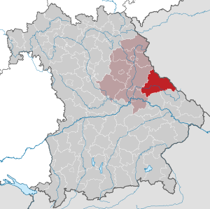
| Location of the Cham district in Bavaria | |
  |
|
The district of Cham [ kaːm ] is the easternmost district of the administrative district of Upper Palatinate in Eastern Bavaria .
geography
The district area belongs almost entirely to the large landscapes of the Upper Palatinate and the Bavarian Forest , which are separated from each other here by the Cham-Further valley . The Regen River runs through the district from southeast to west. A special geological feature is the so-called pile , a crystalline fault along the entire length of the Bavarian Forest. The district area lies in its entirety in the Upper Bavarian Forest Nature Park , which also includes part of the Schwandorf district.
With an area of 1511.87 km², the district of Cham ranks fifth among the 71 districts in Bavaria and first among the seven districts in Upper Palatinate. The average area of the Bavarian districts is 985 km².
Spatial planning
The district of Cham is assigned to planning region 11 (Regensburg). It is a funding area according to the Bavarian regional funding programs, the joint task "Improvement of the regional economic structure" and Objective 3 funding area of the European Union. The district of Cham borders the Czech district of Pilsen (Plzeňský kraj) in the east over a length of 71.6 kilometers . The region is therefore an eligible area under the European INTERREG and PHARE programs.
Neighboring areas
The district borders counterclockwise (starting in the north) on the districts of Schwandorf , Regensburg , Straubing-Bogen and Regen . It borders the Czech Republic in the northeast and east .
Bridge to the east
With a border of around 70 km with the Czech Republic, the Cham district has a bridge function to the east. The meeting of people plays a role in this, expressed in partnerships and institutions such as the cross-border pilgrimage , encounter and environmental education center "Haus zur Aussaat" Neukirchen b.Hl.Blut or the youth education center in Waldmünchen . In order to cope with the challenges of the eastward expansion of the European Union, joint projects such as those in the municipal action alliances “Künisches Gebirge” and “Cerchov” are carried out.
history
Until 1800
The verifiable history of what is now the district of Cham begins in 748. The Regensburg monastery of St. Emmeram founded the “Cella”, the original parish in Chammünster. The seat of the secular rule of the Mark Cham were initially the royal court districts of Cham and Roding. The Reichsburg Cham, mentioned in 976 as “civitas chamma”, with the surrounding castles Runding , Haidstein , Chamerau and Wetterfeld was the military center of the Mark on the border with Bohemia.
Numerous local foundations fell into the eleventh century; In the twelfth century, the important monasteries Reichenbach and Walderbach were founded in the Regental , which promoted the settlement of the area until the Reformation. After 1667 they pioneered the re-Catholicization of the Upper Palatinate.
The border region was particularly hard hit during the Hussite Wars in the 15th century, and the Further Drachenstich takes up this topic in a festival. The theme of an open-air play ( Trenck der Pandur in front of Waldmünchen ) is also the War of the Austrian Succession from 1741 to 1745.
Regional courts
With the administrative reform of 1803, the district court districts of Cham (with the further district of Furth im Wald), Kötzting, Roding and Waldmünchen , all of which belonged to the Regenkreis until 1817 , were created in what is now the district of Cham . Then Cham and Furth as well as Kötzting came to the Unterdonaukreis , while Waldmünchen and Roding remained with the Regenkreis (the later Upper Palatinate). In 1838 the Cham and Furth district courts were also assigned to the now Upper Palatinate and Regensburg district, while the Kötzting district court remained with the now Lower Bavaria district. At the same time, the new district court of Nittenau was created in 1838 from some communities in the district of Roding and in 1852 another district court of Falkenstein, which was dissolved again in 1879/80.
District Offices
The district office of Cham was formed in 1862 through the merger of the regional courts of the older order Cham and Furth i.Wald. Likewise, the district courts of Kötzting and Neukirchen b.Hl.Blut were combined to form the district office of Kötzting and the district courts of Falkenstein, Nittenau and Roding to form the district office of Roding, while the district office of Waldmünchen followed the district court of Waldmünchen.
On July 1, 1904, the Sengenbühl community of the Kötzting district office was reclassified to the Cham district office.
Counties
On January 1, 1939, as everywhere in the German Reich, the designation district was introduced. Thus the district offices became the districts of Cham, Kötzting, Roding and Waldmünchen.
In 1946, the district of Waldmünchen received the municipality of Ried bei Gleißenberg from the district of Cham. It was incorporated into Gleißenberg .
Cham district
In the course of the regional reform on July 1, 1972, a new, significantly larger district of Cham was formed from the following components:
- the entire old district of Cham;
- the dissolved district of Kötzting with the exception of the municipality of Lohberg ; this was initially assigned to the district of Regen , but also came to the district of Cham in May 1978;
- the dissolved district of Roding with the exception of the communities Bleich, Bruck in the Upper Palatinate , Fischbach, Kaspeltshub and Nittenau , which came to the new district of Schwandorf;
- the dissolved district of Waldmünchen ;
- the communities Großenzenried, Hillstett and Pillmersried of the dissolved district of Neunburg vorm Wald ;
- the communities Altenschneeberg , Hannesried , Heinrichskirchen , Irlach and Schönau of the dissolved district of Oberviechtach ;
- the municipality of Rettenbach in the district of Regensburg.
On May 1, 1978 the community of Niederndorf moved from the Cham district to the Regen district and was incorporated into Arnbruck . In return, the Wettzell community moved from the Regen district to the Cham district and was incorporated into the town of Kötzting .
The district of Cham reached almost the historical extent of the old Margraviate Cham. The area of the district of Kötzting thus moved from Lower Bavaria to the Upper Palatinate. Today the district of Cham is the largest district in the Upper Palatinate and fifth largest in Bavaria.
With the accession of the neighboring country of the Czech Republic to the European Union on May 1, 2004, the decades-long isolation from the east was finally overcome.
On May 25, 2009, the district received the title “ Place of Diversity ” awarded by the federal government .
Population development
From 1988 to 2008 the district of Cham grew by over 7,000 inhabitants or around six percent. Since 2003, after a peak of around 131,600 inhabitants, the trend has been declining. In 2014 and 2015, however, the population increased again for the first time. Between 1988 and 2018 the district grew from 121,981 to 127,882 by 5,901 inhabitants or 4.8%.
The western district clearly benefits with population increases of between 20 and 44% in the period from 1988 to 2018, while the eastern district, especially on the border, recorded losses of up to 16% in this period.
The following figures refer to the territorial status on May 25, 1987.

|
|
politics
In addition to the political parties, the Cham district is traditionally strongly influenced by numerous regional voter communities.
District council
The district council of the Cham district consists of 60 members and the district administrator . The local election on March 16, 2014 resulted in the following distribution of votes and seats with a turnout of 65.64 percent (figures compared to the local election of 2008):
| Parties and constituencies | 2008 | 2014 | ||
|---|---|---|---|---|
| % | Seats | % | Seats | |
| Christian Social Union in Bavaria (CSU) | 35.9 | 23 | 34.33 | 21st |
| Social Democratic Party of Germany (SPD) | 9.7 | 6th | 8.07 | 5 |
| Alliance 90 / The Greens (GREENS) | 4.6 | 2 | 4.20 | 2 |
| Joint list of the former district of Waldmünchen (GLLW) | 11.0 | 7th | 10.04 | 6th |
| Hohenbogen list (HBL) | 8.4 | 5 | 8.41 | 5 |
| Free voters from town and country (FWSL) | 11.1 | 7th | 9.82 | 6th |
| Free Christian Voting Community - Central Collection (FCWG) | 7.9 | 5 | 7.86 | 5 |
| Border flag (border flag) | 5.6 | 3 | 6.08 | 4th |
| Ecological Democratic Party (ödp) | 1.7 | 1 | 2.32 | 1 |
| Free Voters Bavaria (FW) | - | - | 8.44 | 5 |
| Free Democratic Party (FDP) | 1.0 | 0 | 0.41 | 0 |
| Bavarian Party (BP) | - | - | - | - |
| total | 100 | 60 | 100 | 60 |
| voter turnout | 68.2% | 65.64% | ||
CSU, GLLW, HBL and Grenzfahne form a parliamentary group and thus have an absolute majority in the district council.
District administrators
Franz Löffler (CSU) has been the district administrator of the Cham district since July 20, 2010 . In the runoff election for the district council on July 18, 2010, he was directly elected to this office for the first time with a share of the vote of 50.3 percent and a turnout of 38.6 percent. Löffler is the third district administrator in the Cham district since the regional reform of 1972 . The first district administrator of the then reorganized district was the district administrator of the former Roding district , Ernst Girmindl. Since then, all Cham district administrators have been appointed by the CSU.
| Surname | from | to |
|---|---|---|
| Ernst Girmindl (CSU) | 1972 | 1996 |
| Theo Zellner (CSU) | 1996 | 2010 |
| Franz Löffler (CSU) | 2010 | today |
coat of arms
|
|
Blazon : "Under the shield head with the Bavarian diamonds in red, the two-towered silver church of Chammünster in side view." |
|
Justification for the coat of arms: The Bavarian diamonds emphasize the centuries-long affiliation to the Wittelsbach territory of the Upper Palatinate. The stylized rendering of the church highlights the importance of the Cham area for Christianization in the early Middle Ages.
The white-blue diamonds come from the Bavarian Forest. They were originally the colors of the Counts of Bogen , whose possession came to the Wittelsbach family through marriage at the beginning of the 13th century. The Wittelsbachers, who ruled Bavaria for 750 years, also adopted their house colors. |
District partnerships
A partnership with the Lichtenrader Volkspark in Berlin - Lichtenrade has existed since 1983 .
In 1992 a partnership was established with the Saxon district of Bautzen .
economy
The district of Cham has a diversified medium-sized economic structure in handicraft, trade, industry and services. The spectrum ranges from traditional wood processing companies to high-tech companies in the fields of mechanical engineering, electrical engineering, plastics technology and mechatronics. A total of around 9,000 companies are located in the Cham district, including some with over 1,000 employees.
Networks such as the “Lebens- und Wirtschaftsraum Landkreis Cham e. V. ”or regional clusters in the areas of mechatronics and wood / forestry shape the cooperation.
In the 2016 Future Atlas, the Cham district was ranked 266 out of 402 districts, municipal associations and urban districts in Germany, making it one of the regions with a “balanced risk-opportunity mix” for the future. In order to promote the digitization of the region, including one was in the district of Cham incubation center set up and a self-propelled for digital infrastructure established that with federal and state funding, a circular-wide fiber optic network built and leased.
traffic
Trunk roads
The district of Cham is through the federal highways Bundesstrasse 16 (Ingolstadt – Regensburg – Nittenau – Roding), Bundesstrasse 20 (Straubing – Furth im Wald), Bundesstrasse 22 (Bayreuth – Weiden – Oberviechtach – Cham) and Bundesstrasse 85 (Amberg – Schwandorf – Passau) connected to the federal trunk road network. The closest motorways are the A 3 (Nuremberg – Regensburg – Passau), A 93 (Regensburg – Schwandorf – Weiden – Hof) and A 92 (Munich – Landshut – Deggendorf). As one of the few districts in Bavaria, the district of Cham is not crossed by a motorway, but the federal roads are mostly developed, sometimes with longer three or four-lane sections.
County roads
Bus and rail transport
The main traffic artery of the rail network in the district of Cham is the Schwandorf – Cham – Furth im Wald (–Pilsen) railway line , which was built in 1861 by the AG der Bayerischen Ostbahnen up to the state border. From Schwandorf you can change trains in the direction of Weiden, Nuremberg or Regensburg or Munich.

The Bavarian State Railways made the city of Cham the starting point for two local railways more than thirty years later:
- 1892 to Miltach – Kötzting and
- 1895 to Waldmünchen .
A cross-connection into the Danube valley to Straubing was established by the former in Miltach in 1905 with the completion of the Straubing – Miltach railway line , while the continuation from Kötzting to Lam came about as early as 1893 by the local railway company Lam – Kötzting . Finally, in 1928 the Regentalbahn (RAG) made Blaibach station the starting point for a line to Viechtach, completing the Gotteszell – Blaibach line . Regardless of the railway network that was created in this way, the Falkenstein market received a line from Regensburg in 1913 and the town of Rötz from Bodenwöhr Nord via Neunburg vorm Wald in 1915.
In addition to the alex trains from Nuremberg and Munich via Schwandorf – Cham – Furth to Prague, the Länderbahn also operates the “ Oberpfalzbahn ” passenger service on the entire 109 km network. 32 km of local railways were shut down in 1969, 1984 and 1991:
- 1969: Bodenwöhr Nord – Hillstett – Rötz (five kilometers)
- 1984: Regensburg – Wutzlhofen – Roßbach – Wald – Falkenstein (17 km) and Miltach – Altrandsberg – Straubing (seven kilometers)
- 1991: Viechtach – Blaibach (three kilometers)
The information in brackets () relates to the length of the route in the district.
In 2002 the rail connections of the Upper Palatinate Railway were integrated into the existing traffic community of the district of Cham . This means that there is a transport association in the district with uniform tariffs on all buses and trains.
Since May 2008, the Cham district has been connected to the neighboring Czech district of Pilsen via the first German-Czech bus route in Bavaria.
Communities


(Population figures as of December 31, 2019)
|
Other communities
|
Municipalities of the district before the territorial reform 1971/1978
Before the regional reform, the district of Cham had 38 municipalities. The municipalities that still exist today are written in bold , all of the named municipalities have not changed the district:
Several poorly populated municipalities were incorporated on January 1, 1946:
- Atzenzell and Obergosszell in the community of Sattelbogen
- Birnbrunn in the municipality of Sattelpeilnstein
- Chameregg , Gutmaning and Hof b. Cham to the municipality of Chammünster
- Grabitz in the city of Furth im Wald
- Hötzing to the community of Schorndorf
- Kager to the municipality of Pemfling
- Katzberg to the city of Cham
- Loifling to the community of Traitsching
- Ried near Gleißenberg in the municipality of Gleißenberg in the district of Waldmünchen
Protected areas
There are ten nature reserves , four landscape protection areas , 22 FFH areas and at least 161 geotopes designated by the Bavarian State Office for the Environment (as of August 2016) in the district.
See also:
- List of nature reserves in the Cham district
- List of landscape protection areas in the Cham district
- List of FFH areas in the Cham district
- List of geotopes in the Cham district
License Plate
On July 1, 1956, the district was assigned the distinctive sign CHA when the vehicle license plates were introduced . It is still issued today.
Until the 1990s, vehicles from the old districts received special identification numbers:
| area | Letters | numbers |
|---|---|---|
| Old district of Cham | A to Z | 1 to 999 |
| AA to JZ | ||
| Altkreis Kötzting | KA to PZ | |
| Roding district | RA to VZ | |
| Altkreis Waldmünchen | WA to ZZ |
Since July 10, 2013, the license plate liberalization has also made the distinguishing marks KÖZ (Bad Kötzting), ROD (Roding) and WÜM (Waldmünchen) available.
Others
A popular homonym pun that has to do with the circle is the sentence When I just got to Cham, the train to Furth was furth (away). The railway line in question is in the district.
Web links
- Official website of the Cham district
- Geographical directories of the Cham district
- Literature from and about the Cham district in the catalog of the German National Library
- Entry on the coat of arms of the Cham district in the database of the House of Bavarian History
Individual evidence
- ↑ "Data 2" sheet, Statistical Report A1200C 202041 Population of the municipalities, districts and administrative districts 1st quarter 2020 (population based on the 2011 census) ( help ).
- ^ Wilhelm Volkert (ed.): Handbook of Bavarian offices, communities and courts 1799–1980 . CH Beck, Munich 1983, ISBN 3-406-09669-7 , p. 439 .
- ^ Wilhelm Volkert (ed.): Handbook of Bavarian offices, communities and courts 1799–1980 . CH Beck, Munich 1983, ISBN 3-406-09669-7 , p. 97 .
- ^ Ordinance on the reorganization of Bavaria into rural districts and independent cities of December 27, 1971
- ↑ residents in the last 6 years. Retrieved February 3, 2017 .
- ↑ Preliminary result of the 2014 district council election on March 16, 2014 Cham district ( Memento from August 12, 2014 in the Internet Archive )
- ↑ District of Cham: former district administrators of the district of Cham since 1972 ( Memento of January 2, 2011 in the Internet Archive )
- ↑ Entry on the coat of arms of the Cham district in the database of the House of Bavarian History , accessed on August 29, 2017 .
- ↑ Future Atlas 2016. (No longer available online.) Archived from the original on October 2, 2017 ; accessed on March 23, 2018 .
- ↑ Gerlinde Wiesmüller: Roding: Start-up center is a springboard. In: Chamer Zeitung. Retrieved February 28, 2020 .
- ↑ Vodafone becomes a broadband partner of the Cham district. In: BR24. February 21, 2020, accessed February 28, 2020 .
- ↑ "Data 2" sheet, Statistical Report A1200C 202041 Population of the municipalities, districts and administrative districts 1st quarter 2020 (population based on the 2011 census) ( help ).
- ↑ Bavarian State Statistical Office (ed.): Official city directory for Bavaria, territorial status on October 1, 1964 with statistical information from the 1961 census . Issue 260 of the articles on Bavaria's statistics. Munich 1964, DNB 453660959 , Section II, Sp. 525 ( digitized version ).
Districts:
Aichach-Friedberg |
Altötting |
Amberg-Sulzbach |
Ansbach |
Aschaffenburg |
Augsburg |
Bad Kissingen |
Bad Toelz-Wolfratshausen |
Bamberg |
Bayreuth |
Berchtesgadener Land |
Cham |
Coburg |
Dachau |
Deggendorf |
Dillingen on the Danube |
Dingolfing-Landau |
Danube Ries |
Ebersberg |
Eichstätt |
Erding |
Erlangen-Höchstadt |
Forchheim |
Freising |
Freyung-Grafenau |
Fürstenfeldbruck |
Fürth |
Garmisch-Partenkirchen |
Gunzburg |
Hatred Mountains |
Yard |
Kelheim |
Kitzingen |
Kronach |
Kulmbach |
Landsberg am Lech |
Landshut |
Lichtenfels |
Lindau (Lake Constance) |
Main-Spessart |
Miesbach |
Miltenberg |
Mühldorf am Inn |
Munich |
Neuburg-Schrobenhausen |
Neumarkt in the Upper Palatinate |
Neustadt an der Aisch-Bad Windsheim |
Neustadt an der Waldnaab |
Neu-Ulm |
Nuremberg Country |
Oberallgäu |
Ostallgäu |
Passau |
Pfaffenhofen an der Ilm |
Rain |
Regensburg |
Rhön-Grabfeld |
Rosenheim |
Roth |
Rottal-Inn |
Schwandorf |
Schweinfurt |
Starnberg |
Straubing Arch |
Tirschenreuth |
Traunstein |
Unterallgäu |
Weilheim-Schongau |
Weißenburg-Gunzenhausen |
Wunsiedel in the Fichtel Mountains |
Wurzburg
Independent cities:
Amberg |
Ansbach |
Aschaffenburg |
Augsburg |
Bamberg |
Bayreuth |
Coburg |
Erlangen |
Fürth |
Hof (Saale) |
Ingolstadt |
Kaufbeuren |
Kempten (Allgäu) |
Landshut |
Memmingen |
Munich |
Nuremberg |
Passau |
Regensburg |
Rosenheim |
Schwabach |
Schweinfurt |
Straubing |
Willows in the Upper Palatinate |
Wurzburg