
Bad Kötzting
| coat of arms | Germany map | |
|---|---|---|

|
Coordinates: 49 ° 10 ' N , 12 ° 51' E |
|
| Basic data | ||
| State : | Bavaria | |
| Administrative region : | Upper Palatinate | |
| County : | Cham | |
| Height : | 409 m above sea level NHN | |
| Area : | 62.18 km 2 | |
| Residents: | 7480 (Dec. 31, 2019) | |
| Population density : | 120 inhabitants per km 2 | |
| Postal code : | 93444 | |
| Primaries : | 0 99 41 | |
| License plate : | CHA, KÖZ, ROD , WÜM | |
| Community key : | 09 3 72 137 | |
| City structure: | 51 districts | |
City administration address : |
Herrenstrasse 5 93444 Bad Kötzting |
|
| Website : | ||
| First Mayor : | Markus Hofmann ( FW ) | |
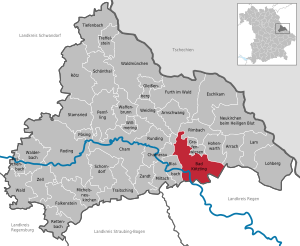
| Location of the city of Bad Kötzting in the Cham district | ||
  |
||


Bad Kötzting (until 2005 Kötzting ) is a city in the Upper Palatinate district of Cham in Eastern Bavaria and since December 2005, a nationally recognized Kneipp spa .
geography
location
The city is located at the northern foot of the Kaitersberg in the north of the Bavarian Bohemian Forest ( Bavarian Forest ). The black rain that is dammed up here to form the elongated Blaibacher See partially forms the western boundary of the municipality. Another important body of water is the White Rain , which runs through the municipality from the northeast over the core city to the union with the Black Rain and leaves the municipality as rain to the west.
City structure
There are 51 districts:
There are nine districts in the municipality : Arndorf, Bad Kötzting, Gehstorf, Haus, Liebenstein, Sackenried, Traidersdorf, Weißenregen and Wettzell.
history
Until the middle of the 20th century
Bad Kötzting was first mentioned in 1085 as "Chostingen". Different properties emerged from four original farms: 36 market fiefs , ten Sölden and twenty houses. Around 1260 Kötzting was granted the first market rights, which were confirmed in 1344 by Emperor Ludwig of Bavaria ; Full citizens (with brewing rights ) were only the users of the market loan. The rulership of the Rott monastery ended in 1614, and a few years later the market approved a priory for the monastery .
See also Burgstall Liebenstein
During the Thirty Years War , the Swedes under Georg Christoph von Taupadel - colonel in the Swedish army of Field Marshal Bernhard von Sachsen-Weimar - burned Kötzting completely down at the end of November 1633 because the population had refused to follow the instructions. There were renewed incursions by Swedish and imperial troops in 1635 and 1640. The magistrate consisted of an internal and an external council. The four inner councils provided the mayor of Kammerer every six months. The most important chamberlain of Kötzting was Samuel Luckner , 1715–1794, the brother of Count Nikolaus von Luckner . In 1805 the market became an independent parish . In 1867 the place was hit by another major fire.
Kötzting had been the seat of a nursing court of the Duchy of Bavaria since 1371 . The district court of Kötzting as a judicial and administrative authority was established in 1803. The municipality founded in 1818 with the Bavarian municipal edict was elevated to a city in 1953 . At the end of the Second World War , master blacksmith Wolfgang Stöger, together with other citizens, campaigned for the site to be handed over to the advancing US troops without a fight. Stöger was imprisoned in the district court prison and shortly afterwards murdered by SS men near Schönbuchen . A wayside shrine at the scene of the murder reminds of this incident.
Territorial reform of the 1970s
Kötzting was the district town of the Kötzting district , which belonged to Lower Bavaria . This was dissolved in the course of the district reform on July 1, 1972 and added to the district of Cham and thus the administrative district of Upper Palatinate . Kötzting has been recognized as a climatic health resort since 1986 and as a Kneipp health resort since 1995 . On October 1, 1971, the previously independent communities of Arndorf, Gehstorf, Haus, Traidersdorf and Weißenregen were incorporated. Liebenstein joined on October 1, 1977. On May 1, 1978 parts of the dissolved communities of Niederndorf and Wettzell followed.
21st century
On December 10, 2005, the city was recognized as a Kneipp spa and the name was changed in Bad Kötzting by decision of the district office .
Population development
Between 1988 and 2018 the city grew from 6,849 to 7,498 by 649 inhabitants or 9.5%.
politics
City council
Since the local elections on March 15, 2020, the city council has consisted of six parties and groups as before .

| Party / list | Share of votes | Seats | G / V |
| CSU | 21.0% | 4th | ± 0 |
| SPD Bavaria / Free Citizens | 13.2% | 2 | - 1 |
| Independent voter community Kötzting-Land | 13.9% | 3 | ± 0 |
| Free voters Bavaria - local group | 30.6% | 6th | + 3 |
| Free voter group Zellertal | 8.9% | 2 | ± 0 |
| Wettzeller list area | 5.9% | 1 | ± 0 |
G / V = difference to the previous term
mayor
Markus Hofmann (* 1975) has been the mayor since May 1, 2014. He was confirmed in office in 2020 with 82.5 percent of the vote.
coat of arms
The coat of arms is handed down in the seal, which has been documented since 1409. The description reads: In silver on green ground, a bushy green tree.
Town twinning
Bad Kötzting maintains connections with several municipalities in the EU as part of the Douzelage town partnership . (See navigation bar below)
Culture, customs and sights


Buildings
- The city parish church of the Assumption of the Virgin Mary forms the center of a fortification system with an outer curtain wall, moat and inner ring of fortifications. The church, mentioned in a papal document in 1179, was expanded in 1737/38, and the choir and tower rebuilt in 1766/69. The interior is Baroque with the high altar from 1771 and the pulpit from 1730. Of the original five ceiling frescoes on the Pentecost theme, only three ceiling frescoes have survived and were painted by the neo-baroque painter Josef Wittmann in 1930. The lively correspondence between the pastor at the time and the painter as well as other important personalities has been preserved and the original is archived in the parish. These Pentecost steps are according to Dr. Hermann Reidel from the Diözesanmuseum Regensburg the only frescoes north of the Alps on this subject.
From 1361 the castle was the official building of the regional and maintenance court and has served as a parsonage since 1805. - The neighboring St. Anna Chapel, formerly the cemetery chapel in the fortified church area, was rebuilt around 1686. The high altar dates from 1664 and contains a late Gothic Anna Selbdritt, the side altars were created in 1689. In the extension there is a Romanesque font and tombstones.
- The Church of St. Veit ("Veitskirche") was probably built at the latest when the Marktstrasse was built (before 1250), burned down when Sweden invaded in 1633, then poorly repaired. After the market fire in 1867, it was given a pointed tower instead of the dome. In front of the church is the octagonal Marienbrunnen, built in 1800. A larger-than-life Marian column was added in 1903.
Next to the church there is a small fountain, on the collecting basin of which the saying “Dear what is rare, drink what is clear, i.e. what is true” can be found. This saying can also be read in four lines in front of a fountain next to the Bogenberg pilgrimage church . "AD - 1987 - drinking water" is written below the tap. - The old town hall from the baroque period has a crooked roof with a two-storey dome tower. A carillon with 18 chimes and 2 chiming bells sounds daily at 11.00 a.m. , plus a play of figures with characters from the Kötztinger Whitsun kick and the Kötztinger customs.
- The New Town Hall was the vicarage and provost house of the Benedictines of Rott Monastery until 1803 , then the district court, district and district office; since 1972 it has been the town hall.
- The Benedictine fountain was created in 1993 by the sculptor J. Neustifter. It reminds of the centuries-old work of the Benedictines in the area around Bad Kötzting.

- The Pentecostal Fountain is a work by the sculptor J. Neustifter from 1985. The base of the fountain contains the names of the Pentecostal fighters who have participated fifty times or more. On the hollow granite body is a bronze sculpture with motifs from the story of Pentecost, with a mounted cross carrier at the end.
- The Baroque pilgrimage church of the Assumption of Mary is located in the Weißenregen district . It was built from 1750 to 1765 and contains an unusual ship's pulpit.
Museums
The Pentecost Museum in the fortified church, a late medieval fortification with cemetery, church and castle, shows the history of the Pentecost pilgrimage and the symbolic Pentecost wedding with historical objects.

Natural monuments
The old tungsten linden tree is in Ried . This summer linden ( Tilia platyphyllos ) is one of the strongest and oldest trees in Germany. It was named after the minstrel Wolfram von Eschenbach . Their age is estimated to be 850 years. It has a trunk circumference of 12.21 meters and a height of 13 meters.
Pentecost


The Whitsun Strike in Bad Kötzting is one of the largest mounted processional processions in the world and, according to tradition, goes back to a promise made in 1412. According to this, a man was dying in the village of Steinbühl, about seven kilometers from Kötzting, and asked for the sacred sacraments of the death . The pastor found himself unable to get there without protection. The Kötztinger boys escorted him at his request. After the happy return, everyone vowed to repeat the ride every year. So every year on Whit Monday, often up to 1000 riders go out through the Zellertal to Steinbühl , praying on their horses and in traditional Waidler costumes .
At eight o'clock in the morning, under the solemn ringing of the Whitsun bells, citizens and farmers leave the city, praying on festively decorated horses, renewing their ancient vows. The rider procession is led by the cross bearer. He is followed by lantern bearers, the fanfare players, clergy officer with sacristan and acolytes . Behind them the Pentecostal groom rides with the two brides. The official head of the procession is finally completed by the Pentecostal groom of the previous year, who carries the market flag, his bride grooms and the fraternity representative. This is followed by all other riders. Many of the riders carry the large commemorative flags that they received for their long participation in the rides. The officer preaches the gospel at four stations and blesses the hallways with the monstrance .
Finally, the equestrian service is celebrated in the Pentecostal pilgrimage church of St. Nikolaus in Steinbühl. After a break for horse and rider and their food, the equestrian procession starts back to Bad Kötzting at around 12 noon. The ecclesiastical part of the ride ends with the ceremony and the Eucharistic blessing, the presentation of the wreath of virtues, the award of long-standing Pentecostal fighters and the solemn “ Te Deum ”.
After Pentecost, another ceremony will take place on the square in front of the St. Vitus Church in the city center. The “Pentecostal bridegroom” is presented with the so-called virtue wreath by the accompanying cooperator . This is followed by a procession of boys through the old town and finally the actual Whitsun wedding , with the symbolic marriage of the “groom of virtue” with the “Pentecostal bride”.
Numerous events take place in Bad Kötzting throughout the Whitsun week, including:
- a folk festival with a traditional folk festival (festival host, floats, horses, music bands, clubs, etc.)
- Performances of the "Whitsun Game" at the Bad Kötztinger Rathausplatz,
- a traction test of the cold blood and Haflinger breed association Bayer. Forest,
- a torchlight procession by the boys 'hikers' association Bad Kötzting with illumination of the entire city
Festival
In the Bad Kötztinger Forest Festival , dialect versions of classics such as Goethe's Faust , Georg Büchner's Woyzeck , Shakespeare's drama Macbeth and others are performed.
Facilities

- German Clinic for Traditional Chinese Medicine , University Clinic since February 2010 due to a cooperation with Peking University
- Kneipp spa facilities
- Central Bavarian rehabilitation center
- “Klinikum Luitpold” for orthopedics and rheumatology
- Rehabilitation clinic specializing in neurology
- Education center with a college for elderly care
- Bavarian Casino Bad Kötzting ( casino )
- "AQACUR" bathing world Kötzting (indoor and outdoor wave pool ) with sauna world, sauna garden with nudist , bath café, brine pool, various health baths, wellness oasis, solariums. Sports pool 10 m × 25 m, wave pool 25 m × 12.5 m.
- Kurpark (12.6 ha)
- Geodetic Observatory Wettzell
education
- Kindergarten : "Holy Spirit" and "Queen of Angels"
- Special needs school : Bad Kötzting special needs education center
- Primary school : Bad Kötzting primary school
- Middle school : Karl-Peter-Obermaier-Middle School Bad Kötzting
- Realschule : State Realschule Bad Kötzting
- Grammar school : Benedikt-Stattler-Gymnasium Bad Kötzting
- Vocational school : Branch of the State Vocational School Cham and Vocational School for Elderly Care
- Music school : Cham district music school
- Adult Education Center : VHS Cham
Former Bundeswehr base
From November 24, 1965 to 2004 Bad Kötzting was a garrison of the Bundeswehr . In the High Arch barracks one was air force unit of the telecommunications regiment 72 stationed the reconnaissance storm on the high arc that Telecommunication Sector F operation.
media
- Kötztinger newspaper - regional edition of the newspaper group Straubinger Tagblatt / Landshuter Zeitung
- Kötztinger Umschau - regional edition of the Mittelbayerische Zeitung
traffic
Bad Kötzting is on the state roads St 2132 and St 2140 .
The Cham – Lam railway also crosses the city. The trains of the Upper Palatinate Railway stop at Bad Kötzting train station and at the Zellertal stop every two hours. At Bad Kötzting station, the section of the route maintained by DB Netz AG changes to that of the Regentalbahn . It has park-and-ride facilities and a bus station .
sons and daughters of the town

- Benedikt Stattler (1728–1797), Catholic theologian of the Enlightenment
- Joseph von Armansperg (1787–1853), Bavarian and Greek statesman
- Michael Heigl (1816–1857), robber
- Anton Schwarz (1858–1931), composer and music teacher
- August Henneberger (1873–1961), sculptor
- Eugen Hubrich (1885–1963), local poet and NSDAP party functionary
- Walther Fischer-Schlemm (1888–1958), university professor, rector of the University of Hohenheim
- Otto Schaffner (1913–1978), theologian
- Hermann Berger (1926–2005), Indologist and religious scholar
- Hartmut Riederer (* 1942), painter, writer and actor
- Helmut Brunner (* 1954), politician and Bavarian State Minister from 2008 to 2018
- Alfred Müller-Kranich (* 1955), composer and organist
- Ruth Toma (* 1956), screenwriter
- Gisela Dachs (* 1963), publicist and journalist, including ZEIT correspondent in Tel Aviv
- Johannes Reitmeier (* 1962), author, director and general manager
- Harald Schwartz (* 1969), politician (CSU, MdL)
- Matthias Aschenbrenner (* 1972), mathematician
- Thomas Dworzak (* 1972), photographer
- Josef Rabl (* 1949), grammar school teacher, holder of the Federal Cross of Merit
literature
- Harald Stark : The Notthracht family - looking for traces in Egerland, Bavaria and Swabia . Späthling, Weißenstadt 2006. ISBN 3-926621-46-X (to the district Grub)
- Timetable on de parish website
Web links
- Homepage
- Entry on the coat of arms of Bad Kötzting in the database of the House of Bavarian History
Individual evidence
- ↑ "Data 2" sheet, Statistical Report A1200C 202041 Population of the municipalities, districts and administrative districts 1st quarter 2020 (population based on the 2011 census) ( help ).
- ^ Municipality of Bad Kötzting: Mayor. Retrieved May 24, 2020 .
- ^ City of Bad Kötzting in the local database of the Bavarian State Library Online . Bavarian State Library
- ↑ Peter Engerisser: From Kronach to Nördlingen. The Thirty Years' War in Franconia Swabia and the Upper Palatinate 1631–1635 . Verlag Späthling Weißenstadt 2007, p. 210. ISBN 978-3-926621-56-6
- ^ Max Piendl: Historical Atlas of Bavaria. Volume: Altbayern Series I, Issue 5: The Kötzting Regional Court , Munich, 1953 ( digitized version )
- ↑ Memorial sites for the victims of National Socialism. A documentation, volume 1. Federal Agency for Civic Education, Bonn 1995, ISBN 3-89331-208-0 , p. 156
- ^ Wilhelm Volkert (ed.): Handbook of Bavarian offices, communities and courts 1799–1980 . CH Beck, Munich 1983, ISBN 3-406-09669-7 , p. 499 .
- ^ Federal Statistical Office (ed.): Historical municipality directory for the Federal Republic of Germany. Name, border and key number changes for municipalities, counties and administrative districts from May 27, 1970 to December 31, 1982 . W. Kohlhammer GmbH, Stuttgart / Mainz 1983, ISBN 3-17-003263-1 , p. 643 and 644 .
- ↑ StBA: Changes in the municipalities in Germany, see 2005
- ^ Bavarian State Office for Statistics
- ↑ Official final result, 03/18/2020 10:14:10 AM on bad-koetzting.de
- ↑ Mayoral election on the city website , accessed on August 3, 2020
- ↑ Douzelage ( Memento of the original from April 6, 2009 in the Internet Archive ) Info: The archive link was inserted automatically and has not yet been checked. Please check the original and archive link according to the instructions and then remove this notice.
- ^ Wolframslinde in the directory of monumental oaks . Retrieved January 31, 2017
- ↑ Bad Kötzting becomes "University City " ( page no longer available , search in web archives ) Info: The link was automatically marked as defective. Please check the link according to the instructions and then remove this notice. , January 25, 2010
- ↑ Special educational support center in the school database of the Bavarian State Ministry for Education and Culture , accessed on August 3, 2020.
- ↑ Bad Kötzting primary school in the school database of the Bavarian State Ministry for Education and Culture , accessed on August 3, 2020.
- ↑ Middle School Bad Kötzting in the school database of the Bavarian State Ministry for Education and Culture , accessed on August 3, 2020.
- ^ Realschule Bad Kötzting in the school database of the Bavarian State Ministry for Education and Culture , accessed on August 3, 2020.
- ^ Gymnasium Bad Kötzting in the school database of the Bavarian State Ministry for Education and Culture , accessed on August 3, 2020.
- ↑ Lots of insights into history
Ammermühle | Arndorf | Bachmaierholz | Bad Kötzting | Bärndorf | Beckendorf | Berghäusl | Bonried | Buchberg near Steinbühl | Buchberg near Wettzell | Dachsenbühl | Fischerhof | Gadsdorf | Gehstorf | Gradis | Grub | Hafenberg | House | House grinder | Kingdom of Heaven | Hofern | Höfing | Hofmannsgütl | Kaitersbach | Chambers | Kieslau | Klobighof | Lick | Liebenstein | Ludwigsberg | Maiberg | Matzelsdorf | Sneezing | Ramsried | Regenstein | Riding Mountain | Riding stone | Ried am Haidstein | Ried am See | Riedersfurt | Sackenried | Sperlhammer | Steinbühl | Stockmühle | Traidersdorf | Woad | Weißenholz | White rain | Wettzell | Wölkersdorf | Tent village

Arnschwang | Arrach | Bad Kötzting | Blaibach | Cham | Chamerau | Eschlkam | Falkenstein | Furth in the forest | Gleißenberg | Grafenwiesen | Hohenwarth | Lam | Lohberg | Michelsneukirchen | Miltach | Neukirchen near the Holy Blood | Pemfling | Pösing | Reichenbach | Rettenbach | Rimbach | Roding | Rötz | Rounding | Schönthal | Schorndorf | Stamsried | Tiefenbach | Traitsching | Treffelstein | Weapon Well | Forest | Walderbach | Waldmünchen | Weiding | Willmering | Zandt | Cell