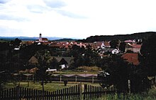
Stamsried
| coat of arms | Germany map | |
|---|---|---|

|
Coordinates: 49 ° 16 ' N , 12 ° 32' E |
|
| Basic data | ||
| State : | Bavaria | |
| Administrative region : | Upper Palatinate | |
| County : | Cham | |
| Management Community : | Stamsried | |
| Height : | 453 m above sea level NHN | |
| Area : | 43.43 km 2 | |
| Residents: | 2236 (Dec. 31, 2019) | |
| Population density : | 51 inhabitants per km 2 | |
| Postal code : | 93491 | |
| Area code : | 09466 | |
| License plate : | CHA, KÖZ, ROD , WÜM | |
| Community key : | 09 3 72 161 | |
| Market structure: | 43 districts | |
Market administration address : |
Schlossstrasse 10 93491 Stamsried, Germany |
|
| Website : | ||
| Mayor : | Herbert Bauer ( CSU ) | |
| Location of the Stamsried market in the Cham district | ||
Stamsried is a market in the Upper Palatinate district of Cham in Bavaria , the seat of the Stamsried administrative community and a state-approved resort.
geography
Stamsried is located in the Upper Bavarian Forest Nature Park .
Community structure
Stamsried has 43 districts:
There are the districts of Asbach, Diebersried, Dörfling, Friedersried, Großenzenried, Hitzelsberg, Kollenzendorf and Stamsried.
history
Until the church is planted
The Stamsried market belonged to the Amberg Rent Office and the Wetterfeld Regional Court of the Electorate of Bavaria . The Counts of Holnstein and the Barons of Trogler owned an open Hofmark here . Stamsried had market rights with important proprietary rights (e.g. neck jurisdiction) since at least 1524 . In the course of the administrative reforms in Bavaria , the municipality was created with the municipality edict of 1818 .
The ruins of Kürnberg Castle, built in 1346, are located on the Haidberg near Stamsried . Stamsried Castle is in the village itself .
Incorporations
On April 1, 1949, part of the dissolved Hilpersried community was incorporated. On July 1, 1971 Diebersried (with the rest of the Hilpersried community incorporated on April 1, 1949), Friedersried and Hitzelsberg were added. On July 1, 1972, Großenzenried followed from the dissolved district of Neunburg vorm Wald . Parts of the Hansenried ( Thanried ) area were added on May 1, 1978.
Population development
Between 1988 and 2018 the market grew from 1,981 to 2,234 by 253 inhabitants or by 12.8%.
- 1961: 1832 inhabitants
- 1970: 1858 inhabitants
- 1987: 1908 inhabitants
- 1991: 2061 inhabitants
- 1995: 2216 inhabitants
- 2000: 2304 inhabitants
- 2005: 2278 inhabitants
- 2010: 2141 inhabitants
- 2015: 2191 inhabitants
politics
City council and mayor
14 voluntary citizens sit on the municipal council. The municipal council elections on March 16, 2014 and March 15, 2020 had the following results:
| Seats 2020 | Share of votes 2020 | Seats 2014 | Share of votes in 2014 | |
|---|---|---|---|---|
| CSU | 8th | 59.2% | 10 | 67.9% |
| Free community of voters | 6th | 40.8% | 4th | 32.1% |
| total | 14th | 100.0% | 14th | 100.0% |
The turnout was 66.3% (2020) and 62.7% (2014), respectively.
Herbert Bauer (CSU) has been mayor since May 1, 2008; he was elected for a further six years on March 15, 2020 with 62.6% of the valid votes.
coat of arms
The description reads: In red under a silver zigzag bar a golden flax break. The coat of arms has been known since the 17th century.
Community partnerships
Architectural monuments
Economy and Infrastructure
Economy including agriculture and forestry
In 2017, the municipal tax revenue amounted to 1,343,000 euros, of which 223,000 euros (net) were trade tax receipts and 874,000 euros were the municipality's share of income tax.
In 2017 there were 240 jobs subject to social security contributions in the municipality. Of the resident population, 997 people were in an employment relationship subject to compulsory insurance. This means that the number of out-commuters was 757 greater than that of in-commuters. 29 residents were unemployed. In 2016 there were 74 farms; 2,643 hectares of the community area were used for agriculture.
education
There are the following facilities in Stamsried:
- Theresia-Gerhardinger- Kindergarten with 68 places, which was fully occupied on March 1, 2018 and
- Wolfgang-Spießl-Grundschule Stamsried-Pösing with ten teachers and 126 students
Natural pool
Fully biological natural pool and geomantic nature trail in the middle of a baroque park.
Personalities
- Karl von Abel (1788-1859), Bavarian politician and landowner in Stamsried
- Wolfgang Spießl (1938–1998), Mayor and member of the Bavarian Senate
literature
- Albert Ehrhardt: Chronicle of the market Stamsried . Vögel-Verlag, Stamsried 2006, ISBN 3-89650-234-4
- Thomas Ries: Brief history of the parish Stamsried O. Pf. , Kaufbeuren 1906
Individual evidence
- ↑ "Data 2" sheet, Statistical Report A1200C 202041 Population of the municipalities, districts and administrative districts 1st quarter 2020 (population based on the 2011 census) ( help ).
- ↑ http://www.bayerische-landesbibliothek-online.de/orte/ortssuche_action.html ? Anzeige=voll&modus=automat&tempus=+20111204/193344&attr=OBJ&val= 932
- ^ Wilhelm Volkert (ed.): Handbook of Bavarian offices, communities and courts 1799–1980 . CH Beck, Munich 1983, ISBN 3-406-09669-7 , p. 560 .
- ^ Federal Statistical Office (ed.): Historical municipality directory for the Federal Republic of Germany. Name, border and key number changes in municipalities, counties and administrative districts from May 27, 1970 to December 31, 1982 . W. Kohlhammer GmbH, Stuttgart / Mainz 1983, ISBN 3-17-003263-1 , p. 645 .
- ↑ 2020 municipal council election , accessed on August 21, 2020
- ↑ Wolfgang-Spießl-Grundschule Stamsried-Pösing in the school database of the Bavarian State Ministry for Education and Culture , accessed on August 21, 2020.
Web links
- Entry on the Stamsried coat of arms in the database of the House of Bavarian History


