
Miltach
| coat of arms | Germany map | |
|---|---|---|

|
Coordinates: 49 ° 9 ' N , 12 ° 46' E |
|
| Basic data | ||
| State : | Bavaria | |
| Administrative region : | Upper Palatinate | |
| County : | Cham | |
| Height : | 382 m above sea level NHN | |
| Area : | 25.25 km 2 | |
| Residents: | 2309 (Dec. 31, 2019) | |
| Population density : | 91 inhabitants per km 2 | |
| Postal code : | 93468 | |
| Area code : | 09944 | |
| License plate : | CHA, KÖZ, ROD , WÜM | |
| Community key : | 09 3 72 143 | |
| LOCODE : | DE MIA | |
| Community structure: | 26 districts | |
| Address of the municipal administration: |
Kötztinger Str. 3 93468 Miltach |
|
| Website : | ||
| Mayor : | Johann Aumeier ( Free Voting Association Altrandsberg ) | |
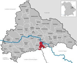
| Location of the community of Miltach in the district of Cham | ||
  |
||

Miltach is a municipality in the Upper Palatinate district of Cham .
geography
Geographical location
Miltach is located in the Bavarian Forest in the area of the rain depression .
The mountainous area offers interesting hiking routes and is not far from the ski area of the Großer Arber . The two rivers, the Regen and the Perlbach, which flow together in Miltach, are also characteristic of the community.
Community structure
Miltach has 26 districts
There are the districts Allmannsdorf , Altrandsberg, Eismannsberg , Kreuzbach , Miltach and Oberndorf. Parishes in italics are shared with neighboring parishes.
history

Until the church is planted
Miltaha was first mentioned in 1070. Around the year 1100 it belonged to the Counts of Bogen and in the late 12th century to the Margraves of Cham . In 1307 Miltach was pledged to Konrad von Chamerau , in 1321 it owned the saddle bows .

In 1463 Miltach was regal again. During the Löwler war the place was plundered by the rebels in 1492, as well as in September 1504 during the Landshut War of Succession by the Bohemian-Palatinate war people. Miltach Castle was probably built around 1600 under Justinian von Peilnstein.
In 1650 the Neukirchner nurse Johann Wilhelm von Leiblfing acquired the castle and the Hofmark Miltach. In 1679 the Schönprunners were first mentioned as the owners of Miltach Castle.
From then on Miltach belonged to the Barons von Schönprunn. The place was part of the Electorate of Bavaria and formed a closed Hofmark. Altrandsberg, which belongs to the municipality of Miltach, also formed a closed Hofmark (Barons von Leoprechting ). In the course of the administrative reforms in Bavaria , today's municipality was created with the municipal edict of 1818 .
19th and 20th centuries
In 1820 the Schönprunn family was allowed to set up a second class patrimonial court for Miltach. Until the abolition of patrimonial jurisdiction in 1849, the Schönprunners remained the lords of the royal court in Miltach.
The owners of the castle have changed several times since then. From 1871 to 1875 it belonged to the writer Maximilian Schmidt . It has been owned by the Schleyerbach family since 1979 and is used for exhibitions and music events, among other things.
Incorporations
- On February 1, 1963, the Allmannsdorf community was dissolved. As a result, the districts of Allmannsdorf and Obergschaidt were incorporated into the municipality of Eismannsberg, the districts of Untergschaidt and Wimbach came to the municipality of Kreuzbach.
- On January 1, 1972, the communities of Altrandsberg, Oberndorf and the divided community of Kreuzbach became the districts of Anzenberg, Höhenried and Dietersdorf, but not the eponymous district of Kreuzberg and the districts of Untergschaidt and Wimbach, which were only incorporated in 1963 (these three places were simultaneously part of the community of Blaibach reclassified) incorporated into the community of Miltach.
- On May 1, 1978, the community Eismannsberg with the districts Eismannsberg, Allmannsdorf and Obergschaidt was incorporated into Miltach.
Population development
Between 1988 and 2018 the municipality grew from 2,226 to 2,267 by 41 inhabitants or by 1.8%.
- 1961: 1832 inhabitants
- 1970: 1885 inhabitants
- 1987: 2211 inhabitants
- 1991: 2296 inhabitants
- 1995: 2305 inhabitants
- 2000: 2351 inhabitants
- 2005: 2372 inhabitants
- 2010: 2308 inhabitants
- 2015: 2295 inhabitants
politics
Municipal council
14 voluntary citizens sit on the municipal council. The municipal council elections on March 16, 2014 and March 15, 2020 had the following results:
| Political party | Share 2014 | Seats 2014 | Share 2020 | Seats 2020 |
| CSU / Free Voting Community | 26.1% | 4th | 22.8% | 3 |
| Free voter community Altrandsberg | 27.0% | 4th | 35.1% | 5 |
| Independent voter community | 18.3% | 2 | 16.3% | 2 |
| Christian voter community | 13.2% | 2 | 11.2% | 2 |
| Voting Community Oberndorf | 15.3% | 2 | 14.5% | 2 |
| total | 100.0% | 14th | 100.0% | 14th |
In 2014, the turnout was 68.9%, in 2020 it was 75.4%.
mayor
Mayor has been Johann Aumeier (Free Voting Association Altrandsberg) since May 1, 2008; he was confirmed in office for another six years with a competitor on March 15, 2020 with 79.4% of the valid votes.
coat of arms
The description of the municipal coat of arms introduced in 1982 reads: Split of silver and blue; Above a lowered wavy bar in confused colors in front a black label, inside a growing golden well, behind a label divided by a right step of silver and black. The coat of arms has been in use since 1982.
Town twinning
For several years the community has had a partner town, Rathewalde (a district of Hohnstein ), with which it maintains good contacts.
Culture and sights
The parish church of St. Martin has Romanesque tower basements and a late Gothic choir . The nave was expanded in 1975. Most of the furnishings date from the second half of the 18th century. Remains of late Gothic frescoes have been preserved in the choir, as well as a colored carved relief from around 1480 depicting the death of Mary and a late Gothic figure of St. Barbara.

The cemetery chapel on the cemetery, which is partially enclosed by medieval walls, was rebuilt around 1720. On the road to Kötzting is the small Maria-Hilfkapelle from 1780.
Miltach Castle was built around 1600 on the basis of a previous building from the 12th century. The four-wing Altrandsberg Castle also dates back to the 12th century and was built in its current form in the 16th and 17th centuries. The two castles in Miltach and Altrandsberg are in excellent condition after renovations. In addition to the exhibitions, there are regular cultural events that are very popular.

The community of Miltach is also known for the Martiniritt in November, which has so far been held more than 180 times and in which over 200 riders with festively decorated horses take part.
Soil monuments
See: List of ground monuments in Miltach
particularities
The clubs offer numerous sports and leisure opportunities. FC Miltach with over 1,000 members is one both in football ( Bezirksliga Oberpfalz South ) and in table tennis (1st District League) and many other sectors for sporting elite in the district of Cham.
Economy and Infrastructure
Economy including agriculture and forestry
Some representatives of the local economy and service providers are important far beyond the local borders, such as B. the foam waffle factory Beier, the wooden toy factory Nemmer, a foundry, the senior care Grassl-Stoiber or a veterinary clinic.
In 2017 there were 847 jobs subject to social security contributions in the municipality. Of the resident population, 952 people were in employment subject to compulsory insurance. The number of out-commuters was 105 more than that of in-commuters. 23 residents were unemployed. In 2016 there were 40 farms; 961 hectares of the community area were used for agriculture.
traffic
Miltach is on the B 85 between the towns of Cham and Viechtach .
Today's single-track Miltach stop is located on the Cham – Lam railway line , a 19-minute drive from Cham. The Oberpfalzbahn trains serve this every two hours.
In earlier years the station had six tracks and was unofficially nicknamed "Bavaria's largest branch station" until the 1980s. This is where the Straubing – Miltach railway ended until 1995. This made the community a hub in the railway traffic of the Bavarian Forest . This railway line was dismantled by 1997 and converted into a cycle path between Miltach and Bogen.
Public facilities
education
There are the following facilities:
- two day-care centers with a total of 87 approved places and 84 children (as of March 1, 2018) and
- a primary school with nine teachers and 188 students (as of the 2018/19 school year).
Other infrastructure
As a small center, Miltach has other facilities:
Multipurpose hall, sports facilities (football, tennis courts), pharmacy, doctor, dentist, veterinarian (and veterinary clinic), care for the elderly, psychotherapeutic practice, as well as bus and train connections to the nearest cities.
Individual evidence
- ↑ "Data 2" sheet, Statistical Report A1200C 202041 Population of the municipalities, districts and administrative districts 1st quarter 2020 (population based on the 2011 census) ( help ).
- ^ Miltach community in the local database of the Bavarian State Library Online . Bavarian State Library, accessed on August 1, 2020.
- ↑ a b Wilhelm Volkert (Ed.): Handbook of the Bavarian offices, communities and courts 1799–1980 . CH Beck, Munich 1983, ISBN 3-406-09669-7 , p. 499 .
- ^ Federal Statistical Office (ed.): Historical municipality directory for the Federal Republic of Germany. Name, border and key number changes in municipalities, counties and administrative districts from May 27, 1970 to December 31, 1982 . W. Kohlhammer GmbH, Stuttgart / Mainz 1983, ISBN 3-17-003263-1 , p. 644 .
- ↑ 2020 municipal council election , accessed on August 16, 2020
- ↑ Mayoral election 2020 , accessed on August 16, 2020
- ^ Miltach elementary school in the school database of the Bavarian State Ministry for Education and Culture , accessed on August 16, 2020.
Web links
- Altrandsberg Castle at www.notthracht.de
- Miltach Castle
- Entry on the Miltach coat of arms in the database of the House of Bavarian History

Arnschwang | Arrach | Bad Kötzting | Blaibach | Cham | Chamerau | Eschlkam | Falkenstein | Furth in the forest | Gleißenberg | Grafenwiesen | Hohenwarth | Lam | Lohberg | Michelsneukirchen | Miltach | Neukirchen near the Holy Blood | Pemfling | Pösing | Reichenbach | Rettenbach | Rimbach | Roding | Rötz | Rounding | Schönthal | Schorndorf | Stamsried | Tiefenbach | Traitsching | Treffelstein | Weapon Well | Forest | Walderbach | Waldmünchen | Weiding | Willmering | Zandt | Cell