Gleißenberg
| coat of arms | Germany map | |
|---|---|---|

|
Coordinates: 49 ° 19 ' N , 12 ° 44' E |
|
| Basic data | ||
| State : | Bavaria | |
| Administrative region : | Upper Palatinate | |
| County : | Cham | |
| Management Community : | Weiding | |
| Height : | 419 m above sea level NHN | |
| Area : | 15.4 km 2 | |
| Residents: | 904 (Dec. 31, 2019) | |
| Population density : | 59 inhabitants per km 2 | |
| Postal code : | 93477 | |
| Area code : | 09975 | |
| License plate : | CHA, KÖZ, ROD , WÜM | |
| Community key : | 09 3 72 128 | |
| Community structure: | 4 districts | |
| Address of the municipal administration: |
Main street 4 93477 Gleißenberg |
|
| Website : | ||
| Mayor : | Wolfgang Daschner ( Free Association of Voters "Bavarian Meran" ) | |
| Location of the community of Gleißenberg in the district of Cham | ||
Gleißenberg is a municipality in the Upper Palatinate district of Cham .
geography
The community lies between the towns of Waldmünchen and Furth im Wald .
Community structure
Gleißenberg has four districts (the type of settlement in brackets):
- Gleißenberg ( parish village )
- Berghof ( wasteland )
- Hofmühle ( hamlet )
- Ried near Gleißenberg (village)
There is only the Gleißenberg district .
history
Until the church is planted
Gleißenberg and the Waldmünchen area had belonged to the Schwarzenburg-Rötz-Waldmünchen lordship since the 14th century, which was subject to changing pawnbrokers and was sold to the Palatinate in 1509. In 1434, during one of the last Hussite attacks, the place was burned down and completely destroyed. In 1777 Gleißenberg came to the Amberg Rent Office and the Waldmünchen district court of the Electorate of Bavaria . In the course of the administrative reforms in Bavaria , today's municipality was created with the municipal edict of 1818 .
Incorporations
In 1946, Ried bei Gleißenberg was incorporated into the municipality of Gleißenberg.
Population development
In 2015, Gleißenberg was the municipality with the lowest number of inhabitants in the Cham district.
- 1961: 666 inhabitants
- 1970: 676 inhabitants
- 1987: 834 inhabitants
- 1991: 886 inhabitants
- 1995: 983 inhabitants
- 2000: 1011 inhabitants
- 2005: 961 inhabitants
- 2010: 891 inhabitants
- 2015: 905 inhabitants
Between 1988 and 2018 the municipality grew from 837 to 913 by 76 inhabitants or 9.1%.
politics
The community is a member of the administrative community Weiding .
mayor
The first mayor from June 1994 was Josef Christl (Gleißenberg citizens' block).
In the local elections in Bavaria on March 15, 2020, Wolfgang Daschner ( Free Voters' Group “Bavarian Merano”) was elected as the new First Mayor from May 1, 2020.
Municipal council
In the local elections on March 15, 2020, 8 municipal council seats were awarded.
| Political party | Abbreviation | percent | Seats |
|---|---|---|---|
| Citizens' block Gleißenberg-Ried | BGR | 28.48% | 2 |
| Free voter group "Bavarian Meran" | FWBM | 50.37% | 4th |
| Christian Free Voting Community | CFW | 21.14% | 2 |
Town twinning
A partnership with the Czech municipality of Trhanov has existed since July 2010 .
coat of arms
|
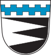
Blazon : "Under a silver shield head, inside a blue alternating battlement bar, split from silver and black by two right points."
Wappen has been in use since 1983. |
|
Architectural monuments
Economy and Infrastructure
Economy including agriculture and forestry
There are only a few jobs subject to social security contributions in the municipality; In 2017, 359 people from the resident population commuted to an external job.
education
There is a kindergarten with 25 places; According to the statistics from March 1, 2018, 20 children visited the facility. There is also a school camp in the Ried district.
Web links
Individual evidence
- ↑ "Data 2" sheet, Statistical Report A1200C 202041 Population of the municipalities, districts and administrative districts 1st quarter 2020 (population based on the 2011 census) ( help ).
- ^ Community of Gleißenberg in the local database of the Bavarian State Library Online . Bavarian State Library, accessed on August 15, 2020.
- ↑ a b Local election 2020 - Gleißenberg municipality. Retrieved March 18, 2020 .
- ↑ Municipal Council. Gleißenberg municipality, accessed on August 1, 2020 .
- ↑ 30 May 2017 11:20 am: The Gleißenberg fire brigade maintains a partnership with its Czech friends in Thranov. Retrieved April 22, 2020 .
- ↑ Entry on the coat of arms of Gleißenberg in the database of the House of Bavarian History


