
Deggendorf district
| coat of arms | Germany map |
|---|---|

|

Coordinates: 48 ° 47 ' N , 13 ° 0' E |
| Basic data | |
| State : | Bavaria |
| Administrative region : | Lower Bavaria |
| Administrative headquarters : | Deggendorf |
| Area : | 861.3 km 2 |
| Residents: | 119,478 (Dec. 31, 2019) |
| Population density : | 139 inhabitants per km 2 |
| License plate : | DEG |
| Circle key : | 09 2 71 |
| NUTS : | DE224 |
| Circle structure: | 26 municipalities |
| Address of the district administration: |
Herrenstrasse 18 94469 Deggendorf |
| Website : | |
| District Administrator : | Christian Bernreiter ( CSU ) |
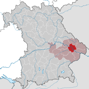
| Location of the Deggendorf district in Bavaria | |
  |
|
The district of Deggendorf is located in the middle of the Bavarian administrative district of Lower Bavaria . With 119,204 inhabitants, it is one of the medium-sized districts in Bavaria. Geographically, the district of Deggendorf is divided into two parts by the Danube : one half is shaped by the foothills of the Bavarian Forest , the other half by the fertile plains of the Gäuboden . In addition, the Isar flows into the Danube in the Deggendorf district . Due to its location in the Bavarian Forest and in the Bavarian Golf and Thermenland, the district is a popular tourist region.
geography
location
The Deggendorf district is part of the Bavarian Forest in the north and east . In the middle, the Danube runs through the district from northwest to southeast. To the southwest of Deggendorf, the Isar flows into the Danube when coming from the southwest. A meadow landscape has been preserved around the estuary, to which the Gäuboden , one of Bavaria's granaries , connects to the south of the Isar .
The highest mountain in the Deggendorf district is the Einödriegel in the Grafling community (1120 m), the lowest point is in the Lenau district of Künzing at 303 m above sea level. NN
Neighboring areas
The district borders clockwise to the north, beginning with the districts of Regen , Freyung-Grafenau , Passau , Rottal-Inn , Dingolfing-Landau and Straubing-Bogen .
climate
Due to its location in Central Europe, the district of Deggendorf is in the cool, temperate climate zone in the transition area between the humid Atlantic and the dry continental climate .
The following graphic shows the climate values of the district (the altitude of the Bavarian Forest can have lower temperature values):
|
Average temperature and precipitation values
Source: MSN Weather - Deggendorf, DEU
|
||||||||||||||||||||||||||||||||||||||||||||||||||||||||||||||||||||||||||||||||||||||||||||||||||||||||||||||||||||||||||||||||||||||||||||||||||||||
history
Regional courts
The Deggendorf district is one of the old Bavarian regions. In 1803 the regional courts Deggendorf and Vilshofen were established here, which from 1808 belonged to the Lower Danube District (capital Passau) and from 1838 to Lower Bavaria (capital Landshut). In 1838 the new Hengersberg district court was established for some communities in the Deggendorf district and the new Osterhofen district court for the western communities in the Vilshofen district .
District Offices
The District Office Deggendorf was formed in 1862 through the merger of the regional courts of the older order Deggendorf and Hengersberg. The regional courts of Osterhofen and Vilshofen were also merged to form the Vilshofen district office.
On October 1, 1879, the city of Deggendorf left the Deggendorf district and became a city immediately within the district .
On April 1, 1928, the Deggendorf district office was expanded to include the Oberaign municipality of the Grafenau district office.
On March 31, 1935, the community of Schaching was incorporated into the city of Deggendorf.
district
On January 1, 1939, as everywhere in the German Reich, the designation district was introduced. So the district office became the district of Deggendorf.
On April 1, 1940, the town of Deggendorf was incorporated into the Deggendorf district, but this was reversed on April 1, 1948.
In 1946 the district gave the municipality of Allhartsmais to the Grafenau district. Allhartsmais was incorporated into Schöfweg .
In the course of the regional reform , the district of Deggendorf was enlarged on July 1, 1972. New arrivals to the county
- the city of Deggendorf, the status of a district after losing the freedom district town received
- the municipality of Bernried from the dissolved district of Bogen
- the municipality of Lailling from the dissolved Landau an der Isar and
- the western part of the dissolved Vilshofen district with the city of Osterhofen and the communities of Aholming , Aicha an der Donau , Altenmarkt , Anning , Buchhofen , Forsthart , Galgweis , Gergweis , Göttersdorf , Kirchdorf bei Osterhofen , Künzing , Langenamming , Langenisarhofen , Moos , Neusling , Neutiefenweg , Niedermünchsdorf , Niederpöring , Oberpöring , Ottmaring , Ramsdorf , Wallerfing and Wisselsing .
With this, the district of Deggendorf reached its present size.
Municipalities in the Altlandkreis Deggendorf
|
|
politics
District administrators
Christian Bernreiter (CSU) has been the district administrator of the Deggendorf district since May 1, 2002 . He was last re-elected on March 15, 2020 with 69.49% of the vote. The district administrator's deputies are Roman Fischer (CSU, elected deputy of the district administrator), Josef Färber (FW) and Eugen Gegenfurtner (SPD).
The previous state councils since 1945:
- April 1945 – May 1945: Anton Reus
- May 1945 – May 1946: Erich Chrambach
- May 1946 – April 1948: Alois Weinzierl
- May 1948 – February 1963: Ludwig Heigl (CSU)
- February 1963 – May 1972: Josef Krug
- June 1972-30. April 1978: Walter Fritsch (SPD)
- May 1, 1978-30. April 2002: Georg Karl (CSU)
- since May 1, 2002: Christian Bernreiter (CSU)
District council
The district council has 60 seats. After the local elections on March 15, 2020, the Deggendorf district council will have nine parties or voter communities.
| CSU | FW | SPD | GREEN | AfD | Boy list | BP | ödp | FDP | REP | total | |
| 2020 | 25th | 12 | 6th | 5 | 5 | 3 | 2 | 1 | 1 | - | 60 |
| 2014 | 28 | 11 | 10 | 3 | - | 4th | - | 2 | 1 | 1 | 60 |
| 2008 | 26th | 11 | 11 | 3 | - | 4th | - | 2 | 1 | 2 | 60 |
| 2002 | 28 | 13 | 12 | 2 | - | 4th | - | - | - | 1 | 60 |
coat of arms
 |
Blazon : "In gold a lowered blue wavy bar, above a red armed black double-headed eagle, below a green three-mountain." |
District partnerships
Since June 20, 2001 there has been a partnership with the Czech Okres Plzeň-sever (Pilsen-North district).
population
As of June 30, 2019, the Deggendorf district had 119,204 inhabitants. This makes it one of the medium-sized counties in terms of population. In Lower Bavaria it ranks 5th and in Bavaria 40th. The population density of 138 inhabitants per square kilometer is below the Bavarian average. The average age of the district population was 44.2 years in 2018. For every 1,000 inhabitants there are 8.5 births and 11.3 deaths per year. In 2011, 76.3% of the population of the district were Roman Catholic, 9.2% Evangelical Lutheran, the proportion of foreigners made up around 4%.
Population development
From 1988 to 2008 the district of Deggendorf grew by over 15,000 inhabitants or around 15%. After the population was temporarily down, positive growth can now be seen again. The relative population development between 2011 and 2018 was 4%, triggered primarily by positive net migration, especially among those aged 18 to 24 (educational migration ). The following figures refer to the territorial status on May 25, 1987.
| Population development | ||||||||||||||
|---|---|---|---|---|---|---|---|---|---|---|---|---|---|---|
| year | 1840 | 1900 | 1939 | 1950 | 1961 | 1970 | 1987 | 1991 | 1995 | 2000 | 2005 | 2010 | 2015 | 2019 |
| Residents | 47.121 | 61,597 | 74,833 | 100.040 | 89,226 | 95,827 | 101,436 | 108.037 | 112,538 | 115,532 | 117,492 | 117.005 | 116,596 | 119.204 |
A project by the Lower Bavarian district administrators (“Aufbruch Jetzt! Niederbayern”) with the aim of counteracting demographic change and negative net migration and increasing the attractiveness of the Lower Bavarian administrative district as a business location and for skilled workers is noticeable here . The initiative was started in 2011 under the direction of the Deggendorf District Administrator Christian Bernreiter. In 8 working groups under the leadership of the district administrators and lord mayors, more than 200 people dealt with the effects of demographic change on Lower Bavaria. They developed starting points and specific projects in order to cushion its effects as well as possible or to use them where possible. In the individual working groups, both approaches and demands (to the state government) for a successful future in Lower Bavaria arose.
Economy and Infrastructure
In the Future Atlas 2016 , the Deggendorf district was ranked 127th out of 402 districts, municipal associations and independent cities in Germany, making it one of the regions with “future opportunities”.
The gross domestic product in the Deggendorf district in 2017 was EUR 4,227 million. The purchasing power in 2019 was 96.1 and thus slightly below the German average (index = 100). The per capita disposable income was EUR 22,645 (Lower Bavaria: EUR 23,106, Bavaria: EUR 24,963; as of 2017).
The unemployment rate averaged 2.7% in 2018. In 2018, 50,836 employees were employed in the district subject to social security contributions, which corresponds to an employment rate of 62.1% of the working-age population. The largest share of employment with 58.4% is in the tertiary sector , which with EUR 2,498 million also contributes the largest share of gross value added in the district (as of 2017).
The following table shows the distribution of employees subject to social security contributions by industry:
| Industry | Employees subject to social security contributions (30.9.2018) | Share of the economic sector in total employment in% |
|---|---|---|
| Manufacturing | 12,869 | 25.3 |
| construction industry | 6,964 | 13.7 |
| trade | 7,601 | 15.0 |
| Hospitality | 1,153 | 2.3 |
| Transport & storage | 1,656 | 3.3 |
| other service providers | 19,337 | 38.0 |
In Lower Bavaria, in addition to the independent cities and the district of Dingolfing-Landau, only the district of Deggendorf has a surplus of commuters . This means that more employees come to work in the district than there are district residents who are employed outside the district. The dynamic economic development of the region is particularly evident in the number of employees: between 2008 and 2018 this increased by 21.9% in the Deggendorf district.
Regional management and business development
In order to actively shape the economic development, the Deggendorf district introduced various support measures at an early stage. As early as 1932, a separate “ economic development ” department was introduced at the district office . Since then, this has served as the central point of contact for companies, government and residents of the district. In addition, the business development agency acts as an intermediary between business and administration - both in relation to the district office and to government and ministries. Economic development in the Deggendorf district has been supplemented by the first regional management funded throughout Bavaria since 2007 . Created by an initiative of the Deggendorf-Plattling subarea, the regional management in the Deggendorf district is primarily oriented towards the economic issues in the region. At the beginning, the focus of the work was in particular on initiating cooperation between regional companies and the TH Deggendorf . With the introduction of a knowledge and technology transfer center at the TH Deggendorf, the focus was on dampening the effects of demographic change on companies in the region. “Securing skilled workers” has been an important focus of the work since then.
Companies
Deggendorf is the only district in Lower Bavaria that has 6 industrial companies with more than 500 employees. The production and processing of metal, vehicle construction and mechanical engineering are the largest branches of industry in the Deggendorf district. There is also the wood industry and the production of paper and cardboard. The trend from a formerly agricultural region towards a service-oriented economy is positive.
Important companies with headquarters or (production) locations in the Deggendorf district include:
|
In addition to many national awards, some companies are already able to call themselves "TOP companies in Lower Bavaria". They are recognized for their entrepreneurial achievements and their commitment. These include, for example, congatec AG, Edscha, the Karl corporate group, Kermi and RILE.
Public facilities
The following public institutions and authorities are located in the Deggendorf district:
- Office for Food, Agriculture and Forests Deggendorf
- Employment Agency
- Tax office
- Federal Police Department
- District Court
- Chamber of the Labor Court of Passau
- district Court
- Service point of the building authority Passau
- Motorway Directorate South Bavaria
- Water Management Office
- Branch office of the Office for Digitization
- Branch office of the Federal Office for Migration and Refugees
- Customs office
- Water police group
education
The Deggendorf district offers a continuous educational landscape from day care centers to universities. In addition, the district provides a variety of opportunities in the field of vocational education and training. In 2013, the Deggendorf district was recognized as an “educational region” in the quality competition “Educational Region in Bavaria” organized by the Bavarian State Ministry for Education and Culture, Science and Art.
Technical college
The Deggendorf University of Technology was founded in 1994. Today the university has eight faculties :
- Civil engineering and environmental technology
- Applied economics
- Electrical engineering and media technology
- Mechanical engineering and mechatronics
- Applied natural sciences and industrial engineering
- Applied Health Sciences
- Applied computer science
- European Campus Rottal-Inn
At the beginning of the 2019/2020 winter semester, 7,158 students from over 100 nations were enrolled at the university, who are supervised by around 150 professors. In addition to the location in Deggendorf, the university operates another study location in Pfarrkirchen (European Campus) as well as eleven research and technology campuses. There are partnerships with over 190 universities in 58 countries.
The TH Deggendorf led to the development of an active start-up scene in the district. This is why the Innovation and Technology Campus (ITC) was founded in 2000 on the initiative of Prof. Reinhard Höpfl in cooperation with the district, the city and the Sparkasse Deggendorf. Since ITC GmbH was founded, more than 1,000 jobs have been created in the Deggendorf region. Around 400 people currently work in over 30 companies on campus. Since January 1, 2017, ITC1 has also been the start-up center for digitization in Lower Bavaria.
In order to strengthen the transfer of knowledge and technology from the university to the economy, the transfer office WTT has also been developed at the Deggendorf Technical University. The WTT transfer office is a central point of contact for companies and research institutions that are interested in working with the THD and the Technologie Campus or are looking for research project partners or research services. Among other things, it is used to process and prepare external inquiries to the THD in order to identify suitable professors and to implement forms of cooperation with internal and external partners.
Schools in the county
High schools
The district of Deggendorf can be described as a center of higher education, which is evident from the existence of a technical university and four grammar schools . What is striking is the high level of commitment on the part of church organizations in the field of education.
- Comenius-Gymnasium Deggendorf (state): The school was founded in 1900 as a secondary school, and in 1965 it was renamed "Gymnasium Deggendorf". In 1971 it was named "Comenius-Gymnasium Deggendorf". The Comenius-Gymnasium is a scientific, technological and linguistic high school with boarding school and a remedial class for particularly talented pupils.
- Robert Koch Gymnasium Deggendorf (state): The Robert Koch Gymnasium was founded in 1970. It is a science and technology as well as an economics and social science high school.
- St. Gotthard Gymnasium Niederalteich ( sponsored by : Kloster Niederaltaich ): The St. Gotthard Gymnasium is a state-recognized gymnasium in independent church sponsorship. It has an artistic, a linguistic and a scientific-technological branch and has been a recognized all-day school since 2004.
- St. Michaels Gymnasium Metten (sponsor: Kloster Metten ): The St. Michaels Gymnasium Metten is a state-recognized high school. The school sponsor is the Metten Monastery. It is a humanistic, modern language and natural science high school.
Realschulen
- Conrad-Graf-Preysing-Realschule Plattling
- Landgraf-Leuchtenberg secondary school in Osterhofen
- Realschule Deggendorf of the Maria Ward School Foundation
- State Schöllnach secondary school
Business school
- State business school, Deggendorf
Vocational schools
- Vocational training and technology center of the Chamber of Crafts Ndb./Opf. Deggendorf
- Vocational school for IT professions Plattling
- Vocational school for nursing at the Deggendorf Clinic
- Vocational school for music in the Deggendorf district in Plattling
- Vocational school for physiotherapy in the Deggendorf district
- BRK vocational school for geriatric care and geriatric care assistance, Plattling
- State Recognized private vocational school St. Erhard for special educational support in Plattling
- State Vocational School I Deggendorf (commercial-technical)
- State Vocational School II Deggendorf (commercial)
- Agricultural school
- State recognized vocational school for foreign language professions
County schools
- Vocational school for IT professions, Plattling
- Vocational school for nursing at the clinic, Deggendorf
- Vocational school for music , Plattling
- Vocational school for physiotherapy at the clinic, Deggendorf
- Specialized Academy for Social Education, Deggenau
Technical college / vocational school
- Aloys-Fischer-Schule Deggendorf (state technical college and vocational college)
Special schools
- Learning with fun Deggendorf
- Pestalozzi School Deggendorf
- Special educational support center Osterhofen
- Special educational support center Schöllnach
- St. Notker School Deggendorf
Elementary and middle schools
There are 35 primary and secondary schools in the Deggendorf district:
|
|
traffic
With the motorway junction of the A3 and A92 motorways, the ICE stop in Plattling and the location along the Danube, the Deggendorf district has good transport links and acts as a central transport hub in Lower Bavaria.
Road traffic
The A3 (Nuremberg - Passau) and the A92 (Munich - Deggendorf) run through the Deggendorf district . The A3 and A92 intersect south of Deggendorf and form the only motorway junction in Lower Bavaria. Due to its central location and good access to the motorways, important centers and metropolises can be reached quickly from Deggendorf: Munich Airport can be reached within 1 hour (approx. 110 km), the city of Munich in 1:39 hours (146 km ) and Nuremberg in just under 2 hours (180 km). The nearest cities such as Regensburg (70 km) or Passau (54 km) can also be reached quickly via the motorway. There are important connections abroad, in particular to Austria: Linz , the capital of Upper Austria, for example , is only 160 km away. Vienna (330 km) is an extension of Linz and can be reached in around 3.5 hours from Deggendorf. Further connections exist via federal highways towards the Czech Republic. It is almost 50 km to the border to Bayerisch Eisenstein . The next larger city in the Czech Republic is Pilsen , which is around 140 km from Deggendorf. The state capital Prague is 225 km away.
The following national roads lead through the district:
- A 3 Passau - Deggendorf - Nuremberg
- A 92 Deggendorf - Plattling - Munich
- B 8 Straubing - Plattling - Osterhofen - Vilshofen - Passau
- B 11 Deggendorf - Patersdorf - Regen - Bay. Eisenstein
- B 533 Hengersberg - Grafenau - Freyung
Rail transport
The AG of the Bavarian Eastern Railways opened the Regensburg - Passau route in the Danube Valley as early as 1860. An important railway junction was created on it in Plattling when the Plattling-Deggendorfer Eisenbahn-Gesellschaft started operating in 1866 ; in 1877 it was brought into the Bavarian Forest by the Ostbahngesellschaft.
A few years earlier (1875) the Ostbahn had opened its line in the direction of Landau, which continues today to Munich.
Deggendorf also became the starting point for two branch lines: In 1891, the local railway company Deggendorf-Metten began operating , which later became part of the Regentalbahn . In 1913/14 the state railway line was built at the foot of the Bavarian Forest to Hengersberg - Kalteneck.
The network now covered exactly 100 km. Around a third of these were shut down in 1981/83:
- 1981: Deggendorf Hbf – Hengersberg – Kalteneck 31 km
- 1983: Deggendorf Hbf – Metten 4 km
The Regentalbahn AG began to establish the brand name " Die Länderbahn " in 2002 . The Länderbahn, in turn, operates various lines in the Bavarian Forest under the brand name "Waldbahn". a. the Plattling - Deggendorf - Zwiesel - Bayerisch Eisenstein line, which runs every hour, between Plattling and Deggendorf every half hour.
Currently (2014) there are five access points to rail traffic in the district:
The connection to long-distance traffic is guaranteed via the Plattling train station, which continues to function as a railway junction with an ICE stop in eastern Lower Bavaria.
River navigation and port
The Danube runs through the Deggendorf district. The Deggendorf port is located in the Deggendorf district of Deggendorf as a freight center (GVZ) and freight port.
The port of Deggendorf consists of three sub-areas. The general port ("Althafen") has a handling area of around 1.7 hectares and is located between Danube kilometers 2282.970 - 2283.870 on the left. There are u. a. a gantry crane (container bridge), a luffing slewing crane, a Ro-Ro system, a reach stacker for container handling and a heavy and dangerous goods plate. The owner is the Zweckverband Donau-Hafen Deggendorf.
The oil port is on the left between Danube kilometers 2282.629 - 2282.970. It comprises 14 tanks with a total volume of 25,800 m³. The owner of the oil port is Friedrich Scharr KG / Sailer Mineralölhandel GmbH.
The former free port (Danube km 2282.374 - 2282.629 left) was opened in 1992 as the second inland free port next to Duisburg. In May 2016, the free zones were abandoned nationwide after the introduction of the Union Customs Code. The former free port has around 7,000 m² of handling space and two mobile cranes. Like the General Harbor, it is operated by the Donau-Hafen Deggendorf Association.
As a railway infrastructure company (EIU), the port of Deggendorf has around 5 km of track network (3 km of which can be driven over) and is directly connected to the DB Netz AG rail network and TEN-T (Trans European Network Transport) via Deggendorf and Plattling stations . In addition, the GVZ Hafen Deggendorf operates its own railway company (EVU) with shunting locomotives in the port.
Around 70,000 m² of free settlement areas are available in the port area for companies serving the port.
The Deggendorf motorway junction (A3 / A92) is 2 km away and the Hengersberg junction (111) on the A3 is 8 km away via the state road St2125. Munich Airport is about 60 minutes away on the A92 motorway
The Isar also flows into the Danube near Deggendorf.
Local passenger shipping as well as the river cruise fleet on the Danube use the landing stages on Deggendorf's Danube promenade.
Health care and medical care
There are several clinics in the district with a focus on different specialist areas:
- Donau-Isar-Klinikum Deggendorf : The clinic was created through the merger of the Deggendorf, Dingolfing and Landau clinics and has a total of 735 beds. This makes it the largest clinic in Lower Bavaria. At the Deggendorf site there are 17 wards (including intensive care units) with currently 470 beds, there are 9 functional departments, a palliative ward with 10 beds, 10 dialysis beds and a main department for acute geriatrics. A social pediatric center has been operating in the children's clinic since 2010. A day clinic for child and adolescent psychiatry is available in cooperation with the Lower Bavaria district.
- Fachklinik Osterhofen : The specialist clinic specializes in the areas of amputation medicine and multimodal pain therapy.
- Asklepios Klinik Schaufling : The Asklepios Klinik Schaufling is a rehabilitation center for patients with neurological, orthopedic, geriatric and cardiological diseases as well as for injured persons. The clinic has 350 beds.
- Mainkofen District Hospital : The Mainkofen District Hospital was opened in 1911 as a sanatorium and nursing home. Today it is a clinic for psychiatry, psychotherapy and psychosomatics, neurology, neurological early rehabilitation as well as forensic psychiatry and psychotherapy with 714 beds. The ALKURE rehabilitation clinic also has a ward for short-term alcohol weaning with 13 beds. Another location is in Passau.
- Angermühle Clinic : The Angermühle Clinic is located in the Palais am Stadtpark in Deggendorf. She specializes in the fields of neurology, psychotherapy, psychosomatics and sleep medicine. The clinic offers outpatient, partial inpatient and inpatient therapy options.
Health region
The district of Deggendorf has been one of the health regions plus since 2019 . With the “Health Regions Plus” concept, the Bavarian State Ministry for Health and Care wants to further improve medical and nursing care and prevention in the Free State through regional networks. The Deggendorf district intends to optimize the health care and preventive care of the citizens in the region as part of the initiative through closer networking of health care institutions and experts, improving communication among each other and initiating or creating new projects and structures. For this purpose, six working groups were formed. a. deal with the issues of promoting physical activity and securing skilled workers.
cities and communes
(Residents on December 31, 2019)
Other communities
|
 
|
Natural disasters
Snow chaos in winter 2005/2006
The eastern part of the Deggendorf district, like the entire eastern Bavarian Forest, was affected by the snow chaos in winter 2005/2006. Building owners, fire brigades, THW , federal police officers, soldiers from the Bundeswehr and volunteers shoveled countless buildings from the snow masses. Nevertheless, over 20 halls, houses and agricultural outbuildings as well as a large number of other smaller buildings in the district collapsed.
The disaster alarm in the Deggendorf district was issued on February 9, 2006 at 11:20 am by District Administrator Christian Bernreiter and lifted again after five days on February 14, 2006 at 7:00 pm.
Flood in June 2013

Due to persistent rainfall in May and early June, both the Danube and the Isar carried excessive amounts of water and hit the district with unprecedented floods . The German Weather Service warned on May 30 of continuous rain and severe storms in Bavaria. On May 31, the responsible water management authority in Deggendorf informed District Administrator Christian Bernreiter that extreme rainfall events were to be expected. On June 2, the Danube and Isar reached reporting level 4 in the evening. After informing the endangered communities in the district and the aid organizations early on, as dykes were endangered, the district administrator issued the disaster alarm on June 3 at 8:40 am. Local media reported at 12:00 p.m. that dam protection work was taking place at the mouth of the Isar under difficult conditions.
On June 4th, the backwater of the Danube broke this dam on the Isar near the town of Deggendorf and flooded the two districts of Fischerdorf and Natternberg. On the same day, the Danube dam near Winzer could no longer withstand the masses of water, and large parts of Niederalteich were flooded. Further dam breaches in the district were prevented by the numerous emergency services in particular from the THW , the fire brigade , the BRK , the Federal Armed Forces , the Federal Police and the police with the help of local companies and an additional 3000 volunteers. The help of the volunteers was organized by around 30 students from the Deggendorf clears up initiative at the Deggendorf University of Technology , who were awarded the German Engagement Prize in December 2013. Over a million sandbags were filled and used to stabilize the dike.
Large-scale evacuations began on June 4, 2013, and more than 6,000 people had to leave their homes. The Danube level at Deggendorf was 8 m from June 4th to June 6th, and reached a high of 8.30 m in Niederalteich.
In addition to Autobahn 3 and Autobahn 92 in the area of the Deggendorf interchange, state and district roads along the Danube were flooded and closed for over a week. After the Maxbrücke in Deggendorf and the Danube bridge of the A92 autobahn had to be completely closed after the fishing village was flooded, the parts of the district on the right and left of the Danube were largely isolated from each other in terms of traffic. School operations in the entire district had to be interrupted for a week, in Niederalteich for two weeks.
It was not until June 18 that the last residents of the Deggendorf districts of Fischerdorf and Natternberg were able to return to their houses without boats to begin the clean-up work. Aid organizations and volunteers also provided help with the clean-up work. Forecasts put the damage in the Deggendorf district alone at 500 million euros. Due to the contamination with heating oil, 150 buildings were expected to be demolished; by the end of 2013, ⅔ of these buildings had already been demolished. Looking back at the end of 2014, it was found that 209 buildings need to be demolished and rebuilt, 587 buildings need to be renovated.
The Bavarian Prime Minister Horst Seehofer visited Deggendorf on June 6th and August 6th, the Federal President Joachim Gauck on June 16th and a year later on July 7th, 2014.
The disaster alert lasted 19 days and was canceled on June 21 at 5:00 p.m.
tourism
In 2018, 1,153 employees subject to social insurance contributions were employed in the hospitality industry. In 2017, 327 taxable hospitality companies were registered in the Deggendorf district, with a turnover of 169,855,000 euros.
In 2018, 119,580 guest arrivals and 235,120 overnight stays were registered in the Deggendorf district (+ 7% since 2013). The average length of stay was 2 days.
Tourist location & regions
Part of the Deggendorf district is part of the Bavarian Forest, another part of the district belongs to the Bavarian Golf and Thermenland tourist region . The Danube forms a rough border between these two regions. The city of Deggendorf is included in the Bavarian Forest due to its location and is often referred to as the gateway to the Bavarian Forest . The foothills of the Gäuboden also run through the Deggendorf district.
The Isar, which flows into the Danube at Deggendorf, also shapes the landscape. The mouth of the Isar is the only still intact mouth of an Alpine river into the Danube. In the area of the estuary, a significant meadow landscape was created, which has been designated a nature reserve and is a habitat for many, sometimes endangered, animals and plants.
As a tourist region, the district is also divided into different areas:
Lallinger angle
The Lalling, Hunding and Schaufling communities belong to the Lallinger Winkel region. The area is located in the northeast of the district. Due to the topographical location of the region and the resulting mild climate, the Lallinger Winkel is an important fruit-growing area in the Bavarian Forest. In 2018 the Lallinger Winkel was recognized as a Bavarian Pleasure Place . There are numerous hiking trails in the region, including a. with a connection to the Goldsteig and Gunthersteig long-distance hiking trails , riding trails , leisure facilities such as an 18-hole golf course and opportunities for winter sports.
Hirschenstein region
The Hirschenstein region is located in the north of the district and consists of the communities of Bernried, Metten and Offenberg. The name giver and center of the region is the Hirschenstein (1,095 m). The brick observation tower on the mountain allows a view over the mountain range of the Bavarian Forest and over the Danube plain to the Alps. Various marked hiking trails lead to the Hirschenstein.
Sonnenwald region
Sonnenwald is a hiking and skiing region in the east of the district, consisting of the communities Grattersdorf and Schöllnach. The center of the region is the Brotjacklriegel (1,011 m). 300 km of hiking trails open up the region. A special feature is the nearly two kilometer long Sonnenwald adventure trail with ten themed stations with interactive elements.
Bavarian Danube Valley & Klosterwinkel
The “Bayerisches Donautal & Klosterwinkel” tourism association consists of 13 towns and cities in the Deggendorf district and the neighboring districts. The member communities from the Deggendorf district are Künzing, Moos, Osterhofen and Winzer. The Danube, with its extensive network of cycle paths, is particularly characteristic of the landscape. The numerous churches in the region are also worth seeing. B. the Asambasilika Altenmarkt , which is considered a masterpiece of late baroque Bavarian church architecture.
hike
The landscape of the Deggendorf district is a popular hiking region. Various long-distance and circular hiking trails lead through the district.
The most important long-distance hiking trails through the Deggendorf district are:
- Böhmweg : The Böhmweg leads over four stages with a total length of 52 km from Deggendorf via Bischofsmais , Zwiesel and Ludwigsthal to Železná Ruda in the Czech Republic.
- Donau-Panoramaweg: The Donau-Panoramaweg leads 220 km from Neustadt ad Donau to Passau and also crosses the district of Deggendorf. The path leads past Metten , through Deggendorf and the Niederalteich monastery to Winzer .
- European long-distance hiking trail E8 : The path leads through parts of the Bavarian Forest. Stations in the district of Deggendorf: Hirschenstein (1,095 m) - Kalteck - Vogelsang (1,022 m) - Gotteszell - Oberbreitenau - Breitenauriegel (1,114 m) - Rusel - Kapfing - Lalling - Rohrstetten - Büchelstein (832 m) - Brotjacklriegel (1,011 m)
- Goldsteig : The Goldsteig is one of the top trails of Germany . Part of the hiking trail leads through the Bavarian Forest. The more demanding northern variant leads from Thanstein over the 1000-meter peaks of the Bavarian Forest along the Bohemian border to Passau. The more moderate southern route runs over the ridges of the Upper Bavarian Forest and also leads through the Deggendorf district.
- Gunthersteig: The 88 km long Gunthersteig begins in Niederalteich and leads to Dobrá Voda (Gutwasser) in the Czech Republic. In the Deggendorf district, the path leads through the Lallinger Winkel and over the southern main ridge of the Bavarian Forest.
- Via Nova : Via Nova is a non-denominational European pilgrimage . In Deggendorfer Land, the path leads past the abbeys in Metten and Niederalteich .
To go biking
Various (long-distance) cycle paths lead through the river valleys of the Danube and Isar, and the Bavarian Forest is a popular mountain bike region.
The most important cycle paths in the Deggendorf district are as follows:
- Danube Cycle Path : The Danube Cycle Path is the longest long-distance cycle path in Europe and, like the Danube, runs through the Deggendorf district, from Metten via Deggendorf , Niederalteich and Osterhofen until it leaves the district again in the direction of Vilshofen .
- Isar Cycle Path: The Isar Cycle Path runs for 290 km from the source of the Isar via Munich and Landshut to the mouth of the Isar at Deggendorf. From there there is a connection to the Danube Cycle Path and the Danube-Ilz Cycle Path via the ferry to Niederalteich. An alternative route leads via Plattling to Deggendorf.
- Donau-Ilz-Radweg: The Donau-Ilz-Radweg runs from Niederalteich on the Danube, partly on a former railway line, to the Bavarian Forest. With its flat stages, it is particularly suitable for families and leisurely cyclists.
- Vilstalradweg: The Vilstalradweg leads a short distance through the district of Deggendorf, namely through Göttersdorf, Galgweis and Gergweis in the municipality of Osterhofen . In Vilshofen, where the Vils meets the Danube, the cycle path joins the Danube cycle path.
- Trans Bayerwald: Trans Bayerwald is a mountain bike travel route. It leads on around 700 km or two 7-day stages in north-south or south-north direction between Furth im Wald and Passau through the Bavarian Forest.
Health tourism
The part of the Deggendorf district south of the Danube and around the Isar is part of the Bavarian Golf and Thermenland tourist region . The area in Eastern Bavaria is one of the leading health and wellness regions in Europe. The region includes the medicinal and thermal baths of Bad Füssing , Bad Griesbach , Bad Birnbach , Bad Gögging and Bad Abbach , and the Bavarian golf and thermal spa region has the highest density of golf courses in Germany. The district of Deggendorf positions itself here primarily with its natural landscapes, the nature reserve around the mouth of the Isar and cultural institutions such as the Asambasilika Altenmarkt, the Benedictine Abbey Niederaltaich or the Deggendorf City Museum.
Winter sports
The district of Deggendorf is also a winter sports region with various ski areas, for example in the area of Brotjacklriegel-Sonnenwald, Rusel-Greising-Oberbreitenau-Geißkopf or Hirschenstein-Kalteck. In addition to possibilities and lifts for alpine skiing, there are various cross-country trails and toboggan runs. The short distances between the different ski areas are characteristic of the district as a winter sports region. Geißkopf, Arber and all other lifts and mountains can be reached within a short distance.
Recreational facilities
- Winzer observatory: the only planetarium in Eastern Bavaria. Using a simulation projector z. B. current constellations, planetary constellations or sun u. Lunar eclipses presented in an understandable way.
- Gut Aiderbichl : The sanctuary near Deggendorf is home to more than 120 rescued animals.
- Feng Shui Kurpark Lalling: The Kurpark is the first of its kind in Germany to focus on Feng Shui .
- Outdoor and indoor pools: There are outdoor pools in Metten, Bernried, Osterhofen (with indoor pool), Plattling and Schöllnach. A year-round pool "elypso" is located in Deggendorf.
- Golf: The Deggendorfer Golf Club operates an 18-hole golf course at an altitude of 840 m. At the camping site on Kapfelberg there is the possibility of winter golf with a driving range with 10 tees and four short courses.
- Minigolf: There are mini golf courses in Bernried and Deggendorf.
- ES-Vertical climbing center Deggendorf: The DAV climbing center Deggendorf is a barrier-free climbing hall with possibilities for bouldering and rope climbing .
- Deggendorf ice rink: Deggendorfer SC's ice hockey home games take place in the ice rink . The ice rink is also open to public ice skating.
Culture
Castles
- Offenberg Castle : Offenberg Castle is a castle whose history can be traced back to the Middle Ages. Originally it served as a ministerial castle for the Counts of Bogen. At the beginning of the 18th century, the castle received its current baroque three-wing complex. The castle is privately owned and can u. a. be used for events.
- Egg Castle : Egg Castle was first mentioned in 1103. The medieval knight's castle was romanticized around 1840 and converted into a palace. The main features of the moated castle are still preserved today. Egg Castle can be visited and is available for example. B. available for civil weddings. The castle has also served as a backdrop for various films in recent years, e.g. B. Five Friends 2 (2013) and Bullyparade - The Film (2016).
- Castle ruin Winzer : The village Winzer was first mentioned in 1005. Winzer Castle was built in the middle of the 11th century. In 1744 the castle was destroyed in the War of the Austrian Succession. In the 19th century the ruins served as a quarry for the old Danube bridge in Vilshofen, until it was listed as a historical monument by King Ludwig I in 1825 . The remains of the former summit castle are freely accessible today.
- Natternberg castle ruins : The castle was first mentioned in a document in 1145, but it probably existed as early as 1000 BC. A walled settlement on the Natternberg. The medieval castle was damaged in the Thirty Years War and finally destroyed in the War of the Austrian Succession. The forecourt of the castle ruins is freely accessible all year round and offers a view of Deggendorf. The interior of the castle is only accessible on Saturdays and Sundays from April to September.
- Castle ruins Dobl : The former Castel Sant'Angelo was probably built in the 14th century. In the course of the Thirty Years' War the castle was badly damaged and later devastated by Pandurs during the War of the Austrian Succession . It has been a ruin since the 19th century. Only the two-storey Romanesque castle chapel and remains of the castle walls are preserved today.
Museums
- Nindorf Farm Museum: Collection of agricultural implements and machines from the early wood age to motorization.
- Vehicle and Art Museum Streicher : Exhibition with 100 cars and over 200 motorcycles, plus a collection of miniatures and the largest exhibition by the glass artist Kristian Klepsch.
- Gerhard Neumann Museum : The Aviation Museum in Niederalteich was named after the engine engineer and former Vice President of General Electric, Gerhard Neumann , and shows, among other things. a. four starfighters as well as other exhibits from aviation history.
- Handicraft Museum Deggendorf : The handicraft museum is dedicated to regional and national handicrafts and shows z. B. the history of handicrafts and the importance of woodworking in the Bavarian Forest.
- Art Collection East Bavaria : The permanent exhibition in the Hengersberg Hospital shows works by around 80 artists, and there are also various special exhibitions every year.
- Museum Quintana : The archeology museum in Künzing shows the 7,000 year old history of the place and exhibits from more than 125 years of archaeological research in Künzing.
- St. Nepomuk Museum Plattling : The museum is dedicated to St. John of Nepomuk , another museum building shows the history of the city of Plattling and the St. Johann Nepomuk Association.
- Stadtmuseum Deggendorf : The museum is dedicated to the history of the Deggendorf district. a. the fully constructed sales room of the "Sell'schen Apotheke" from the Biedermeier period. The museum is complemented by contemporary art exhibitions in the city gallery.
- Brick and Lime Museum Flintsbach : The history of brick and lime production is presented in the exhibition rooms. A kiln from 1883 can be visited, among other things .
- Agricultural technology and handicraft museum Bernried : The museum shows an extensive collection with over 200 exhibits from 300 years. Regular demonstrations of old trades complement the program.
Churches & monasteries
- Metten Monastery : Benedictine abbey founded in 766 with parish church, baroque library and ballroom
- Niederaltaich Monastery : The Benedictine abbey was founded in 741, the Baroque-style monastery and parish church of St. Mauritius is well worth seeing.
- Asambasilika Altenmarkt : The Asambasilika belongs to the Osterhofen monastery. The monastery church was built from 1726 to 1740 under the direction of Johann Michael Fischer, the interior was designed by Cosmas Damian and Egid Quirin Asam. In 1983 the monastery church was elevated to a papal basilica.
- Kreuzbergkirche Haardorf : Romanesque pilgrimage church near Osterhofen
- St. Jakob Plattling : former parish church from the 12th / 13th centuries Century, today cemetery chapel
- Heilig-Grabkirche St. Peter and St. Paul : three-aisled basilica in Deggendorf, worth seeing is the baker's altar from the early 16th century
- Parish Church of the Assumption of Mary Deggendorf: oldest church in Deggendorf, worth seeing is the baroque high altar made of red and white marble, which originally stood in Eichstätter Cathedral and was sold to Deggendorf in 1881.
- Pilgrimage church "Maria in der Rose": late Gothic church on the Geiersberg, built around 1500, numerous votive tablets are well worth seeing
- Pilgrimage Church of Mater dolorosa half mile: built around 1780 in the late Rococo style
- St. Michael Hengersberg : The parish church of Hengersberg is also called "Rohrbergkirche" due to its location. Built around 1590, the larger-than-life crucifixion group from the early 18th century, which is one of the most important works of late baroque sculpture in Bavaria, is worth seeing.
- Marienkirche Hengersberg: The Marienkirche on the Frauenberg dates back to the 15th century and is used today for both profane and ecclesiastical events.
- Gotthard Chapel Reichersdorf: consecrated to St. Gotthard, who, according to legend, was born in Reicherdorf in 960. In 1131 he was canonized as the first old Bavarian. The neo-Gothic chapel was consecrated in 1853.
- Pilgrimage church Uttobrunn : According to legend, the blessed Otto is said to have lived there as a hermit. Charlemagne found him and entrusted him with building a monastery, today's Benedictine abbey in Metten. The pilgrimage to the spring at this location began in the 16th century, and the chapel was built around 1700.
- Pilgrimage Church to the Holy Cross Loh: Loh has developed into a place of pilgrimage since the 14th century, today's pilgrimage church was built around 1689 and is one of the most important baroque and rococo churches in Bavaria.
- Handlab pilgrimage church : The baroque church was built in 1644, over 600 votive plaques testify to the importance of the church as a place of pilgrimage.
Information centers
- Isar estuary information center : The Isar estuary information center includes a. a permanent exhibition on the diversity of the river landscape, the habitats of the Isar estuary and their formation. The information center also includes an 8 hectare open-air area, which depicts the living areas of the floodplain.
- Würzingerhaus Ausernzell : Information center of the Bavarian Forest Nature Park eV The exhibition shows the characteristics of nature and landscape and deals with the tasks of the association.
- Schiffmeisterhaus Deggendorf : The history of the building goes back to the 14th century. The Schiffmeisterhaus received its present form around 1590. Today it serves as a public information, exhibition and event center for water management.
Venues
- Deggendorfer Stadthallen : The "old" Stadthalle in Deggendorf was opened in 1984 and expanded in 2005 by a 2500 m² extension. Both town halls are connected to each other and are used for concerts, conferences, trade fairs and other events.
- Kapuzinerstadl Deggendorf : The former Kapuzinerkirche has been used as an event location since 1990. Exhibitions, concerts, conferences and smaller congresses and symposia take place here.
- Bürgerspital Plattling : The 19th century Bürgerspital was rebuilt after a fire in the 1980s and now houses the city and parish library as well as the tourist information office. Event rooms are also available for concerts, exhibitions and other events.
Protected areas
The district has 13 nature reserves , two landscape protection areas , 15 FFH areas and at least 29 geotopes designated by the Bavarian State Office for the Environment (as of August 2016).
See also
- List of nature reserves in the Deggendorf district
- List of landscape protection areas in the district of Deggendorf
- List of FFH areas in the Deggendorf district
- List of geotopes in the Deggendorf district
License Plate
On July 1, 1956, the district was assigned the distinctive sign DEG when the vehicle registration number that is still valid today was introduced . It is still issued today.
Web links
- Official website of the district
- Literature from and about the district of Deggendorf in the catalog of the German National Library
- Entry on the coat of arms of the district of Deggendorf in the database of the House of Bavarian History
Individual evidence
- ↑ "Data 2" sheet, Statistical Report A1200C 202041 Population of the municipalities, districts and administrative districts 1st quarter 2020 (population based on the 2011 census) ( help ).
- ^ Wilhelm Volkert (ed.): Handbook of Bavarian offices, communities and courts 1799–1980 . CH Beck, Munich 1983, ISBN 3-406-09669-7 , p. 444 .
- ^ Wilhelm Volkert (ed.): Handbook of Bavarian offices, communities and courts 1799–1980 . CH Beck, Munich 1983, ISBN 3-406-09669-7 , p. 97 .
- ^ Ordinance on the reorganization of Bavaria into rural districts and independent cities of December 27, 1971
- ↑ https://www.wahl.info/kandidaten/landkreis/deggendorf_2.html
- ^ Deggendorf district , accessed on July 1, 2020.
- ↑ http://www.geschichtsverein-deggendorf.de/docs/2002_PNP_49.pdf
- ^ Entry on the coat of arms of the Deggendorf district in the database of the House of Bavarian History , accessed on September 4, 2017 .
- ^ Deggendorf district , accessed on July 1, 2020.
- ↑ Bavarian State Office for Statistics , accessed on July 1, 2020.
- ↑ wegweiser-kommune.de , accessed on July 1, 2020.
- ↑ Bavarian State Office for Statistics , accessed on July 1, 2020.
- ↑ wegweiser-kommune.de , accessed on July 1, 2020.
- ^ Deggendorf district , accessed on July 1, 2020.
- ↑ Future Atlas 2016. (No longer available online.) Archived from the original on October 2, 2017 ; accessed on March 23, 2018 . Info: The archive link was inserted automatically and has not yet been checked. Please check the original and archive link according to the instructions and then remove this notice.
- ↑ IHK Niederbayern , accessed on July 1, 2020.
- ↑ Structural data for Lower Bavaria , accessed on July 1, 2020.
- ↑ Commuter study IHK Niederbayern , accessed on July 1, 2020.
- ↑ Lower Bavaria creates the future , accessed on July 1, 2020.
- ↑ Deggendorf University of Applied Sciences , accessed on July 1, 2020.
- ^ Port of Deggendorf , accessed on July 1, 2020.
- ^ Donau-Isar-Klinikum Deggendorf , accessed on July 1, 2020.
- ↑ Fachklinik Osterhofen , accessed on July 1, 2020.
- ↑ Asklepios Klinik Schaufling , accessed on July 1, 2020.
- ↑ Mainkofen District Hospital , accessed on July 1, 2020.
- ↑ Angermühle Clinic , accessed on July 1, 2020.
- ↑ Health Regions plus , accessed on July 1, 2020.
- ↑ "Data 2" sheet, Statistical Report A1200C 202041 Population of the municipalities, districts and administrative districts 1st quarter 2020 (population based on the 2011 census) ( help ).
- ↑ a b c pnp.de flood chronicle , accessed on June 20, 2013.
- ↑ a b c Deggendorfer Zeitung of June 20, 2013, page 21.
- ↑ www.hdu-deggendorf.de Deggendorf cleans up ( memento of the original from June 15, 2013 in the Internet Archive ) Info: The archive link was inserted automatically and has not yet been checked. Please check the original and archive link according to the instructions and then remove this notice. , accessed June 20, 2013.
- ↑ Deggendorfer Zeitung of December 6, 2013, page 10
- ^ Flood news service Bavaria , accessed on June 19, 2013.
- ^ Deggendorfer Zeitung , accessed on June 20, 2013.
- ^ Deggendorfer Zeitung , accessed on June 19, 2013.
- ↑ Flood balance: 209 buildings have to be demolished. PNP , December 10, 2014, accessed December 10, 2014 .
- ↑ Deggendorfer Zeitung ( Memento of the original from July 15, 2014 in the Internet Archive ) Info: The archive link was inserted automatically and has not yet been checked. Please check the original and archive link according to the instructions and then remove this notice. , accessed June 20, 2013.
- ^ Deggendorfer Zeitung , accessed on August 13, 2013.
- ^ Deggendorfer Zeitung , accessed on June 20, 2013.
- ^ Deggendorfer Zeitung , accessed on July 9, 2014.
- ^ Deggendorfer Zeitung , accessed on June 21, 2013.
- ↑ Structural data for Lower Bavaria , accessed on July 1, 2020.
- ^ Lallinger Winkel in the Deggendorf district , accessed on July 1, 2020.
- ↑ Hirschenstein region in the Bavarian Forest , accessed on July 1, 2020.
- ↑ Sonnenwald region , accessed on July 1, 2020.
- ↑ Deggendorf in the Bavarian Golf and Thermal Region , accessed on July 1, 2020.
Districts:
Aichach-Friedberg |
Altötting |
Amberg-Sulzbach |
Ansbach |
Aschaffenburg |
Augsburg |
Bad Kissingen |
Bad Toelz-Wolfratshausen |
Bamberg |
Bayreuth |
Berchtesgadener Land |
Cham |
Coburg |
Dachau |
Deggendorf |
Dillingen on the Danube |
Dingolfing-Landau |
Danube Ries |
Ebersberg |
Eichstätt |
Erding |
Erlangen-Höchstadt |
Forchheim |
Freising |
Freyung-Grafenau |
Fürstenfeldbruck |
Fürth |
Garmisch-Partenkirchen |
Gunzburg |
Hatred Mountains |
Yard |
Kelheim |
Kitzingen |
Kronach |
Kulmbach |
Landsberg am Lech |
Landshut |
Lichtenfels |
Lindau (Lake Constance) |
Main-Spessart |
Miesbach |
Miltenberg |
Mühldorf am Inn |
Munich |
Neuburg-Schrobenhausen |
Neumarkt in the Upper Palatinate |
Neustadt an der Aisch-Bad Windsheim |
Neustadt an der Waldnaab |
Neu-Ulm |
Nuremberg Country |
Oberallgäu |
Ostallgäu |
Passau |
Pfaffenhofen an der Ilm |
Rain |
Regensburg |
Rhön-Grabfeld |
Rosenheim |
Roth |
Rottal-Inn |
Schwandorf |
Schweinfurt |
Starnberg |
Straubing Arch |
Tirschenreuth |
Traunstein |
Unterallgäu |
Weilheim-Schongau |
Weißenburg-Gunzenhausen |
Wunsiedel in the Fichtel Mountains |
Wurzburg
Independent cities:
Amberg |
Ansbach |
Aschaffenburg |
Augsburg |
Bamberg |
Bayreuth |
Coburg |
Erlangen |
Fürth |
Hof (Saale) |
Ingolstadt |
Kaufbeuren |
Kempten (Allgäu) |
Landshut |
Memmingen |
Munich |
Nuremberg |
Passau |
Regensburg |
Rosenheim |
Schwabach |
Schweinfurt |
Straubing |
Willows in the Upper Palatinate |
Wurzburg